Lincoln Highway (Australia)

Last updated

Lincoln Highway
South Australia
Australia South Australia location map.svg
Red pog.svg
NE end
Red pog.svg
SW end
Coordinates
General information
Type Highway
Length 327 km (203 mi)
Route number(s) AUS Alphanumeric Route B100.svg B100
Former
route number
Australian national route ALT1.svg Alternate National Route 1
Major junctions
NE endAustralian national highway A1.svg Eyre Highway, 26km west of Port Augusta, South Australia
SW endAUS Alphanumeric Route B100.svg Flinders Highway, Port Lincoln, South Australia
Location(s)
Major settlements Whyalla, Cowell, Arno Bay, Tumby Bay
Highway system

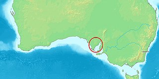
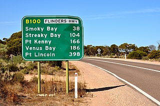
Lincoln Highway is a highway in South Australia which links the cities of Port Augusta and Port Lincoln located on the east coast of Eyre Peninsula over a distance of 327 kilometres (203 miles). [1] It was formerly designated as National Route Alternate 1 and is currently B100.

South Australia State of Australia

South Australia is a state in the southern central part of Australia. It covers some of the most arid parts of the country. With a total land area of 983,482 square kilometres (379,725 sq mi), it is the fourth-largest of Australia's states and territories by area, and fifth largest by population. It has a total of 1.7 million people, and its population is the second most highly centralised in Australia, after Western Australia, with more than 77 percent of South Australians living in the capital, Adelaide, or its environs. Other population centres in the state are relatively small; Mount Gambier, the second largest centre, has a population of 28,684.

Eyre Peninsula South Australia

The Eyre Peninsula is a triangular peninsula in South Australia. It is bounded on the east by Spencer Gulf, the west by the Great Australian Bight, and the north by the Gawler Ranges.

Contents

Sealed with bitumen, it has many straight stretches with few steep inclines or declines, and for the most part has a 110 km/h speed limit. It has one lane in each direction, with few overtaking lanes. [2] :8 The highway runs along the eastern coast of the Eyre Peninsula but just so far inland as to allow only glimpses of the Gulf in certain places.

The first Europeans to traverse most of this route, in April 1840, were Governor Gawler and John Hill, who explored on horseback from Port Lincoln to the Middleback Range near the location of the site of Whyalla.

George Gawler Governor of South Australia (1838-1841)

Lieutenant-Colonel George Gawler, KH, was the second Governor of South Australia: from 17 October 1838 until 15 May 1841.

John Hill was an English explorer of South Australia and part of the European exploration of Australia. Hill was the first European to discover and traverse the Clare Valley.

Middleback Range mountain range in South Australia

The Middleback Range is a mountain range on the eastern side of Eyre Peninsula in South Australia. The Middleback Range has been a source of iron ore for over a century, particularly to feed the Whyalla Steelworks. Mines in the region were first developed by the Broken Hill Proprietary Company from the 1890s and are now owned and operated by Arrium Ltd.

In general, after leaving Port Augusta the highway passes through hot and arid saltbush-covered and scrub terrain. [2] :15 It soon passes through the largest and most significant town along the route, which is the steel city of Whyalla. Continuing southwest it connects with such coastal towns as Cowell, Port Neill and Arno Bay which have good fishing spots. The terrain here is interspersed with broad-acre grain cropping in suitable localities, and the scenery gets greener the more it heads southwest towards Port Lincoln.

Cowell, South Australia Town in South Australia

Cowell is a coastal town on Franklin Harbor on the eastern side of the Eyre Peninsula, in South Australia on the Lincoln Highway 111 km south of the major town of Whyalla. It is 493 km by road from Adelaide.

Port Neill, South Australia Town in South Australia

Port Neill is a small coastal town on the eastern side of the Eyre Peninsula, in South Australia about 3 km off the Lincoln Highway between the major towns of Whyalla and Port Lincoln. It is 576 km by road from Adelaide.

Arno Bay, South Australia Town in South Australia

Arno Bay is a small fishing and tourist town on the east coast of Eyre Peninsula in South Australia, located on the Lincoln Highway about halfway between Whyalla and Port Lincoln. First proclaimed under the name Bligh in 1883, the current name dates back to 1940. It is a recreational town with a number of marine and nature based attractions, including fishing, surfing and swimming.

Port Lincoln itself is a prosperous fishing port and an important grain terminal serving the Eyre Peninsula wheatbelt. Japanese demand for freshest tuna made many of the fishermen millionaires.

Japan Constitutional monarchy in East Asia

Japan is an island country in East Asia. Located in the Pacific Ocean, it lies off the eastern coast of the Asian continent and stretches from the Sea of Okhotsk in the north to the East China Sea and the Philippine Sea in the south.

Tuna tribe of fishes

A tuna is a saltwater fish that belongs to the tribe Thunnini, a subgrouping of the Scombridae (mackerel) family. The Thunnini comprise 15 species across five genera, the sizes of which vary greatly, ranging from the bullet tuna up to the Atlantic bluefin tuna. The bluefin averages 2 m (6.6 ft), and is believed to live up to 50 years.

Localities

Tumby Bay, South Australia Town in South Australia

Tumby Bay is a coastal town situated on the Spencer Gulf, on the eastern coast of Eyre Peninsula in South Australia, 45 kilometres (28 mi) north of Port Lincoln. The town of Tumby Bay is the major population centre of the District Council of Tumby Bay, and the centre of an agricultural district farming cereal crops and sheep, as well as having established fishing and tourism industries.

Louth Bay, South Australia Town in South Australia

Louth Bay is a town and locality in the Australian state of South Australia. It is named after the bay named by Matthew Flinders on 26 February 1802 which itself is derived from a place in Lincolnshire. At the 2006 census, Louth Bay had a population of 408.

North Shields, South Australia Town in South Australia

North Shields is a town on the east coast of Eyre Peninsula, overlooking Boston Bay in Spencer Gulf in South Australia. In 2011 it had a population of 503. It is 11 km (6.8 mi) north of Port Lincoln.

Major junctions

LGA [1] Location [3] km [4] miDestinations [1] Notes
unincorporated area Lincoln Gap 00.0 Eyre HighwayPort Augusta, Kimba
Whyalla Whyalla 4729Iron Knob Road – Iron Knob
Middleback Range 7245Middleback Road – Iron Baron
Franklin Harbour Cowell 161100 Birdseye HighwayCleve
Cleve Arno Bay 198123Arno Bay Road – Cleve
Tumby Bay Tumby Bay 269167Bratten Way – Cummins
Port Lincoln Port Lincoln 315196 Flinders Highway
1.000 mi = 1.609 km; 1.000 km = 0.621 mi

See also

Related Research Articles

Spencer Gulf A large inlet in South Australia between the Eyre Peninsula and the Yorke Peninsula

The Spencer Gulf is the westernmost of two large inlets on the southern coast of Australia, in the state of South Australia, facing the Great Australian Bight. It spans from the Cape Catastrophe and Eyre Peninsula in the west to Cape Spencer and Yorke Peninsula in the east.

Eyre Highway highway in South Australia and Western Australia

Eyre Highway is a 1,660-kilometre (1,030 mi) highway linking Western Australia and South Australia via the Nullarbor Plain. Signed as National Highways 1 and A1, it forms part of Highway 1 and the Australian National Highway network linking Perth and Adelaide. It was named after explorer Edward John Eyre, who was the first European to cross the Nullarbor by land, in 1840–1841. Eyre Highway runs from Norseman in Western Australia, past Eucla, to the state border. Continuing to the South Australian town of Ceduna, it then crosses the top of the Eyre Peninsula before reaching the city of Port Augusta in South Australia.

Flinders Highway, South Australia highway in South Australia

Flinders Highway connects the South Australian towns of Ceduna and Port Lincoln, a distance of 410 kilometres. The highway was formerly designated as National Route Alternate 1 and currently signed as B100. Route B100, formerly National Route Alternate 1, consisting of the Flinders Highway and Lincoln Highway, presents an alternative but somewhat longer coastal route between Port Augusta and Ceduna, compared to the more direct Eyre Highway.

Tod Highway highway in South Australia

Tod Highway is an important 177 kilometre highway serving South Australia's Eyre Peninsula's wheatbelt. It runs from Kyancutta, on the Eyre Highway to Port Lincoln and is signed as B90. It practically divides the Eyre Peninsula into eastern and western halves. It is named after Robert Tod who explored the area in 1839. The highway passes through wheat, barley, wool and livestock farms. The highway provides access to grain terminals in Port Lincoln. The main town on the highway is Lock, practically in the centre of the Eyre Peninsula.

Streaky Bay, South Australia Town in South Australia

Streaky Bay is a coastal town on the western side of the Eyre Peninsula, in South Australia just off the Flinders Highway 303 km north west of Port Lincoln and 727 km by road from Adelaide. At the 2011 census, Streaky Bay recorded a population of 1,625.

Eyre Peninsula Railway railway on the Eyre Peninsula

The Eyre Peninsula Railway is a 1,067 mm gauge railway located on the Eyre Peninsula of South Australia. The system is isolated from the rest of the South Australian railway network.

Barngarla people Australian Aboriginal ethnic group of the Port Lincoln, Whyalla and Port Augusta areas of South Australia

The Barngarla, formerly known as Parnkalla, are an Aboriginal people of the Port Lincoln, Whyalla and Port Augusta areas. The Barngarla are the traditional owners of much of Eyre Peninsula, South Australia, Australia.

Port Augusta West, South Australia Suburb of Port Augusta, South Australia

Port Augusta West is a suburb of Port Augusta, South Australia.

Lucky Bay, South Australia Town in South Australia

Lucky Bay is a locality in the District Council of Franklin Harbour, on the Eyre Peninsula, South Australia. It is a terminus for SeaSA's Spencer Gulf passenger ferry and is also earmarked for future iron ore exports. Lucky Bay is located immediately north-east of the Franklin Harbour wetlands. Its adjacent waters lie within the outer boundary of the Franklin Harbor Marine Park. A ferry service crossing Spencer Gulf from Lucky Bay to Wallaroo commenced in 2006, and the dirt road connecting Lucky Bay with the Lincoln Highways was finally sealed in 2008. As of 2015, harbor expansion works are underway to facilitate future iron ore exports.

Copper Coast Highway road in South Australia, Australia

The Copper Coast Highway is a highway in South Australia which branches off from the Augusta Highway 2 km north of Port Wakefield and heads northwest across the top of Yorke Peninsula to Kadina and ends at the Spencer Gulf town of Wallaroo.

Yorke Highway road from Adelaide to the southern parts of the Yorke Peninsula in South Australia

The Yorke Highway is the main road from Adelaide to the southern parts of the Yorke Peninsula in South Australia. It runs from the northeast to the southwest of the peninsula. It branches off of the Copper Coast Highway after rounding the top of Gulf St Vincent, runs down the coast to Ardrossan then inland through Maitland to the Spencer Gulf coast at Hardwicke Bay then through Warooka to the south coast at Marion Bay and Stenhouse Bay on Investigator Strait.

Birdseye Highway road across Eyre Peninsula in South Australia

The Birdseye Highway is an east-west road across Eyre Peninsula in South Australia. It connects Cowell on the Lincoln Highway near the Spencer Gulf coast through Cleve and Lock to Elliston on the Flinders Highway on the west coast.

Transport in South Australia is provided by a mix of road, rail, sea and air transport. The capital city of Adelaide is the centre to transport in the state. With its population of 1.4 million people, it has the majority of the state's 1.7 million inhabitants. Adelaide has the state's major airport and sea port.

County of Manchester Cadastral in South Australia

County of Manchester is a cadastral unit located in the Australian state of South Australia that covers land both located in the north-east of Eyre Peninsula and to the peninsula's north. It was proclaimed in 1891 and named after George Montagu, 6th Duke of Manchester who was the father-in-law of the Rt Hon. Earl of Kintore GCMG, the Governor of South Australia at the time.

The Port Lincoln Times is a newspaper published twice-weekly by Rural Press in Port Lincoln, South Australia. It was first printed in August 1927, and has been published continuously ever since. It is now part of the Fairfax Media group.

References

  1. 1 2 3 A.J. Millazzo, Delegate of the Commissioner of Highways (28 February 2011). "Naming of State Rural Roads - Eyre Peninsula" (PDF). Government of South Australia. Rack Plan 997. Retrieved 23 September 2015.
  2. 1 2 "Eyre Peninsula". RAA Regional Road Assessment. Royal Automobile Association. February 2015. Retrieved 27 December 2017.
  3. "Property Location Browser" . Retrieved 23 September 2015.
  4. Google (23 September 2015). "Lincoln Highway driving directions" (Map). Google Maps . Google. Retrieved 23 September 2015.