Gawler bypass road

Last updated

Gawler Bypass Road
South Australia
General information
Type Freeway
Length 7 km (4.3 mi)
Opened 1980s
Route number(s)
  • AUS Alphanumeric Route A20.svg A20
Former
route number
  • Australian national highway 20.svg National Highway 20 (Evanston – Willaston)
  • AUS Alphanumeric Route A52.svg A52 south of Northern Expressway, 2010–2016
Major junctions
North endAustralian national highway A20.svg Sturt Highway (National Highway A20), Hewett
 
South endAUS Alphanumeric Route A52.svg Main North Road (A52), Evanston
Location(s)
Major suburbs Evanston, Gawler West, Willaston
Highway system

Gawler Bypass Road is a major north-south route in the outer northern suburbs of the city of Adelaide, South Australia. It had the national designation of National Highway A20 north of the Northern Expressway, while south of this intersection it had the state designation of A52. [1] [ full citation needed ] From late 2016, the entire length was designated A20, corresponding to the Northern Expressway being designated M2 (instead of M20). [2]

Adelaide City in South Australia

Adelaide is the capital city of the state of South Australia, and the fifth-most populous city of Australia. In June 2017, Adelaide had an estimated resident population of 1,333,927. Adelaide is home to more than 75 percent of the South Australian population, making it the most centralised population of any state in Australia.

South Australia State of Australia

South Australia is a state in the southern central part of Australia. It covers some of the most arid parts of the country. With a total land area of 983,482 square kilometres (379,725 sq mi), it is the fourth-largest of Australia's states and territories by area, and fifth largest by population. It has a total of 1.7 million people, and its population is the second most highly centralised in Australia, after Western Australia, with more than 77 percent of South Australians living in the capital, Adelaide, or its environs. Other population centres in the state are relatively small; Mount Gambier, the second largest centre, has a population of 28,684.

Northern Expressway freeway in Adelaide, South Australia

The Northern Expressway, also known as the Fatchen Northern Expressway, is a 23 kilometre long controlled-access highway in Adelaide, South Australia. It travels from Gawler to Port Wakefield Road. The road has been built to four-lane standard and provides a faster route between Adelaide and Gawler, whilst reducing the amount of traffic on Main North Road, which passes through the heart of the northern suburbs and is interspersed with frequent traffic lights. It also allows freight vehicles to avoid residential areas and go straight to Port Wakefield Road and onto the Port River Expressway (A9) to reach the harbour at Port Adelaide.

Contents

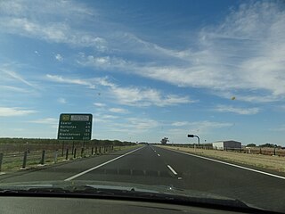
It is a freeway standard route connecting Main North Road to the Sturt Highway, bypassing Gawler. Major exits include Angle Vale Road, Two Wells Road, Northern Expressway, Mallala Road and Horrocks Highway (formerly Main North Road). Each of these exits also have minor roads leading into Gawler.

Main North Road road in South Australia

Main North Road is the major north-south arterial route through the suburbs north of the Adelaide City Centre in the city of Adelaide, South Australia. It continues north through the settled areas of South Australia and is a total of 307 kilometres (191 mi) long, from North Adelaide to 21 kilometres (13 mi) out of Port Augusta. It follows the route established in the early years of the colony by explorer John Horrocks and was a major route for farmers and graziers to reach the capital, passing through rich farmland and the Clare Valley wine region. In 2011, the section of road between Gawler to Wilmington was renamed Horrocks Highway.

Sturt Highway Australian national highway in New South Wales, Victoria, and South Australia

The Sturt Highway is an Australian national highway in New South Wales, Victoria, and South Australia. The Sturt Highway is an important road link for the transport of passengers and freight between Sydney and Adelaide and the regions situated adjacent to the route.

Gawler is the oldest country town on the Australian mainland in the state of South Australia, and is named after the second Governor of the colony of South Australia, George Gawler. It is about 40–44 km (25–27 mi) north of the centre of the state capital, Adelaide, and is close to the major wine producing district of the Barossa Valley. Topographically, Gawler lies at the confluence of two tributaries of the Gawler River, the North and South Para rivers, where they emerge from a range of low hills.

The route was built in 1963 in an attempt to redirect traffic on the national highway out of Gawler town centre and has been upgraded and realigned several times since then.

History

The first Gawler bypass was planned in the 1950s [3] and built as a single two-lane carriageway around the town in 1963 with at-grade intersections and carried 3000 vehicles per day. [4] It ended at a tee-junction at the southern end, and followed an alignment that included what is now the southbound on-ramp and Brereton Road, Jack Cooper Drive over the Winckel Bridge, [5] and Paternoster Drive to the railway bridge.

The next advance developed the road to dual carriageway with grade-separated intersections at the southern end in the 1980s and new bridges over the Gawler River. When it was approved, the 1963 bypass was carrying 7000 vehicles per day, and 300 collisions had been recorded between 1977 and 1982. [4]

Gawler River (South Australia) river in South Australia

The Gawler River is a river located in the Adelaide Plains district of the Mid North region in the Australian state of South Australia.

Improvements to the Sturt Highway have included upgrades to the northern end of the Gawler Bypass to facilitate smooth flow between them, completed in 2010. [6]

The construction of the Northern Expressway in 2010 resulted in realignment of the northbound carriageway as part of creating a grade-separated intersection with smooth flow between the northern section of the Gawler bypass and both the Northern Expressway and the southern part of the Gawler bypass. As both roads lead broadly south, there is no provision to turn directly from one to the other.

Exits and Interchanges

LGA [7] LocationkmmiDestinationsNotes
Light Hewett, Gawler Belt 00.0Australian national highway A20.svg Sturt Highway continues towards Nuriootpa, Mildura and Sydney
AUS Alphanumeric Route B82.svg Horrocks Highway (Main North Road) – Roseworthy, Riverton, Clare / Main North Road – Hewett, Gawler
AUS Alphanumeric Route B81.svg Thiele Highway (Also known as Freeling Road)Kapunda, Eudunda, Morgan via Main North Road
Gawler Belt, Willaston 1.50.93Redbanks Road – Mallala, Balaklava / Gawler, Willaston Also known as Mallala Road
Gawler Belt, Willaston, Reid 3.92.4 Roseworthy railway line
Ward Belt, Reid, Buchfelde 4.12.5AUS Alphanumeric Route M2.svg Northern ExpresswayAdelaide, Port Adelaide ramps on north side only
Reid, Buchfelde 4.62.9Two Wells Road – Gawler West, Two Wells ramps on north side only
Light, Gawler Evanston, Evanston Gardens Gawler River
Gawler Evanston, Hillier 5.73.5Jack Cooper Drive – Evanston, Evanston Gardens south side ramps only
Evanston, Evanston Gardens 6.23.9 Gawler railway line
Evanston, Evanston Gardens, Evanston Park, Evanston South 74.3AUS Alphanumeric Route B19.svg Adelaide RoadEvanston, Gawler continues as AUS Alphanumeric Route A20.svg Main North Road
Route diagram
Sturt Highway Australian National Route A20.svg
BSicon LSTR.svgBSicon LSTR.svg
Australian National Route A20.svg Sturt Highway
BSicon STRg.svgBSicon STRf.svg
BSicon STRc2.svgBSicon ABZg3.svgBSicon STR.svg
Thiele Highway Australian Alphanumeric State Route B81.png UK traffic sign 602.svg
BSicon LSTRq.svgBSicon STR+r.svgBSicon STR+1.svgBSicon STR+c4.svgBSicon ABZgl+l.svgBSicon STR+r.svg
Horrocks Highway Australian Alphanumeric State Route B82.svg UK traffic sign 602.svg
BSicon LSTRq.svgBSicon ABZqlr.svgBSicon KRZ.svgBSicon KRZo.svgBSicon KRZo.svgBSicon ABZqlr.svgBSicon STRq.svgBSicon LSTRq.svg
UK traffic sign 602.svg Main North Road
BSicon STR2.svgBSicon STR+c3.svgBSicon STR.svg
BSicon STRc1.svgBSicon ABZg+4.svgBSicon STR.svg
BSicon STRg.svgBSicon STRf.svg
BSicon STR+l.svgBSicon ABZgr+r.svgBSicon STR.svg
Redbanks Road UK traffic sign 602.svg
BSicon LSTRq.svgBSicon STRq.svgBSicon ABZqlr.svgBSicon KRZu.svgBSicon KRZu.svgBSicon ABZq+lr.svgBSicon STRq.svgBSicon LSTRq.svg
Australia R1-3.svg Redbanks Road
BSicon STR.svgBSicon ABZgl+l.svgBSicon STRr.svg
BSicon STRg.svgBSicon STRf.svg
(Disused) Roseworthy Line
BSicon uLSTRq.svgBSicon uSTRq.svgBSicon uSTRq.svgBSicon mKRZo.svgBSicon mKRZo.svgBSicon uSTRq.svgBSicon uSTRq.svgBSicon uLSTRq.svg
Roseworthy Line (Disused)
BSicon STRg.svgBSicon STRf.svg
BSicon STRc2.svgBSicon ABZg3.svgBSicon STR.svg
BSicon STR+1.svgBSicon STR+c4.svgBSicon STR.svg
BSicon LSTRq.svgBSicon STRfq.svgBSicon KRZu.svgBSicon STRr.svgBSicon STR.svg
Northern Expressway Australian Alphanumeric State Route M2.png UK motorway symbol.svg
BSicon LSTRq.svgBSicon STRgq.svgBSicon KRZu.svgBSicon STRq.svgBSicon ABZgr.svg
BSicon ABZg2.svgBSicon STRc3.svgBSicon ABZg2.svgBSicon STRc3.svg
BSicon STR+c1.svgBSicon STR+4.svgBSicon STR+c1.svgBSicon STR+4.svg
Two Wells Road UK traffic sign 602.svg
BSicon LSTRq.svgBSicon STRq.svgBSicon ABZqlr.svgBSicon KRZu.svgBSicon KRZu.svgBSicon ABZqlr.svgBSicon STR+r.svg
Gawler River
BSicon WASSERq.svgBSicon WASSERq.svgBSicon WASSER+r.svgBSicon STRg.svgBSicon STRf.svgBSicon WASSER+l.svgBSicon WBRUCKE1.svgBSicon WASSERq.svg
Gawler River
BSicon WASSERl.svgBSicon WBRUCKE1.svgBSicon WBRUCKE1.svgBSicon WASSERr.svgBSicon ABZgl+l.svgBSicon LSTRq.svg
Australia R1-3.svg Ryde Street
Jack Cooper Drive UK traffic sign 602.svg
BSicon LSTRq.svgBSicon STRq.svgBSicon ABZq+lr.svgBSicon KRZo.svgBSicon KRZo.svgBSicon ABZq+lr.svgBSicon STRr.svg
BSicon STR2.svgBSicon STR+c3.svgBSicon STR+c2.svgBSicon STR3.svg
BSicon STRc1.svgBSicon ABZg+4.svgBSicon ABZg+1.svgBSicon STRc4.svg
BSicon STRg.svgBSicon STRf.svg
Gawler line
BSicon uLSTRq.svgBSicon uSTRq.svgBSicon uSTRq.svgBSicon mKRZo.svgBSicon mKRZo.svgBSicon uSTRq.svgBSicon uSTRq.svgBSicon uLSTRq.svg
Gawler line
Dawson Road
BSicon LSTRq.svgBSicon STRq.svgBSicon STRq.svgBSicon KRZo.svgBSicon KRZo.svgBSicon STRq.svgBSicon STRq.svgBSicon LSTRq.svg
Dawson Road
BSicon STR.svgBSicon STR.svg
BSicon STR+l.svgBSicon KRZo.svgBSicon KRZo.svgBSicon ABZq+l.svgBSicon STRq.svgBSicon LSTRq.svg
UK motorway symbol.svg Australian Alphanumeric State Route B19.svg Adelaide Road
BSicon STR2.svgBSicon STR+c3.svgBSicon STR+c2.svgBSicon STR3.svg
BSicon STRc1.svgBSicon ABZg+4.svgBSicon ABZg+1.svgBSicon STRc4.svg
BSicon STRg.svgBSicon STRf.svg
Main North Road Australian Alphanumeric State Route A20.png
BSicon LSTR.svgBSicon LSTR.svg
Australian Alphanumeric State Route A20.png Main North Road

See also

Australia road sign W5-29.svg Australian Roadsportal

Related Research Articles

Hume Highway highway in New South Wales and Victoria

The Hume Highway, inclusive of the sections now known as the Hume Freeway and Hume Motorway, is one of Australia's major inter-city national highways, running for 840 kilometres (520 mi) between Melbourne in the southwest and Sydney in the northeast. Upgrading of the route from Sydney's outskirts to Melbourne's outskirts to dual carriageway was completed on 7 August 2013.

Pacific Highway (Australia) highway in New South Wales and Queensland

The Pacific Highway is a 790-kilometre-long (490 mi) national highway and major transport route along the central east coast of Australia, with the majority of it being part of Australia's national route 1.

Midland Highway (Tasmania) highway in Tasmania

The Midland Highway is one of Tasmania's major inter-city highways, running for 176 kilometres (109 mi) between Hobart and Launceston. It is part of the AusLink National Network and is a vital link for road freight to transport goods to and from the two cities. It represents a major north–south transportation corridor in Tasmania and has the route 1 designation as part of the National Highway. The highway consists of various traffic lane arrangements, the most common being two lanes – one in each direction, with overtaking options and at-grade intersections. At both the Launceston and Hobart sections of the highway there are small portions of grade-separated dual carriageway.

Limited-access road high-speed road with many characteristics of a controlled-access highway (freeway or motorway)

A limited-access road, known by various terms worldwide, including limited-access highway, dual-carriageway, expressway, and partial controlled access highway, is a highway or arterial road for high-speed traffic which has many or most characteristics of a controlled-access highway, including limited or no access to adjacent property, some degree of separation of opposing traffic flow, use of grade separated interchanges to some extent, prohibition of some modes of transport such as bicycles or horses, and very few or no intersecting cross-streets. The degree of isolation from local traffic allowed varies between countries and regions. The precise definition of these terms varies by jurisdiction.

Pacific Motorway (Brisbane–Brunswick Heads) motorway in New South Wales and Queensland

The Pacific Motorway is a motorway in Australia between Brisbane, Queensland, and Brunswick Heads, New South Wales, through the New South Wales–Queensland border at Tweed Heads.

South Road, Adelaide road in Adelaide, South Australia

South Road, also known as Main South Road, is a major north–south conduit in Adelaide and Fleurieu Peninsula in South Australia. It is one of Adelaide's most important arterial and bypass roads.

New Zealand State Highway 1 road in New Zealand

State Highway 1 is the longest and most significant road in the New Zealand road network, running the length of both main islands. It appears on road maps as SH 1 and on road signs as a white number 1 on a red shield, but it has the official designations SH 1N in the North Island, SH 1S in the South Island.

The Port River Expressway is a 5.5-kilometre (3.4 mi) freeway-grade road. The expressway links Port Adelaide and the LeFevre Peninsula to the northern suburbs of Adelaide and major interstate routes via Salisbury Highway (A13) to Port Wakefield Road (A1) and the Max Fatchen Expressway (M20) to Perth, Darwin and Sydney.

Two-lane expressway Article collection to the topic "two-lane expressways" (Limited-access road of a specific country)

A two-lane expressway or two-lane freeway is an expressway or freeway with only one lane in each direction, and usually no median barrier. It may be built that way because of constraints, or may be intended for expansion once traffic volumes rise. The term super two is often used by roadgeeks for this type of road, but traffic engineers use that term for a high-quality surface road. Most of these roads are not tolled.

New Zealand State Highway 2 road in New Zealand

State Highway 2 runs north–south through eastern parts of the North Island of New Zealand from the outskirts of Auckland to Wellington. It runs via Tauranga in the Bay of Plenty, Gisborne, and Napier and Hastings in Hawke's Bay. It is the second-longest highway in the North Island, after State Highway 1, which runs the length of both of the country's main islands.

The Waikato Expressway is a dual carriageway section of State Highway 1 in the Waikato region of the North Island of New Zealand that is being constructed in stages. It forms part of the link between Auckland and Hamilton. When completed it will stretch 116 km (72 mi) and be 6 km (3.7 mi) shorter than the roads it replaced.

This is a list of freeways in Australia, sorted by states and territories and their corresponding routes. This list includes tollways / toll roads such as the CityLink freeway system in Melbourne. This list has over 70 entries. The only jurisdiction in Australia without freeways is the Northern Territory. Victoria has the largest and densest freeway network in Australia.

State Highway 74 is a state highway in New Zealand servicing the eastern suburbs of Christchurch. Mostly two-lane, it is composed of limited-access expressways, with part of the highway as the Christchurch-Lyttelton Motorway, and connects the city to its port town of Lyttelton.

North–South Motorway elevated freeway in Adelaide, South Australia

The North–South Motorway is an incomplete planned motorway traversing the inner western suburbs of Adelaide from Wingfield in the north to Bedford Park in the south. It is planned to be a non-stop north–south route overlaying the same motor traffic corridor as South Road by grade separation. The motorway is to be the central section of Adelaide's North–South Corridor, being flanked north and south by the Northern Expressway and Southern Expressway, respectively.

North–South Corridor, Adelaide road route in and beyond Adelaide, South Australia

The North–South Corridor is a series of road projects currently under construction or planning which travel through Adelaide, South Australia that will eventually form a continuous link from Old Noarlunga in the outer southern metropolitan Adelaide suburbs through to Nuriootpa in the inner northern rural area around the Barossa Valley, a distance of over 100 km, aiming to be without a single stop by 2030.

References

  1. "Nearmap". Nearmap. 5 December 2010. Retrieved 2010-12-05.(subscription required)
  2. "Road Route Numbers (Trail Blazer)". Data SA. Government of South Australia. 8 November 2016. Retrieved 16 October 2017.
  3. "Main North Road By-Pass Altered". The Bunyip (5251). South Australia. 23 February 1951. p. 3. Retrieved 28 June 2016 via National Library of Australia.
  4. 1 2 Peter Morris, Minister for Transport Australia (9 May 1984). "$18 Million Gawler Bypass gets Go Ahead". Media Release. 71/84. Retrieved 28 June 2016.
  5. "NEW PLAN OF MAIN NORTH ROAD". The Bunyip (5237). South Australia. 3 November 1950. p. 1. Retrieved 28 June 2016 via National Library of Australia.
  6. "Sturt Highway Upgrade". Department of Planning, Transport and Infrastructure . Retrieved 8 February 2017.
  7. "Property Location Browser". Department of Planning, Transport and Infrastructure . Retrieved 29 May 2015.