Jammu and Kashmir was a region formerly administered by India as a state from 1954 to 2019, constituting the southern and southeastern portion of the larger Kashmir region, which has been the subject of a dispute between India, Pakistan and China since the mid-20th century. The underlying region of this state were parts of the former princely state of Jammu and Kashmir, whose western districts, now known as Azad Kashmir, and northern territories, now known as Gilgit-Baltistan, are administered by Pakistan. The Aksai Chin region in the east, bordering Tibet, has been under Chinese control since 1962.

Situated at the center of the Kashmir valley, Srinagar is the second most populous district in the Indian Union Territory of Jammu and Kashmir, after Jammu District and is home to the summer capital (Srinagar) of Jammu and Kashmir. The largest city is Srinagar.

The Pulwama district is a district in the Indian Union territory of Jammu and Kashmir. Its capital city is Pulwama.

Udhampur (ˌʊd̪ʱəmpur) is a city and a municipal committee in Udhampur District in the Indian Union territory of Jammu and Kashmir. Named after Raja Udham Singh, it serves as the district capital and the Northern Command headquarters of the Indian Army. A Forward Base Support Unit (FBSU) of the Indian Air Force is also stationed here. Udhampur is used by the Armed Forces as a transit point between Jammu and Srinagar when travelling by road on National Highway 1A.

The Kashmir Valley, also known as the Vale of Kashmir, is an intermontane valley in the portion of the Kashmir region administered by India. The valley is bounded on the southwest by the Pir Panjal Range and on the northeast by the main Himalayas range. It is approximately 135 km (84 mi) long and 32 km (20 mi) wide, and drained by the Jhelum River.

Doda is a district in the eastern part of Jammu Division in the Indian union territory of Jammu and Kashmir. The district consists of 18 tehsils viz. Thathri, Bhaderwah, Doda, Mahalla, Bhagwa, Assar, Bhalla, Gundna, Marmat, Kahara, Gandoh (Bhalessa), Bhella, Bharth Bagla, Chiralla, Chilly Pingal, Phagsoo(Fagsu) and Kashtigarh.

Leh district is a district in the union territory of Ladakh in northern India. With an area of 45,110 km2, it is the second-largest district in the country in terms of area. It is bounded on the north by Gilgit-Baltistan's Kharmang and Ghanche districts and Xinjiang's Kashgar and Hotan prefectures linked via the historic Karakoram Pass. It has Aksai Chin and Tibet are to the east, Kargil district to the west, and Lahul and Spiti to the south. The district headquarters is in Leh. It lies between 32 to 36 degree north latitude and 75 to 80 degree east longitude.

Jammu is the most populous of the districts of Jammu and Kashmir in India, and is home to the winter capital (Jammu) of Jammu and Kashmir. The capital moves to Srinagar city in the summer. The largest city is Jammu.

Poonch or Punch is a district in Jammu and Kashmir, India. With headquarters the town of Poonch, it is bounded by the Line of Control on three sides. The 1947-48 war between India and Pakistan divided the earlier district into two parts. One went to Pakistan and the other became part of the then Indian state of Jammu and Kashmir.

Awantipora, also known as Avantipur or Aavantipur, is a town on the banks of the River Jehlum in the Pulwama district of the Indian union territory of Jammu and Kashmir. It is on the Jammu-Srinagar National Highway, south of Srinagar and north of Anantnag. Awantipora was named after the Kashmiri king Avantivarman and has the ruins of two 9th century Hindu temples built by him.

Kupwara District is one of 10 districts located in Kashmir region of Jammu and Kashmir, India. The river Kishenganga, originating from the Himalayas, flows through the outer areas of the district from east to west.

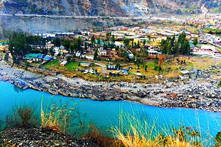
Ramban is a town in Ramban district of Jammu and Kashmir, India, which is the district headquarters of Ramban district. It lies on the banks of the Chenab river in Chenab Valley on the National Highway-1A at about 150 km from Jammu and about 150 km from Srinagar, making it almost the central point on the Jammu-Srinagar National Highway.

Samba District is a district in the Indian Union territory of Jammu and Kashmir formed in 2006. Before its formation, this area was part of Jammu district and Kathua district.

Ramban is one of the 20 districts in the union territory of Jammu and Kashmir, India. Ramban is located in the lap of the Pir Panjal mountain range. It was carved out of the erstwhile Doda District on 1 April 2007. Ramban town is the district headquarters. The town is located midway between Jammu and Srinagar along the Chenab river in Chenab Valley on National Highway-44, approximately 150 km from Jammu and Srinagar.

Jammu and Kashmir, also known as Kashmir and Jammu, was a princely state during the British East India Company rule as well as the British Raj in India from 1846 to 1947. The princely state was created after the First Anglo-Sikh War, when the East India Company, which had annexed the Kashmir Valley, Jammu, Ladakh, and Gilgit-Baltistan from the Sikhs as war indemnity, then sold the region to the Raja of Jammu, Gulab Singh, for 7,500,000 rupees.

Jammu Division is a revenue and administrative division within Jammu and Kashmir, a union territory of India. It consists of the districts of Jammu, Doda, Kathua, Ramban, Reasi, Kishtwar, Poonch, Rajouri, Udhampur and Samba. Most of the land is hilly or mountainous, including the Pir Panjal Range which separates it from the Kashmir Valley and part of the Great Himalayas in the eastern districts of Doda and Kishtwar. Its principal river is the Chenab. The Chenab Valley is another important region in the Jammu division. It is also known as Duggar Pradesh.

Jammu is the winter capital of the Indian union territory of Jammu and Kashmir. It is the headquarters and the largest city in Jammu district of the union territory. Lying on the banks of the river Tawi, the city of Jammu, with an area of 240 km2 (93 sq mi), is surrounded by the Himalayas in the north and the northern-plains in the south. Jammu is the second most populous city of the union territory.

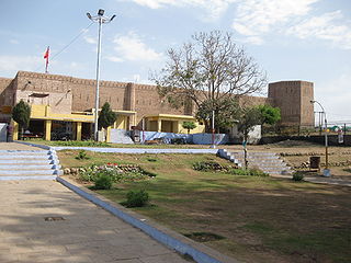
Kalakote is a village located in Rajouri district of Jammu region in the Indian union territory of Jammu and Kashmir.

Jammu and Kashmir is a region which is administered by India as a union territory and consists of the southern portion of the larger Kashmir region, which has been the subject of a dispute between India and Pakistan since 1947, and between India and China since 1962. The region of Jammu and Kashmir is separated by the Line of Control from the Pakistani-administered territories of Azad Kashmir and Gilgit-Baltistan in the west and north, respectively. It lies to the north of the Indian states of Himachal Pradesh and Punjab and to the west of Ladakh, which is also subject to the dispute as a part of Kashmir, and administered by India as a union territory.


