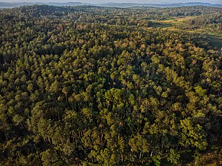
Malnad is a region in the state of Karnataka in India. Malenadu covers the western and eastern slopes of the Western Ghats or Sahyadri mountain range, and is roughly 100 kilometers in width. The region experiences heavy annual rainfall of 1000 to 3800 mm; it includes Agumbe, which receives the highest annual rainfall in Karnataka.

Kodachadri is a mountain peak with dense forests in the Western Ghats in South India, 78 km from Shimoga. It is declared as natural heritage site by the Karnataka Government. and it is 13th highest peak of Karnataka.

Sharavati is a river which originates and flows entirely within the state of Karnataka in India. It is one of the few westward flowing rivers of India and a major part of the river basin lies in the Western Ghats. The famous Jog Falls, located about 25 km from Siddapura, are formed by this river. The river itself and the region around it are rich in biodiversity and are home to many rare species of flora and fauna.

Agumbe is a village situated in the Thirthahalli taluka of Shivamogga district, Karnataka, India. It is nestled in the thickly forested Malenadu region of the Western Ghats mountain range. Owing to its high rainfall, it has received the epithet of "The Cherrapunji of South India", after Cherrapunji, one of the rainiest places in India.

Shimoga district, officially known as Shivamogga district, is a district in the Karnataka state of India. A major part of Shimoga district lies in the Malnad region or the Sahyadri. Shimoga city is its administrative centre. Jog Falls view point is a major tourist attraction. As of 2011 Shimoga district has a population of 17,52,753. There are seven taluks: Soraba, Sagara, Hosanagar, Shimoga, Shikaripura, Thirthahalli, and Bhadravathi. Channagiri and Honnali were part of Shimoga district until 1997 when they became part of the newly formed Davanagere district.
Hosanagara is a panchayat town in Shimoga district in the Indian state of Karnataka. It is nested in western ghats of India. The World Cattle Conference with main emphasis on cow was held in month of April 2007 in Hosanagar. The different uses of cow were exhibited. Near Hosanagar there is a mutt named Sri Ramachandrapura Math, 6 km from the town.
Varahi River originate and flows through Western Ghats in the Indian state of Karnataka. It is also known as Halady or Haladi river in downstream areas. It joins the Arabian sea after flowing through places like Halady, Basrur, Kundapura and Gangolli. It joins with the Souparnika River, Kedaka River, Chakra River, and Kubja River which are known by Panchagangavalli River and merges into the Arabian Sea. Pancha means five in Kannada and Samskrita and Ganga means river. According to mythology, Varaha is one of the incarnations of Lord Vishnu. Varahi is consort of Varaha.

Karnataka is the sixth largest state in India and has been ranked as the third most popular state in the country for tourism in 2014. It is home to 507 of the 3600 centrally protected monuments in India, second only to Uttar Pradesh. The State Directorate of Archaeology and Museums protects an additional 752 monuments and another 25,000 monuments are yet to receive protection.

The Indian State of Karnataka is located between 11°30' North and 18°30' North latitudes and between 74° East and 78°30' East longitude.It is situated on a tableland where the Western Ghats and Eastern Ghats converge into the complex, in the western part of the Deccan Peninsular region of India. The State is bounded by Maharashtra and Goa States in the north and northwest; by the Lakshadweep Sea in the west; by Kerala in the south-west and Tamil Nadu in the south and south-east, Andhra Pradesh in the south-east and east and Telangana in the north-east. Karnataka extends to about 850 km (530 mi) from north to south and about 450 km (280 mi) from east to west.

Ghat Roads are access routes into the mountainous Western and Eastern Ghats, mountain ranges of the Indian subcontinent. These roads are remarkable feats of engineering, and most were constructed during the British Raj. Ghat Roads were built to connect to the hill stations established in the mountains for residents to avoid summer heat. They generally served to connect coastal areas with the upper Deccan Plateau.
Kunchikal Falls is a waterfall in India located in the Nidagodu village near Masthikatte in the Shimoga district of state Karnataka. Kunchikal falls cascades down rocky boulders and the total height of the falls is 455 meters according to the World Waterfall Database. Kunchikal falls is formed by the Varahi river.

The state of Karnataka in India has a bittersweet relationship with rains. While its regions of Malnad and Coastal Karnataka receive copious amount of rainfall; its north Bayaluseemae region in the Deccan Plateau is one of the most arid regions in the country. Most of the rains received in the state is during the monsoon season. Being an agrarian economy with a large percentage of its citizens engaged in agriculture, the failure of rains can have a crippling effect on the economy of the state. Apart from the benefits in agriculture, the Government of Karnataka has tried to avail other benefits of rainfall using scientific methods. An example of this is the project, Rainwater Harvesting in Rural Karnataka which is initiated by the Karnataka State Council for Science and Technology and is one of the largest rainwater harvesting projects in the world. Agumbe in the Shimoga district, Amagaon in Belgaum District, Hulikal again in Shimoga district and Talakaveri in Madikeri are some of the known places with the highest annual rainfall in South India. Of this Amagaon has received over 10000 mm rain fall twice in 10 years.
Someshwara Wildlife Sanctuary is a protected wildlife sanctuary in the Western Ghats of Karnataka state in India. It is named after the presiding deity "Lord Someshwara" of the famed Someshwara temple located within the sanctuary. The sanctuary lies in Udupi & Shivamogga districts of Karnataka, below Agumbe. The sanctuary houses Sitanadi nature camp run by Karnataka Forest Department. Udupi to Agumbe road passes through this wildlife sanctuary. The nearest town is Hebri which is connected by bus service to Udupi, Mangaluru and Bengaluru on a daily basis.
Amagaon is a village in Belagavi district bordered by Goa in west in the southern state of Karnataka, India. Amagaon nestles in the dense forests of the Western Ghats in and is known for its heavy rainfall. It is known to get over 10,000 mm annual rainfall occasionally and the average annual rainfall is around 9,000 mm. It is also called as Cherrapunji of South India

Gavali is a small village located in the Belgaum district, Karnataka state in India, southwest of the city of Belgaum. The village is surrounded by forests, waterways and falls, which are subject to illegal mining, removal of medicinal plants and deforestation.
Halady, also spelled Haladi, is a small village located in Kundapura Taluk, Udupi District, Karnataka, 22 km from Taluk Centre Kundapura. Halady village consists of Halady 76 and Halady 28, which are two portions of the village.

Hulikal is a village located in the Hosanagara taluk of the Shimoga district in the Indian state of Karnataka and is known for its heavy rainfall. The Hulikal village lies in western ghat region of Karnataka state. The range of ghat is known by the name Hulikal ghat or Balebare ghat. The road running between Hosangadi and Mastikatte through Hulikal ghati connects coastal district of Udupi with Shivamogga district. The Mani dam reservoir and Savehoklu reservoir are nearby. KPCL has its colony at Mastikatte near to Hulikal. The nearest airport is at Mangalore, situated 123 km south-west of Hulikal. It has an elevation of 600m.
Kattinahole ಕಟ್ಟಿನಹೊಳೆ is a small village in Hosanagara Taluk, Shimoga district of the Indian state of Karnataka. The local language of Kattinahole is Kannada.

Sagara is a city located in the Indian state of Karnataka. It is also a sub divisional and a taluk headquarters. Located in the Sahyadri Mountain range on the banks of river Varada, it is known for its proximity to Jog Falls and to the historical places of Ikkeri, Keladi and Varadamoola. The river Varada originates near Varada-moola. Sagara subdivision consists of Sagara, Soraba, Hosanagara and Shikaripur taluks.
Ripponpeté is a small town located in Hosanagara Taluk, Shivamogga district, Karnataka, India.and it is center point of four taluks they are Shimoga sagara thirtahalli and hosanagra, the town is a gateway to the Malenadu (Malnad) region of India.
