Mille Lacs County is a county in the East Central part of the U.S. state of Minnesota. As of the 2020 census, the population was 26,459. Its county seat is Milaca. The county was founded in 1857, and its boundary was expanded in 1860.

Aitkin County is a county in the U.S. state of Minnesota. As of the 2020 census, the population was 15,697. Its county seat is Aitkin. Part of the Mille Lacs Indian Reservation is in the county. The county was created in 1857 and organized in 1871.
Lake Saint Pierre is a lake in Quebec, Canada, a widening of the Saint Lawrence River between Sorel-Tracy and Trois-Rivières. It is located downstream, and northeast, of Montreal; and upstream, and southwest, of Quebec City. The end of the lake delimits the beginning of the estuary of Saint Lawrence.

The Rum River is a slow, meandering stream that connects Minnesota's Mille Lacs Lake with the Mississippi River. It runs for 151 miles (243 km) through the communities of Onamia, Milaca, Princeton, Cambridge, Isanti, and St. Francis before ending at the city of Anoka, roughly 20 miles northwest of Minneapolis. It is one of the six protected Wild and Scenic rivers in Minnesota.
Mille Lacs Indian Reservation is the popular name for the land-base for the Mille Lacs Band of Ojibwe in Central Minnesota, about 100 miles (160 km) north of Minneapolis-St. Paul. The contemporary Mille Lacs Band reservation has significant land holdings in Mille Lacs, Pine, Aitkin and Crow Wing counties, as well as other land holdings in Kanabec, Morrison, and Otter Tail Counties. Mille Lacs Indian Reservation is also the name of a formal Indian reservation established in 1855. It is one of the two formal reservations on which the contemporary Mille Lacs Band retains land holdings. The contemporary Mille Lacs band includes several aboriginal Ojibwe bands and villages, whose members reside in communities throughout central Minnesota.
The Mille Lacs Band of Ojibwe, also known as the Mille Lacs Band of Chippewa Indians, is a federally recognized American Indian tribe in east-central Minnesota. The Band has 4,302 members as of 2012. Its homeland is the Mille Lacs Indian Reservation, consisting of District I, District II, District IIa, and District III.

The Upper Mississippi River National Wildlife and Fish Refuge is a 240,000-acre (970 km2), 261-mile long (420 km) National Wildlife Refuge located in and along the Upper Mississippi River. It runs from Wabasha, Minnesota in the north to Rock Island, Illinois in the south.

The Atlantic Flyway is a major north-south flyway for migratory birds in North America. The route generally starts in Greenland, then follows the Atlantic coast of Canada, then south down the Atlantic Coast of the United States to the tropical areas of South America and the Caribbean. Every year, migratory birds travel up and down this route following food sources, heading to breeding grounds, or traveling to overwintering sites.

The Crocodile Lake National Wildlife Refuge is part of the United States National Wildlife Refuge System, located in north Key Largo, less than 40 miles (64 km) south of Miami off SR 905. The 6,686 acres (2,706 ha) refuge opened during the year of 1980, under the Land and Water Conservation Fund Act of 1965 and the Endangered Species Act of 1973. It was established in order to protect critical breeding and nesting habitat for the threatened American crocodile and other wildlife. This area also includes 650 acres (260 ha) of open water in and around the refuge. In addition to being one of only three breeding populations of the American crocodile, the refuge is home to tropical hardwood hammock, mangrove forest, and salt marsh. It is administered as part of the National Key Deer Refuge which is also located in the Florida Keys.
The Des Lacs National Wildlife Refuge is located in the U.S. state of North Dakota and extends from the Canada–United States border to near the town of Kenmare, North Dakota along Des Lacs Lake. The refuge was established in 1935 and includes 19,500 acres (78.9 km2). The refuge is considered to be one of the most important bird sanctuaries in the U.S., with tens of thousands of birds using the refuge for migration and breeding. The refuge is also home to elk, moose, bison and pronghorn.

Gravel Island National Wildlife Refuge is a National Wildlife Refuge located off the Door Peninsula in Wisconsin. Founded in 1913, the refuge consists of two Lake Michigan islands that act as nesting grounds for native bird species. It is inhabited by large colonies of shore birds and waterfowl in addition to hosting a pair of great black-backed gulls, one of farthest westward breeding sites of the species.

Straddling the headwaters of the Minnesota River in west-central Minnesota, Big Stone National Wildlife Refuge is within the heart of the tallgrass prairie's historic range. Today, less than one-percent of tallgrass prairie remains.

Tamarac National Wildlife Refuge is a National Wildlife Refuge of the United States. It lies in the glacial lake country of northwestern Minnesota in Becker County, 18 miles (29 km) northeast of Detroit Lakes. It was established in 1938 as a refuge breeding ground for migratory birds and other wildlife. It covers 42,724 acres (172.90 km2).

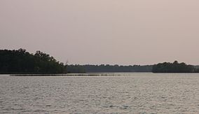
Mille Lacs Lake is a large, shallow lake in the U.S. state of Minnesota. It is located in the counties of Mille Lacs, Aitkin, and Crow Wing, roughly 75 miles north of the Minneapolis-St. Paul metropolitan area.
The Wisconsin Islands Wilderness is a 29-acre (12 ha) wilderness area located in Door County in northeastern Wisconsin. It is one of the smallest wilderness areas in the United States. Managed by the U.S. Fish & Wildlife Service, the wilderness area is composed of three islands in Lake Michigan.
East Lake is an unincorporated community in Spalding Township, Aitkin County, Minnesota, United States.

Farm Island Lake is a lake in the U.S. state of Minnesota, located in Aitkin County north of Mille Lacs Lake. It is just west of U.S. Route 169. Zebra mussels, an invasive species, have been found there.
Minnesota Scenic Byways are a system of roads in the U.S. state of Minnesota which pass through areas of scenic, cultural, or recreational significance. There are currently 22 scenic byways in the system with a total length of 2,948 miles (4,744 km). Eight of these byways are also designated as National Scenic Byways, and the North Shore Scenic Drive is further designated as an All-American Road.