Montezuma National Wildlife Refuge is a wildlife preserve operated by the United States Fish and Wildlife Service, encompassing part of the Montezuma Swamp at the north end of Cayuga Lake. The 10,004-acre (40.48 km2) preserve is composed of swamps, pools and channels and is a stopping point for migratory birds. It is the largest contiguous wetland complex in the northeastern United States and comprises a portion of the larger Montezuma Wetlands Complex, which is a partnership between the USFWS, the New York State Department of Environmental Conservation, as well as several other non-profit support organizations.

Quivira National Wildlife Refuge in south central Kansas, United States, includes rare inland marshes. Located near the town of Stafford, it lies mostly in northeastern Stafford County, but small parts extend into southwestern Rice and northwestern Reno Counties. Its proximity to the Central Flyway migration route and the salt marshes on the refuge combine to endow the refuge with a large variety of birds. Many of these birds are uncommon in other parts of Kansas or even the central part of the continent.

The tallgrass prairie is an ecosystem native to central North America. Historically, natural and anthropogenic fire, as well as grazing by large mammals provided periodic disturbances to these ecosystems, limiting the encroachment of trees, recycling soil nutrients, and facilitating seed dispersal and germination. Prior to widespread use of the steel plow, which enabled large scale conversion to agricultural land use, tallgrass prairies extended throughout the American Midwest and smaller portions of southern central Canada, from the transitional ecotones out of eastern North American forests, west to a climatic threshold based on precipitation and soils, to the southern reaches of the Flint Hills in Oklahoma, to a transition into forest in Manitoba.

Ankeny National Wildlife Refuge is located in the fertile Willamette Valley of northwestern Oregon, 12 miles (19 km) south of Salem. The valley was once a rich mix of wildlife habitats. Valley wetlands were once extensive, with meandering stream channels and vast seasonal marshes. Today, the valley is a mix of farmland and growing cities, with few areas remaining for wildlife.
The Yazoo National Wildlife Refuge is a 12,941 acre (52.4 km2) National Wildlife Refuge located in Washington County, Mississippi. Named after the Yazoo tribe, it was established to provide waterfowl and other migratory birds in the Mississippi Flyway with nesting, feeding, brooding, and resting habitat.

Arrowwood National Wildlife Refuge is located in the U.S. state of North Dakota. Arrowwood NWR is a part of the Arrowwood National Wildlife Refuge Complex, and is managed by the U.S. Fish and Wildlife Service. The refuge parallels 16 miles (27 km) of the James River and is a mixture of wetlands, forest and prairie. Efforts to ensure the refuge continues to provide prime nesting habitat for waterfowl include prescribed fire, haying, crop cultivation and livestock grazing. The refuge has forests with oak and hackberry which are uncommon on the prairie. It is believed that the name for the refuge is derived from Native American naming for arrow wood, as the wood in the forest was prized for the making of arrows.
The Rydell National Wildlife Refuge is an 2,120-acre (9 km2) National Wildlife Refuge in northwestern Minnesota, located in Woodside Township, Polk County, just west of Erskine in northwestern Minnesota. It was established in 1992, and receives more than 7,800 visitors each year. The refuge is a combination of maple/basswood/oak forest, wetlands, tallgrass prairie and bogs.
Handy Brake National Wildlife Refuge is located just north of Bastrop, Louisiana in Morehouse Parish, north central Louisiana. The refuge was established in 1988 with the southeast's first fee title transfer of a Farmer's Home Administration tract to the U.S. Fish and Wildlife Service. A free lease of 38 acres (150,000 m2) from International Paper increased the refuge to the current 501 acres (2.03 km2).

Lacassine National Wildlife Refuge is located in Cameron and Evangeline Parishes in southwestern Louisiana, was established in 1937 by Executive Order No. 7780 as "a refuge and breeding ground for migratory birds and other wildlife." The refuge is nearly 35,000 acres (140 km2) in size, including 653 acres (2.64 km2) leased from the Cameron Parish School Board. The Evangeline Parish unit is called Duralde Prairie and is currently being developed. It is located south of the city of Eunice.
The San Luis National Wildlife Refuge Complex is located in the northern San Joaquin Valley, within Merced County and Stanislaus County of California. The complex, with four federal National Wildlife Refuges, is managed by the U.S Fish & Wildlife Service.
Union Slough National Wildlife Refuge, located in Kossuth County, Iowa, was established in 1938 to provide a refuge and breeding ground for waterfowl and other migratory birds. The actual slough is all that remains of a pre-glacial riverbed, and its name is derived from the connection or "union" of two watersheds: the Blue Earth River of Minnesota and the East Fork of the Des Moines River. The terrain is nearly flat, allowing the flow of the water to be determined by the direction of the wind at times.

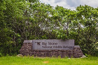
Straddling the headwaters of the Minnesota River in west-central Minnesota, Big Stone National Wildlife Refuge is within the heart of the tallgrass prairie's historic range. Today, less than one-percent of tallgrass prairie remains.
Crane Meadows National Wildlife Refuge, located in central Minnesota, USA, was established in 1992 to preserve a large, natural wetland complex. It is an essential stop for many species of migrating birds. Located within a large watershed that includes Rice, Skunk and Mud Lakes, Platte and Skunk Rivers, Rice and Buckman Creeks, and sedge meadow wetlands, it harbors one of the largest nesting populations of greater sandhill cranes in Minnesota. Habitats include native tallgrass prairie, oak savanna and wetlands with wild rice stands. With a total authorized acquisition boundary of 13,540 acres (54.8 km2) encompassing this important wetland complex and adjacent uplands, the refuge exists as scattered parcels totaling about 2,000 acres (8.1 km2). Existing ownership lies in Little Falls and Agram townships in Morrison County.

Hamden Slough National Wildlife Refuge is a National Wildlife Refuge of the United States in Minnesota. Eastern hardwood forests stretching from the Atlantic seaboard give way to the western prairie at the area, in Audubon Township, near Audubon, Minnesota. Prior to settlement, its diverse vegetation was attractive to wildlife: waterfowl, upland birds, bison, wolves, and other prairie wildlife. When fully restored, the refuge will provide the largest contiguous block of wetland prairie habitat in the region, encompassing nearly 6,000 acres (24 km2).
Northern Tallgrass Prairie National Wildlife Refuge was established to provide a means of working with individuals, groups, private organizations, and government entities to permanently preserve a portion of the remaining remnant tracts of northern tallgrass prairie in Minnesota and Iowa. The United States Fish and Wildlife Service is acquiring remnant prairie tracts for the refuge in both easement and fee title interests from willing sellers.

Waubay National Wildlife Refuge is a National Wildlife Refuge in South Dakota. "Waubay" means "a place where numbers of birds make their nests" in the Dakota language. The Refuge encompasses 4,650 acres (18.8 km2) of wetlands, native tallgrass prairie, and bur oak forest that provide a wide variety of nesting habitat for more than 100 species of waterfowl, song birds, and upland game birds as well as 140 additional bird species during migrations. Mammals include species from the ever-present white-tailed deer to the more elusive coyote and the diminutive pygmy shrew. The central location of Waubay National Wildlife Refuge in North America gives visitors the chance to see a mix of eastern, western, northern, and southern species.

Hagerman National Wildlife Refuge (HNWR), a haven for migratory birds and other wildlife, lies in northwestern Grayson County, Texas, on the Big Mineral Arm of Lake Texoma, on the Red River between Oklahoma and Texas. This National Wildlife Refuge is made up of water, marsh, and upland habitat. Visitors can hike, observe wildlife, hunt, and fish throughout the year.
Detroit Lakes Wetland Management District is located in northwest Minnesota and includes the counties of Becker, Clay, Mahnomen, Norman, and Polk - an area of approximately 6,000 square miles (16,000 km2). The district is divided into three general landscape areas, roughly equal in size. From west to east, these are: the Red River Valley floodplain, the glacial moraine/prairie pothole region, and the hardwood/coniferous forest. The district currently manages over 42,000 acres (170 km2) of public land in 165 waterfowl production areas (WPAs). Additionally, district staff are responsible for more than 300 wetland and upland easements on private property, totaling more than 11,000 acres (45 km2).

The Windom Wetland Management District acquires and manages Waterfowl Production Areas, enforces wetland easements, and provides conservation assistance to landowners in 12 southwestern Minnesota counties. The landscape is dominated by intense, row-crop agriculture, which has led to the drainage of most wetlands and widespread water quality problems. Deteriorating drainage tile systems and the abundance of historic wetland basins provide unlimited opportunities for wetland restorations.

Located in south-central North Dakota, Kulm Wetland Management District was established in July 1971. Located in the Prairie Pothole Region of North America, Kulm Wetland Management District provides breeding, nesting, and brood rearing areas for many species of waterfowl and other migratory birds. The District currently manages 201 waterfowl production areas that total 45,683 acres (184.87 km2), 3 national wildlife refuges that are easement refuges, and 120,000 acres (490 km2) of wetland and grassland easements. The District's headquarters is in Kulm, North Dakota.


