Aitkin County is a county in the U.S. state of Minnesota. As of the 2020 census, the population was 15,697. Its county seat is Aitkin. Part of the Mille Lacs Indian Reservation is in the county. The county was created in 1857 and organized in 1871.
Halden Township is a township in Saint Louis County, Minnesota, United States. The population was 129 at the 2010 census.

The Saint Louis River is a river in the U.S. states of Minnesota and Wisconsin that flows into Lake Superior. The largest U.S. river to flow into the lake, it is 192 miles (309 km) in length and starts 13 miles (21 km) east of Hoyt Lakes, Minnesota. The river's watershed covers 3,634 square miles (9,410 km2). Near the Twin Ports of Duluth, Minnesota and Superior, Wisconsin, the river becomes a freshwater estuary.

The Driftless Area, also known as Bluff Country and the Paleozoic Plateau, is a topographical and cultural region in the Midwestern United States that comprises southwestern Wisconsin, southeastern Minnesota, northeastern Iowa, and the extreme northwestern corner of Illinois. The Driftless Area is a USDA Level III Ecoregion: Ecoregion 52. The Driftless Area takes up a large portion of the Upper Midwest forest–savanna transition. The Blufflands refers to the eastern section of the Driftless area in Minnesota, due to the steep bluffs and cliffs around the river valleys. The western half is known as the Rochester Plateau, which is flatter than the Blufflands. The Coulee Region refers to the southwestern part of the Driftless Area in Wisconsin. It is named for its numerous ravines.

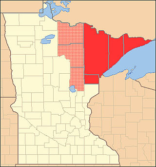
The Arrowhead Region is located in the northeastern part of the U.S. state of Minnesota, so called because of its pointed shape. The predominantly rural region encompasses 10,635.26 square miles (27,545.2 km2) of land area and includes Carlton, Cook, Lake and Saint Louis counties. Its population at the 2000 census was 248,425 residents. The region is loosely defined, and Aitkin, Itasca, and Koochiching counties are sometimes considered as part of the region, increasing the land area to 18,221.97 square miles (47,194.7 km2) and the population to 322,073 residents. Primary industries in the region include tourism and iron mining.

Grand Portage National Monument is a United States National Monument located on the north shore of Lake Superior in northeastern Minnesota that preserves a vital center of fur trade activity and Anishinaabeg Ojibwe heritage. The area became one of the British Empire's four main fur trading centers in North America, along with Fort Niagara, Fort Detroit, and Michilimackinac.
The Chicago Portage was an ancient portage that connected the Great Lakes waterway system with the Mississippi River system. Connecting these two great water trails meant comparatively easy access from the mouth of the St Lawrence River on the Atlantic Ocean to the Rocky Mountains, and the Gulf of Mexico. The approximately six-mile link had been used by Native Americans for thousands of years during the Pre-Columbian era for travel and trade.

Jay Cooke State Park is a state park of Minnesota, United States, protecting the lower reaches of the Saint Louis River. The park is located about 10 miles (16 km) southwest of Duluth and is one of the ten most visited state parks in Minnesota. The western half of the park contains part of a rocky, 13-mile (21 km) gorge. This was a major barrier to Native Americans and early Europeans traveling by canoe, which they bypassed with the challenging Grand Portage of the St. Louis River. The river was a vital link connecting the Mississippi waterways to the west with the Great Lakes to the east.

The geology of Minnesota comprises the rock, minerals, and soils of the U.S. state of Minnesota, including their formation, development, distribution, and condition.

Minnesota State Highway 232 (MN 232) was a 9.540-mile-long (15.353 km) highway in northeast Minnesota, which ran from its intersection with Aitkin County Road 3 on the east edge of Palisade and continued east to its eastern terminus at its intersection with State Highway 65 and Aitkin County Road 14 in Shamrock Township, near Big Sandy Lake and the town of McGregor. Almost sixteen years after the Minnesota Legislature repealed MN 232's route definition in 1996, MnDOT and Aitkin County finally came to an agreement in April 2012 to transfer the road to the county, which became an extension of Aitkin County Road 3.

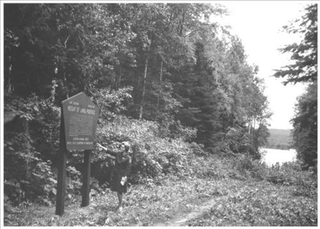
Height of Land Portage is a portage along the historic Boundary Waters route between Canada and the United States. Located at the border of the Canadian province of Ontario and the U.S. state of Minnesota, the path is a relatively easy crossing of the Laurentian Divide separating the Hudson Bay and Great Lakes-St. Lawrence watersheds.

The proglacial lakes of Minnesota were lakes created in what is now the U.S. state of Minnesota in central North America in the waning years of the last glacial period. As the Laurentide Ice Sheet decayed at the end of the Wisconsin glaciation, lakes were created in depressions or behind moraines left by the glaciers. Evidence for these lakes is provided by low relief topography and glaciolacustrine sedimentary deposits. Not all contemporaneous, these glacial lakes drained after the retreat of the lobes of the ice sheets that blocked their outlets, or whose meltwaters fed them. There were a number of large lakes, one of which, Glacial Lake Agassiz, was the largest body of freshwater known to have existed on the North American continent; there were also dozens of smaller and more transitory lakes filled from glacial meltwater, which shrank or dried as the ice sheet retreated north.

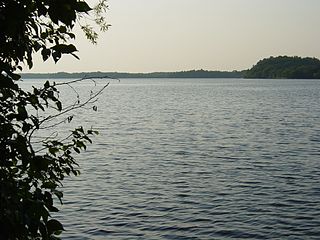
Big Sandy Lake is a lake in Aitkin County, Minnesota, approximately nine miles north of McGregor. The lake is considered fertile walleye ground with several habitat types, including the open main basin, the deep, cold eastern basin, and a shallow, more isolated south basin. Shallow bays containing dense beds of wild rice are found on south, west, and northwest sides of the lake.

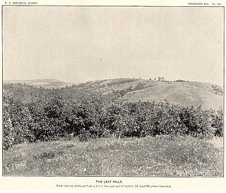
The Leaf Hills Moraines, sometimes called the Leaf Mountains, are a range of hills in west-central Minnesota. The land does not exhibit many characteristics of mountains, but nevertheless rises typically to a height of 100 to 300 feet above the surrounding farmland, occasionally reaching higher than 350 feet (107 m). The name of this range of hills is translated from the Ojibwe Gaaskibag-wajiwan, which was interpreted by Gilfillan as “Rustling Leaf Mountains.” The name is also shared by Leaf Mountain Township, the two Leaf Lakes ("Gaaskibag-wajiwi-zaaga'iganan"), and the Leaf River ("Gaaskibag-wajiwi-ziibi"), all named for the hills. In turn, the hills in Ojibwe are named after Inspiration Peak ("Gaaskibag-wajiw"), a prominent hill in this area.
The East Savanna River is a small yet historic stream in Aitkin and Saint Louis counties in the U.S. state of Minnesota. With a total length of 15.3 miles (24.6 km), the river rises in Wolf Lake, a small body of water within a spruce bog in Savanna Portage State Park, and flows northeasterly to the Saint Louis River at Floodwood, whence its waters flow to Lake Superior through the Great Lakes and the Saint Lawrence River to the Atlantic Ocean. A few thousand years ago the East Savanna was part of the Mississippi River itself, originating in northeast Minnesota and flowing southwesterly to Big Sandy Lake, from which the great river drained down its present valley to the Gulf of Mexico.

The North Shore Highlands are a physiographic and ecological region of the U.S. state of Minnesota in central North America. They were formed by a variety of geologic processes, but are principally composed of rock created by magma and lava from a rift about 1.1 billion years ago, which rock formations are interspersed with and overlain by glacial deposits. Their ecology derives from these origins, with thin, rocky soils supporting flora and fauna typical of their northern, inland location.
The Mississippi Headwaters State Forest is a state forest located near the town of Wilton in Beltrami County, Minnesota. Portions of the forest extend into the neighboring counties of Clearwater and Hubbard. The majority of the forest is managed by the respective counties, with the Minnesota Department of Natural Resources managing around 9,000 acres (3,600 ha). The forest is named after its location immediately downstream (north) of Lake Itasca, the headwaters of the Mississippi River.

This article covers the water based Canadian canoe routes used by early explorers of Canada with special emphasis on the fur trade.
Libby is an unincorporated community in Libby Township, Aitkin County, Minnesota, United States. The community is located between McGregor and Jacobson along State Highway 65. The Mississippi River flows nearby. Libby is located immediately northwest of Big Sandy Lake.
The Savanna State Forest is located in Aitkin and Saint Louis counties in the U.S. State of Minnesota. Comprising over 238,000 acres, the forest is bisected by the Upper Mississippi River, and contains Savanna Portage State Park, which preserves a historic trade route connecting the Mississippi River with upper reaches of the Saint Lawrence River drainage basin.


