Montezuma National Wildlife Refuge is a wildlife preserve operated by the United States Fish and Wildlife Service, encompassing part of the Montezuma Swamp at the north end of Cayuga Lake. The 10,004-acre (40.48 km2) preserve is composed of swamps, pools and channels and is a stopping point for migratory birds. It is the largest contiguous wetland complex in the northeastern United States and comprises a portion of the larger Montezuma Wetlands Complex, which is a partnership between the USFWS, the New York State Department of Environmental Conservation, as well as several other non-profit support organizations.

Quivira National Wildlife Refuge in south central Kansas, United States, includes rare inland marshes. Located near the town of Stafford, it lies mostly in northeastern Stafford County, but small parts extend into southwestern Rice and northwestern Reno Counties. Its proximity to the Central Flyway migration route and the salt marshes on the refuge combine to endow the refuge with a large variety of birds. Many of these birds are uncommon in other parts of Kansas or even the central part of the continent.

Arrowwood National Wildlife Refuge is located in the U.S. state of North Dakota. Arrowwood NWR is a part of the Arrowwood National Wildlife Refuge Complex, and is managed by the U.S. Fish and Wildlife Service. The refuge parallels 16 miles (27 km) of the James River and is a mixture of wetlands, forest and prairie. Efforts to ensure the refuge continues to provide prime nesting habitat for waterfowl include prescribed fire, haying, crop cultivation and livestock grazing. The refuge has forests with oak and hackberry which are uncommon on the prairie. It is believed that the name for the refuge is derived from Native American naming for arrow wood, as the wood in the forest was prized for the making of arrows.

Chase Lake Wetland Management District is located in the U.S. state of North Dakota around Chase Lake. The district is located in what is known as the Prairie Pothole Region of lakes and ponds, which were left behind by the retreat of glaciers at the end of the last ice age. It was established in 1993.
The Rydell National Wildlife Refuge is an 2,120-acre (9 km2) National Wildlife Refuge in northwestern Minnesota, located in Woodside Township, Polk County, just west of Erskine in northwestern Minnesota. It was established in 1992, and receives more than 7,800 visitors each year. The refuge is a combination of maple/basswood/oak forest, wetlands, tallgrass prairie and bogs.

Goose Lake Prairie State Natural Area is a 2,537-acre (1,027 ha) state park in Illinois. More than half of the state park is a tallgrass prairie maintained as an Illinois Nature Preserve. It is located in Grundy County near the town of Morris approximately 50 miles (80 km) southwest of Chicago.

Glacial Ridge National Wildlife Refuge was created on October 12, 2004, the 545th National Wildlife Refuge in the United States. Its creation was the result of cooperation between at least 30 agencies or governmental entities. The creation of the refuge was spearheaded by The Nature Conservancy, and the initial endowment of 2,300 acres (9.3 km2) of land was donated by the Conservancy. In light of its planned final size of 37,756 acres (153 km2), it is described by the US Fish and Wildlife Service as "the largest tallgrass prairie and wetland restoration project in U.S. history."

Lacassine National Wildlife Refuge is located in Cameron and Evangeline Parishes in southwestern Louisiana, was established in 1937 by Executive Order No. 7780 as "a refuge and breeding ground for migratory birds and other wildlife." The refuge is nearly 35,000 acres (140 km2) in size, including 653 acres (2.64 km2) leased from the Cameron Parish School Board. The Evangeline Parish unit is called Duralde Prairie and is currently being developed. It is located south of the city of Eunice.

Wapato Lake is a restored historic lake located in what became parts of Washington County and Yamhill County in the U.S. state of Oregon. The area was sometimes known as Wapato Lake Bed and Wapato Flat. The lake is located about a half mile east of Gaston at 55 metres (180 ft) elevation. The lake bed soils contain a layer of organic peat that once supported a wetland community dominated by the wapato plant, Sagittaria latifolia, particularly in the upper marsh areas. Wapato plants were reintroduced to the restored lake by tribal people from the Confederated Tribes of the Grand Ronde Community in preparation for the opening of the Wapato Lake National Wildlife Refuge in March 2023.

The Michigan Wetland Management District consists of a 14-county area and includes three waterfowl production areas (WPAs): the 160-acre (0.65 km2) Schlee WPA and the 138-acre (0.56 km2) Mahan WPA in Jackson County and the 77-acre (310,000 m2) Kinney WPA in Van Buren County. The Michigan Department of Natural Resources, Wildlife Division, oversees day-to-day management of these three areas through a partnership with the U.S. Fish and Wildlife Service.

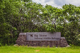
Straddling the headwaters of the Minnesota River in west-central Minnesota, Big Stone National Wildlife Refuge is within the heart of the tallgrass prairie's historic range. Today, less than one-percent of tallgrass prairie remains.
Northern Tallgrass Prairie National Wildlife Refuge was established to provide a means of working with individuals, groups, private organizations, and government entities to permanently preserve a portion of the remaining remnant tracts of northern tallgrass prairie in Minnesota and Iowa. The United States Fish and Wildlife Service is acquiring remnant prairie tracts for the refuge in both easement and fee title interests from willing sellers.
Waubay Wetland Management District is located in the "Coteau des Prairies", or prairie hills region of South Dakota. It includes more than 300 waterfowl production areas (WPAs) in six counties of northeastern South Dakota: Clark, Codington, Day, Grant, Marshall, and Roberts. The WPAs range from 40 acres (16 ha) to more than 1,600 acres (650 ha) in size, comprising a total of 40,000 acres (160 km2). WPAs provide vital wildlife habitat in a landscape of cropland and pasture.

Hagerman National Wildlife Refuge (HNWR), a haven for migratory birds and other wildlife, lies in northwestern Grayson County, Texas, on the Big Mineral Arm of Lake Texoma, on the Red River between Oklahoma and Texas. This National Wildlife Refuge is made up of water, marsh, and upland habitat. Visitors can hike, observe wildlife, hunt, and fish throughout the year.
Big Stone Wetland Management District is a protected area encompassing scattered wetlands in Lincoln and Lyon Counties, Minnesota, United States. It is operated by the U.S. Fish and Wildlife Service out of headquarters within Big Stone National Wildlife Refuge. District staff also serve private land resource interests by providing technical assistance for United States Department of Agriculture programs and restoring wetlands on private lands.
Detroit Lakes Wetland Management District is located in northwest Minnesota and includes the counties of Becker, Clay, Mahnomen, Norman, and Polk - an area of approximately 6,000 square miles (16,000 km2). The district is divided into three general landscape areas, roughly equal in size. From west to east, these are: the Red River Valley floodplain, the glacial moraine/prairie pothole region, and the hardwood/coniferous forest. The district currently manages over 42,000 acres (170 km2) of public land in 165 waterfowl production areas (WPAs). Additionally, district staff are responsible for more than 300 wetland and upland easements on private property, totaling more than 11,000 acres (45 km2).
The Fergus Falls Wetland Management District is a protected area in the U.S. state of Minnesota. It was established in 1962 with the initiation of the Accelerated Small Wetlands Acquisition Program. It is located in west central Minnesota and includes the counties of Douglas, Grant, Otter Tail, Wadena and Wilkin.
The Morris Wetland Management District includes 244 waterfowl production areas, encompassing over 50,000 acres (200 km2) scattered throughout an eight-county area. Like other wetland management districts in the prairie states, the goal of the Morris District is to restore and protect sufficient wetland and grassland habitat to meet the needs of prairie wildlife, particularly breeding waterfowl, as well as provide places for public recreation.
The St. Croix Wetland Management District in west-central Wisconsin, United States, encompasses a diversity of habitats lying along the eastern edge of the tallgrass prairie. Within the eight-county district, one can travel north through the high river bluffs of Pepin County, to the prairie potholes of St. Croix County, and then to the pine barrens of Burnett County.

The Sue and Wes Dixon Waterfowl Refuge is a 3,100-acre riverine wetland in Putnam County, Illinois. Located just south of the county seat of Hennepin, it occupies the former site of Hennepin Lake and adjacent Hopper Lake. The reclaimed wetland is a Ramsar treaty site, a wetland of international importance.


