
Starved Rock State Park is a state park in the U.S. state of Illinois, characterized by the many canyons within its 2,630 acres (1,064 ha). Located just southeast of the village of Utica, in Deer Park Township, LaSalle County, Illinois, along the south bank of the Illinois River, the park hosts over two million visitors annually, the most for any Illinois state park.

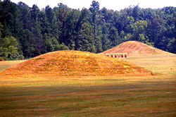
Ocmulgee Mounds National Historical Park in Macon, Georgia, United States preserves traces of over ten millennia of culture from the Indigenous peoples of the Southeastern Woodlands. Its chief remains are major earthworks built before 1000 CE by the South Appalachian Mississippian culture These include the Great Temple and other ceremonial mounds, a burial mound, and defensive trenches. They represented highly skilled engineering techniques and soil knowledge, and the organization of many laborers. The site has evidence of "12,000 years of continuous human habitation." The 3,336-acre (13.50 km2) park is located on the east bank of the Ocmulgee River. Macon, Georgia developed around the site after the United States built Fort Benjamin Hawkins nearby in 1806 to support trading with Native Americans.

Moccasin Bend Archeological District is an archeological site in Chattanooga, Tennessee, that is part of the Chickamauga and Chattanooga National Military Park unit. The National Park Service refers to it as one of the "most unique units found in the entire National Park Service." The area contains remnants of 12,000 years of continuous human habitation and serves as an area with unique cultural significance. For many years, there was little recognition of the historical significance of the area, and years of industrial development occurred on and around sites of archeological importance. After decades of campaigning by concerned citizens, private organizations, local officials, the Friends of Moccasin Bend National Park, and finally a state representative, the area was officially recognized as a National Archeological District in 2003. Moccasin Bend is currently undergoing a process of renovation and restoration that will allow the area to fulfill the National Park Service's mission of preserving "natural and cultural resources" for the "enjoyment, education, and inspiration of this and future generations."

Shiloh Indian Mounds Site (40HR7) is an archaeological site of the South Appalachian Mississippian culture. It is located beside the Tennessee River on the grounds of the Shiloh National Military Park, in Hardin County of southwestern Tennessee. A National Historic Landmark, it is one of the largest Woodland era sites in the southeastern United States.

This is a list of properties and districts in Illinois that are on the National Register of Historic Places. There are over 1,900 in total. Of these, 85 are National Historic Landmarks. There are listings in all of the state's 102 counties.
This National Park Service list is complete through NPS recent listings posted January 3, 2025.
The Mound House is an archeological site located in Greene County, Illinois in the Illinois River floodplain. The site is a multicomponent site; however, the mounds were constructed during the Middle Woodland and are associated with the Havana Hopewell culture. The mound center has two identified mounds.

The Kincaid Mounds Historic Site c. 1050–1400 CE, is a Mississippian culture archaeological site located at the southern tip of present-day U.S. state of Illinois, along the Ohio River. Kincaid Mounds has been notable for both its significant role in native North American prehistory and for the central role the site has played in the development of modern archaeological techniques. The site had at least 11 substructure platform mounds, and 8 other monuments.

Albany Mounds State Historic Site, also known as Albany Mounds Site, is a historic site operated by the Illinois Historic Preservation Agency. It spans over 205 acres of land near the Mississippi River at the northwest edge of the state of Illinois in the United States. In 1974, the site was added to the National Register of Historic Places list. The historical site is under the provision of the Illinois Historic Preservation Agency, a governmental agency founded in 1985 for the maintaining of historical sites within the state. In the 1990s, the site underwent a restoration project that aimed to return its appearance to its original condition.

The archaeology of Iowa is the study of the buried remains of human culture within the U.S. state of Iowa from the earliest prehistoric through the late historic periods. When the American Indians first arrived in what is now Iowa more than 13,000 years ago, they were hunters and gatherers living in a Pleistocene glacial landscape. By the time European explorers visited Iowa, American Indians were largely settled farmers with complex economic, social, and political systems. This transformation happened gradually. During the Archaic period American Indians adapted to local environments and ecosystems, slowly becoming more sedentary as populations increased. More than 3,000 years ago, during the Late Archaic period, American Indians in Iowa began utilizing domesticated plants. The subsequent Woodland period saw an increase on the reliance on agriculture and social complexity, with increased use of mounds, ceramics, and specialized subsistence. During the Late Prehistoric period increased use of maize and social changes led to social flourishing and nucleated settlements. The arrival of European trade goods and diseases in the Protohistoric period led to dramatic population shifts and economic and social upheaval, with the arrival of new tribes and early European explorers and traders. During the Historical period European traders and American Indians in Iowa gave way to American settlers and Iowa was transformed into an agricultural state.

The Mines of Spain State Recreation Area and E. B. Lyons Nature Center is a state park in Dubuque County, Iowa, United States. It is near Dubuque, the eleventh-largest city in the state. The park features picnic areas, 15 miles (24 km) of walking/hiking trails, 4 miles (6.4 km) of ski trails, and the Betty Hauptli Bird and Butterfly Garden. It also includes archaeological sites of national importance as an early lead mining and smelting venture led by French explorer Julien Dubuque, as well as Dubuque's gravesite. These sites were collectively designated a National Historic Landmark District as Julien Dubuque's Mines.

Towosahgy State Historic Site (23MI2), also known as Beckwith's Fort Archeological Site, is a large Mississippian archaeological site with a Woodland period Baytown culture component located in Mississippi County, Missouri, United States. It is believed to have been inhabited from c. 400–1350 CE. The site is maintained by the Missouri Department of Natural Resources as a state historic site. The name Towosahgy is an Osage word which means "old town". It is not known if members of the historic Osage people, who dominated a large area of present-day Missouri at the beginning of the 19th century, ever occupied the site. The site was acquired by the Missouri state park system in 1967 and added to the National Register of Historic Places in 1969 as NRIS number 69000113.
Pharr Mounds is a Middle Woodland period archaeological site located near Tupelo in parts of Itawamba and Prentiss counties in northern Mississippi. This complex was made of earthwork mounds.

The Bynum Mound and Village Site (22CS501) is a Middle Woodland period archaeological site located near Houston in Chickasaw County, Mississippi. The complex of six burial mounds was in use during the Miller 1 and Miller 2 phases of the Miller culture and was built between 100 BC and 100 AD. It was listed on the National Register of Historic Places in 1989 as part of the Natchez Trace Parkway at milepost 232.4.

Cranberry Creek Archeological District, also known as Cranberry Creek Mound Group, is an ancient American Indian burial mound site from circa AD 100–800 near New Miner, Wisconsin, United States. It is three miles east of Necedah National Wildlife Refuge in Juneau County. It is part of the "effigy mound culture" of native peoples in Wisconsin, who practiced the "respectful burial of their dead".

The Cleiman Mound and Village Site is a prehistoric archaeological site located near the Mississippi River in Jackson County, Illinois. The site includes an intact burial mound and the remains of a village site. The village was inhabited by a number of prehistoric cultures during the Archaic, Woodland, and Mississippian periods; settlement at the site began prior to 400 B.C. and lasted through 1300 A.D. The mound was built during the Middle Woodland Period by Hopewellian peoples and is likely the only Hopewell mound in the Mississippi Valley in Southern Illinois.

The Carrier Mills Archaeological District is a group of prehistoric archaeological sites located along the Saline River south of Carrier Mills, Illinois. The sites were inhabited over the period from 2500 B.C. to 700 A.D. The oldest three sites date from the Late Archaic period, which encompassed the first 1500 years of occupation at the district; these sites include two small campsites and a larger base camp. Several sites were inhabited during the Early Woodland period, which lasted until 500 B.C.; these sites are distinguished by fragments of pottery, which was developed during this period. The Early Woodland period sites are likely to have been a part of the Crab Orchard culture, a local subtype of the Hopewell tradition. A number of sites date from the Middle Woodland Period, which spanned from 300 B.C. to 500 A.D.; these sites appear to have adopted the technology, but not the traditions, of the Hopewell culture. A single projectile point from the Late Woodland period has also been recovered from the site.

The Collins Archeological District is a pre-Columbian archaeological site located in Kennekuk County Park in Vermilion County, Illinois. The site dates from the Late Woodland period and was used roughly from 900 to 1100 A.D. The core of the site includes two mounds and a ceremonial area. The inhabitants of the region used the site for ceremonial purposes, and the ceremonies conducted at the site were influenced by Mississippian traditions. The site provides evidence of the spread of Mississippian culture from Cahokia to other peoples and regions.

The Spikebuck Town Mound and Village Site is a prehistoric and historic archaeological site on Town Creek near its confluence with the Hiwassee River within the boundaries of present-day Hayesville, North Carolina. The site encompasses the former area of the Cherokee village of Quanassee and associated farmsteads. The village was centered on what is known as Spikebuck Mound, an earthwork platform mound, likely built about 1,000 CE by ancestral indigenous peoples during the South Appalachian Mississippian culture period.

Duncan Farm is an archaeological site located on a farmstead south of Illinois Route 100 in Jersey County, Illinois, near the city of Grafton. The site, which dates from the Woodland period, includes two burial mounds and a habitation site. The site was part of the Hopewell exchange system in Illinois and is the closest neighboring village site to the Golden Eagle regional transaction center, a major trade and social hub in the system. Archaeologists have suggested that the site is a local transaction center in the Golden Eagle site's region due to its two large mounds, which are roughly 200 feet (61 m) long and 100 feet (30 m) wide each. In addition, the site is archaeologically significant due to its distinctive stratification, which allows its artifacts to be easily dated.

The John Chapman Village Site is a prehistoric archaeological site located in the Apple River Valley south of Hanover, Illinois. The site includes a village area and a platform mound; the latter is the only known platform mound in the Apple River Valley. The village was occupied from roughly 1100 to 1250 A.D., toward the end of the Late Woodland period and the beginning of the Mississippian period; it is associated with a transitional phase between the two periods known as the Bennett Phase. Archaeologists have hypothesized that the site formed part of a trade network between Cahokia and settlements further north, such as Aztalan, as evidenced by the artifacts found at the site.


