This article needs additional citations for verification .(July 2022) |
Narasinghapur Narsingpur | |
|---|---|
Village | |
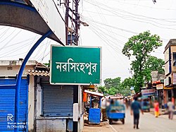 Narasinghapur Bus Stand | |
 Narasinghapur Location in West Bengal  Narasinghapur Location in India  Narasinghapur Location in Asia  Narasinghapur Location in Earth | |
| Coordinates: 24°12′03″N88°41′38″E / 24.2009204°N 88.6939674°E | |
| Country | |
| State | West Bengal |
| District | Murshidabad |
| Named after | Narasimha |
| Government | |
| • Type | State governments |
| Population | |
• Total | 4,939 |
| Languages | |
| • Official | Bengali, English |
| Time zone | UTC+5:30 (IST) |
| PIN | 742306 |
| Vehicle registration | WB 58 |
| Lok Sabha constituency | Murshidabad |
| Vidhan Sabha constituency | Jalangi |
| Website | Official Website |
Narsinghpur or Narasinghapur is a village in CD block Jalangi in the Domkal subdivision of the Murshidabad district in the state of West Bengal, India. [1] It was formerly under Jalangi Police Station but now it is under newly formed Sagarpara Police Station. The district headquarters is located at a distance of 65 km from Berhampore.
Contents
It has a population of around 5,000, engaged in trades , small scale industries , agricultural and .It lies at the geographic co-ordinates of latitude 24.2009204, longitude 88.6939674.
There is a many Temples and education Schools & Colleges situated near Narasinghapur. Narasinghapur is located under Jalangi police station in West Bengal. It is 2 kilometres from the Padma River.


