O'Hara's Tower | |
---|---|
O'Hara's Folly | |
Part of Fortifications of Gibraltar | |
Upper Rock Nature Reserve, Gibraltar | |
Coordinates | 36°07′26″N5°20′34″W / 36.123845°N 5.342880°W |
Type | Watchtower |
Site history | |
Built | 1787-1791 |
Materials | Stone, Iron |
Demolished | 1888 |
O'Hara's Tower was a watchtower in the British Overseas Territory of Gibraltar. It was located at the highest point of the Rock of Gibraltar, at what is now O'Hara's Battery, near the southern end of the Upper Rock Nature Reserve.
Initially known as St. George's Tower, it was constructed in the late 18th century on the order of then Lieutenant Governor Charles O'Hara, under the presumption that it would be useful in observing the enemy at the Port of Cadiz.
Not only was it unsuccessful; it was struck by lightning shortly after it was built, and remained in ruins for much of the 19th century until its demolition in 1888. Formerly referred to as St. George's Tower, it came to be known as O'Hara's Tower or, frequently, O'Hara's Folly. [1] [2]
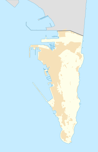
O'Hara's Tower was in Gibraltar, the British Overseas Territory at the southern end of the Iberian Peninsula. [3] [4] The watchtower was located at the summit of the Rock of Gibraltar near what is now O'Hara's Battery in the southern end of the Upper Rock Nature Reserve, at an altitude of 426 metres (1,398 ft). [5] [6] [7] It was positioned at the southern terminus of the current O'Hara's Road, known as O'Hara's Point. [8] [9]
The tower had first been proposed by General Charles O'Hara, then Lieutenant Governor, who served as Governor of Gibraltar from 1795 to 1802. [5] [11] [12] He was notorious for having surrendered to both George Washington and Napoleon Bonaparte, at Yorktown (1781) and Toulon (1793), respectively. [13] [14] [15] O'Hara had been of the opinion that a tower at The Rock's summit would enable the garrison to observe the activity of the Spanish fleet at the Port of Cadiz, about 60 miles (97 km) away. [6] [7] [11] He was alone in this belief; despite this, with persistence, he succeeded in having the tower built. [6] [12] It was constructed of hewn stone and iron between 1787 and 1791. [1] [16] [17]
However, others' concerns were justified, as it turned out that Cadiz was not visible from the tower due to the elevation of intervening mountains. [2] [12] Not long after the tower's construction, it was hit by lightning during a violent storm and severely damaged. One of the tower's sentinels died in the lightning strike. [1] [12] [17] By 1811 the tower had garnered the nickname of "O'Hara's Folly", bestowed by the garrison. [1] [11] [17] O'Hara's Tower was in ruins through much of the remainder of the 19th century. [12] [17]
O'Hara's Tower had been scheduled for demolition in 1888. [6] [7] [11] The details of its demolition vary slightly. In one account, the tower came down that year as a result of target practice by the crew of HMS Wasp. [7] In another, there was a wager between the gunners of the garrison and the officers of HMS Wasp. The men of HMS Wasp adjusted their guns such that they were able to target at a high elevation, and brought down the tower with their sixth shot. [6] However this is unlikely due to the fact HMS Wasp (1880) foundered in 1884 and HMS Wasp (1886) was lost with all hands in 1887. Following demolition of the tower, O'Hara's Battery was constructed on the same site, with the first 6-inch breech-loading gun installed on a Vavasseur mounting in 1890. [18]
The Rock of Gibraltar is a monolithic limestone mountain 426 m (1,398 ft) high dominating the western entrance to the Mediterranean Sea. It is situated near the end of a narrow 9 kilometres (5.6 mi) long promontory stretching due south into the Mediterranean Sea and is located within the British territory of Gibraltar, and is 27 km north-east of Tarifa, Spain, the southwestern tip of Europe on the Iberian Peninsula. The rock serves as an impregnable fortress and contains a labyrinthine network of man-made tunnels known as the Tunnels of Gibraltar. Most of the Rock's upper area comprises a nature reserve which is home to about 300 Barbary macaques. It is a major tourist attraction.
The Royal Gibraltar Regiment is part of British Forces Gibraltar for the British overseas territory of Gibraltar, which historically, along with Bermuda, Halifax, Nova Scotia, and Malta, had been designated an Imperial fortress rather than a colony. It was formed in 1958 from the Gibraltar Defence Force as an infantry unit, with an integrated artillery troop. The regiment is included in the British Army as a defence engagement force.
General Charles O'Hara was a British Army officer who served in the Seven Years' War, the American War of Independence, and the French Revolutionary War and later served as governor of Gibraltar. He served with distinction during the American War of Independence, commanding a brigade of Foot Guards as part of the army of Charles Cornwallis and was wounded during the Battle of Guilford Courthouse. He offered the British surrender during the siege of Yorktown on behalf of his superior Charles Cornwallis and is depicted in the eponymous painting by John Trumbull. During his career O'Hara personally surrendered to both George Washington and Napoleon Bonaparte.
The Trafalgar Cemetery is a cemetery in the British Overseas Territory of Gibraltar. Formerly known as the Southport Ditch Cemetery, it occupies a small area of land just to the south of the city walls, in what had been a defensive ditch during the period of Spanish rule of Gibraltar. Although it is named for the Battle of Trafalgar of 21 October 1805, only two victims of the battle are buried there. The remainder of the interments are mostly of those killed in other sea battles or casualties of the yellow fever epidemics that swept Gibraltar between 1804 and 1814. In addition, tombstones were transferred to the Trafalgar Cemetery from St. Jago's Cemetery and Alameda Gardens.
Rosia Bay is the only natural harbour in Gibraltar, the British Overseas Territory at the southern end of the Iberian Peninsula. Formerly referred to as Rosia Harbour, it is located on the southwest side of Gibraltar. Rosia Bay was the site of the Royal Navy Victualling Yard complex which was constructed in the early 19th century, allowing vessels to anchor and obtain provisions, including food and water. Vice Admiral Horatio Nelson obtained supplies for his Mediterranean Fleet at Rosia Bay. It was to that same anchorage that his vessel HMS Victory was towed after Nelson's death in the 1805 Battle of Trafalgar. The area is also the location of gun batteries, including Parson's Lodge Battery at the south end of the bay and Napier of Magdala Battery at the north end. In the 21st century, Rosia Bay was the focus of controversy following the government's demolition of the historic Rosia Water Tanks and construction of the affordable housing development Nelson's View, which necessitated the relocation of the owners of the adjacent 19th century Rosia Cottages.
Prince Edward's Gate is a city gate at the entrance to Prince Edward's Road in the British Overseas Territory of Gibraltar. It cuts through Charles V Wall, one of the 16th century fortifications of Gibraltar at the former southern limit of the city. The gate is adjacent to the west wall of the Flat Bastion, another 16th-century fortification. The gate was named after Prince Edward, the future Duke of Kent, and was opened in 1790, the same year the prince arrived at Gibraltar as commander of the 7th Regiment of Foot. While the gate now has a limited role in the defence of Gibraltar, it continues to provide vehicular and pedestrian access through Charles V Wall. Prince Edward's Gate is listed with the Gibraltar Heritage Trust.
The Southport Gates are three city gates in the British Overseas Territory of Gibraltar. They are located in the Charles V Wall, one of the 16th century fortifications of Gibraltar. The gates are clustered together, with the South Bastion to the west, and the Trafalgar Cemetery to the east. The first and second Southport Gates were constructed at present day Trafalgar Road in 1552 and 1883, respectively. The third gate, Referendum Gate, is the widest of the three and was constructed in 1967 at Main Street, immediately west of the first two gates. The Southport Gates are listed with the Gibraltar Heritage Trust.
Streets in the British Overseas Territory of Gibraltar are represented by road signs as in the United Kingdom. As of 2007, Gibraltar has a network of 29 kilometres (18 mi) of roads.
The Gibraltar Cross of Sacrifice is a war memorial in the British Overseas Territory of Gibraltar. It is located west of North Front Cemetery, at the junction of Winston Churchill Avenue and Devil's Tower Road. The Cross of Sacrifice was designed by Sir Reginald Blomfield in 1917, and his monument is found in numerous Commonwealth War Graves Commission cemeteries. The cross in Gibraltar was erected by the Royal Engineers for the commission, and unveiled on Armistice Day 1922. The British Pathé film recorded at the dedication ceremony that day represents the first motion picture made in Gibraltar. The Gibraltar Cross of Sacrifice served as the focus of Remembrance Sunday ceremonies in Gibraltar until 2009, at which time the location was changed to the Gibraltar War Memorial.
Princess Caroline's Battery is an artillery battery in the British Overseas Territory of Gibraltar. It is located at the northern end of the Upper Rock Nature Reserve, at the junction of Willis's Road and Queen's Road. The nearby Princess Anne's Battery is often mistakenly referred to as Princess Caroline's Battery. The latter was built in 1732 and named after Princess Caroline, the daughter of King George II. Princess Caroline's Battery was updated in 1905, and a 6 inch Mark VII gun was mounted above the magazine. Later, the battery was decommissioned and the gun removed. The underground magazine is now home to the Military Heritage Centre, which includes the Memorial Chamber.
O'Hara's Battery is an artillery battery in the British Overseas Territory of Gibraltar. It is located at the highest point of the Rock of Gibraltar, near the southern end of the Upper Rock Nature Reserve, in close proximity to Lord Airey's Battery. It was constructed in 1890 at the former site of a watchtower that had earned the name O'Hara's Folly. The battery and tower were both named after the Governor of Gibraltar Charles O'Hara. The first gun mounted on the battery was a 6-inch breech loading gun, which was replaced with a 9.2 inch Mark X BL gun in 1901. The battery was in use during World War II and was last fired during training exercises in 1976. O'Hara's Battery has been refurbished and is open to the public. The battery and its associated works are listed with the Gibraltar Heritage Trust.
Princess Amelia's Battery is an artillery battery in the British Overseas Territory of Gibraltar. It is located on Willis's Plateau at the northern end of the Upper Rock Nature Reserve, adjacent to Gun No. 4 of Princess Anne's Battery. It was named after Princess Amelia of Great Britain, the second daughter of George II. It was formerly referred to as the 2nd Willis's Battery. The plateau and its batteries had previously been named after an artillery officer by the name of Willis who was outstanding during the capture of Gibraltar in 1704. Princess Amelia's Battery saw action during the Great Siege of Gibraltar, during which it sustained substantial damage. Little remains of the original site, aside from two derelict buildings. The battery is listed with the Gibraltar Heritage Trust.
Lord Airey's Battery is an artillery battery in the British Overseas Territory of Gibraltar. It is located near the southern end of the Upper Rock Nature Reserve, just north of O'Hara's Battery. It was named after the Governor of Gibraltar, General Sir Richard Airey. Construction of the battery was completed in 1891. The first gun mounted on the battery was a 6-inch breech loading gun, which was replaced with a 9.2-inch Mark X BL gun by 1900. The gun at the battery was last fired in the 1970s. In 1997, it was discovered that Lord Airey's Shelter, adjacent to Lord Airey's Battery, was the site chosen for a covert World War II operation that entailed construction of a cave complex in the Rock of Gibraltar, to serve as an observation post. The battery is listed with the Gibraltar Heritage Trust.
Breakneck Battery is an artillery battery in the British Overseas Territory of Gibraltar. It is located on Ministry of Defence property at the Upper Rock Nature Reserve, north of Lord Airey's Battery. It is one of a dozen batteries in Gibraltar that had 9.2-inch (233.7 mm) guns installed around the turn of the twentieth century. The emplacement features a 9.2-inch Mark X breech-loading gun on a Mark V mounting. The battery was refurbished by 10 Signal Regiment in 2012 and 2016 whilst being on Ceremonial duties whilst the Gibraltar Regiment where on exercise and is one of three surviving 9.2-inch gun emplacements at the Upper Ridge of the Rock of Gibraltar. By the late twentieth century, the 9.2-inch guns in Gibraltar, Bermuda, Portugal, South Africa, and Australia were the remaining examples of an emplacement that at one point had been mounted at strategic locations across the British Empire.
Spur Battery is an artillery battery in the British Overseas Territory of Gibraltar. It is located in the Upper Battery area of the southern end of the Upper Rock Nature Reserve, just southwest of O'Hara's Battery. A 9.2-inch Mark X breech-loading gun was mounted on the emplacement in 1902, with improvements made to the battery after World War I. In 1981 the 9.2-inch gun at Spur Battery was dismantled and transferred to the Imperial War Museum in Duxford, England, for preservation. The operation was known as Project Vitello.
Levant Battery is an artillery battery in the British Overseas Territory of Gibraltar. It is located on Windmill Hill, at the southern end of the Upper Rock Nature Reserve, below observation post Fire Control South. It was named after the Levanter cloud, below which it perched, giving it an unobstructed view. Construction started in 1901 and, by 1903, a 9.2-inch Mark X breech-loading gun had been mounted. The battery was decommissioned in the 1970s and the gun was later removed, to rest in a scrap yard. A community group has been formed to garner support for the gun's recovery and restoration.
Middle Hill is a hill in the British Overseas Territory of Gibraltar. It is located at the northern end of the Upper Rock Nature Reserve. It figured prominently in the early history of the 1704 siege of Gibraltar by the Spanish and French. The artillery battery at Middle Hill had been constructed by 1727 and was active for more than two centuries. In the mid twentieth century, Middle Hill transitioned to use as an aerial farm for the Ministry of Defence. The radio farm was refurbished in 1958. About 1970, the Princess Caroline's Battery Group of Barbary macaques were moved to Middle Hill, where they were provisioned at a group of derelict buildings that were part of the battery complex. In 2005, much of Middle Hill was transferred from the Ministry of Defence to the Government of Gibraltar, and is now managed by the Gibraltar Ornithological and Natural History Society.
The twelfth siege of Gibraltar was fought between September 1704 and May 1705 during the War of the Spanish Succession. It followed the capture in August 1704 of the fortified town of Gibraltar, at the southern tip of Spain, by an Anglo–Dutch naval force led by Sir George Rooke and Prince George of Hesse-Darmstadt. The members of the Grand Alliance, the Holy Roman Empire, England, the Netherlands, Pro-Habsburg Spain, Portugal and Savoy, had allied to prevent the unification of the French and Spanish thrones by supporting the claim of the Habsburg pretender Archduke Charles VI of Austria as Charles III of Spain. They were opposed by the rival claimant, the Bourbon Philip, Duke of Anjou, ruling as Philip V of Spain, and his patron and ally, Louis XIV of France. The war began in northern Europe and was largely contained there until 1703, when Portugal joined the confederate powers. From then, English naval attentions were focused on mounting a campaign in the Mediterranean to distract the French navy and disrupt French and Bourbon Spanish shipping or capture a port for use as a naval base. The capture of Gibraltar was the outcome of that initial stage of the Mediterranean campaign.
King's Bastion is a coastal bastion on the western front of the fortifications of the British overseas territory of Gibraltar, protruding from the Line Wall Curtain. It is located between Line Wall Road and Queensway and overlooks the Bay of Gibraltar. It played a crucial role in defending The Rock during the Great Siege of Gibraltar. In more recent history the bastion was converted into a generating station which powered Gibraltar's electricity needs. Today it continues to serve the community as Gibraltar's leisure centre.
Mediterranean Steps is a path and nature trail in the British Overseas Territory of Gibraltar. One of the footpaths of Gibraltar, the path is located entirely within the Upper Rock Nature Reserve and was built by the British military but is now used by civilians as a pedestrian route linking Martin's Path to Lord Airey's Battery near the summit of Rock of Gibraltar. The path offers views over the Strait of Gibraltar, Windmill Hill, Europa Point, the Great Sand Dune, Gibraltar's east side beaches, the Mediterranean Sea and the Spanish Costa del Sol.