Pic River 50 | |
---|---|
Pic River 50 | |
Coordinates: 48°38′N86°16′W / 48.633°N 86.267°W Coordinates: 48°38′N86°16′W / 48.633°N 86.267°W | |
Country | |
Province | |
District | Thunder Bay |
First Nation | Ojibways of the Pic River |
Area | |
• Land | 3.65 km2 (1.41 sq mi) |
Population (2011) [1] | |
• Total | 395 |
• Density | 108.3/km2 (280/sq mi) |
Website | www.picriver.com |
Biigtigong Nishnaabeg is an Ojibway (Anishinaabe) First Nation on the northern shore of Lake Superior. It is sometimes referred to as Ojibways of the Pic River First Nation (or "Pic River" for short). Pic River is not a signatory to the Robinson Superior treaty; however, they did petition, starting in 1879, for a reserve and the request was subsequently granted. The community is located on the on the northern shore of Lake Superior at the mouth of the Pic River 316.6-hectare (782-acre) and is called Pic River 50. In November 2007, their total registered population was 964 people, of which their on-reserve population was 480.
The Ojibwe, Ojibwa, Chippewa, or Saulteaux are an Anishinaabe people of Canada and the United States. They are one of the most numerous indigenous peoples north of the Rio Grande. In Canada, they are the second-largest First Nations population, surpassed only by the Cree. In the United States, they have the fifth-largest population among Native American peoples, surpassed in number only by the Navajo, Cherokee, Choctaw and Sioux.
Anishinaabe is the autonym for a group of culturally related indigenous peoples in what are now Canada and the United States. These include the Odawa, Saulteaux, Ojibwe, Potawatomi, Oji-Cree, and Algonquin peoples. The Anishinaabe speak Anishinaabemowin, or Anishinaabe languages that belong to the Algonquian language family. They historically lived in the Northeast Woodlands and Subarctic.
In Canada, the First Nations are the predominant indigenous peoples in Canada south of the Arctic Circle. Those in the Arctic area are distinct and known as Inuit. The Métis, another distinct ethnicity, developed after European contact and relations primarily between First Nations people and Europeans. There are 634 recognized First Nations governments or bands spread across Canada, roughly half of which are in the provinces of Ontario and British Columbia.
The mouth of the Pic River has been a center of native trade and settlement for thousands of years. It was a strategic location in the region's water transportation network because it offered access to northern lands and a canoe route to James Bay. The halfway point for canoers travelling the north shore of Lake Superior, "the Pic" first appeared on European maps in the mid-seventeenth century.
Local First Nations peoples traded furs with the French as early as the 1770s. A French fur trader set up a permanent post around 1792. The Hudson's Bay Company set up a permanent post in 1821 until encroaching settlement let to its relocation in 1888. In 1914, their Pic River 50 became a treaty-established reserve.
The fur trade is a worldwide industry dealing in the acquisition and sale of animal fur. Since the establishment of a world fur market in the early modern period, furs of boreal, polar and cold temperate mammalian animals have been the most valued. Historically the trade stimulated the exploration and colonization of Siberia, northern North America, and the South Shetland and South Sandwich Islands.
The Hudson's Bay Company is a Canadian retail business group. A fur trading business for much of its existence, HBC now owns and operates retail stores in Canada, the United States, and parts of Europe, including Belgium, the Netherlands, and Germany. The company's namesake business division is Hudson's Bay, commonly referred to as The Bay. Other divisions include Galeria Kaufhof, Home Outfitters, Lord & Taylor and Saks Fifth Avenue. HBC's head office is currently located in Brampton, Ontario. The company is listed on the Toronto Stock Exchange under the symbol "HBC".
Pic River 50 is an Indian reserve on the north shore of Lake Superior at the mouth of the Pic River, near Marathon, Ontario, Canada. The reserve is 316.6 ha within its exterior boundaries. The reserve contains the community of Heron Bay, Ontario and serves as the land-base for the Ojibways of the Pic River First Nation. In November, 2007, the First Nation reported their total registered population was 964 people, of which their on-reserve population was 480.
In Canada, an Indian reserve is specified by the Indian Act as a "tract of land, the legal title to which is vested in Her Majesty, that has been set apart by Her Majesty for the use and benefit of a band."
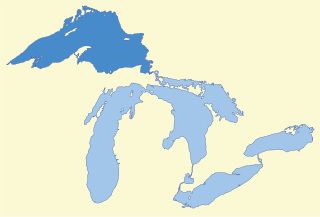
Lake Superior, the largest of the Great Lakes of North America, is also the world's largest freshwater lake by surface area, and the third largest freshwater lake by volume. The lake is shared by the Canadian province of Ontario to the north, the U.S. state of Minnesota to the west, and Wisconsin and the Upper Peninsula of Michigan to the south. The farthest north and west of the Great Lakes chain, Superior has the highest elevation of all five great lakes and drains into the St. Mary's River.
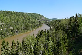
The Pic River is a river in the east part of Thunder Bay District in northwestern Ontario, Canada. It flows from McKay Lake southeast of the community of Longlac and empties into Lake Superior southeast of the town of Marathon.
Pic River 50 is known for the role it has played in developing "run of the river" hydroelectric projects in Northern Ontario. It is partner to three projects: the 13.5 MW Black River generating station (GS), the 5.0 MW Twin Falls GS and the 23.0 MW Umbata Falls GS. In all, these projects produce enough electricity to meet the needs of some 30,000 homes in Ontario.
Ojibways of the Pic River First Nation are currently attempting to create a self-sustainable reserve with employment, education and resources being developed and used within the reserve itself. Thus far, Pic River 50 has a thriving forestry company, a cable television company and a high speed internet company.
The Pic River 50 reserve is home to many wild Northern Ontario species such as the beaver, moose, woodland caribou, wolf, black bear, white tailed and red tailed hawk, bald eagle, northern flicker, and many arctic alpine plants. The shores of Pic River 50 are dominated by the mass sandy dunes on the Little Pic river, which translates to "little muddy."
The beaver is a large, primarily nocturnal, semiaquatic rodent. Castor includes two extant species, the North American beaver and Eurasian beaver (Eurasia). Beavers are known for building dams, canals, and lodges (homes). They are the second-largest rodent in the world. Their colonies create one or more dams to provide still, deep water to protect against predators, and to float food and building material. The North American beaver population was once more than 60 million, but as of 1988 was 6–12 million. This population decline is the result of extensive hunting for fur, for glands used as medicine and perfume, and because the beavers' harvesting of trees and flooding of waterways may interfere with other land uses.
The moose or elk (Eurasia), Alces alces, is a member of the New World deer subfamily and is the largest and heaviest extant species in the deer family. Moose are distinguished by the broad, palmate antlers of the males; other members of the deer family have antlers with a dendritic ("twig-like") configuration. Moose typically inhabit boreal forests and temperate broadleaf and mixed forests of the Northern Hemisphere in temperate to subarctic climates. Hunting and other human activities have caused a reduction in the size of the moose's range over time. Moose have been reintroduced to some of their former habitats. Currently, most moose are found in Canada, Alaska, New England, Fennoscandia, Baltic states, and Russia. Their diet consists of both terrestrial and aquatic vegetation. The most common moose predators are the gray wolf along with bears and humans. Unlike most other deer species, moose do not form herds and are solitary animals, aside from calves who remain with their mother until the cow begins estrus, at which point the cow chases away young bulls. Although generally slow-moving and sedentary, moose can become aggressive and move quickly if angered or startled. Their mating season in the autumn features energetic fights between males competing for a female.
The wolf, also known as the gray/grey wolf, timber wolf, or tundra wolf, is a canine native to the wilderness and remote areas of Eurasia and North America. It is the largest extant member of its family, with males averaging 43–45 kg (95–99 lb) and females 36–38.5 kg (79–85 lb). It is distinguished from other Canis species by its larger size and less pointed features, particularly on the ears and muzzle. Its winter fur is long and bushy and predominantly a mottled gray in color, although nearly pure white, red and brown to black also occur. Mammal Species of the World, a standard reference work in zoology, recognises 38 subspecies of C. lupus.
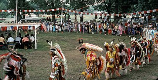
Pic River hosts an annual pow wow in mid July. The First Nation is active in economic and workforce development, with interests in run-of-the-river hydroelectric generating plants on the Kagiano River and Black River (Wawatay Generating Station). [2]
A pow wow is a social gathering held by many different Native American communities. A modern pow wow is a specific type of event for Native American people to meet and dance, sing, socialize, and honor their cultures. Pow wows may be private or public. There is generally a dancing competition, with many different types of traditional dances, music and regalia, often with significant prize money awarded. Pow wows vary in length from a one-day event, to major pow wows called for a special occasion which can be up to one week long.
The Kagiano River is a river in the east part of Thunder Bay District in northwestern Ontario, Canada. It is in the Great Lakes Basin and flows from Devork Lake, 42 kilometres (26 mi) south of the community of Longlac on Ontario Highway 11, to the Pic River 55 kilometres (34 mi) north northeast of the town of Marathon on Ontario Highway 17.
The Black River is a river in Thunder Bay District in Northwestern Ontario, Canada. It is part of the Great Lakes Basin, and is a left tributary of the Pic River.
The current electoral leadership of the council consists of Chief Duncan Michano and 10 councillors. Their two-year term began on October 1, 2014.
James Bay is a large body of water on the southern end of Hudson Bay in Canada. Both bodies of water extend from the Arctic Ocean, of which James Bay is the southernmost part. It borders the provinces of Quebec and Ontario. Islands within the bay are part of the Nunavut territory.
Thunder Bay District is a district and census division in Northwestern Ontario in the Canadian province of Ontario. The district seat is Thunder Bay.
Lake Superior Provincial Park is one of the largest provincial parks in Ontario, covering about 1,550 square kilometres (600 sq mi) along the northeastern shores of Lake Superior between Sault Ste. Marie and Wawa in Algoma District in Northeastern Ontario, Canada. Ontario Highway 17 now runs through the park. When the park was established by Ontario in 1944, there was no road access.
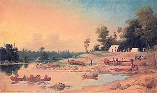
The Winnipeg River is a Canadian river which flows roughly northwest from Lake of the Woods in the province of Ontario to Lake Winnipeg in Manitoba. This river is 235 kilometres (146 mi) long from the Norman Dam in Kenora to its mouth at Lake Winnipeg. Its watershed is 106,500 square kilometres (41,100 sq mi) in area, mainly in Canada. About 29,000 square kilometres (11,000 sq mi) of the watershed is in northern Minnesota, United States.
Lake Nipigon is the largest lake entirely within the boundaries of the Canadian province of Ontario. It is part of the Great Lake drainage basin.
Fort Albany First Nation is a Cree First Nation reserve in Cochrane District in Northeastern Ontario, Canada. Situated on the southern shore of the Albany River, Fort Albany First Nation is only accessible by air or by winter road. The community is policed by the Nishnawbe-Aski Police Service, an Aboriginal-based service. It shares the Fort Albany 67 Indian Reserve with the Kashechewan First Nation. Fort Albany First Nation controls the Fort Albany Indian Settlement on the south shore of the Albany River, and the Kashechewan First Nation controls the Kashechewan Indian Settlement directly across the river.
Rod Michano, is a noted Canadian First Nations HIV/AIDS activist and educator. He is a member of the Ojibways of the Pic River First Nation in Northern Ontario.
Eabametoong, also known as Fort Hope or Eabamet Lake by Canada Post, is an Ojibway First Nations band government in Kenora District, Ontario, Canada. Located on the shore of Eabamet Lake in the Albany River system, the community is located approximately 300 kilometres northeast of Thunder Bay and is accessible only by airplane via Fort Hope Airport or water, or by winter/ice roads, which connect the community to the Northern Ontario Resource Trail. The Eabametoong First Nation Reserve is completely surrounded by territory of the Unorganized Kenora District.
Robinson Treaty may refer to one of two treaties signed between the Ojibwa chiefs and The Crown in 1850. The first treaty involved Ojibwa chiefs along the north shore of Lake Superior. The second treaty, signed two days later, also included Ojibwa chiefs from along the eastern and northern shores of Lake Huron. The Wiikwemkoong First Nation did not sign either treaty, and their land is considered "unceded".
Kitchenuhmaykoosib Inninuwug, also known as Big Trout Lake First Nation or KI for short, is an Oji-Cree First Nation reserve in Northwestern Ontario and is a part of Treaty 9. The community is about 580 km (360 mi) north of Thunder Bay, Ontario.
Pays Plat First Nation is a small First Nation reserve community located near Rossport, Ontario, Canada, about 175 kilometres (109 mi) northeast of Thunder Bay. The Pays Plat 51 Reserve is in the boundaries of the territory described in the Robinson-Superior Treaty of 1850. The community is located along Highway 17.
Deer Lake First Nation is an Oji-Cree First Nations band government in Northern Ontario, located north of Red Lake, Ontario Canada. It is one of the few First Nations in Ontario to have signed Treaty 5. It is part of the Keewaytinook Okimakanak Council and the Nishnawbe Aski Nation. As of December, 2007, the First Nation had 1,072 registered members, of which their on-reserve population was 868.
Ear Falls is a community and township located in Northwestern Ontario, Canada, on the right bank of the English River near the outlet of Lac Seul. It is located along Highway 105, 100 kilometres (62 mi) north of Highway 17 and Vermilion Bay, about halfway between Highway 17 and Red Lake, or about 480 kilometres (300 mi) northwest of Thunder Bay.
Chapleau Ojibway First Nation is an Ojibwa First Nation located near Chapleau Township, Sudbury District, Ontario, Canada. The First Nation have reserved for themselves the 67 ha Chapleau 61A Indian Reserve, 64.7 ha Chapleau 74 Indian Reserve and the 799.3 ha Chapleau 74A Indian Reserve. In September, 2007, their total registered population 39, of which their on-reserve population was 30.
Long Lake 58 First Nation is a Anishinaabe (Ojibway) First Nation band government located in Northern Ontario, located approximately 40 km east of Geraldton, Ontario, Canada, on the northern shore of Long Lake, immediately north of Ginoogaming First Nation and west of the community of Longlac, Ontario. As of January, 2008, their total registered population was 1,248 people, of which their on-Reserve population was 427.
The Whitesand First Nation is an Ojibway First Nation reserve in Northern Ontario, Canada. They have reserved for themselves the 249-hectare (615-acre) Whitesand reserve. The community of Armstrong Settlement is their main community, located coterminously with Armstrong, Thunder Bay District, Ontario. In June 2008, their total registered population was 1086 people, of which their on-reserve population was 311.
The Batchewana First Nation of Ojibways is an Ojibway First Nation in northern Ontario. Their traditional lands run along the eastern shore of Lake Superior, from Batchawana Bay to Whitefish Island. They were reserved this land in the 1850 Robinson Huron Treaty, but surrendered most of it under the 1859 Pennefather Treaty. Through purchase and land claims, it has reclaimed some territories, including Goulais Bay 15A, Obadjiwan 15E, Rankin Location 15D and Whitefish Island.