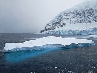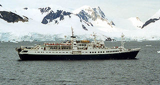
Thurston Island is a largely ice-covered, glacially dissected island, 135 nautical miles long and 55 nautical miles wide, lying between Amundsen Sea and Bellingshausen Sea a short way off the northwest end of Ellsworth Land, Antarctica. The island is separated from the mainland by Peacock Sound, which is occupied by the west portion of Abbot Ice Shelf.
The Prince Olav Mountains is a mountain group in the Queen Maud Mountains in Antarctica stretching from Shackleton Glacier to Liv Glacier at the head of the Ross Ice Shelf.

James Ross Island is a large island off the southeast side and near the northeastern extremity of the Antarctic Peninsula, from which it is separated by Prince Gustav Channel. Rising to 1,630 metres (5,350 ft), it is irregularly shaped and extends 40 nautical miles in a north–south direction.
Drygalski Glacier is a broad glacier, 18 nautical miles long which flows southeast from Herbert Plateau through a rectangular re-entrant to a point immediately north of Sentinel Nunatak on the east coast of Graham Land, Antarctica.
Surveyors Range is a 30 miles (48 km) long mountain range in the Churchill Mountains of Antarctica.
The Detroit Plateau is a major interior plateau of Graham Land on the Antarctic Peninsula, with heights between 1,500 and 1,800 metres. Its northeast limit is marked by the south wall of Russell West Glacier, from which it extends some 90 nautical miles in a general southwest direction to Herbert Plateau.
The Duroch Islands are a group of islands and rocks which extend over an area of about 3 nautical miles, centred about 1 nautical mile off Cape Legoupil on the north coast of Trinity Peninsula, Antarctica. The islands are close to Chile's Base General Bernardo O'Higgins Riquelme at Cape Legoupil.
The Mulock Glacier is a large, heavily crevassed glacier which flows into the Ross Ice Shelf 40 kilometers south of the Skelton Glacier in the Ross Dependency, Antarctica.
Chavdar Peninsula is a 10 kilometres (6.2 mi) wide peninsula projecting 13 kilometres (8.1 mi) in northwest direction from Graham Land on the Antarctic Peninsula in Antarctica.
Bogen Glacier is a small glacier on the north side of Drygalski Fjord between Trendall Crag and Hamilton Bay, at the southeast end of South Georgia. It was named by the UK Antarctic Place-Names Committee in 1979 after Arne Bogen, Norwegian sealer working in South Georgia after 1950; Master of the sealing vessel Albatross and Station Foreman, Grytviken.
Dead End Glacier is a glacier flowing east from the south end of the Salvesen Range of South Georgia into the west side of Salomon Glacier. It was surveyed by the South Georgia Survey in the period 1951–57, and so named by the UK Antarctic Place-Names Committee because there is no route for sledging parties from the head of this glacier to the north shore of Drygalski Fjord.
Lancing Glacier is a glacier 3 nautical miles (6 km) long, flowing south from Mount Corneliussen and Smillie Peak to Newark Bay on the south side of South Georgia. It was surveyed by the South Georgia Survey in the period 1951–57, and named by the UK Antarctic Place-Names Committee for the Lancing, built in 1898, and converted to a whale factory ship in 1923. It was the first factory ship to be fitted with a slipway.

Andvord Bay is a bay, 9 nautical miles long and 3 nautical miles wide, which lies between Beneden Head and Duthiers Point along the west coast of Graham Land, Antarctica.
The Cayley Glacier is a glacier flowing northwest into the south side of Brialmont Cove, on the west coast of Graham Land, Antarctica.

Croft Bay is a bay which indents the north-central side of James Ross Island and forms the southern part of Herbert Sound, south of the northeastern end of the Antarctic Peninsula.

Paradise Harbour is a wide embayment behind Lemaire Island and Bryde Island, indenting the west coast of Graham Land, Antarctica, between Duthiers Point and Leniz Point. The name was first applied by whalers operating in the vicinity and was in use by 1920.
Goldsmith Glacier is a glacier flowing west-northwest through the Theron Mountains of Antarctica, 6 nautical miles (11 km) south of Tailend Nunatak. It was first mapped in 1956–57 by the Commonwealth Trans-Antarctic Expedition (CTAE) and named for Rainer Goldsmith, medical officer with the advance party of the CTAE in 1955–56.
Hobbs Ridge is a prominent arc-shaped ridge which circumscribes Hobbs Glacier to the north and northwest and forms the divide with the lower part of Blue Glacier, on the Scott Coast of Victoria Land, Antarctica. It was named in association with Hobbs Glacier. It forms the northernmost part of the Denton Hills.
Lehrke Inlet is an ice-filled inlet, 8 nautical miles wide, which recedes southwest for 17 nautical miles between Cape Boggs and Cape Sharbonneau, along the east coast of Palmer Land, Antarctica.
Bone Bay is a rectangular bay along the northwest coast of Trinity Peninsula, Antarctica. It is nearly 10 nautical miles wide at the entrance between Notter Point and Cape Roquemaurel.


