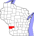
Readstown, Wisconsin

Last updated
Readstown, Wisconsin
Readstown municipal building and post office.JPG
Readstown Municipal Building and post office
Vernon County Wisconsin Incorporated and Unincorporated areas Readstown Highlighted.svg
Location of Readstown in Vernon County, Wisconsin.
Coordinates: 43°26′55″N90°45′39″W / 43.44861°N 90.76083°W / 43.44861; -90.76083 Coordinates: 43°26′55″N90°45′39″W / 43.44861°N 90.76083°W / 43.44861; -90.76083
Country Flag of the United States.svg  United States
State Flag of Wisconsin.svg  Wisconsin
County Vernon
Area
[1]
  Total1.73 sq mi (4.49 km2)
  Land1.71 sq mi (4.43 km2)
  Water0.02 sq mi (0.05 km2)
Elevation
[2]
761 ft (232 m)
Population
 (2010) [3]
  Total415
  Estimate 
(2019) [4]
416
  Density243.13/sq mi (93.86/km2)
Time zone UTC-6 (Central (CST))
  Summer (DST) UTC-5 (CDT)
Area code(s) 608
FIPS code 55-66450 [5]
GNIS feature ID1572122 [2]
Website www.mwt.net/~vilrdstn/

Readstown is a village in Vernon County, Wisconsin, United States. The population was 415 at the 2010 census.

Contents

Geography

Readstown is located at 43°26′55″N90°45′39″W / 43.44861°N 90.76083°W / 43.44861; -90.76083 (43.448544, -90.760708). [6]

According to the United States Census Bureau, the village has a total area of 1.79 square miles (4.64 km2), of which, 1.77 square miles (4.58 km2) of it is land and 0.02 square miles (0.05 km2) is water. [7]

Demographics

Historical population
CensusPop.
1900 403
1910 51527.8%
1920 5466.0%
1930 544−0.4%
1940 5847.4%
1950 541−7.4%
1960 469−13.3%
1970 395−15.8%
1980 3960.3%
1990 4206.1%
2000 395−6.0%
2010 4155.1%
2019 (est.)416 [4] 0.2%
U.S. Decennial Census [8]

2010 census

At the 2010 census there were 415 people, 186 households, and 99 families living in the village. The population density was 234.5 inhabitants per square mile (90.5/km2). There were 213 housing units at an average density of 120.3 per square mile (46.4/km2). The racial makup of the village was 96.4% White, 1.4% African American, 0.2% Native American, 1.0% Asian, and 1.0% from two or more races. Hispanic or Latino of any race were 1.2%. [3]

Of the 186 households 25.3% had children under the age of 18 living with them, 39.2% were married couples living together, 9.7% had a female householder with no husband present, 4.3% had a male householder with no wife present, and 46.8% were non-families. 38.7% of households were one person and 23.1% were one person aged 65 or older. The average household size was 2.20 and the average family size was 2.99.

The median age in the village was 44.9 years. 20.7% of residents were under the age of 18; 5.5% were between the ages of 18 and 24; 24.1% were from 25 to 44; 30.7% were from 45 to 64; and 19% were 65 or older. The gender makeup of the village was 46.0% male and 54.0% female.

2000 census

At the 2000 census there were 395 people, 187 households, and 104 families living in the village. The population density was 221.0 people per square mile (85.2/km2). There were 216 housing units at an average density of 120.8 per square mile (46.6/km2). The racial makup of the village was 100.00% White. [5] Of the 187 households 22.5% had children under the age of 18 living with them, 41.7% were married couples living together, 8.0% had a female householder with no husband present, and 43.9% were non-families. 36.9% of households were one person and 25.1% were one person aged 65 or older. The average household size was 2.11 and the average family size was 2.73.

The age distribution was 21.0% under the age of 18, 7.6% from 18 to 24, 24.3% from 25 to 44, 24.8% from 45 to 64, and 22.3% 65 or older. The median age was 43 years. For every 100 females, there were 85.4 males. For every 100 females age 18 and over, there were 80.3 males.

The median household income was $21,250 and the median family income was $28,125. Males had a median income of $26,250 versus $18,889 for females. The per capita income for the village was $12,957. About 9.3% of families and 21.2% of the population were below the poverty line, including 27.8% of those under age 18 and 21.4% of those age 65 or over.

Related Research Articles

Whitmore Village, Hawaii Census-designated place in Hawaii, United States

Whitmore Village is a census-designated place (CDP) in Honolulu County, Hawaiʻi, United States. The population was 4,499 at the 2010 census.

Melba, Idaho City in Idaho, United States

Melba is a city in Canyon County, Idaho. The population was 513 at the time of the 2010 census, up from 439 in 2000. It is part of the Boise metropolitan area.

Wilder, Idaho City in Idaho, United States

Wilder is a city in Canyon County, Idaho, United States. The population was 1,533 at the 2010 census.

Fraser, Iowa City in Iowa, United States

Fraser is a city in Dodge Township, Boone County, Iowa, United States. The population was 101 at the time of the 2020 census. It is part of the Boone, Iowa Micropolitan Statistical Area, which is a part of the larger Ames-Boone, Iowa Combined Statistical Area. The city is located along the Des Moines River.

Marne, Iowa City in Iowa, United States

Marne is a city in Cass County, Iowa, United States. The population was 110 at the time of the 2020 census.

Monona, Iowa City in Iowa, United States

Monona is a city in Clayton County, Iowa, United States. The population was 1,471 at the time of the 2020 census.

Orchard, Iowa City in Iowa, United States

Orchard is a city in Mitchell County, Iowa, United States. The population was 68 at the time of the 2020 census.

Ruthven, Iowa City in Iowa, United States

Ruthven is a city in Palo Alto County, Iowa, United States. The population was 725 at the time of the 2020 census.

Varina, Iowa City in Iowa, United States

Varina is a city in Pocahontas County, Iowa, United States. The population was 68 at the time of the 2020 census.

Castalia, Iowa City in Iowa, United States

Castalia is a city in Winneshiek County, Iowa, United States. The population was 145 at the 2020 census.

Kensett, Iowa City in Iowa, United States

Kensett is a city in Worth County, Iowa, United States. The population was 257 at the time of the 2020 census. It is part of the Mason City Micropolitan Statistical Area.

Hollandale, Minnesota City in Minnesota, United States

Hollandale is a city on State Highway 251 in Freeborn County, Minnesota, United States. The population was 303 at the 2010 census.

Wheatland, Missouri City in Missouri, United States

Wheatland is a city in Hickory County, Missouri, United States. The population was 371 at the 2010 census.

Unity Village, Missouri Village in Missouri, United States

Unity Village is a village in Jackson County, Missouri, United States, bordering Kansas City and Lee's Summit. Its population was 99 at the 2010 census. It is the world headquarters of Unity Church, which has over 2 million followers. The Unity Tower was designed by the Kansas City firm Boillot & Lauck and built in 1929 to store water. Unity Village is part of the Kansas City metropolitan area.

Tarrants, Missouri Inactive Village in Missouri, United States

Tarrants is an inactive village in Pike County, Missouri, United States. The population was 22 at the 2010 census.

Riverton, Nebraska Village in Nebraska, United States

Riverton is a village in Franklin County, Nebraska, United States. The population was 89 at the 2010 census.

Regan, North Dakota City in North Dakota, United States

Regan is a city in Burleigh County, North Dakota, United States. Its population was 43 at the 2010 census.

Wood Village, Oregon City in Oregon, United States

Wood Village is a city in Multnomah County, Oregon, United States. The population was 3,878 at the 2010 census. Despite the name, Wood Village is classified as a city.

Sherwood, Wisconsin Village in Wisconsin, United States

Sherwood is a village in Calumet County, Wisconsin, United States. The population was 2,713 at the 2010 census. The former historical unincorporated community of High Cliff is located within present-day Sherwood. The current mayor of Sherwood is Ryan T Washington of Neenah.

Winter, Wisconsin Village in Wisconsin, United States

Winter is a village in Sawyer County, Wisconsin, United States. The population was 233 at the 2010 census. The village is within the Town of Winter.

References

  1. "2019 U.S. Gazetteer Files". United States Census Bureau. Retrieved August 7, 2020.
  2. 1 2 "US Board on Geographic Names". United States Geological Survey. 2007-10-25. Retrieved 2008-01-31.
  3. 1 2 "U.S. Census website". United States Census Bureau . Retrieved 2012-11-18.
  4. 1 2 "Population and Housing Unit Estimates". United States Census Bureau. May 24, 2020. Retrieved May 27, 2020.
  5. 1 2 "U.S. Census website". United States Census Bureau . Retrieved 2008-01-31.
  6. "US Gazetteer files: 2010, 2000, and 1990". United States Census Bureau. 2011-02-12. Retrieved 2011-04-23.
  7. "US Gazetteer files 2010". United States Census Bureau. Archived from the original on 2012-01-25. Retrieved 2012-11-18.
  8. "Census of Population and Housing". Census.gov. Retrieved June 4, 2015.