Reubens, Idaho

Last updated

Reubens, Idaho
Reubens city, Idaho [1]
[2]
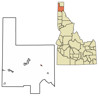
Lewis County Idaho Incorporated and Unincorporated areas Reubens Highlighted 1667150.svg
Location of Reubens in Lewis County, Idaho.
Coordinates: 46°19′23″N116°32′34″W / 46.32306°N 116.54278°W / 46.32306; -116.54278
Country United States
State Idaho
County Lewis
Area
[3]
  Total
0.17 sq mi (0.44 km2)
  Land0.17 sq mi (0.44 km2)
  Water0.00 sq mi (0.00 km2)
Elevation
[4]
3,524 ft (1,074 m)
Population
 (2010) [5]
  Total
71
  Density378.70/sq mi (146.07/km2)
Time zone UTC-8 (Pacific (PST))
  Summer (DST) UTC-7 (PDT)
ZIP code
83548 [6]
Area code 208
FIPS code 16-67150
GNIS feature ID2410928 [4]
Historical population
CensusPop.Note
1920 176
1930 1918.5%
1940 119−37.7%
1950 116−2.5%
1960 113−2.6%
1970 81−28.3%
1980 877.4%
1990 46−47.1%
2000 7256.5%
2010 71−1.4%
2019 (est.)64 [7] −9.9%
U.S. Decennial Census [8]

Reubens is a city in Lewis County, Idaho, United States, on the Camas Prairie. The population was 71 at the 2010 census, and 72 in 2000. [9]

Contents

Geography

According to the United States Census Bureau, the city has a total area of 0.29 square miles (0.75 km2), all of it land. [10]

The town is located on the northern edge of Lewis County, immediately south of the Nez Perce County line. Reubens is located on a flat, with thin and deep valleys located just over a mile to the east and west. On the west, Lapwai Creek cuts a gorge more than a thousand feet deep and carries U.S. Route 95. To the east, the valley of Big Canyon Creek reaches depths of nearly a thousand feet in the immediate vicinity of Reubens. [11]

Demographics

2010 census

As of the census [5] of 2010, there were 71 people, 29 households, and 20 families residing in the city. The population density was 244.8 inhabitants per square mile (94.5/km2). There were 32 housing units at an average density of 110.3 per square mile (42.6/km2). The racial makeup of the city was 97.2% White, 1.4% Native American, and 1.4% from two or more races.

There were 29 households, of which 41.4% had children under the age of 18 living with them, 58.6% were married couples living together, 10.3% had a female householder with no husband present, and 31.0% were non-families. 27.6% of all households were made up of individuals, and 3.4% had someone living alone who was 65 years of age or older. The average household size was 2.45 and the average family size was 2.95.

The median age in the city was 39.8 years. 28.2% of residents were under the age of 18; 4.2% were between the ages of 18 and 24; 26.9% were from 25 to 44; 33.7% were from 45 to 64; and 7% were 65 years of age or older. The gender makeup of the city was 46.5% male and 53.5% female.

2000 census

As of the census [12] of 2000, there were 72 people, 28 households, and 18 families residing in the city. The population density was 248.1 inhabitants per square mile (95.8/km2). There were 31 housing units at an average density of 106.8 per square mile (41.2/km2). The racial makeup of the city was 97.22% White, 1.39% from other races, and 1.39% from two or more races.

There were 28 households, out of which 39.3% had children under the age of 18 living with them, 57.1% were married couples living together, 3.6% had a female householder with no husband present, and 35.7% were non-families. 32.1% of all households were made up of individuals, and 7.1% had someone living alone who was 65 years of age or older. The average household size was 2.57 and the average family size was 3.33.

In the city, the population was spread out, with 33.3% under the age of 18, 29.2% from 25 to 44, 23.6% from 45 to 64, and 13.9% who were 65 years of age or older. The median age was 38 years. For every 100 females, there were 111.8 males. For every 100 females age 18 and over, there were 100.0 males.

The median income for a household in the city was $29,375, and the median income for a family was $35,417. Males had a median income of $33,750 versus $21,250 for females. The per capita income for the city was $11,078. There were 13.3% of families and 20.5% of the population living below the poverty line, including 21.2% of under eighteens and 27.3% of those over 64.[ citation needed ]

Government

No government structure is on file. [13]

See also

Related Research Articles

<span class="mw-page-title-main">Garden City, Idaho</span> City in Idaho, United States

Garden City is a city in Ada County, Idaho. The population was 12,316 at the time of the 2020 census. Garden City is nearly surrounded by Boise but retains a separate municipal government.

<span class="mw-page-title-main">Chubbuck, Idaho</span> City in Idaho, United States

Chubbuck is a city in Bannock County, Idaho. It is part of the Pocatello Metropolitan Statistical Area. The population was 15,570 at the 2020 census. Chubbuck is located immediately north of Pocatello, Idaho, and has opposed several consolidation proposals since the 1960s.

<span class="mw-page-title-main">Bloomington, Idaho</span> City in Idaho, United States

Bloomington is a city in Bear Lake County, Idaho, United States. The population was 206 at the 2010 census. It was first settled in 1864.

<span class="mw-page-title-main">East Hope, Idaho</span> City in Idaho, United States

East Hope is a city in Bonner County, Idaho, United States. The population was 210 at the 2010 census.
<span class="mw-page-title-main">Hope, Idaho</span> City in Idaho, United States

Hope is a city in Bonner County, Idaho, United States. The population was 86 at the 2010 census.

<span class="mw-page-title-main">Irwin, Idaho</span> City in Idaho, United States

Irwin is a city in Bonneville County, Idaho, United States. It is part of the Idaho Falls, Idaho Metropolitan Statistical Area. The population was 259 at the 2020 census, and 219 at the 2010 census.

<span class="mw-page-title-main">Wilder, Idaho</span> City in Idaho, United States

Wilder is a city in Canyon County, Idaho, United States. The population was 1,533 at the 2010 census.

<span class="mw-page-title-main">Soda Springs, Idaho</span> City in the United States

Soda Springs is a city in Caribou County, Idaho, United States. Its population was 3,133 at the time of the 2020 census. The city has been the county seat of Caribou County since the county was organized in 1919. In the 1860s, Soda Springs served as the seat of Oneida County.
<span class="mw-page-title-main">Weston, Idaho</span> City in Idaho, United States

Weston is a city in Franklin County, Idaho, United States. The population was 511 at the 2020 census. It is part of the Logan, Utah-Idaho Metropolitan Statistical Area. It was first settled in 1865. The community was so named due to its location at the west bank of the Bear River.

<span class="mw-page-title-main">Drummond, Idaho</span> City in Idaho, United States

Drummond is a city in Fremont County, Idaho, United States. The population was 16 at the 2010 census. It is part of the Rexburg, Idaho Micropolitan Statistical Area.

<span class="mw-page-title-main">Warm River, Idaho</span> City in Idaho, United States

Warm River is a city in Fremont County, Idaho, United States. The population was 3 at the 2010 census, making it the least populous city in Idaho. It is part of the Rexburg, Idaho Micropolitan Statistical Area.

<span class="mw-page-title-main">Wendell, Idaho</span> City in Idaho, United States

Wendell is a city in southern Gooding County, Idaho, United States. The population was 2,782 at the 2010 census.

<span class="mw-page-title-main">Hamer, Idaho</span> City in Idaho, United States

Hamer is an unincorporated area in Jefferson County, Idaho, United States. It is part of the Idaho Falls Metropolitan Statistical Area. The population was 83 at the 2020 census. Hamer was incorporated by Jefferson County in 1973, the city disincorporated after residents approved through an election in 2022.

<span class="mw-page-title-main">Hazelton, Idaho</span> City in Idaho, United States

Hazelton is a city in Jerome County, Idaho, United States. The population was 807 at the 2020 census. It is part of the Twin Falls, Idaho Micropolitan Statistical Area.
<span class="mw-page-title-main">Dalton Gardens, Idaho</span> City in Kootenai County, Idaho, United States

Dalton Gardens is a city in Kootenai County, Idaho, United States. It is considered a suburb of Coeur d'Alene and borders the city to the north and east. The city of Dalton Gardens is also part of the larger Spokane-Coeur d'Alene Combined Metropolitan Statistical Area which encompasses Kootenai County, Idaho. The population of Dalton Gardens was 2,335 at the time of the 2010 census.

<span class="mw-page-title-main">Kendrick, Idaho</span> City in Idaho, United States

Kendrick is a city in Latah County, Idaho, United States. Its population was 303 at the 2010 census, a decrease from 369 in 2000.

<span class="mw-page-title-main">Culdesac, Idaho</span> City in Idaho, United States

Culdesac is a city in Nez Perce County, Idaho, United States. The population was 380 at the 2010 census. It is part of the Lewiston, ID-WA Metropolitan Statistical Area.

<span class="mw-page-title-main">Grand View, Idaho</span> City in Owyhee County, Idaho, United States

Grand View is a city along the Snake River in Owyhee County, Idaho, United States. The population was 440 at the 2020 census. It is part of the Boise City–Nampa, Idaho Metropolitan Statistical Area.

<span class="mw-page-title-main">Marsing, Idaho</span> City in Owhyee County, Idaho, United States

Marsing is a city in Owyhee County, Idaho, United States. The population was 1,031 at the time of the 2010 census. It is part of the Boise metropolitan area.

<span class="mw-page-title-main">Fruitland, Idaho</span> City in Payette County, Idaho, United States

Fruitland is a city along the Snake and Payette rivers in Payette County, Idaho, United States. It lies along U.S. Route 95 in the Treasure Valley of southwest Idaho, about 50 miles (80 km) west of Boise on the border with Oregon. It is part of the Ontario Micropolitan Area. Fruitland is named after apple orchards that surround the community, and its slogan is "The Big Apple of Idaho."

References

  1. Bureau, US Census. "Search Results". The United States Census Bureau. Retrieved September 15, 2021.{{cite web}}: |last= has generic name (help)
  2. "Reubens - History of Idaho". historyofidaho.com. Retrieved September 15, 2021.
  3. "2019 U.S. Gazetteer Files". United States Census Bureau. Retrieved July 9, 2020.
  4. 1 2 U.S. Geological Survey Geographic Names Information System: Reubens, Idaho
  5. 1 2 "U.S. Census website". United States Census Bureau . Retrieved December 18, 2012.
  6. "Reubens, Idaho". BestPlaces.net. Retrieved September 14, 2021.
  7. "Population and Housing Unit Estimates". United States Census Bureau. May 24, 2020. Retrieved May 27, 2020.
  8. "Census of Population and Housing". Census.gov. Retrieved June 4, 2015.
  9. Spokesman-Review - 2010 census - Reubens, Idaho - accessed 2011-12-26
  10. "US Gazetteer files 2010". United States Census Bureau. Archived from the original on July 2, 2012. Retrieved December 18, 2012.
  11. "Reubens Quadrangle" (Map). usgs.gov. U.S. Geological Survey. 2020. Retrieved May 5, 2022.
  12. "U.S. Census website". United States Census Bureau . Retrieved January 31, 2008.
  13. "Reubens, Idaho". Ballotpedia. Retrieved September 15, 2021.