Santana do Araguaia Airport Aeroporto de Santana do Araguaia | |||||||||||
|---|---|---|---|---|---|---|---|---|---|---|---|
| Summary | |||||||||||
| Airport type | Private | ||||||||||
| Serves | Santana do Araguaia | ||||||||||
| Time zone | BRT (UTC−03:00) | ||||||||||
| Elevation AMSL | 187 m / 614 ft | ||||||||||
| Coordinates | 09°19′12″S050°19′43″W / 9.32000°S 50.32861°W | ||||||||||
| Map | |||||||||||
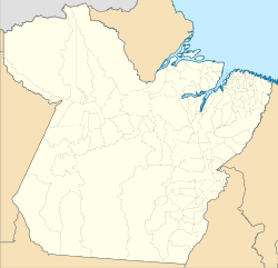 CMP Location in Brazil  CMP CMP (Brazil) | |||||||||||
| Runways | |||||||||||
| |||||||||||
| Sources: ANAC, [1] DECEA [2] | |||||||||||
Santana do Araguaia Airport( IATA : CMP, ICAO : SD12) formerly SNKE, is the airport serving Santana do Araguaia, Brazil.