Sarazm

Last updated • 8 min readFrom Wikipedia, The Free Encyclopedia
Sarazm
Sarazm,area12-W.jpg
Sarazm
West Asia non political with water system.jpg
Archaeological site icon (red).svg
Location of the site in Tajikistan
Greater Bactria map.jpg
Archaeological site icon (red).svg
Sarazm (Bactria)
Tajikistan relief map.svg
Archaeological site icon (red).svg
Sarazm (Tajikistan)
Location Sughd Region, Tajikistan
RegionZarafshan Valley
Coordinates 39°30′30″N67°27′40″E / 39.50833°N 67.46111°E / 39.50833; 67.46111
TypeSettlement
Site notes
ArchaeologistsA. Isakov, R. Besenval, B. Lyonnet
Official nameProto-urban Site of Sarazm
TypeCultural
Criteriaii, iii
Designated2010 (34th session)
Reference no. 1141rev
Region Asia-Pacific

Sarazm (Tajik : Саразм) is an ancient town and also a jamoat in north-western Tajikistan. It dates back to the 4th millennium BC, with C14 dates ranging from 3900-2100 BC, and is today a UNESCO World Heritage Site. The jamoat is part of the city of Panjakent in Sughd Region, and has a total population of 27,877 (2015). [1] It consists of 21 villages, including Chimqal'a (the seat), Abdusamad, Bostondeh, Kamar, Kamar-Tash and Sohibnazar. [2]

Contents

The archaeological site of the ancient city of Sarazm is located near Sohibnazar, a village situated on the left bank of the river Zeravshan, near the border with Uzbekistan. [3] The culture of Sarazm precedes by far the arrival of the Andronovo steppe culture in South Central Asia in the 2nd millennium BC. [4] [5] [6]

Archeology

Located 15 kilometers west of the city of Panjakent, the site occupies an area of about 1.5 km in length and 400 to 900m in width. [7] At the peak of the occupation, the site would have covered an area of up to 90 hectares, 35 of which are unobstructed. [7]

The site is of great interest for archaeologists as it constitutes the first proto-historical agricultural society in this region of Central Asia. Moreover, it is the most north-eastern of those proto-historical agricultural permanent settlements. [8] Sarazm was the first city in Central Asia to maintain economic relations with a network of settlements covering a vast territory from the Turkmenistan steppes and the Aral sea (in the northwest) to the Iranian Plateau and the Indus (in the south and southeast). [3]

Discovery and excavations

Following surface discoveries unearthed due to agricultural activity, the first excavation of the site started in 1977 and was conducted by Abdullah Isakov of the Academy of Science of Tajikistan. [8] During that first excavation, eight soundings in the different locations were conducted and three areas were excavated. [7] In 1987, seven areas were excavated and twenty soundings had been conducted. [8]

International cooperation

Artifacts excavated in Sarazm Sarazm,Dushanbe1.jpg
Artifacts excavated in Sarazm
12-petalled flower from the cult structure in Sarazm, Tajikistan, early 3rd millennium BCE 12-petalled flower MNAT SZM001.jpg
12-petalled flower from the cult structure in Sarazm, Tajikistan, early 3rd millennium BCE
Bead necklace from the tomb of the so-called "Sarazm princess" in Sarazm, Tajikistan, middle 4th millennium BCE Necklace Sarazm NMAT SZM5-190 1147-365.jpg
Bead necklace from the tomb of the so-called “Sarazm princess” in Sarazm, Tajikistan, middle 4th millennium BCE

The site was researched through multiple partnership between the Tajik SSR and international partners. Most notably, a fruitful collaboration between French and Tajik researchers flourished starting in 1984 with a first scientific mission. [9] In 1985, a cooperation agreement was signed between the Centre national de la recherche scientifique (CNRS) and the Tajik Academy of Science for three years, a partnership that would be renewed until 1998, when the French mission changed towards supporting the preservation of the site. [10] Most archeometric analysis were conducted by the CNRS in France. [9] The French mission was supervised by R. Besenval, R. Lyonnet (ceramology) and F. Cesbron (mineralogy). [9]

In 1985, two American professors, P.L. Kohl (Wellesley College) and C.C. Lamberg-Karlovsky (Harvard) took part in an expedition organised as a joint USSR and USA archeological exchange program. [11]

Stratigraphy and datation

The site is composed of four distinct layers of occupation separated by long period of abandonment. [7] [8] This classification was established during the first excavations. There are about 1.5 to 2 meters of deposits in total for about a millennium of occupation and not all four layers are found in every location, suggesting the settlement moved over the centuries. [8] The different layers are numbered Sarazm I, II, III, IV, with Sarazm I being the most ancient layer. [7] [8]

The datation of the layers is uncertain, although most agree on the first half of the 4th millennium BC as the beginning of the occupation. [8] [11] The datation has been established initially through radiocarbon dating.

Here are the datation results as recalibrated in 1985 by the American-USSR mission, using the results from the Leningrad laboratory. [11]

Sarazm Radiocarbon Datation [11]
LayerExcavationDatation (BP)Datation (Recalibrated)
Sarazm I4LE-2172:5050±60 BPcal 3907-3775 BC (1σ)
Sarazm I4LE-2173:4880±30 BPcal 3790-3645 BC (1σ)
Sarazm I2LE-2174:4940±30 BPcal 3870-3660 BC (1σ)
Sarazm II3LE-1806:4460±50 BPcal 3365-3020 BC (1σ)
Sarazm II3LE-1808:4230±40 BPcal 2970-2795 BC (1σ)
Sarazm III2LE-1807:3840±40 BPcal 2415-2185 BC (1σ)
Sarazm III3LE-1420:3790±80 BPcal 2410-2115 BC (1σ)

The excavation VII, which was conducted by the French mission also produced some radiocarbon datation of this site.

Excavation VII Radiocarbon Datation [8]
LayerDatation (BP)Datation (calibrated)
Sarazm I4450±60 BPcal 3350-2937 BC (2σ)
Sarazm I4380±70 BPcal 3330-2890 BC (2σ)
Sarazm II4130±70 BPcal 2910-2494 BC (2σ)
Sarazm III3990±70 BPcal 2863-2330 BC (2σ)
Sarazm IV3850±90 BPcal 2580-2044 BC (2σ)
Sarazm IV3800±70 BPcal 2470-2040 BC (2σ)

The datation was also confirmed through the cultural artefacts belonging to others cultures who had already been investigated. For instance the presence of Turkmen clay shards from the Namazga II and III period and Togau ceramics from Baluchistan can attest of occupation from the first half of the fourth millennium to the second half of the third millennium BC. [12]

Economy

Cylinder seal, Sarazm, Tajikistan, end of the 4th millennium BCE Cylinder seal cow MNAT SZM211.jpg
Cylinder seal, Sarazm, Tajikistan, end of the 4th millennium BCE

Following the first excavation, Isakov concludes that "It has been clearly established that the inhabitants of Sarazm were occupied not only with agriculture and herding but also with metallurgical production". [7] A large metal repertoire has been unearthed from the II, III and IV layers: daggers, awls, chisels, axes and decorative pieces were among the discoveries. [11] There is ample evidence that the metal was actually worked in Sarazm using techniques similar to those used in Mesopotamia, the Iranian Plateau and the Indus Valley. [11]

Some have even claimed that around 3000 BC, it was the largest exporting metallurgical center of Central Asia. [13]

The ceramics discovered at Sarazm indicate contacts extending to the Iranian Plateau, Northern Baluchistan and Turkmenistan. [11] For example, pottery from the Bronze Age north-eastern Iranian culture, from Seistan and Baluchistan have been found. [12]

The agriculture was also facilitated by the construction of irrigation facilities that allowed the inhabitants to use the water from the Zerafshan river and capture the water from the mountains as well. [3] Wheat (free-threshing hexaploid) and barley (both naked and hulled) were discovered at the site, while evidence for broomcorn millet and pulses were not found. The naked barley found at Sarazm is similar in morphology to the barley found in sites in Pakistan such as Mehrgarh and Nausharo, and also similar to the barley found in the earliest sites in China where barley was first found. [14] The inhabitants were also involved in herding of mainly cattle, sheep and goat. [15] The herding was oriented towards the maximisation of the secondary products (milk, wool, leather). [15]

The Sarazm III period corresponds to the peak of Sarazm's economy as the population had grown, building techniques improved and various economic activities such as pottery (using the newly invented slow rotating wheel) and more specialisation in metallurgy and other crafts. [16]

The city is believed to have been revived as a mining point to collect from nearby sources of turquoise. [17] Moreover, the Zerafshan valley is rich in minerals: gold, silver, galena, copper, tin and mercury. [12] The town would have been involved in the mining and transformation of local resources. [12]

Architecture

Raw earth architecture in Sarazm. Sarazm.jpg
Raw earth architecture in Sarazm.

Among the many structures that were excavated, the majority appear to be multi-rooms habitations, but some seem to have a different purpose and serve as communal buildings. [12] Those buildings seem to be well thought out with clear plans, regular bricks with walls that are sometimes covered in coloured coating, however their functions remain unclear. Two main building techniques are present on the site: raw earth brick (moulded and dried under the sun) and hand-shaped earth construction. [18]

Sarazm I architecture was badly damaged by the subsequent layer, therefore it has not been studied thoroughly. [7] The buildings from the second period show the presence of passages of 50-60 centimeters by 20–25 cm linking the building of a complex together and allowing for access to a courtyard where bread ovens were also found. [7] The floors during the Sarazm III period were usually burned. Some buildings also presented large hearths and it was theorised based on observation of similar hearths in Turkmenistan that these buildings might have served as cult areas. [7]

Fortifications were also discovered in the excavation II. [7]

Burial sites

Genetic proximity of the Sarazm Early Neolithic remains (), with ancient (color) and modern (grey) populations. Primary Component Analysis (detail). PC Sarazm EN.png
Genetic proximity of the Sarazm Early Neolithic remains ( FRD EQP+SRF.svg ), with ancient (color) and modern (grey) populations. Primary Component Analysis (detail).

Burial sites were in the shape of a large circle of 15 meters diameter surrounded by a wall. In some of the burial chambers, valuables objects such as pottery and beads have been found. A large necropolis has yet to be discovered. [3]

Following the analysis of the remains, the anthropologist Khodzhaiov has concluded that the people of Sarazm originated in southern part of Central and Southwest Asia and are genetically related to the population of other Eneolithic sites in Turkmenistan (Göksur and Qara-depe).

Priya Moorjani, et al. (2024), show that most Indians derive ancestry from three ancestral groups related to ancient Iranian farmers, Eurasian Steppe pastoralists and South Asian hunter-gatherers. The source of Iranian Farmer ancestry is derived from Sarazm Culture. [21]

Culture and art

At the peak of the occupation of Sarazm, the city was economically thriving and artistic production flourished. Pottery was richly ornamented with motifs such as circles, crosses, triangles, lines and net pattern painted using red, yellow and blue pigments. [16] The rosette patterns found on some ceramic could be indicative of an understanding of the solar calendar. [16]

Terracotta statuettes of women and animals with magical powers were also found as sculptural figures emerged as an important artistic trend. [16]

The religious beliefs of the Sarazm people are unclear, but we know that they had altars where sacred fires burned. [16]

Sarazm seems to be connected to the Göksür culture through its east-ward migration in the region. [16]

World Heritage Site status

The proto-urban site of Sarazm was inscribed on the World Heritage List in July 2010 as "an archaeological site bearing testimony to the development of human settlements in Central Asia, from the 4th millennium BCE to the end of the 3rd millennium BCE". [22] It is the first World Heritage Site in Tajikistan.

To protect the archaeological site, some areas have been covered by a metal roof while others have been reburied under soil. With the help of local people and the CRATerre research institute, a protective coating of rice husk and stabilised earth has been designed to cover fragile previously uncovered areas. [18]

Related Research Articles

The Iron Age is the final epoch of the three historical Metal Ages, after the Chalcolithic and Bronze Age. It has also been considered as the final age of the three-age division starting with prehistory and progressing to protohistory. In this usage, it is preceded by the Stone Age and Bronze Age. These concepts originated for describing Iron Age Europe and the Ancient Near East. The indigenous cultures of the New World did not develop an iron economy before 1500.

<span class="mw-page-title-main">Tajikistan</span> Landlocked country in Central Asia

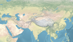
Tajikistan, officially the Republic of Tajikistan, is a landlocked country in Central Asia. Dushanbe is the capital and most populous city. Tajikistan is bordered by Afghanistan to the south, Uzbekistan to the west, Kyrgyzstan to the north, and China to the east. It is separated from Pakistan by Afghanistan's Wakhan Corridor. It has a population of approximately 10.6 million people.

<span class="mw-page-title-main">5th millennium BC</span> Millennium between [5000 BC - 4000 BC)

The 5th millennium BC spanned the years, that is, inclusive of 5000 BC but exclusive of 4000 BC. It is impossible to precisely date events that happened around the time of this millennium and all dates mentioned here are estimates mostly based on geological and anthropological analysis.

<span class="mw-page-title-main">Bactria–Margiana Archaeological Complex</span> c. 2250–1700 BC Central Asian archaeological culture

The Bactria–Margiana Archaeological Complex (BMAC) is the modern archaeological designation for a particular Middle Bronze Age civilisation of southern Central Asia, also known as the Oxus Civilization. The civilisation's urban phase or Integration Era, was dated in 2010 by Sandro Salvatori to c. 2400–1950 BC, but a different view is held by Nadezhda A. Dubova and Bertille Lyonnet, c. 2250–1700 BC.

<span class="mw-page-title-main">Panjakent</span> City in Sughd Region, Tajikistan

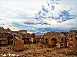
Panjakent or Penjikent is a city in the Sughd province of Tajikistan on the river Zeravshan, with a population of 52,500. It was once an ancient town in Sogdiana. The ruins of the old town are on the outskirts of the modern city. The Sarazm Important Bird Area lies downstream of the city on the tugay-vegetated floodplain of the river.

<span class="mw-page-title-main">Andronovo culture</span> Group of Bronze Age cultures, 2000–900 BC

The Andronovo culture is a collection of similar local Late Bronze Age cultures that flourished c. 2000–1150 BC, spanning from the southern Urals to the upper Yenisei River in central Siberia and western Xinjiang in the east. In the south, the Andronovo sites reached Tajikistan and Uzbekistan. It is almost universally agreed among scholars that the Andronovo culture was Indo-Iranian. Some researchers have preferred to term it an archaeological complex or archaeological horizon.

<span class="mw-page-title-main">Shahr-e Sukhteh</span> Archaeological site in Sistan and Baluchistan Province, Iran

Shahr-e Sukhteh, c. 3550–2300 BC, also spelled as Shahr-e Sūkhté and Shahr-i Sōkhta, is an archaeological site of a sizable Bronze Age urban settlement, associated with the Helmand culture. It is located in Sistan and Baluchistan Province, the southeastern part of Iran, on the bank of the Helmand River, near the Zahedan-Zabol road. It was placed on the UNESCO World Heritage List in June 2014.

<span class="mw-page-title-main">Central Asian cuisine</span> Culinary traditions of Central Asia

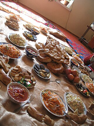
Central Asian cuisine has been influenced by Persian, Indian, Arab, Turkish, Chinese, Mongol, African and Russian cultures, as well as the culinary traditions of other varied nomadic and sedentary civilizations. Contributing to the culinary diversity were the migrations of Uyghur, Slav, Korean, Tatar, Dungan and German people to the region.

<span class="mw-page-title-main">Yaz culture</span> Early Iron Age culture of Margiana, Bactria and Sogdia

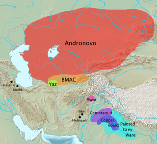
The Yaz culture was an early Iron Age culture of Margiana, Bactria and Sogdia. It emerges at the top of late Bronze Age sites (BMAC), sometimes as mud-brick platforms and sizeable houses associated with irrigation systems. Ceramics were mostly hand-made, but there was increasing use of wheel-thrown ware. Bronze and iron arrowheads, also iron sickles and carpet knives among other artifacts have been found.

The Yaghnobi Tajiks, commonly referred to as Yaghnobis, are an Eastern Iranian ethnic group residing in Tajikistan's Sughd province, specifically in the valleys of the Yaghnob, Qul, and Varzob rivers. Although they are considered part of the broader Tajik ethnicity, they are distinguished from other Tajiks by their use of the Yaghnobi language, an eastern Iranian language.

Tapeh Yahya is an archaeological site in Kermān Province, Iran, some 220 kilometres (140 mi) south of Kerman city, 90 kilometres (56 mi) south of Baft city and 90 km south-west of Jiroft. The easternmost occupation of the Proto-Elamite culture was found there.

Konar Sandal is a Bronze Age archaeological site, situated in the valley of the Halil River just south of Jiroft, Kermān Province, Iran.

<span class="mw-page-title-main">Takht-i Sangin</span> Greco-Bactrian archaeological site

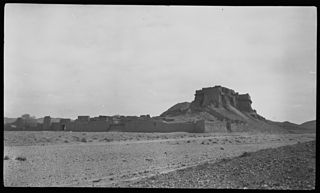
Takht-i Sangin is an archaeological site located near the confluence of the Vakhsh and Panj rivers, the source of the Amu Darya, in southern Tajikistan. During the Hellenistic period it was a city in the Greco-Bactrian kingdom with a large temple dedicated to the Oxus, which remained in use in the following Kushan period, until the third century AD. The site may have been the source of the Oxus Treasure.

<span class="mw-page-title-main">Gonur Depe</span> Early Bronze Age settlement in Turkmenistan

Gonur Depe is an archaeological site, dated from 2400 to 1600 BCE, and located about 60 km north of Mary, Turkmenistan consisting of a large early Bronze Age settlement. It is the "capital" or major settlement of the Bactria–Margiana Archaeological Complex (BMAC).

<span class="mw-page-title-main">Mundigak</span> Archeological site in Kandahar, Afghanistan

Mundigak is an archaeological site in Kandahar province in Afghanistan. During the Bronze Age, it was a center of the Helmand culture. It is situated approximately 55 km (34 mi) northwest of Kandahar near Shāh Maqsūd, on the upper drainage of the Kushk-i Nakhud River.

<span class="mw-page-title-main">Prehistory of Iran</span>

The prehistory of the Iranian plateau, and the wider region now known as Greater Iran, as part of the prehistory of the Near East is conventionally divided into the Paleolithic, Epipaleolithic, Neolithic, Chalcolithic, Bronze Age and Iron Age periods, spanning the time from the first settlement by archaic humans about a million years ago until the beginning of the historical record during the Neo-Assyrian Empire, in the 8th century BC.

<span class="mw-page-title-main">Tepe Hissar</span> Archaeological site in Semnan province, Iran

Tepe Hissar is a prehistoric site located in the village Heydarabad just south of Damghan in Semnan Province in northeastern Iran.

<span class="mw-page-title-main">Vakhsh culture</span> Archaeological culture

The Vakhsh culture is a Bronze Age culture which took place around 2500-1650 BC, as shown by radiocarbon dates, and flourished along the lower Vakhsh River in southern Tajikistan, earlier thought to be from ca. 1700 BC to 1500 BC.

<span class="mw-page-title-main">Sassi Punnu Fort</span> Archaeological site in Turbat, Pakistan

Sassui Punnhu Fort, , also known as Miri Kalat, is a historical site and tourist spot near Turbat City in Turbat Tehsil, Kech District, Balochistan, Pakistan. The ancient archaeological site is located near the fort in which ancient graves are sited. In the graves, the skeletons of humans are openly laid into graves. The fort is now on the verge of disappearance.

Said Qala Tepe is an archaeological site near Kandahar in Afghanistan. The tell is about 8 meters high and 200 × 200 meters in area. It has produced particularly strong evidence for the prehistoric period, showing an intensive settlement of the site in the fourth and third millennium BC, attributed to the Helmand culture.

References

  1. Jamoat-level basic indicators, United Nations Development Programme in Tajikistan, accessed 5 October 2020
  2. Jamoat Sarazm, tojkiston.ucoz.ru
  3. 1 2 3 4 "Proto-urban Site of Sarazm: Advisory Body Evaluation (ICOMOS)". UNESCO. March 2010.
  4. "Nomination to the World Heritage list of Sarazm" (PDF): 22. Sarazm is unique as a gateway to the steppe world, up to Southern Siberia, during the Chalcolithic period (Afanasevo) long before the spread of the Andronovo steppe culture in South Central Asia in the 2nd millennium BC.{{cite journal}}: Cite journal requires |journal= (help)
  5. Anthony, David W. (26 July 2010). The Horse, the Wheel, and Language: How Bronze-Age Riders from the Eurasian Steppes Shaped the Modern World. Princeton University Press. p. 433. ISBN   978-1-4008-3110-4.
  6. Ibbotson, Sophie; Lovell-Hoare, Max (4 December 2017). Tajikistan. Bradt Travel Guides. p. 10. ISBN   978-1-78477-054-9.
  7. 1 2 3 4 5 6 7 8 9 10 Isakov, A. (1981). "Excavations of the Bronze Age Settlement of Sarazm". Soviet Anthropology and Archeology. 19 (3–4): 273–286. doi:10.2753/aae1061-1959190304273. ISSN   0038-528X.
  8. 1 2 3 4 5 6 7 8 Besenval, Roland; Isakov, Abdullah Isakovič (1989). "Sarazm et les débuts du peuplement agricole dans la région de Samarkand". Arts Asiatiques. 44 (1): 5–20. doi:10.3406/arasi.1989.1254. ISSN   0004-3958.
  9. 1 2 3 Francfort, Henri-Paul (1993). "Mission archéologique française en Asie centrale (MAFAC)". Bulletin de l'École Française d'Extrême-Orient. 80 (1): 281–285. doi:10.3406/befeo.1993.2613. ISSN   0336-1519.
  10. Besenval, Roland (2001). "Brève notice sur la coopération archéologique franco-tadjike". Cahiers d'Asie Centrale. 9: 277–283.
  11. 1 2 3 4 5 6 7 Isakov, A.; Kohl, P. L.; Lamberg-Karlovsky, C. C.; Maddin, R. (1987). "Metallurgical Analysis from Sarazm, Tadjikistan SSR". Archaeometry. 29 (1): 90–102. doi:10.1111/j.1475-4754.1987.tb00400.x. ISSN   0003-813X.
  12. 1 2 3 4 5 Besenval, Roland (1987). "Découvertes récentes à Sarazm (R.S.S. du Tadjikistan) : attestation des relations au IIIe millénaire entre l'Asie centrale, l'Iran du Nord-Est et le Baluchistan". Comptes rendus des séances de l'Académie des Inscriptions et Belles-Lettres. 131 (2): 441–456. doi:10.3406/crai.1987.14510. ISSN   0065-0536.
  13. Kuzʹmina, E. E. (2007). The origin of the Indo-Iranians. Leiden, the Netherlands Boston: Brill. p. 212. ISBN   9789004160545.
  14. Spengler, Robert N.; et al. (2013). "Archaeobotanical results from Sarazm, Tajikistan, an Early Bronze Age Settlement on the edge: Agriculture and exchange". Journal of Environmental Archaeology . 18 (3): 211–221. doi:10.1179/1749631413Y.0000000008. S2CID   56266583.
  15. 1 2 Desse, Jean (1997). "ARCHÉOZOOLOGIE AUX MARGES OCCIDENTALES DU BÉLOUCHISTAN". Anthropozoologica. 25–26: 671–676.
  16. 1 2 3 4 5 6 ISAKOV, A. I. (1994). "Sarazm: An Agricultural Center of Ancient Sogdiana". Bulletin of the Asia Institute. 8: 1–12. JSTOR   24048761.
  17. Anthony, D.W. (2008) p 419
  18. 1 2 Razzokov, Abdurauf; Gandreau, David (2013). "Conservation et mise en valeur du site de Sarazm, Tadjikistan". Earthen Architecture in Today's World: Proceedings of the UNESCO International Colloquium on the Conservation of World Heritage Earthen Architecture. 36: 73–77.
  19. Zhang, Fan; Ning, Chao; Scott, Ashley (November 2021). "The genomic origins of the Bronze Age Tarim Basin mummies". Nature. 599 (7884): 256–261. doi: 10.1038/s41586-021-04052-7 . ISSN   1476-4687. PMC   8580821 .
  20. Zhang, Fan; Ning, Chao; Scott, Ashley (November 2021). "The genomic origins of the Bronze Age Tarim Basin mummies". Nature. 599 (7884): 256–261. doi: 10.1038/s41586-021-04052-7 . ISSN   1476-4687. PMC   8580821 . Overview of key Eurasian geographic regions, features and archaeological sites (24,000-0 BCE)
  21. Kerdoncuff, Elise; Skov, Laurits; Patterson, Nick; Zhao, Wei; Lueng, Yuk Yee; Schellenberg, Gerard D.; Smith, Jennifer A.; Dey, Sharmistha; Ganna, Andrea (2024-02-20), 50,000 years of Evolutionary History of India: Insights from ∼2,700 Whole Genome Sequences, doi:10.1101/2024.02.15.580575, PMC   10888882 , retrieved 2024-07-09
  22. "Proto-urban Site of Sarazm".

Bibliography