Sunnyside, Utah

Last updated
Sunnyside, Utah
Former city
Carbon County Utah incorporated and unincorporated areas Sunnyside highlighted.svg
Location in Carbon County and the state of Utah.
Map of USA UT.svg
Location of Utah in the United States
Coordinates: 39°33′8″N110°24′3″W / 39.55222°N 110.40083°W / 39.55222; -110.40083 Coordinates: 39°33′8″N110°24′3″W / 39.55222°N 110.40083°W / 39.55222; -110.40083
Country United States
State Utah
County Carbon
Settled1879
Area
  Total3.1 sq mi (8.1 km2)
  Land3.1 sq mi (8.1 km2)
  Water0.0 sq mi (0.0 km2)
Elevation
[1]
6,414 ft (1,955 m)
Population
 (2010)
  Total377
  Density120/sq mi (46.5/km2)
Time zone UTC-7 (Mountain (MST))
  Summer (DST) UTC-6 (MDT)
ZIP code
84539
Area code(s) 435
FIPS code 49-74370 [2]
GNIS feature ID2412007 [1]

Sunnyside is a former city in Carbon County, Utah, United States. The population was 377 at the 2010 census. [3] On January 1, 2014, the city merged with the neighboring city of East Carbon. [4]

Contents

Geography

Sunnyside is located southeast of the center of Carbon County and is east of East Carbon. Price, the county seat, is 26 miles (42 km) to the west. Before its merger with East Carbon, Sunnyside had a total area of 3.1 square miles (8.1 km2), all of it land. [3]

Climate

According to the Köppen Climate Classification system, Sunnyside has a semi-arid climate, abbreviated "BSk" on climate maps. [5]

Demographics

Historical population
CensusPop.
1900 240
1910 1,811654.6%
1920 2,07214.4%
1930 749−63.9%
1940 434−42.1%
1950 1,881333.4%
1960 1,740−7.5%
1970 485−72.1%
1980 61126.0%
1990 339−44.5%
2000 40419.2%
2010 377−6.7%
2018 (est.)374−0.8%

As of the 2000 census, [2] [ needs update ] there were 404 people, 160 households, and 104 families residing in the city. The population density was 128.6 people per square mile (49.7/km²). There were 183 housing units, with an average density of 58.3 per square mile (22.5/km²). The racial makeup of the city was 90.84% White, 0.50% African American, 6.93% from other races, and 1.73% from two or more races. Hispanic or Latino of any race were 20.30% of the population.

There were 160 households, of which 28.8% had children under the age of 18 living with them, 58.1% were married couples living together, 3.8% had a female householder with no husband present, and 34.4% were non-families. 30.0% of all households were made up of individuals (single person) and 16.9% had someone living alone who was 65 years of age or older. The average household size was 2.53 and the average family size was 3.20.

In the city, the population was spread out, with 26.7% under the age of 18, 7.2% aged 18 to 24, 24.3% aged 25 to 44, 24.0% aged 45 to 64, and 17.8% who were 65 years of age or older. The median age was 40 years. For every 100 females, there were 83.6 males. For every 100 females age 18 and over, there were 87.3 males.

The median income for a household in the city was $32,955. The median income for a family was $36,875. Males had a median income of $39,688 versus $18,333 for females. The per capita income for the city was $13,752. About 12.8% of families and 14.7% of the population were below the poverty line, including 14.2% of those under age 18 and 16.4% of those age 65 or over.

History

The area known as Sunnyside was founded in 1879, when George and James Whitmore arrived at the base of the Book Cliffs and established the Whitmore Cattle Ranch. In 1883, the Denver and Rio Grande Western Railroad (D&RGW) extended its line from the railhead at Deseret to Price. Along this 60-mile (97 km) stretch two additional railheads were added, one at Woodside, and another 20 miles (32 km) north at Sunnyside, named for its location on the sunny side of the Book Cliffs.

For over a century, Sunnyside was the leader in coal production in Carbon County. The history of coal mining in Sunnyside began shortly after Jefferson Tidwell and his three sons discovered coal in Whitmore Canyon in 1896. By 1898, the Pleasant Valley Coal Company had acquired the rights to the coal from Tidwell. On July 4 of that year, the Sunnyside railhead was abandoned by the D&RGW, and the coal camp located in Whitmore Canyon was named Sunnyside. By 1901, the D&RGW and its subsidiary, Utah Fuel Coal Company, acquired the operation.

Sunnyside was officially incorporated as a town in 1916, with a mayor and four trustees.

July 1946 photographs of government-built homes in Sunnyside Some of the houses on this government housing project. Many miners from nearby coal mines live here. Sunnyside... - NARA - 540537.jpg
July 1946 photographs of government-built homes in Sunnyside

For fifty years, Utah Fuel operated the coal mines in Sunnyside, selling its interest to Kaiser Steel Corporation in 1949. The financial investments of these companies turned Tidwell's mining operation into a major coal industry, inextricably tied to Sunnyside.

Until 1994, the Sunnyside's mayor was not an elected official. Instead, the office was held by the Superintendent of Mines for Utah Fuel, then later by Kaiser Steel Corporation when it took over in 1950.

Education

Sunnyside is located in the Carbon School District. It has one elementary school, which also accommodates students from East Carbon City. Students attend middle and high school in Price.

Related Research Articles

Carbon County, Utah U.S. county in Utah

Carbon County is a county in the U.S. state of Utah. As of the 2010 United States Census, the population was 21,403. Its county seat and largest city is Price.

Carbon Hill, Alabama City in Alabama, United States

Carbon Hill is a city in Walker County, Alabama, United States. It incorporated in February 1891. At the 2010 census the population was 2,021, down from 2,071 in 2000.

Sunnyside–Tahoe City, California census-designated place in California, United States

Sunnyside–Tahoe City is a census-designated place (CDP) in Placer County, California, located on the northwest shore of Lake Tahoe. The population was 1,557 at the 2010 census, down from 1,761 at the 2000 census, and a total area of 3.4 sq mi (8.8 km2), all of it land. It comprises two communities, Sunnyside, and Tahoe City.

East Carbon, Utah City in Utah, United States

East Carbon is a city in Carbon County, Utah, United States. The population was 1,301 at the 2010 census. East Carbon was incorporated on July 23, 1973, from the merger of the two struggling mining towns of Dragerton and Columbia. On January 1, 2014, the city merged with the neighboring city of Sunnyside.

Helper, Utah City in Utah, United States

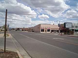
Helper is a city in Carbon County, Utah, United States, approximately 110 miles (180 km) southeast of Salt Lake City and 7 miles (11 km) northwest of the city of Price. It is known as the "Hub of Carbon County". The population was 2,201 at the 2010 census.

Price, Utah City in Utah, United States

Price is a city in the U.S. state of Utah and the county seat of Carbon County. The city is home to Utah State University Eastern, as well as the USU Eastern Prehistoric Museum. Price is located within short distances of both Nine Mile Canyon and the Manti-La Sal National Forest.

Scofield, Utah Town in Utah, United States

Scofield is a town in Carbon County, Utah, United States. The population was 23 at the 2010 census. Scofield's name is frequently applied to the 1900 mine disaster in the Pleasant Valley Coal Company's Winter Quarters mine. The community was named for General Charles W. Scofield, a timber contractor and local mine official. It is the smallest incorporated area in Utah by population.

Wellington, Utah City in Utah, United States

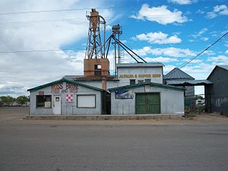
Wellington is a city in Carbon County, Utah, United States. The population was 1,676 at the 2010 census. The community was settled in 1878 by a band of thirteen Mormons led by Jefferson Tidwell. The town was named for Justus Wellington Seeley, Jr., of the Emery County Court. Many residents commute to nearby Price for their jobs, or work in one of the various coal mines in the area.

Myton, Utah City in Utah, United States

Myton is a city in Duchesne County, Utah, United States. Established in 1905, Myton had a population of 569 at the 2010 census.

Huntington, Utah City in Utah, United States

Huntington is a city in northwestern Emery County, Utah, United States. The population was 2,129 at the 2010 census. It is the largest town in Emery County.

Cedar City, Utah City in Utah, United States

Cedar City is the largest city in Iron County, Utah, United States. It is located 250 miles (400 km) south of Salt Lake City, and 170 miles (270 km) north of Las Vegas on Interstate 15. It is the home of Southern Utah University, the Utah Shakespeare Festival, the Utah Summer Games, the Simon Fest Theatre Co., and other events. As of the 2010 census the city had a population of 28,857, up from 20,257 in 2000. As of 2019 the estimated population was 34,764.

Nephi, Utah City in Utah, United States

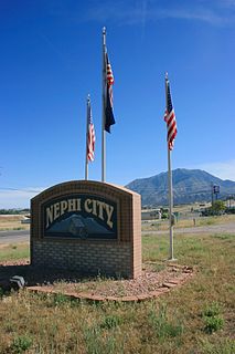
Nephi is a city in Juab County, Utah, United States. It is part of the Provo–Orem metropolitan area. The population was 5,389 at the 2010 census and an estimated 6,378 in 2019. It is the county seat of Juab County. It was settled by Mormon pioneers in 1851 as Salt Creek, and it acquired its current name in 1882. It is the principal city in the Juab Valley, an agricultural area. Nephi was named after Nephi, son of Lehi, from the Book of Mormon.

Big Water, Utah Town in Utah, United States

Big Water is a town in Kane County, Utah, United States. The population was 475 at the 2010 census, up from 417 at the 2000 census. It is located 17 miles (27 km) northwest of Page, Arizona, on US-89 near Lake Powell and the Glen Canyon Dam. It was originally called "Glen Canyon City" and housed workers who built the dam in the 1950s.

Wales, Utah Town in Utah, United States

Wales is a town in Sanpete County, Utah, United States. The population was 219 at the 2000 census. The town is governed by a mayor and several council members. As of December 2008, Wales had no stores, gas stations nor stop lights. It does have a park, fire station, library and cemetery.

Aurora, Utah City in Utah, United States

Aurora is a city in north-central Sevier County, Utah, United States. The population was 1,016 at the 2010 census.

Bicknell, Utah Town in Utah, United States

Bicknell is a town along State Route 24 in Wayne County, Utah, United States. As of the 2010 census, the town population was 327.

Uintah, Utah City in Utah, United States

Uintah is a city in Weber County, Utah, United States. The population was 1,322 at the 2010 census. It is part of the Ogden–Clearfield, Utah Metropolitan Statistical Area. Although Uintah was a town in 2000, it has since been classified as a fifth-class city by state law.

Sunnyside, Washington City in Washington, United States

Sunnyside is a city in Yakima County, Washington, United States. As of the 2010 census the population was 15,858.

Williamson, West Virginia City in West Virginia, United States

Williamson is a city in Mingo County, West Virginia, United States, situated along the Tug Fork River. The population was 3,191 at the 2010 census. It is the county seat of Mingo County, and is the county's largest and most populous city. Williamson is home to Southern West Virginia Community and Technical College. The Tug Fork River separates Williamson from South Williamson, Kentucky.

Green River, Utah City in Utah, United States

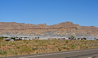
Green River is a city in Emery County, Utah. The population was 952 at the 2010 census.

References

  1. 1 2 U.S. Geological Survey Geographic Names Information System: Sunnyside
  2. 1 2 "U.S. Census website". United States Census Bureau . Retrieved 2008-01-31.
  3. 1 2 "Geographic Identifiers: 2010 Census Summary File 1 (G001): Sunnyside city, Utah". U.S. Census Bureau, American Factfinder. Archived from the original on February 13, 2020. Retrieved August 10, 2015.
  4. McManus, C.J. (January 9, 2014). "Parsons becomes mayor of merged ECC-Sunnyside". The Sun Advocate. Price, Utah. Retrieved January 14, 2014.
  5. Climate Summary for Sunnyside, Utah

Commons-logo.svg Media related to Sunnyside, Utah at Wikimedia Commons