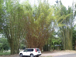
Maryborough is a city and a suburb in the Fraser Coast Region, Queensland, Australia. In the 2021 census, the suburb of Maryborough had a population of 15,287 people.

The Shire of Woocoo was a local government area located in the Wide Bay–Burnett region of Queensland, Australia, containing the rural residential area to the west of the town of Maryborough, and surrounding countryside. The shire covered an area of 2,007.9 square kilometres (775.3 sq mi), and existed as a local government entity from 1914 until 2008, when it was amalgamated with the City of Maryborough, City of Hervey Bay and the 1st and 2nd divisions of the Shire of Tiaro to form the Fraser Coast Region.

Tinana is a rural town and locality in the Fraser Coast Region, Queensland, Australia. In the 2021 census, the locality of Tinana had a population of 5,872 people.

Yengarie is a rural locality in the Fraser Coast Region, Queensland, Australia. In the 2021 census, Yengarie had a population of 615 people.

The Shire of Tinana is a former local government area in the Wide Bay–Burnett area of Queensland, Australia. It is centred on Tinana, on the southern bank of the Mary River, with the Borough of Maryborough on the northern bank. It existed from 1880 to 1917.

Torbanlea is a rural town and locality in the Fraser Coast Region, Queensland, Australia. In the 2021 census, the locality of Torbanlea had a population of 841 people.
Owanyilla is a rural town and locality in the Fraser Coast Region, Queensland, Australia. In the 2021 census, the locality of Owanyilla had a population of 245 people.

Dallarnil is a rural town and locality in the North Burnett Region, Queensland, Australia. In the 2021 census, the locality of Dallarnil had a population of 245 people.
Granville is a rural locality in the Fraser Coast Region, Queensland, Australia. It is a suburb of Maryborough. In the 2021 census, Granville had a population of 2,532 people.
St Helens is a rural locality in the Fraser Coast Region, Queensland, Australia. In the 2021 census, St Helens had a population of 123 people.

Magnolia is a rural locality in the Fraser Coast Region, Queensland, Australia. In the 2021 census, Magnolia had a population of 115 people.

Manyung is a rural town in the Gympie Region with the locality split between the Gympie Region and the South Burnett Region, Queensland, Australia. In the 2021 census, Manyung had a population of 83 people.
Moonford is a rural town and locality in the North Burnett Region, Queensland, Australia. In the 2021 census, the locality of Moonford had a population of 162 people.
Riverleigh is a rural locality in the North Burnett Region, Queensland, Australia. In the 2021 census, Riverleigh had a population of 95 people.
Yerra is a rural locality in the Fraser Coast Region, Queensland, Australia. In the 2021 census, Yerra had a population of 110 people.
Sexton is a rural locality in the Gympie Region, Queensland, Australia. In the 2021 census, Sexton had a population of 187 people.
Stalworth is a rural locality in the South Burnett Region, Queensland, Australia. In the 2021 census, Stalworth had a population of 37 people.

Teddington is a rural locality in the Fraser Coast Region, Queensland, Australia. In the 2021 census, Teddington had a population of 236 people.
Dundathu is a rural locality in the Fraser Coast Region, Queensland, Australia. In the 2021 census, Dundathu had a population of 238 people.
Wilson Valley is a rural locality in the North Burnett Region, Queensland, Australia. In the 2021 census, Wilson Valley had a population of 20 people.


