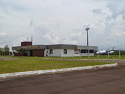
Torres Airport Aeroporto de Torres | |||||||||||
|---|---|---|---|---|---|---|---|---|---|---|---|
| | |||||||||||
 | |||||||||||
| Summary | |||||||||||
| Airport type | Public | ||||||||||
| Operator | |||||||||||
| Serves | Torres | ||||||||||
| Time zone | BRT (UTC−03:00) | ||||||||||
| Elevation AMSL | 9 m / 30 ft | ||||||||||
| Coordinates | 29°24′54″S049°48′36″W / 29.41500°S 49.81000°W | ||||||||||
| Website | www4 | ||||||||||
| Map | |||||||||||
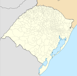 TSQ Location in Brazil  TSQ TSQ (Brazil) | |||||||||||
| Runways | |||||||||||
| |||||||||||
| Statistics (2025) | |||||||||||
| |||||||||||
| Statistics: Infraero [1] Sources: Airport Website, [2] ANAC, [3] DECEA [4] | |||||||||||
Torres Airport( IATA : TSQ, ICAO : SSTE), formerly SBTR, is the airport serving Torres, Brazil.
Contents
It is operated by Infraero.