Tourism in Belize

Last updated
The Great Blue Hole is a prime ecotourism destination. A World Heritage Site, ranked among the top 10 nominees for the world's New 7 Wonders of Nature. Great Blue Hole.jpg
The Great Blue Hole is a prime ecotourism destination. A World Heritage Site, ranked among the top 10 nominees for the world's New 7 Wonders of Nature.
Thousand Foot Falls actually stand at about 1,600 feet high. It is the highest waterfall in Central America. 1,000 ft. Falls.png
Thousand Foot Falls actually stand at about 1,600 feet high. It is the highest waterfall in Central America.

Tourism in Belize has grown considerably recently,[ when? ] and it is now the second largest industry in the nation. Belizean Prime Minister Dean Barrow has stated his intention to use tourism to combat poverty throughout the country. [3] The growth in tourism has positively affected the agricultural, commercial, and finance industries, as well as the construction industry. The results for Belize's tourism-driven economy have been significant, with the nation welcoming almost one million tourists in a calendar year for the first time in its history in 2012. [4]

Contents

History

Prior to its independence in 1981, Belize was not regarded as a tourist destination due to an inadequate infrastructure. However, rapid expansion of the tourist industry over the last decade[ when? ] has made it the nation's second largest industry.

Tourism: 
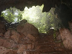
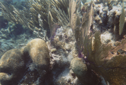
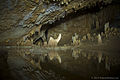
Belize has large array of diverse tourists, adventure tourists and eco-tourist attractions. The Belize Barrier Reef (second largest in the world), over 450 offshore Cayes (islands), excellent fishing, safe waters for windsurfing, swimming, cave rafting, boating, paddleboarding, scuba diving, and snorkelling, numerous rivers for rafting, and kayaking, various jungle and wildlife reserves of fauna and flora, for hiking, bird watching, and helicopter touring, as well as many Maya ruins—support the thriving tourism and ecotourism industry. Of the hundreds of cave systems, Belize also holds the largest cave system in Central America, 544 species of birds, and well-preserved natural beauty. Despite all this, it is still among the least visited countries in the region. [5]

Development costs are high, but the Government of Belize has designated tourism as its second development priority after agriculture. In 2012, tourist arrivals totalled 917,869 (with about 584,683 from the U.S.) and tourist receipts amounted to over $1.3 billion. [4]

Tourism is the domain of the Ministry of Tourism, within which the Belize Tourism Board works as a link between the private and public sector. [6]

The tourism industry is an important part of the economy of Belize, in 2007 contributing to over 25% of all jobs, and making up over 18% of the GDP. [7] This constituted 590 million BZD (295 million USD), according to the Belize government, up 90 million BZD (45 million USD) from the year before. [7] Important tourist attractions in Belize include the natural attractions of land and sea, making the areas important in Ecotourism, as well as the historic ruins of Belize's Pre-Columbian Maya civilization.

Popular tourist destinations include San Pedro Town and Caye Caulker, both located about 70 km and 40 km east off the coast of Belize, both situation only a few miles from the Barrier Reef at any point. They have been regarded as a "tropical paradises" by the Los Angeles Times . [8] Cruise ships have been docking in Belize City, and average 850,000 tourists alone every year, some who partake in tours to nearby districts as well as the colonial city. [9]

Almond Beach, Hopkins Almond Beach, Hopkins, Stann Creek, Belize.jpg
Almond Beach, Hopkins
Maya Beach, Placencia Beach front at Placencia, Belize.jpg
Maya Beach, Placencia
Half Moon Caye BZECAYE.jpg
Half Moon Caye

Mainland beaches

Rural and community-based tourism

Many privately run companies have cooperatives in Southern Belize that manage a rural and community-based tourism project, which has been developed with support from the UNESCO. Tourism allows otherwise marginalized minorities such as the Maya and the Garifuna people to receive new opportunities in alternative markets, harvest crops, preserve and involve foreigners in their culture and diversify their income. [10] Many companies offer visitors the opportunity to visit a cacao, cashew farm, learn about Maya, Kriol or Garifuna craftsmanship, and even to stay overnight on a Maya, Kriol or Garifuna village and explore with a community guide.

Ecological tourism

Biodiversity is an asset for ecotourism. A red-lored amazon Amazona autumnalis -upper body-8a.jpg
Biodiversity is an asset for ecotourism. A red-lored amazon

Eco-tourism aims to be ecologically and socially conscious, it focuses on local culture, wilderness, and adventure. Belize's eco-tourism is growing with every passing year, [11] it boasts a number of eco-tourist tours and energy efficient hotels, with environmentally-conscious and renewable resources. [12] Popular eco-tourism destinations in Belize include the Cockscomb Basin Wildlife Sanctuary, [13] Mountain Pine Ridge Forest Reserve, [14] Swallow Caye Wildlife Sanctuary, [15] and the Community Baboon Sanctuary. [16]

Waterfalls

Archaeological reserves

Overlooking the Caracol ruins, the most extensive archaeological site in the country. Panorama atop Caracol.png
Overlooking the Caracol ruins, the most extensive archaeological site in the country.

Before the arrival of Europeans in America, Belize lay in the heartland of the Maya civilisation, and consequently contains some of the earliest and most important Maya ruins. [18] Archaeological findings at Caracol, in the southern end of the country, have suggested that it formed the centre of political struggles in the southern Maya lowlands. [18] The complex covered an area much larger than present-day Belize City and supported more than twice the modern city's population. [17] Meanwhile, Lamanai, in the north, is known for being the longest continually-occupied site in Mesoamerica, settled during the early Preclassic era and continuously occupied up to and during the area's colonisation. [18]

While the majority of reserves under this category are related to the pre-colonial era, Serpon Sugar Mill and Yarborough Cemetery, both designated in 2009, only date from the 19th century and are alternatively described as historical reserves. [19]

The country's 15 archaeological sites are managed by the Institute of Archaeology, a branch of the National Institute of Culture and History (NICH), [20] which comes under the authority of the Ministry of Tourism, Civil Aviation and Culture. [21] This type of protected area was gazetted under the Ancient Monuments and Antiquities Act, 1 May 1972. [20] [22] All of the following reserves are open to the public. Many other sites, such as Cuello and Uxbenka, are located on private land and can only be visited if prior permission is obtained from the landowner. [18]

List of Maya ruins in Belize

Main natural attractions

Roughly 26% (2.6 million acres, or 1.22 million hectares) of Belizean land and sea is preserved within a total of 95 reserves, which vary in their purpose and level of protection. [23] [24] This network of protected areas exists under a variety of management structures: [25]

National parks

St. Herman's Cave in St. Herman's Blue Hole National Park. St Hermans Cave Belize.jpg
St. Herman's Cave in St. Herman's Blue Hole National Park.

In Belize, national parks are areas designed for the protection and preservation of natural and aesthetic features of national significance for the benefit and enjoyment of the people. Therefore, they are areas of recreation and tourism, as well as environmental protection. National parks are gazetted under the National Parks System Act of 1981. [26] They are administered by the Forest Department and managed through partnership agreements with community-based non-governmental organisations.

List of national parks
ReserveDistrictSize
(ha)
Size
(acres)
IUCN Co-managementEst.Description
Aguas Turbias Orange Walk 3,5418,750II [note 1] 1994 [27]
Bacalar Chico Belize 4,51011,100VGreen Reef Environmental Institute [note 2] 1996Excludes adjacent marine reserve. [28] [29]
Billy Barquedier Stann Creek 6631,640IISteadfast Tourism and Conservation Association2001 [30]
Chiquibul Cayo 106,839264,000IIFriends for Conservation and Development1995Excludes adjacent forest reserve. [31] [32]
Five Blues Lake Cayo 1,6434,060IIFriends of Five Blues Lake National Park1994 [33]
Gra Gra Lagoon Stann Creek 5341,320IIFriends of Gra Gra Lagoon2002 [34]
Guanacaste Cayo 2357II Belize Audubon Society 1994 [35] [36]
Honey Camp Corozal / Orange Walk 3,1457,770IIAssociation of Friends of Freshwater Creek [note 3] 2001 [37]
Laughing Bird Caye Stann Creek 4,09510,120IISouthern Environmental Association1996 [38] [39]
Mayflower Bocawina Stann Creek 2,8687,090IIFriends of Mayflower Bocawina National Park2001 [40] [41]
Monkey Bay Belize 8592,120IIGuardians of the Jewel [note 2] 1994 [42] [43]
Nojkaaxmeen Elijio Panti Cayo 5,13012,700IIBelize Development Foundation [note 4] 2001 [44] [45] [46]
Payne's Creek Toledo 14,73936,420IIToledo Institute for Development and Environment1994 [47] [48]
Peccary Hills Belize 4,26010,500IIGracie Rock Reserve for Adventure, Culture and Ecotourism2007 [49] [50]
Río Blanco Toledo 3894IIRío Blanco Mayan Association1994 [51]
Sarstoon-Temash Toledo 16,93841,850II Sarstoon Temash Institute for Indigenous Management 1994 Ramsar site. [52] [53]
St. Herman's Blue Hole Stann Creek 269660IIBelize Audubon Society1986 [54] [55]

Natural monuments

A natural monument is designated for the preservation of unique geographic features of the landscape. The designation is primarily based on a feature's high scenic value, but may also be regarded as a cultural landmark that represents or contributes to a national identity.

Natural monuments are gazetted under the National Parks System Act of 1981; [26] marine-based monuments additionally come under the Fisheries Act. Of the five natural monuments in the country, three are terrestrial, administered by the Forest Department, while the remaining two are marine-based and come under the authority of the Fisheries Department.

List of natural monuments
ImageReserveDistrictSize
(ha)
Size
(acres)
IUCN Co-managementEst.Description
Actun tunichil muknal-pottery.jpg Actun Tunichil Muknal Cayo 185460Ia Belize Audubon Society; Institute of Archaeology2004Terrestrial. [56] [57]
Blue Hole coral.jpg Blue Hole Belize 4141,020IIIBelize Audubon Society1996Marine. [58] [59] [60]
BZECAYE.jpg Half Moon Caye Belize 3,9549,770IIBelize Audubon Society1982Marine. [61] [62]
1,000 foot water fall at Mountain Pine Ridge in Belize.jpg Thousand Foot Falls Cayo 5221,290III [note 5] 2004Terrestrial. [63]
Victoria-peak-2.jpg Victoria Peak Stann Creek 1,9594,840IIIBelize Audubon Society1998Terrestrial. [64] [65]

Nature reserves

Wilderness scene in the Bladen Nature Reserve. Looking towards the Maya Mountains from the fire watchtower.jpg
Wilderness scene in the Bladen Nature Reserve.

The country's three nature reserves enjoy the highest level of protection within the national protected areas system. The designation was created for the strict protection of biological communities or ecosystems, and the maintenance of natural processes in an undisturbed state. They are typically pristine, wilderness ecosystems.

Nature reserves are legislated under the National Parks System Act of 1981. [26] It is the strictest designation of all categories within the country's national protected areas system, with no extractive use or tourism access permitted. Permits are required to enter the area and are restricted to researchers only. The nature reserves are under the authority of the Forest Department.

The oldest of these, Bladen Nature Reserve, forms the centrepiece of the Maya Mountains biological corridor, and is considered one of the most biodiversity-rich, and topographically unique areas within the Mesoamerican biodiversity hotspot.

List of nature reserves
ReserveDistrictSize
(ha)
Size
(acres)
IUCN Co-managementEst.Description
Bladen Toledo 40,41199,860IaYa’axché Conservation Trust; Bladen Management Consortium1990 [66] [67]
Burdon Canal Belize 2,1265,250Ia [note 6] 1992 [68]
Tapir Mountain Cayo 2,5506,300Ia Belize Audubon Society 1994Formerly known as Society Hall Nature Reserve. [69] [70]

Wildlife sanctuaries

Wildlife sanctuaries are created for the preservation of an important keystone species in the ecosystem. By preserving enough area for them to live in, many other species receive the protection they need as well.

Wildlife sanctuaries are gazetted under the National Parks System Act of 1981, and are the responsibility of the Forest Department. [26] There are currently seven wildlife sanctuaries, three of which are being managed under co-management partnerships, whilst the other four are managed under informal arrangements. Two of the following wildlife sanctuaries are considered to be marine protected areas, and may also have collaborative agreements with the Fisheries Department in place.

List of wildlife sanctuaries
ReserveDistrictSize
(ha)
Size
(acres)
IUCN Co-managementEst.Description
Aguacaliente Toledo 2,2135,470IVAguacaliente Management Team [note 2] 1998Terrestrial. [71] [72]
Cockscomb Basin Stann Creek / Toledo 49,477122,260IV Belize Audubon Society 1997Terrestrial. [73]
Corozal Bay Belize / Corozal 73,049180,510IVSarteneja Alliance for Conservation and Development [note 2] 1998Marine. [74] [75]
Crooked Tree Belize / Orange Walk 15,37237,990IVBelize Audubon Society1984 Ramsar site. Boundaries ill defined. Terrestrial. [76]
Gales Point Belize 3,6819,100IVGales Point Wildlife Sanctuary Community Management Committee [note 2] 1998Terrestrial. [77] [78]
Spanish Creek Belize / Orange Walk 2,4286,000IVRancho Dolores Development Group [note 2] 2002Terrestrial. [79]
Swallow Caye Belize 3,6318,970IVFriends of Swallow Caye2002Marine. [80] [81]

Forest reserves

Big Rock Falls in the Mountain Pine Ridge Forest Reserve. BigRockFalls.jpg
Big Rock Falls in the Mountain Pine Ridge Forest Reserve.

Forest reserves, overseen by the Forest Department, are designed for the sustainable extraction of timber without destroying the biodiversity of the location. These are gazetted under the Forests Act of 1927, [82] which allows the department to grant permits to logging companies after extensive review. There are currently 16 forest reserves with a combined acreage of 380,328 hectares (939,810 acres), making up 9.3% of total national territory. [20]

List of forest reserves
ReserveDistrictSize
(ha)
Size
(acres)
IUCN Est.Description
Caye Caulker Belize 3894VI1998Excludes adjacent marine reserve. [83]
Chiquibul Cayo 59,822147,820VI1995Excludes adjacent national park. [84]
Columbia River Cayo / Toledo 60,016148,300VI1997 [85]
Deep River Toledo 27,23267,290VI [86]
Fresh Water Creek Corozal / Orange Walk 13,51333,390VI1926 [87]
Grants Work Stann Creek 3,1997,900VI1989 [88]
Machaca Toledo 1,2533,100VI1998 [89]
Manatee Belize / Stann Creek 36,62190,490VI1959 [90]
Mango Creek Stann Creek / Toledo 12,09029,900VI1989Comprises two separate segments. [91] [92]
Monkey Caye Toledo 6691,650VI1996 [93]
Mountain Pine Ridge Cayo 43,372107,170VI1944 [94] [95]
Maya Mountain Stann Creek 16,88741,730VI1997 [96]
Sibun Cayo 32,84981,170VI1959 [97] [95]
Sittee River Stann Creek 37,36092,300VI [98]
Swasey Bladen Toledo 5,98014,800VI1989 [99]
Vaca Cayo 14,11834,890VI1991 [100]

Marine reserves

Coral patch in the Hol Chan Marine Reserve. Holchan2.png
Coral patch in the Hol Chan Marine Reserve.

Marine reserves are designed for the conservation of aquatic ecosystems, including marine wildlife and its environment. The majority of these reserves contribute to the conservation of Belize's Barrier Reef, which provides a protective shelter for pristine atolls, seagrass meadows and rich marine life. The preservation of the Barrier Reef system has been recognised as a global interest through the collective designation of seven protected areas, including four of the following marine reserves, as a World Heritage Site.

Marine reserves are legislated under the Fisheries Act, and are administered by the Fisheries Department. One of the department's key responsibilities is to ensure the sustainable extraction of marine resources. There are currently eight marine reserves, management of which is either direct, by the department, or in partnership with non-governmental agencies.

List of marine reserves
ReserveDistrictSize
(ha)
Size
(acres)
IUCN Co-managementEst.Description
Bacalar Chico Belize 6,39115,790IVGreen Reef Environmental Institute [note 2] 1996Excludes adjacent national park. Divided into two zones: a conservation zone, [101] and a general use zone. [102] [29]
Caye Caulker Belize 3,9139,670VIForest & Marine Reserves Association of Caye Caulker1998Excludes adjacent forest reserve. [103]
Gladden Spit and Silk Cayes Stann Creek 10,51425,980IVSouthern Environmental Association2000Divided into two zones: a general use zone, [104] and a conservation zone. [105] [106] [107]
Glover's Reef Belize 86,653214,120IV1993In 2001, the reserve was divided into four zones: a general use zone, [108] a conservation zone, [109] a seasonal closure zone, [110] and a wilderness zone. [111] A spawning aggregation zone was broken off in 2003 and comes under separate management (see below).
Hol Chan Belize 1,4443,570IIHol Chan Trust Fund1987Divided into four zones: Mangrove, [112] Seagrass, [113] Shark Ray Alley, [114] and Coral Reef. [115] [116]
Port Honduras Toledo 40,470100,000IVToledo Institute for Development and Environment2000Divided into two zones: a general use zone, [117] and a conservation zone. [118]
Sapodilla Cayes Toledo 15,61838,590IVSouthern Environmental Association1996 [119]
South Water Caye Stann Creek 47,702117,870IV1996 [120] [121]

Attractions by district

See also

Notes

    1. There is no current co-management partner, nor on-site presence, though the area has been included in past conservation planning under Programme for Belize.
    2. 1 2 3 4 5 6 7 Prospective co-management organisation. No formal co-management agreements are currently being made, but these organisations have informal co-management authority.
    3. No longer active.
    4. Until 2010, co-management was held by the Itzamna Society.
    5. Managed directly by the Forest Department as part of the Mountain Pine Ridge Forest Reserve.
    6. Currently has no co-management partner and is managed directly by the Forest Department, though with no on-site presence. It is considered a paper park.

    Related Research Articles

    <span class="mw-page-title-main">Belize</span> Country in Central America

    Belize is a country on the north-eastern coast of Central America. It is bordered by Mexico to the north, the Caribbean Sea to the east, and Guatemala to the west and south. It also shares a water boundary with Honduras to the southeast.

    <span class="mw-page-title-main">San Pedro Town</span> Town in Belize, Belize

    San Pedro is a town on the southern part of the island of Ambergris Caye in the Belize District of the nation of Belize, in Central America. According to the 2015 mid-year estimates, the town has a population of about 16,444. It is the second-largest town in the Belize District and largest in the Belize Rural South constituency. The once sleepy fishing village was granted the status of a town in 1984.

    <span class="mw-page-title-main">Ambergris Caye</span> Island in Belize

    Ambergris Caye, is the largest island of Belize, located northeast of the country's mainland, in the Caribbean Sea. It is about 40 kilometres (25 mi) long from north to south, and about 1.6 kilometres (1 mi) wide. Many parts of the island have been modified by human development since the arrival of coconut plantations in the 17th century, but it remains largely white coral sand with mangrove forest at its center. Its eastern coast runs parallel to the northernmost stretch of the Belize Barrier Reef, a UNESCO World Heritage Site.

    <span class="mw-page-title-main">North India</span> Group of Northern Indian states

    North India, also called Northern India or simply the North, in a broader geographic context, typically refers to the northern part of India or, historically, of the Indian subcontinent, occupying 72.6% of India's total land area and 75% of India's population, and where speakers of Indo-Aryan languages form a prominent majority population. The region has a varied geography ranging from the Indo-Gangetic Plain and the Himalayas, to the Thar Desert, the Central Highlands and the north-western part of the Deccan plateau. Multiple rivers flow through this region including the Ganges, the Yamuna, the Indus and the Narmada rivers. In a more specific and sometimes administrative sense, North India can also be used to denote the Indo-Gangetic Plain within this broader expanse, stretching from the Ganga-Yamuna Doab to the Thar Desert.

    The flora of Belize is highly diverse by regional standards, given the country's small geographical extent. Situated on the Caribbean coast of northern Central America the flora and vegetation have been intimately intertwined with Belize's history. The nation itself grew out of British timber extraction activities from the 17th century onwards, at first for logwood and later for mahogany, fondly called "red gold" because of its high cost and was much sought after by European aristocracy. Central America generally is thought to have gained much of it characteristic flora during the "Great American interchange" during which time South American elements migrated north after the geological closure of the isthmus of Panama. Few Amazonian elements penetrate as far north as Belize and in species composition the forests of Belize are most similar to the forests of the Petén (Guatemala) and the Yucatán (Mexico).

    <span class="mw-page-title-main">Cockscomb Basin Wildlife Sanctuary</span> Nature reserve in Belize

    The Cockscomb Basin Wildlife Sanctuary is a nature reserve in the Stann Creek District of south-central Belize. It was established to protect the forests, fauna and watersheds of an approximately 400 square kilometres (150 sq mi) area of the eastern slopes of the Maya Mountains.

    <span class="mw-page-title-main">Victoria Peak (Belize)</span> Mountain in Belize

    Victoria Peak within the Maya Mountains is the second highest mountain in Belize, at a height of 1,120 metres (3,675 ft). The highest peak in the country, Doyle's Delight, at a height of 1,124 metres (3,688 ft), is located 57 kilometres (35 mi) southwest of Victoria Peak. Victoria Peak is situated in the Stann Creek District of Belize, in the Cockscomb Basin Wildlife Sanctuary, and is home to many flora and fauna common to Belize. It was pronounced a natural monument in 1998, comprising about 4,847 acres bordered by the Sittee River Wildlife Reserve, Cockscomb Basin Wildlife Sanctuary, and Chiquibul National Park.

    <span class="mw-page-title-main">Belize Barrier Reef</span> Series of coral reefs straddling the coast of Belize

    The Belize Barrier Reef is a series of coral reefs straddling the coast of Belize, roughly 300 metres (980 ft) offshore in the north and 40 kilometres (25 mi) in the south within the country limits. The Belize Barrier Reef is a 300-kilometre (190 mi) long section of the 900-kilometre (560 mi) Mesoamerican Barrier Reef System, which is continuous from Cancún on the north-eastern tip of the Yucatán Peninsula through the Riviera Maya and down to Honduras, making it the second largest coral reef system in the world after the Great Barrier Reef in Australia. It is Belize's top tourist destination, popular for scuba diving and snorkeling and attracting almost half of its 260,000 visitors. It is also vital to the country's fishing industry.

    <span class="mw-page-title-main">Conservation in Belize</span>

    Since declaring independence in 1981, Belize has enacted many environmental protection laws aimed at the preservation of the country's natural and cultural heritage, as well as its wealth of natural resources. These acts have established a number of different types of protected areas, with each category having its own set of regulations dictating public access, resource extraction, land use and ownership.

    Chiquibul National Park is Belize's largest national park. It is 1,073 km2 (414 sq mi) in size. The park is located in Belize's Cayo District. The national park surrounds Caracol, a Mayan city. Caracol has been designated as an archaeological reserve and is not included within the park's total area. Chiquibul Forest Reserve is adjacent to the park.

    Janet Patricia Gibson is a biologist and zoologist from Belize. She was awarded the Goldman Environmental Prize in 1990 for her efforts on conservation of the marine ecosystems along the Belizean coast, in particular the barrier reef system. The Belize Barrier Reef was granted UNESCO World Heritage status in 1996, through efforts of Gibson and others. She is the current director of the Belize Wildlife Conservation Society.

    Bacalar Chico National Park and Marine Reserve (BCNPMR) is a protected area and UNESCO World Heritage Site on the northern part of Ambergris Caye in Belize.

    The Okomu National Park, formerly the Okomu Wildlife Sanctuary, has been identified as one of the largest remaining natural rainforest ecosystem. Due to the high biodiversity seen in the Okomu National Park, a Wildlife Sanctuary was first established there.

    <span class="mw-page-title-main">Bladen Nature Reserve</span> Nature reserve in Toledo, Belize

    Bladen Nature Reserve in Belize is a landscape of caves, sinkholes, streams and rivers, old growth rainforest and an abundance of highly diverse flora and fauna which includes a great deal of rare and endemic species.

    The Belize Audubon Society is a conservation group in Belize, formed in 1969. Like similar societies elsewhere, it is named in honor of ornithologist and naturalist John James Audubon.

    <span class="mw-page-title-main">Half Moon Caye</span>

    Half Moon Caye is an island and natural monument of Belize located at the southeast corner of Lighthouse Reef Atoll. This natural monument was the first nature reserve to have been established in Belize under the National Park Systems Act in 1981 and first marine protected area in Central America. This is also Belize's oldest site of wildlife protection since it was first designated as a bird sanctuary in 1924 to protect the habitat of the red-footed booby birds.

    <span class="mw-page-title-main">Vientiane province</span> Province of Laos

    Vientiane province is a province of Laos in the country's northwest. As of 2015 the province had a population of 419,090. Vientiane province covers an area of 15,610 square kilometres (6,030 sq mi) composed of 11 districts. The principal towns are Vang Vieng and Muang Phôn-Hông.

    <span class="mw-page-title-main">Shipstern Conservation & Management Area</span>

    Shipstern Conservation and Management Area is a protected area located in the Corozal District of northeastern Belize.

    The Maya Golden Landscape is an area in Belize of approximately 275,000 hectares consisting of protected areas, agriculture, private lands and many small communities that is under the management of the Ya'axché Conservation Trust in Toledo District. The Landscape area encompasses the Bladen Nature Reserve, Colombia River Forest Reserve, Cockscomb Basin Wildlife Sanctuary, Deep River Forest River Reserve, Port Honduras Marine Reserve, along with commercial and subsistence farmland. Most of the area is dominated with various types of broadleaf forests which varies with topography, soil type and the disturbance history. One disturbance that affect the area, as well, is fires caused by agricultural farming due to the slash and burn practice.

    References

    1. "THE TOP 77". New7Wonders. Archived from the original on 2009-07-10. Retrieved 2009-07-10.This is the list of the Top 77 nominees eligible for consideration by the Panel of Experts, that by July 21, 2009 will select the 28 Official Finalist Candidates.
    2. "Thousand Foot Falls". GotoCayoBelize.com. Retrieved 2013-03-10..
    3. Cuellar, Marleni (2013-03-01). "Foreign direct investments and tourism up". Channel 5 Belize. Belize. Retrieved 2013-03-08.
    4. 1 2 2012: A Remarkable Year for Belize’s Tourism Industry. San Pedro Sun Newspaper. Retrieved on 6 March 2013.
    5. "Nicaragua Travel Guide". Travelotica. Retrieved 2013-03-08.
    6. "Mission Statement". Belize Tourism Board. Retrieved 2008-05-26.
    7. 1 2 Barrow, Dean (2008-05-15). "Key Note Address by Prime Minister, Hon. Dean Barrow to the 10th Annual Industry Presentation". belizemediacenter.org. Retrieved 2008-05-26.
    8. Wedner, Diane (2007-04-06). "Nicaragua's Corn Islands, an unspoiled Paradise". Los Angeles Times. Retrieved 2007-08-12.
    9. "Belize update: More tourists & greater". Escape Artist. Retrieved 2013-03-08.
    10. Butler, Felicity. "Rural and community-based tourism harvests greater yields" . Retrieved 2007-08-12.
    11. Jennings, Trent. "Luxury Ecotourism in Belize". usatoday.com. USA Today. Retrieved 2013-03-08.
    12. "Ecotourism in Belize - Overview". Earth.com. Retrieved 2013-03-08.
    13. "Cockscomb Basin Wildlife Sanctuary - Roam Belize - Project Expedition". Project Expedition. Retrieved 2016-06-30.
    14. "Mountain Pine Ridge - Hun Chi'ik Tours - Project Expedition". Project Expedition. Retrieved 2016-06-30.
    15. "Swallow Caye Wildlife Sanctuary Sights & Attractions - Project Expedition". Project Expedition. Retrieved 2016-06-30.
    16. "Community Baboon Sanctuary | Sights & Attractions - Project Expedition". Project Expedition. Retrieved 2016-06-30.
    17. 1 2 Caracol Archaeological Project (2011). "Site Overview". Caracol.org. University of Central Florida, College of Sciences. Archived from the original on 1 April 2011. Retrieved 12 July 2011.
    18. 1 2 3 4 Association for Belizean Archaeology (2008). "Maya Archaeological Sites in Belize". Maya Sites in Belize. Cubola Productions, Casado Internet Group. Retrieved 12 July 2011.
    19. Institute of Archaeology 2011 , Serpon Sugar Mill
    20. 1 2 3 Meerman J.C. (August 2005). "Protected Area Categories". National Protected Area System Analysis.{{cite web}}: Missing or empty |url= (help)
    21. National Institute of Culture and History. "About NICH". Government of Belize, Ministry of Tourism, Civil Aviation and Culture. Retrieved 12 July 2011.
    22. The Laws of Belize 2000 , Chpt. 330
    23. Ramos, Adele (2 July 2010). "Belize protected areas 26% - not 40-odd percent". Amandala News Online. Retrieved 2011-04-27.
    24. Meerman, Jan (2005). "National Protected Areas Analysis" (PDF). National Protected Areas Policy & Systems Plan. Government of Belize, Ministry of Natural Resources and the Environment. Retrieved 2011-04-27.
    25. Biodiversity & Environmental Resource Data System. "Protected Areas". Belize Tropical Forest Studies. Retrieved 2011-04-29.
    26. 1 2 3 4 The Laws of Belize 2000 , Chpt. 215
    27. Belize Tropical Forest Studies 2010, p.  64.
    28. Belize Tropical Forest Studies 2010, p.  67.
    29. 1 2 Green Reef Environmental Institute. "The World Heritage Site". Greenreef Belize. Retrieved 17 July 2011.
    30. Belize Tropical Forest Studies 2010, p.  13.
    31. Belize Tropical Forest Studies 2010, p.  85.
    32. Friends for Conservation and Development (2011). "Index". FCD Belize. Retrieved 17 July 2011.
    33. Belize Tropical Forest Studies 2010, p.  95.
    34. Belize Tropical Forest Studies 2010, p.  102.
    35. Belize Tropical Forest Studies 2010, p.  104.
    36. Belize Audubon Society 2008, Guanacaste National Park.
    37. Belize Tropical Forest Studies 2010, p.  107.
    38. Belize Tropical Forest Studies 2010, p.  109.
    39. Naturalight Productions Ltd. (2011). "Laughing Bird Caye National Park". SEA Belize. Southern Environmental Association. Retrieved 17 July 2011.
    40. Belize Tropical Forest Studies 2010, p.  115.
    41. Salam, T. "Friends of Mayflower-Bocawina National Park". APAMO. Association of Protected Areas Management Organisations. Retrieved 17 July 2011.
    42. Belize Tropical Forest Studies 2010, p.  116.
    43. Guardians of the Jewel (2011). "Projects" . Retrieved 17 July 2011.
    44. Belize Tropical Forest Studies 2010, p.  122.
    45. Garcia, M. (2002). "Noj Kaax Meen Elijio Panti National Park". Elijio Panti National Park. Itzamna Society. Retrieved 17 July 2011.
    46. Belize Development Foundation (2011). "Noj K'a'ax Meen Elijio Panti National Park". Elijio Panti National Park Official Website. Archived from the original on 4 March 2016. Retrieved 17 July 2011.
    47. Belize Tropical Forest Studies 2010, p.  124.
    48. Toledo Institute for Development and Environment. "Payne's Creek National Park" . Retrieved 17 July 2011.
    49. Belize Tropical Forest Studies 2010, p.  107637.
    50. Gracie Rock Reserve for Adventure, Culture and Ecotourism. "GRACE Initiative". Rainforest Carbon Remove Society. Retrieved 17 July 2011.
    51. Belize Tropical Forest Studies 2010, p.  126.
    52. Belize Tropical Forest Studies 2010, p.  134.
    53. Gomez, L. "About SATIIM". Sarstoon Temash Institute for Indigenous Management. Retrieved 12 July 2011.
    54. Belize Tropical Forest Studies 2010, p.  75.
    55. Belize Audubon Society 2008, St. Hermans Blue Hole National Park.
    56. Belize Tropical Forest Studies 2010, p.  1981.
    57. Belize Audubon Society 2008, Actun Tunichil Muknal Natural Monument.
    58. Belize Tropical Forest Studies 2010, p.  73.
    59. Belize Tropical Forest Studies 2010, p.  74.
    60. Belize Audubon Society 2008, Blue Hole Natural Monument.
    61. Belize Tropical Forest Studies 2010, p.  105.
    62. Belize Audubon Society 2008, Half Moon Caye Natural Monument.
    63. Belize Tropical Forest Studies 2010, p.  150.
    64. Belize Tropical Forest Studies 2010, p.  152.
    65. Belize Audubon Society 2008, Victoria Peak Natural Monument.
    66. Belize Tropical Forest Studies 2010, p.  71.
    67. Ya’axché Conservation Trust. "Bladen Nature Reserve". Yaaxche.org. Ya’axché Conservation Trust. Retrieved 16 July 2011.
    68. Belize Tropical Forest Studies 2010, p.  77.
    69. Belize Tropical Forest Studies 2010, p.  149.
    70. Belize Audubon Society 2008, Tapir Mountain Nature Reserve.
    71. Belize Tropical Forest Studies 2010, p.  62.
    72. Pop, F. "Aguacaliente Management Team". APAMO. Association of Protected Areas Management Organisations. Retrieved 19 July 2011.
    73. Belize Tropical Forest Studies 2010, p.  86.
    74. Belize Tropical Forest Studies 2010, p.  89.
    75. Verde, J. (2011). "Corozal Bay Wildlife Sanctuary". Sarteneja Alliance for Conservation and Development. Retrieved 19 July 2011.
    76. Belize Tropical Forest Studies 2010, p.  90.
    77. Belize Tropical Forest Studies 2010, p.  97.
    78. Gales Point Wildlife Sanctuary Community Management Committee (2009). "The Sanctuary". Gales Point. Retrieved 19 July 2011.
    79. Belize Tropical Forest Studies 2010, p.  145.
    80. Belize Tropical Forest Studies 2010, p.  146.
    81. Friends of Swallow Caye (2006). "Friends of Swallow Caye News". Belize Manatees. Retrieved 19 July 2011.
    82. The Laws of Belize 2000 , Chpt. 213
    83. Belize Tropical Forest Studies 2010, p.  81.
    84. Belize Tropical Forest Studies 2010, p.  84.
    85. Belize Tropical Forest Studies 2010, p.  87.
    86. Belize Tropical Forest Studies 2010, p.  91.
    87. Belize Tropical Forest Studies 2010, p.  96.
    88. Belize Tropical Forest Studies 2010, p.  103.
    89. Belize Tropical Forest Studies 2010, p.  111.
    90. Belize Tropical Forest Studies 2010, p.  154.
    91. Belize Tropical Forest Studies 2010, p.  112.
    92. Belize Tropical Forest Studies 2010, p.  113.
    93. Belize Tropical Forest Studies 2010, p.  118.
    94. Belize Tropical Forest Studies 2010, p.  119.
    95. 1 2 "Mountain Pine Ridge Forest Reserve". Belize National Parks, Natural Reserves, & Wildlife Sanctuaries. Casado Internet Group. Retrieved 17 July 2011.
    96. Belize Tropical Forest Studies 2010, p.  114.
    97. Belize Tropical Forest Studies 2010, p.  138.
    98. Belize Tropical Forest Studies 2010, p.  140.
    99. Belize Tropical Forest Studies 2010, p.  147.
    100. Belize Tropical Forest Studies 2010, p.  151.
    101. Belize Tropical Forest Studies 2010, p.  107651.
    102. Belize Tropical Forest Studies 2010, p.  66.
    103. Belize Tropical Forest Studies 2010, p.  82.
    104. Belize Tropical Forest Studies 2010, p.  98.
    105. Belize Tropical Forest Studies 2010, p.  107652.
    106. Belize Tropical Forest Studies 2010, p.  139.
    107. "Gladen Split/Silk Cayes". SEA Belize. Southern Environmental Association. Archived from the original on 2 October 2011. Retrieved 12 October 2011.
    108. Belize Tropical Forest Studies 2010, p.  100.
    109. Belize Tropical Forest Studies 2010, p.  107653.
    110. Belize Tropical Forest Studies 2010, p.  107655.
    111. Belize Tropical Forest Studies 2010, p.  107654.
    112. Belize Tropical Forest Studies 2010, p.  107656.
    113. Belize Tropical Forest Studies 2010, p.  106.
    114. Belize Tropical Forest Studies 2010, p.  107658.
    115. Belize Tropical Forest Studies 2010, p.  107657.
    116. Belize Tropical Forest Studies 2010, p.  107659.
    117. Belize Tropical Forest Studies 2010, p.  125.
    118. Belize Tropical Forest Studies 2010, p.  107660.
    119. Belize Tropical Forest Studies 2010, p.  133.
    120. Belize Tropical Forest Studies 2010, p.  144.
    121. South Water Caye Marine Reserve. "Welcome". Government of Belize, Fisheries Department. Retrieved 5 September 2011.