Warwick Village, St. Matthews, Kentucky

Last updated
Warwick Village
USA Kentucky location map.svg
Red pog.svg
Warwick Village
Location within the state of Kentucky
Coordinates: 38°15′30.031″N85°37′1.372″W / 38.25834194°N 85.61704778°W / 38.25834194; -85.61704778 Coordinates: 38°15′30.031″N85°37′1.372″W / 38.25834194°N 85.61704778°W / 38.25834194; -85.61704778
Country United States
State Kentucky
County Jefferson
Elevation
538 ft (164 m)
Time zone UTC-5 (Eastern (EST))
  Summer (DST) UTC-4 (EDT)
Area code(s) 502

Warwick Village is a neighborhood located in Louisville, Kentucky. Warwick Village is just outside the Watterson Expressway and part of the City of St. Matthews, Its boundaries are roughly New La Grange Rd, Washburn Ave, and Columbia Ave. Many of Warwick Village's streets are surrounded by Warwick Park also known as Warwick-Villa Park Playground.

Louisville, Kentucky City in Kentucky

Louisville is the largest city in the Commonwealth of Kentucky and the 29th most-populous city in the United States. It is one of two cities in Kentucky designated as first-class, the other being Lexington, the state's second-largest city. Louisville is the historical seat and, since 2003, the nominal seat of Jefferson County, located in the northern region of the state, on the border with Indiana.

St. Matthews, Kentucky City in Kentucky, United States

St. Matthews is a city in Jefferson County, Kentucky, United States. It forms part of the Louisville Metro government but is separately incorporated as a home rule-class city. The population was 17,472 at the 2010 census, up from 15,852 at the 2000 census. It is the 23rd-largest city in the state.

Contents

Warwick Village is also known through history as Warwick Villa, Warwich Villa, Warwick and Warrick Village.

Geography

Warwick Village is located at 38°15′26.186″N85°36′58.365″W / 38.25727389°N 85.61621250°W / 38.25727389; -85.61621250 (38.25995, -85.61764).

History

Warwick Villa Subdivision was claimed to be the first subdivision in Kentucky. [1] Warwick Village extends from LaGrange Road, running back Washburn Avenue, across the L. & N. Railroad tracks, including now what is known as Fountain Avenue.

Before the turn of the century, with the train stop linking west Lyndon to Louisville, George R. Washburn tried to develop his 50 acres near the tracks into Warwick Villa -- "the beautiful little suburb on the high tide of prosperity." But the panic of 1893 caused financial problems and few houses were built. George R. Washburn enlisted a developer by the name of Colonel Hunter to build Warwick Village on the land mostly owned by the Washburn family. It failed to grow much for at that time, it was too far removed from the city. Before the interurban started, the railroad, running parallel to the Vine Crest Avenue, was the only means of transportation to Louisville. It is said that a path of octagonal stones of different color extended from Warwick Villa all the way to LaGrange Road.

Washburn sold the original lots just west of Lyndon in 1928 to Henry Holzheimer Sr., who successfully developed a Warwick Villa subdivision in St. Matthews. The property had been in the Washburn family since 1815, according to county historic records. The two-story framed Washburn House, built in the 1830s, is still on Fountain Avenue, surrounded by newer homes. [2]

Warwick Villa Hotel was located near Washburn Avenue and fronted the railroad tracks. The hotel had social prominence into the 1900s as a summer hotel. People came from Louisville and other points in Kentucky by train, to enjoy the country air and the delicious meals for which the hotel was famous. The frame hotel contained 20 rooms and according to Mr. Fred Boss, it was destroyed by fire and not rebuilt. Across the road from the Warwick Villa interurban station on LaGrange Road located the Indian Mineral Wells, operated by Colonel Harris, who sold and distributed mineral water into the late 1940s. Another mineral well with pump was located in the front yard of the Robinson's grocery at the corner of Lyndon Lane and Vine Crest Avenue, next to the railroad. LaGrange Road was also known as Zimmerman Lane and the grave marker of one of the family was familiar to residents of this area. It was in a curve of the road adjoining the Mineral Wells site. The stone was knocked down and destroyed and the remains were removed and buried elsewhere when LaGrange Road was made a 4-Lane Highway.

Demographics

There are roughly 350 households in Warwick Village.

Real estate

Warwick Village is known for its attractive, charming 1.5 story Cape Cod homes. St Matthews, along with Warwick Village are made of smaller, single family, cottage-like houses on tree-lined streets full of character and quirks. [3] Homes in the village for sale can range in price from $115,000 to $260,000, with an average size of homes running 650 to 1800 sq. ft.

Cape Cod (house) architectural style

A Cape Cod house is a low, broad, single-story frame building with a moderately steep pitched gabled roof, a large central chimney, and very little ornamentation. Originating in New England in the 17th century, the simple symmetrical design was constructed of local materials to withstand the stormy, stark weather of Cape Cod. It features a central front door flanked by multi-paned windows. The space above the 1st floor was often left unfinished, with or without windows on the gable ends.

Warwick Park

Rededicated in May 2007 after an extensive upgrade, this 8.4 acre park offers amenities such as treed picnic areas, a large pavilion, basketball courts, two baseball diamonds, grills, water fountains, and Port-A-Pot restrooms are on site. There is an asphalt walking track around the perimeter of the park making 2.3 laps equal to one mile, and an up-to-date play area recommended for children 4–12 years with swing and bench seating for adults. The center of the park is an open space suitable for flying kites, tossing discs or as utilized during the spring and fall seasons for numerous soccer practices and games by local schools and athletic groups. A walk in only entrance is located off Virginia Avenue along with free parking areas available at the entrances off of Columbia, Kentucky and Washburn Avenue. Warwick Park is designed to be enjoyed by all aged groups, the pavilion and baseball diamond can be reserved at no cost. [4]

Park area of open space used for recreation or conservation

A park is an area of natural, semi-natural or planted space set aside for human enjoyment and recreation or for the protection of wildlife or natural habitats. Urban parks are green spaces set aside for recreation inside towns and cities. National parks and Country parks are green spaces used for recreation in the countryside. State parks and Provincial parks are administered by sub-national government states and agencies. Parks may consist of grassy areas, rocks, soil and trees, but may also contain buildings and other artifacts such as monuments, fountains or playground structures. Many parks have fields for playing sports such as soccer, baseball and football, and paved areas for games such as basketball. Many parks have trails for walking, biking and other activities. Some parks are built adjacent to bodies of water or watercourses and may comprise a beach or boat dock area. Urban parks often have benches for sitting and may contain picnic tables and barbecue grills.

Related Research Articles

Barbourmeade, Kentucky City in Kentucky, United States

Barbourmeade is a home rule-class city in Jefferson County, Kentucky, United States. It was formally incorporated by the state assembly in 1962. The population was 1,218 at the 2010 census.

Lyndon, Kentucky City in Kentucky, United States

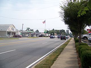
Lyndon is a home rule-class city in Jefferson County, Kentucky, United States. The population was 11,002 at the 2010 census, up from 9,369 at the 2000 census.

Louisville metropolitan area Geographic region surrounding Louisville, KY, USA

The Louisville metropolitan area or Kentuckiana, also known as the Louisville–Jefferson County, Kentucky–Indiana, metropolitan statistical area, is the 45th largest metropolitan statistical area (MSA) in the United States. The principal city is Louisville, Kentucky.

Tyler Park, Louisville human settlement in Louisville, Kentucky, United States of America

Tyler Park is a neighborhood three miles (5 km) southeast of downtown Louisville, Kentucky, USA. It is considered a part of a larger area of Louisville called The Highlands. Near the middle of the neighborhood is a city park of the same name, and many houses in the neighborhood feature park views. The neighborhood boundaries are St Louis Cemetery to the north, Bardstown Road to the east, Eastern Parkway to the south and Beargrass Creek to the west.

Original Highlands, Louisville human settlement in Louisville, Kentucky, United States of America

The Original Highlands is a historic neighborhood in the Highlands area of Louisville, Kentucky, United States.

Crescent Hill, Louisville human settlement in Louisville, Kentucky, United States of America

Crescent Hill is a neighborhood four miles (6 km) east of downtown Louisville, Kentucky USA. This area was originally called "Beargrass" because it sits on a ridge between two forks of Beargrass Creek. The boundaries of Crescent Hill are N Ewing Ave to the St. Matthews city limit by Brownsboro Road to Lexington Road. Frankfort Avenue generally bisects the neighborhood.

Cherokee Gardens is a residential area six miles east of downtown Louisville, Kentucky USA. The area is a collection of small, unconnected subdivisions along Lexington Road and large estates built just outside Cherokee Park.

Neighborhoods in Louisville, Kentucky

This is a list of official neighborhoods in Louisville, Kentucky. Like many older American cities, Louisville has well-defined neighborhoods, many with well over a century of history as a neighborhood.

Hazelwood is a neighborhood on the south side of Louisville, Kentucky, United States. Its boundaries are Manslick Road to the west, I-264 to the north, Taylor Boulevard to the east, and Hazelwood Avenue to the south. Its development, as with other nearby neighborhoods, was spurred by the opening of Iroquois Park in the early 1890s. E.E. Meacham first subdivided the land in 1899. A larger subdivision, called Bergmann's Addition, was financed in 1902. The Hazelwood Center, opened in 1907, is a former tuberculous center and since 1971 a hospital for the mentally handicapped located in the neighborhood.

Cloverleaf is a neighborhood in southwest Louisville, Kentucky. Its boundaries are I-264 to the north, Manslick Road to the east, Gagel Avenue to the south, and the Illinois Central railroad tracks to the west. It takes its name from Cloverleaf Acres, a development in the area. It is residential, and was annexed by Louisville in 1958.

Waverly Hills is a neighborhood in Southwestern Louisville, Kentucky which is centered at Dixie Highway and Pages Lane. It is located in a hilly section of the city, which is part of the larger Knobs Region which extends into southeastern Kentucky. Its boundaries are roughly Stonestreet Road and 3rd Street Road to the south, Dixie Highway to the west, St Andrews Church Road to the north, and Auburndale to the east.

Louisville Railway

The Louisville Railway Company (LRC) was a streetcar and interurban rail operator in Louisville, Kentucky. It began under the name Louisville City Railway in 1859 as a horsecar operator and slowly acquired other rival companies. It was renamed in 1880 following the merger of all Mule operations as the Louisville Railway Company. All tracks were 5 ft gauge.

Fisherville, Louisville human settlement in Louisville, Kentucky, United States of America

Fisherville is a neighborhood of Louisville, Kentucky, United States, which is centered along Taylorsville Road and Finchville Road. It was originally named Curreys after Edward Currey, who opened a post office in 1833. In 1847, it was renamed after Robert Fisher who had died two years earlier and operated a mill on Floyds Fork with his father, John. The area became more commercial in the late 19th and early 20th centuries due to the opening of railroad tracks and the discovery of a mineral water well. Visitors came for the therapeutic value of the mineral water, but when the well went dry in 1914 the area began its reversion to being a primarily residential area. Fisherville is also home of one of Louisville's great Basketball coaches, Denny Crum, who coached for the University of Louisville for 30 years attaining 2 Men's Basketball Championships.

Prairie Village is a neighborhood of Louisville, Kentucky, composed of a series of subdivisions and farms centered on the intersection of Third Street Road, Valley Station Road, and Stonestreet Road.

Lakeland is a neighborhood of Louisville, Kentucky located along LaGrange Road near Central State Hospital and Keeneland, Lyndon, Kentucky.

O'Bannon is a neighborhood of Louisville, Kentucky centered along Old LaGrange Road and Collins Lane. O'Bannon was originally called Williamson after its first postmaster John Williamson, but was renamed in 1859 after postmaster John O'Bannon. The Post Office was located at the southwest corner of Old LaGrange Road and Collins Lane. O'Bannon Elementary School, which was located on Factory Lane, closed in 1960.

Kentucky Route 146 is a 33.505-mile-long (53.921 km) state highway in Kentucky that runs from U.S. Route 60 in the St. Matthews suburb of Louisville to U.S. Route 421, Kentucky Route 55, and Kentucky Route 573 in New Castle via Lyndon, Anchorage, Pewee Valley, Crestwood, Buckner, and La Grange.

Little Haifa or New Preston St. are the two nicknames for a large Jewish neighborhood on Dutchman's Lane in Louisville, Kentucky. The small neighborhood is the center of Louisville's Jewish communities, especially the Orthodox Jewish community. Located between the Highlands and St. Matthews neighborhoods, Little Haifa/New Preston is located on Dutchman's Lane stretching from Abigail Drive through Almara Circle, Vivian Lane, and Woodluck Avenue. It is home to Louisville's Jewish Community Center, Shalom Towers, Jewish Family & Vocational Services, Anshei Sfard & The Chabad House. Additionally, it is within close proximity to Adath Jeshuran and Kenneseth Israel Synagogues. Almara Circle, Vivian Lane, Woodluck Avenue serve as the residential zone for most Jewish homeowners in the area, while most Jewish renters are located in Dutchman's Lane and Abigail Drive. There are also several houses and apartment buildings owned by synagogues and/or members of the Jewish community, that are used as housing for elderly, disabled, and financially unstable community members. Due to the high concentration of Jewish residents in this 1/4 mile stretch of area, the neighborhood is a very tight knit community.

References

  1. "Warwick Villa" (PDF).
  2. . UofL https://louisville.edu/cepm/westlou/west-louisville-general/a-place-in-time-courier-journals-history-of-neighborhoods/ . Retrieved 16 August 2016.Missing or empty |title= (help)
  3. "The Unofficial Homepage of St. Matthews: Kentucky: Louisville: Warwick Village". Stmatthewshomeplace.com. 2012-11-28. Archived from the original on April 16, 2015. Retrieved 2015-04-08.
  4. "Warwick Park - City of St Matthews". Stmatthewsky.gov. 2014-06-20. Retrieved 2015-04-08.