Waukon, Iowa

Last updated

Waukon, Iowa
CityHallWaukonIowa.jpg
Waukon City Hall in 2020
Allamakee County Iowa Incorporated and Unincorporated areas Waukon Highlighted.svg
Location of Waukon within County and State
Waukon IA map.gif
Detailed local map of Waukon
Coordinates: 43°16′8″N91°28′45″W / 43.26889°N 91.47917°W / 43.26889; -91.47917
Country Flag of the United States (23px).png  United States
State Flag of Iowa.svg  Iowa
County Allamakee
Township Makee
Area
[1]
  Total2.84 sq mi (7.35 km2)
  Land2.84 sq mi (7.35 km2)
  Water0.00 sq mi (0.00 km2)
Elevation
1,237 ft (377 m)
Population
 (2020)
  Total3,827
  Density1,349.44/sq mi (520.99/km2)
Time zone UTC-6 (Central (CST))
  Summer (DST) UTC-5 (CDT)
ZIP code
52172
Area code 563
FIPS code 19-82740
GNIS feature ID0462754
Website cityofwaukon.com

Waukon is a city in Makee Township, Allamakee County, Iowa, United States, and the county seat of Allamakee County. [2] The population was 3,827 at the time of the 2020 census. [3]

Contents

History

Waukon is often said to be named for Waukon Decorah, [4] a Ho Chunk (Winnebago) leader who was a U.S. ally during the 1832 Black Hawk War, although the city is also said to be named for his son Chief John Waukon. [5] Winnebagos lived in this area of Iowa in the 1840s, before being forced to relocate to Minnesota.

The first white settler arrived in 1849, and the town was founded and the Waukon Post Office opened in 1853. [6] A courthouse was completed in 1861, and the county seat was moved to Waukon in 1867 after 8 elections attempting to decide the location of the county seat. [7] The town was incorporated in 1883. Ryan Griffith was the first mayor of Waukon, winning the 1883 election by unanimous decision. [8]

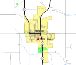
Waukon is only about 16 miles from Waukon Junction, on the Mississippi River, but the rail line between these two points was 33 miles long, climbing 600 feet through some of the roughest terrain in Iowa. [9] The Waukon and Mississippi Railroad, which opened in 1877, was originally built as a narrow gauge line. [7] The line was originally controlled by the Chicago and Northwestern but was quickly acquired by the Chicago, Milwaukee and St. Paul Railway. [10] The line was widened to standard gauge after purchase by the Milwaukee Road. Its only marginal traffic through its existence led to the road's abandonment in the late 1960s. [11]

The Mississippi Valley Iron Co. ore processing plant in 1918. MississipiValleyIronWaukon.jpg
The Mississippi Valley Iron Co. ore processing plant in 1918.

There is a deposit of limonite (Iron Ore) about 3 miles northeast of Waukon called Iron Hill, holding an estimated 10 million tons of ore. This is the highest point in northeastern Iowa. the Waukon Iron Company began developing an open-pit mine and ore-washing plant on this site in 1899, with a capacity of 300 tons per 10-hour shift. Production was seriously limited by the need to haul the ore 3 miles to the railroad, and the mine was, ultimately, a failure. [12]

A second and better capitalised attempt to mine this deposit was begun in 1907 by the Missouri Iron Company, with a railroad connection built in 1910 and a new ore processing plant completed in 1913 with a capacity of 350 to 400 tons per day. [13] [14] The total investment was estimated at $225,000, [15] and two patents were issued for the machinery in the ore processing plant. [16] [17] This mine became the principal mine of the new Mississippi Valley Iron Company of St. Louis, Missouri in 1916. [18]

That year, the mine produced 10,151 tons of concentrated ore, and in 1917, it produced 22,612 tons. [19] In 1918 the mine produced over 7000 tons before it was shut down because of World War I. [20]

The mine never recovered from this shutdown, and the equipment was sold for scrap in 1937. [21] Iron Mine Drive and Allamakee Street cross north of the sites of both old mines ( 43°17′53.62″N91°27′35.85″W / 43.2982278°N 91.4599583°W / 43.2982278; -91.4599583 ). [22]

Geography

Waukon is located at 43°16′8″N91°28′45″W / 43.26889°N 91.47917°W / 43.26889; -91.47917 (43.268889, -91.479212). [23] The headwaters of the north branch of Paint Creek are in Waukon, and the town is just south of the headwaters of Village Creek. [24] This is on the west edge of the deeply eroded Driftless Area of northeast Iowa. [9] The town sits on a plain underlain by the Galena Limestone formation. There are many sinkholes in this plain south of Waukon. To the north, a tongue of Galena Limestone underlies Iron Hill. [25]

According to the United States Census Bureau, the city has a total area of 2.82 square miles (7.30 km2), all land. [26]

Waukon, Iowa.jpg
Iowa Highway 9 running through town

Climate

Climate data for Waukon, Iowa (1991–2020 normals, extremes 1934–present)
MonthJanFebMarAprMayJunJulAugSepOctNovDecYear
Record high °F (°C)56
(13)
60
(16)
82
(28)
91
(33)
92
(33)
96
(36)
106
(41)
100
(38)
99
(37)
91
(33)
75
(24)
63
(17)
106
(41)
Mean daily maximum °F (°C)24.0
(−4.4)
29.0
(−1.7)
41.5
(5.3)
55.7
(13.2)
67.5
(19.7)
77.3
(25.2)
81.3
(27.4)
79.0
(26.1)
72.2
(22.3)
58.7
(14.8)
42.5
(5.8)
29.4
(−1.4)
54.8
(12.7)
Daily mean °F (°C)16.2
(−8.8)
20.5
(−6.4)
32.2
(0.1)
45.0
(7.2)
56.6
(13.7)
67.5
(19.7)
71.5
(21.9)
69.1
(20.6)
61.4
(16.3)
48.7
(9.3)
34.5
(1.4)
22.2
(−5.4)
45.5
(7.5)
Mean daily minimum °F (°C)8.4
(−13.1)
12.0
(−11.1)
22.8
(−5.1)
34.3
(1.3)
45.7
(7.6)
57.7
(14.3)
61.6
(16.4)
59.3
(15.2)
50.7
(10.4)
38.7
(3.7)
26.5
(−3.1)
15.0
(−9.4)
36.1
(2.3)
Record low °F (°C)−31
(−35)
−34
(−37)
−21
(−29)
2
(−17)
24
(−4)
32
(0)
40
(4)
38
(3)
25
(−4)
15
(−9)
−13
(−25)
−27
(−33)
−34
(−37)
Average precipitation inches (mm)1.23
(31)
1.25
(32)
2.03
(52)
4.06
(103)
4.66
(118)
5.92
(150)
4.73
(120)
4.70
(119)
3.92
(100)
2.85
(72)
2.27
(58)
1.57
(40)
39.19
(995)
Source: NOAA [27] [28]

Demographics

Waukon historical population
YearPop.±%
1880 1,350    
1890 1,610+19.3%
1900 2,153+33.7%
1910 2,025−5.9%
1920 2,359+16.5%
1930 2,526+7.1%
1940 2,972+17.7%
1950 3,158+6.3%
1960 3,639+15.2%
1970 3,883+6.7%
1980 3,983+2.6%
1990 4,019+0.9%
2000 4,131+2.8%
2010 3,897−5.7%
2020 3,827−1.8%
Source: "U.S. Census website". United States Census Bureau . Retrieved March 29, 2020.
Source:
U.S. Decennial Census [29] [3]

2020 census

As of the census of 2020, [30] the population was 3,827. The population density was 1,349.4 inhabitants per square mile (521.0/km2). There were 1,939 housing units at an average density of 683.7 per square mile (264.0/km2). The racial makeup of the city was 95.5% White, 0.7% Black or African American, 0.3% Native American, 0.1% Asian, 1.2% from other races, and 2.2% from two or more races. Ethnically, the population was 2.7% Hispanic or Latino of any race.

2010 census

As of the census [31] of 2010, there were 3,897 people, 1,781 households, and 1,008 families residing in the city. The population density was 1,381.9 inhabitants per square mile (533.6/km2). There were 1,946 housing units at an average density of 690.1 per square mile (266.4/km2). The racial makeup of the city was 98.4% White, 0.4% African American, 0.1% Native American, 0.1% Asian, 0.3% from other races, and 0.7% from two or more races. Hispanic or Latino of any race were 1.4% of the population.

There were 1,781 households, of which 24.3% had children under the age of 18 living with them, 43.0% were married couples living together, 9.4% had a female householder with no husband present, 4.2% had a male householder with no wife present, and 43.4% were non-families. 37.5% of all households were made up of individuals, and 18% had someone living alone who was 65 years of age or older. The average household size was 2.11 and the average family size was 2.77.

The median age in the city was 45.8 years. 20.4% of residents were under the age of 18; 7.9% were between the ages of 18 and 24; 20.7% were from 25 to 44; 27% were from 45 to 64; and 24% were 65 years of age or older. The gender makeup of the city was 46.6% male and 53.4% female.

2000 census

As of the census [32] of 2000, there were 4,131 people, 1,790 households, and 1,068 families residing in the city. The population density was 1,404.3 inhabitants per square mile (542.2/km2). There were 1,909 housing units at an average density of 649.0 per square mile (250.6/km2). The racial makeup of the city was 98.74% White, 0.10% Native American, 0.22% Asian, 0.02% Pacific Islander, 0.15% from other races, and 0.77% from two or more races. Hispanic or Latino of any race were 0.73% of the population.

There were 1,790 households, out of which 26.6% had children under the age of 18 living with them, 47.5% were married couples living together, 9.4% had a female householder with no husband present, and 40.3% were non-families. 36.5% of all households were made up of individuals, and 20.3% had someone living alone who was 65 years of age or older. The average household size was 2.21 and the average family size was 2.89.

Age spread: 22.8% under the age of 18, 7.6% from 18 to 24, 23.3% from 25 to 44, 21.7% from 45 to 64, and 24.6% who were 65 years of age or older. The median age was 42 years. For every 100 females, there were 84.3 males. For every 100 females age 18 and over, there were 81.4 males.

The median income for a household in the city was $30,325, and the median income for a family was $41,068. Males had a median income of $27,532 versus $18,833 for females. The per capita income for the city was $17,047. About 8.3% of families and 12.3% of the population were below the poverty line, including 19.7% of those under age 18 and 6.8% of those age 65 or over.

Parks and recreation

Waukon airport Waukon airport.jpg
Waukon airport

Waukon Family Aquatic Area: The aquatic pool is the main attraction in Waukon's park. Also in the park is a small area with a lake, as well as some playgrounds. The park also includes a campground and some softball/athletic fields.

Education

Waukon high school, middle, and elementary school Waukon schools.jpg
Waukon high school, middle, and elementary school
Northeast Iowa Community College in Waukon by the high school Northeast Iowa Community College.webp
Northeast Iowa Community College in Waukon by the high school

The Allamakee Community School District operates local public schools, which include two elementary schools, a middle school, and a high school. [33] A Catholic-church-affiliated private elementary school also operates in Waukon.

Media

Newspaper

Waukon Standard

Radio

Notable people

Related Research Articles

<span class="mw-page-title-main">Winneshiek County, Iowa</span> County in Iowa, United States

Winneshiek County is a county located in the U.S. state of Iowa. As of the 2020 census, the population was 20,070. The county seat is Decorah.

<span class="mw-page-title-main">Fayette County, Iowa</span> County in Iowa, United States

Fayette County is a county located in the U.S. state of Iowa. As of the 2020 census, the population was 19,509. The county seat is West Union.

<span class="mw-page-title-main">Clayton County, Iowa</span> County in Iowa, United States

Clayton County is a county located in the U.S. state of Iowa. As of the 2020 census, the population was 17,043. Its county seat is Elkader. The county was established in 1837 and was named in honor of John M. Clayton, United States Senator from Delaware and later Secretary of State under President Zachary Taylor.

<span class="mw-page-title-main">Allamakee County, Iowa</span> County in Iowa, United States

Allamakee County is the northeasternmost county in the U.S. state of Iowa. As of the 2020 census, the population was 14,061. Its county seat is Waukon.

<span class="mw-page-title-main">Harpers Ferry, Iowa</span> City in Iowa, United States

Harpers Ferry is a city in Taylor Township, Allamakee County, Iowa, United States. The population was 262 at the time of the 2020 census.

<span class="mw-page-title-main">Lansing, Iowa</span> City in Iowa, United States

Lansing is a city in Lansing Township, Allamakee County, Iowa, United States. The population was 968 at the time of the 2020 census.

<span class="mw-page-title-main">New Albin, Iowa</span> City in Iowa, United States

New Albin is a city in Iowa Township, Allamakee County, Iowa, United States. It is the northeasternmost town in Iowa, located on the Mississippi River and the Minnesota border. The population was 432 at the time of the 2020 census.

<span class="mw-page-title-main">Postville, Iowa</span> Village in Iowa, United States

Postville is a village in Allamakee and Clayton counties in the U.S. state of Iowa. It lies near the junction of four counties and at the intersection of U.S. Routes 18 and 52 and Iowa Highway 51, with airport facilities in the neighboring communities of Waukon, Decorah, Monona and Prairie du Chien. The population was 2,503 at the time of the 2020 census, up from 2,273 in 2000. The village is in Allamakee County's southwestern corner and the Clayton County's northwestern corner in a quad county, or four-corner region, where four counties intersect. Winneshiek County is just to the west and Fayette County just to the southwest of Postville.

<span class="mw-page-title-main">Waterville, Iowa</span> City in Iowa, United States

Waterville is a city in Paint Creek Township, Allamakee County, Iowa, United States. The population was 109 at the time of the 2020 census.

<span class="mw-page-title-main">Chester, Iowa</span> City in Iowa, United States

Chester is a city in Howard County, Iowa, United States. The population was 139 in the 2020 census, a decrease of 7.9% from the 151 population in the 2000 census. Chester is located close to the state line from Minnesota.

<span class="mw-page-title-main">Elma, Iowa</span> City in Iowa, United States

Elma is a city in Howard County, Iowa, United States. The population was 505 at the time of the 2020 census.

<span class="mw-page-title-main">Lime Springs, Iowa</span> City in Iowa, United States

Lime Springs is a city in Howard County, Iowa, United States. The population was 473 at the time of the 2020 census.

<span class="mw-page-title-main">Calmar, Iowa</span> City in Iowa, United States

Calmar is a city in Winneshiek County, Iowa, United States. The population was 1,125 at the 2020 census. It is at the junction of U.S. Route 52 and State highways 150 and 24, with both state routes terminating in Calmar.

<span class="mw-page-title-main">Castalia, Iowa</span> City in Iowa, United States

Castalia is a city in Winneshiek County, Iowa, United States. The population was 145 at the 2020 census.

<span class="mw-page-title-main">Decorah, Iowa</span> City in Iowa, United States

Decorah is a city in and the county seat of Winneshiek County, Iowa, United States. The population was 7,587 at the time of the 2020 census. Decorah is located at the intersection of State Highway 9 and U.S. Route 52, and is the largest community in Winneshiek County.

<span class="mw-page-title-main">Fort Atkinson, Iowa</span> City in Iowa, United States

Fort Atkinson is a city in Winneshiek County, Iowa, United States. The population was 312 at the time of the 2020 census. It is home to the historic Fort Atkinson State Preserve and hosts a large annual fur-trapper rendezvous each September. Fort Atkinson holds the largest regional hay auction every Wednesday.

<span class="mw-page-title-main">Ossian, Iowa</span> City in Iowa, United States

Ossian (pronounced|ˈosh-ain) is a city in Winneshiek County, Iowa, United States. The population was 802 at the time of the 2020 census.

<span class="mw-page-title-main">Ridgeway, Iowa</span> City in Iowa, United States

Ridgeway is a city in Winneshiek County, Iowa, United States. The population was 275 at the time of the 2020 census.

<span class="mw-page-title-main">Spillville, Iowa</span> City in Iowa, United States

Spillville is a city in Winneshiek County, Iowa, United States. The population was 385 at the time of the 2020 census. It is located in Calmar Township, approximately 4 mi (6.4 km) west of Calmar and about 12 miles (19 km) southwest of Decorah, the county seat. Spillville is known for its Independence Day fireworks display, held the first Saturday in July.

<span class="mw-page-title-main">Burr Oak, Iowa</span> CDP in Iowa, United States

Burr Oak is an unincorporated community in Winneshiek County, Iowa, United States, very close to the Minnesota state line. Burr Oak is a census-designated place and the population was 166 in the 2010 census.

References

  1. "2020 U.S. Gazetteer Files". United States Census Bureau. Retrieved March 16, 2022.
  2. "Find a County". National Association of Counties. Retrieved June 7, 2011.
  3. 1 2 "2020 Census State Redistricting Data". census.gov. United states Census Bureau. Retrieved August 12, 2021.
  4. Virgil J. Vogel, Indian names on Wisconsin's map (University of Wisconsin Press, 1991), 61.
  5. Val Swinton (August 16, 1994). "Winnebago tribe leaves Iowa legacy: Chief's descendant researches history". The Gazette (Cedar Rapids-Iowa City). Retrieved December 24, 2010.
  6. Waukon Post Office, in the USGS Geographic Names Information System
  7. 1 2 W. E. Alexander, Chapter XII- Chronology, History of Allamakee County, History of Winneshiek and Allamakee Counties, Iowa, Western, Sioux City, 1882; pp. 463-464.
  8. Tom Savage, A Dictionary of Iowa Place Names, University of Iowa Press, 2007; p. 231.
  9. 1 2 Samuel Calvin, What Glaciers have done for Iowa, Annual Report of the Iowa Weather and Crop Service, 1899 Conway, Des Moines, 1900; p. 62.
  10. W. E. Alexander, Railroad History, Chapter VI, History of Winneshiek County, History of Winneshiek and Allamakee Counties, Iowa, Western, Sioux City, 1882; p. 219.
  11. Rehder and Cook (December 1972). Grass Between The Rails. Waukon & Mississippi Press. Archived from the original on March 25, 2012. Retrieved June 19, 2011.
  12. S.W. Beyer, Iowa's Iron Mine, The Iowa Engineer, Vol. 1, No. 4 (March 1902); p. 142–150. The article includes photos.
  13. Ellison Orr, Iron Hill, Chapter VIII -- Geology of Allamakee County, Past and Present of Allamakee County, Iowa, Vol. 1, Ellery M. Hancock, ed., S.J. Clarke, Chicago, 1913; pp. 99–102.
  14. Jesse V. Howell, Treatment of the Ore, The Iron Ore Deposits Near Waukon Iowa, Annual Report, 1914, with Accompanying Papers, Iowa Geological Survey, Des Moines, 1916; pp. 84–92. The photo of the plant on page 85 is noteworthy.
  15. Ernest Wander, The Goltra Process of Concentrating Iron Ores as Developed at Waukon, Iowa, Thesis, School of Mines and Metallurgy, University of Missouri, Rolla, 1917; p. 49. The author of this thesis appears to have worked for both the Waukon Iron Company and the Missouri Iron Company.
  16. Robert W. Erwin, Apparatus for Treating Ores Preparatory to Magnetic Separation, U.S. Patent 1,295,719, Feb. 25, 1919.
  17. Edward F. Goltra, Thomas S. Maffitt, Jesse E. Dana, and Robert W. Erwin, Apparatus for Cleaning Clayey Ores, U.S. Patent 1,288,404, Dec. 17, 1918. The drawings in this patent closely match the actual layout of the mill buildings and therefore serve as an explanation of what was inside those buildings.
  18. Furnace Revival in St. Louis, The Iron Age, Vol. 97, No. 4 (January 27, 1916); p. 281
  19. Ernest F. Burchard, Iron Ore, Pig Iron and Steel,Mineral Resources of the United States 1917, Part I Metals, H. D. McCaskey, ed., Government Printing Office, 1921; p. 584.
  20. James H. Lees, Mineral Production in Iowa for 1917 and 1918, Annual Report, 1918, with Accompanying Papers, Iowa Geological Survey, Des Moines, 1922?; p. 48.
  21. Writers' Program of the Works Progress Administration, Iowa -- A Guide to the Hawkeye State, Iowa State Historical Society, 1938; p. 435.
  22. the former strip mines are visible in the USGS 1m resolution LIDAR image from Iowa Geographic Map Server
  23. "US Gazetteer files: 2010, 2000, and 1990". United States Census Bureau. February 12, 2011. Retrieved April 23, 2011.
  24. Samuel Calvin, Drainage, Geology of Allamakee County, Third Annual Report, 1894, Iowa Geological Survey, 1895; pp. 50–51.
  25. Jesse V. Howell, The Galena Formation, The Iron Ores of Iron Hill Near Waukon Iowa, Annual Report with Accompanying Papers, 1914, Iowa Geological Survey, Des Moines, 1916; pp. 50–51.
  26. "US Gazetteer files 2010". United States Census Bureau. Archived from the original on July 2, 2012. Retrieved May 11, 2012.
  27. "NowData – NOAA Online Weather Data". National Oceanic and Atmospheric Administration. Retrieved June 25, 2021.
  28. "Station: Waukon, IA". U.S. Climate Normals 2020: U.S. Monthly Climate Normals (1991-2020). National Oceanic and Atmospheric Administration. Retrieved June 25, 2021.
  29. "Census of Population and Housing". Census.gov. Retrieved June 4, 2015.
  30. "2020 Decennial Census: Waukon city, Iowa". data.census.gov. U.S. Census Bureau. Retrieved July 22, 2022.
  31. "U.S. Census website". United States Census Bureau . Retrieved May 11, 2012.
  32. "U.S. Census website". United States Census Bureau . Retrieved January 31, 2008.
  33. "ALLAMAKEE" (PDF). Iowa Department of Education . Retrieved August 8, 2020.
  34. 'Annals of Iowa,' Vol X, No. 1, 3rd Series, Notable Deaths, pg. 75

Reference No. 17 Should read Jesse D. Dana. Jesse Dwight Dana of St. Louis (1877 - 1921)