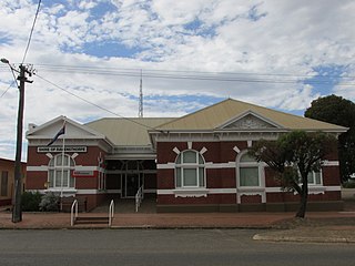
The Shire of Ravensthorpe is a local government area in the Great Southern region of Western Australia, about halfway between the city of Albany and the town of Esperance and about 530 kilometres (329 mi) southeast of the state capital, Perth. The Shire covers an area of 13,551 square kilometres (5,232 sq mi), and its seat of government is the town of Ravensthorpe.
Cascade is a small town in Western Australia located 677 kilometres (421 mi) east of Perth along the South Coast between Ravensthorpe and Esperance in the Goldfields-Esperance region of Western Australia. The Griffiths, Fields and Cascade Nature Reserves are located within Cascade.

Dalyup is a town and locality of the Shire of Esperance in the Goldfields-Esperance region of Western Australia. It is located on the South Coast Highway and the Southern Ocean. The Lake Mortijinup Nature Reserve as well as two unnamed nature reserves are located in Dalyup.
Needilup is a town and locality in the Shire of Jerramungup, Great Southern region of Western Australia. Needilup is situated between Ongerup and Jerramungup along the Gnowangerup-Jerramungup Road. The Needilup and Corackerup Nature Reserves are located within Needilup, as is the Chereninup Creek Reserve.

Coomalbidgup is a town and locality of the Shire of Esperance in the Goldfields-Esperance region of Western Australia. It is located on the South Coast Highway and the Southern Ocean. Almost the entire coast of the locality is covered by protected area, with the Stokes Inlet and the Stokes National Park in the west and two unnamed nature reserves in the east.
West Fitzgerald is a rural locality of the Shire of Jerramungup in the Great Southern region of Western Australia. The South Coast Highway passes through the locality from west to east while its far south is made up of a part of the Fitzgerald River National Park.
Woogenellup, sometimes also spelled Woogenilup, is a rural locality of the Shire of Plantagenet in the Great Southern region of Western Australia. The eastern border of Woogenellup is formed by Chester Pass Road, while the southern boundary of the Stirling Range National Park forms its northern border. The Kalgan River runs through the locality from north-west to south-east, and the Kalgan Plains Nature Reserve is located within Woogenellup, south of the river.
Toompup is a rural locality of the Shire of Gnowangerup in the Great Southern region of Western Australia. Toompup borders the townsite of Borden and Chester Pass Road in the west and the townsite of Ongerup in the north-east. The Toompup Nature Reserve is located within Toompup.
Mindarabin is a rural locality of the Shire of Gnowangerup in the Great Southern region of Western Australia. Mindarabin borders the townsite of Ongerup in the south-east and is home to three unnamed nature reserves in the north. Chester Pass Road passes through the centre of the locality from south to north.
Fitzgerald is a rural townsite and locality of the Shire of Ravensthorpe in the Goldfields-Esperance region of Western Australia. The townsite lies north of the South Coast Highway.

Kundip is an abandoned mining town of the Shire of Ravensthorpe in the Goldfields-Esperance region of Western Australia. It is located within the locality of Ravensthorpe, on the Hopetoun to Ravensthorpe Road.

Red Lake is an abandoned town in the Shire of Esperance in the Goldfields-Esperance region of Western Australia. It is situated within the locality of Grass Patch, on the Coolgardie-Esperance Highway.

Dowak is an abandoned town in the Shire of Esperance in the Goldfields-Esperance region of Western Australia. It is situated within the locality of Salmon Gums, on the Coolgardie-Esperance Highway.
Monjingup is a locality of the Shire of Esperance in the Goldfields-Esperance region of Western Australia. The South Coast Highway and the Kalgoorlie to Esperance railway pass through Monjingup while the Coolgardie–Esperance Highway forms its eastern border. The western part of the townsite of Shark Lake is located in the north-east of Monjingup, while the Lake Warden Nature Reserve is located in the south-east.
Neridup is a rural locality of the Shire of Esperance in the Goldfields-Esperance region of Western Australia. A large part of the Kau Rock Nature Reserve is located in the north-east of Neridup.
Wittenoom Hills is a rural locality of the Shire of Esperance in the Goldfields-Esperance region of Western Australia. A substantial part of the locality is covered by nature reserves, established in 1966 and 1974. The Wittenoom Hills are a range of hills with Mount Burdett, 271 metres (889 ft) high, as its most prominent point.
Mount Ney is a rural locality of the Shire of Esperance in the Goldfields-Esperance region of Western Australia. Parts of the Kau Rock Nature Reserve and all of the Mount Ney Nature Reserve are located within Mount Ney, the latter centred around the 328-metre-high (1,076 ft) mountain of the same name.
Buraminya is a rural locality of the Shire of Esperance in the Goldfields-Esperance region of Western Australia. The locality is extensively covered by protected areas, the Dundas Nature Reserve and the Ngadju Indigenous Protected Area. Mount Buraminya, with a height of 233 metres (764 ft), is located in the south of Buraminya. Buraminya's eastern and south-eastern borders are formed by the boundary of Nuytsland Nature Reserve and Cape Arid National Park.
Beaumont is a rural locality of the Shire of Esperance in the Goldfields-Esperance region of Western Australia. The locality is home to six nature reserves. Mount Beaumont, with a height of 276 metres (906 ft), is located in the north-west of Beaumont, just outside the Beaumont Nature Reserve.
Howick is a rural locality of the Shire of Esperance in the Goldfields-Esperance region of Western Australia, located on the Southern Ocean. The locality is home to a number of nature reserves and borders the Cape Arid National Park in the east.

