Related Research Articles

Tyler Park is a neighborhood three miles (5 km) southeast of downtown Louisville, Kentucky, USA. It is considered a part of a larger area of Louisville called The Highlands. Near the middle of the neighborhood is a city park of the same name, and many houses in the neighborhood feature park views. The neighborhood boundaries are St Louis Cemetery to the north, Bardstown Road to the east, Eastern Parkway to the south and Beargrass Creek to the west.

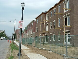
Meriwether is a neighborhood two miles southeast of downtown Louisville, Kentucky, USA, and just east of the University of Louisville. It was laid out by David Meriwether in 1871 and the first houses were built in 1891. Nearly all of the homes are shotgun houses.

South Louisville is a neighborhood two miles south of downtown Louisville, Kentucky, US. The area was incorporated as a city in 1886. The city of Louisville fought to annex the area and did so, after a three-year lawsuit, in 1898. As of 2000, the population of South Louisville was 4,688.
Beechmont is a neighborhood in the south end of Louisville, Kentucky. Its modern boundaries are I-264 to the north, Taylor Boulevard to the west, Southern Parkway and Southland Boulevard to the south, and Third Street, Allmond and Louisville Avenues to the east.

Crescent Hill is a neighborhood four miles (6 km) east of downtown Louisville, Kentucky USA. This area was originally called "Beargrass" because it sits on a ridge between two forks of Beargrass Creek. The boundaries of Crescent Hill are N Ewing Ave to the St. Matthews city limit by Brownsboro Road to Lexington Road. Frankfort Avenue generally bisects the neighborhood.

Shelby Park is a neighborhood two miles southeast of downtown Louisville, Kentucky, USA, named after Kentucky's first governor, Isaac Shelby. Shelby Park has always been considered a working-class neighborhood. It was first populated by German immigrants in the early 1900s. By the 1950s, the neighborhood was majority African-American. Today, Shelby Park is a blend of ethnic and economic diversity. People from all walks of life co-exist in a vibrant, art-filled community.
Highland Park was a city near and eventually neighborhood in Louisville, Kentucky, United States, that was razed as a part of the expansion of Louisville International Airport. Its boundaries were roughly the CSX railroad tracks to the west, and what would become the Kentucky State Fair & Exposition Center and the airport on all other sides.
Algonquin is a neighborhood in Louisville, Kentucky, United States. Its boundaries are Hill street to the north, Cypress Street to the west, CSX tracks to the east, and Bernheim Lane and Algonquin Parkway to the south. It was established in the 1920s and is primarily a residential neighborhood, named for nearby Algonquin Park. Samuel D. Jones Park is located on Thirteenth and Bashear streets.

Auburndale is a neighborhood in Louisville, Kentucky, United States. Its boundaries are Palatka Road to the north, and New Cut Road and Third Street to the east.
Audubon is a neighborhood in Louisville, Kentucky, United States. Its boundaries are Clarks Lane to the north, Poplar Level Road to the east, Preston Highway to the west, and the city of Audubon Park to the south. The smaller city of Parkway Village is surrounded by Audubon. George Rogers Clark Park, the site of a cabin owned by the parents of George Rogers Clark, is a prominent feature of the neighborhood.
Edgewood is a neighborhood on the south side of Louisville, Kentucky, United States. Its boundaries are Fern Valley Road to the south, I-65 to the west and Preston Highway to the north. Streets were laid out in the 1920s, but development was halted by the Great Depression. The area was also far from the city and had poor infrastructure. An improved sewage system after World War II and the large expansion of Standiford Field spurred development of Edgewood and its annexation by Louisville in 1957.
Park Hill is a neighborhood in Louisville, Kentucky, United States, located just west of Old Louisville. Its boundaries are the CSX railroad tracks to the east, Hill Street to the south, Twenty-sixth street to the west, and Virginia Avenue and Oak Street to the north. In the 19th century, the southwestern farmland portion of the neighborhood was known as the Cabbage Patch, the citizens of which inspired Alice Hegan Rice's 1901 children's novel Mrs. Wiggs of the Cabbage Patch.
Phoenix Hill is a neighborhood of Louisville, Kentucky just east of Downtown. Its boundaries are Market Street to the North, Preston Street to the West, Broadway to the South, and Baxter Avenue to the East. The Phoenix Hill neighborhood, settled before 1850 by German immigrants, is now a rich tapestry of people and a diverse mix of business, industry and residences.
Jacobs is a neighborhood on the south side of Louisville, Kentucky, in the United States. Its boundaries are Berry Boulevard to the north, Taylor Boulevard to the east, the I-264 to the south, and Seventh Street to the west. It was developed as Jacob's Addition in 1892 after the opening of nearby Jacob's Park and named for four-time Louisville mayor Charles Donald Jacob. The area housed a veteran's hospital, Nichols General Hospital, until 1952. The area includes Manslick Cemetery, a burial ground for indigents started in the 1870s, and Watterson Lake Park.
Bashford Manor is a neighborhood in Louisville, Kentucky, United States. Its boundaries are I-264 to the north, Bardstown Road to the east, Bashford Manor Lane to the south, and Newburg Road to the west. Originally a part of Thomas Byrd's 1,000 acre (4 km2) land grant from Virginia in 1787, James Bennett Wilder bought the land in 1870 and built a home which he named Bashford Manor, after his family's home in England. He sold the property to George James Long in 1888, who turned it into a horse farm which produced three early Kentucky Derby winners: Azra, Manuel and Sir Huon.
The Point was a thriving 19th century neighborhood in Louisville, Kentucky, east of Downtown Louisville and opposite Towhead Island along the Ohio River. It was also located north of the present day Butchertown area.
Waverly Hills is a neighborhood in Southwestern Louisville, Kentucky which is centered at Dixie Highway and Pages Lane. It is located in a hilly section of the city, which is part of the larger Knobs Region which extends into southeastern Kentucky. Its boundaries are roughly Stonestreet Road and 3rd Street Road to the south, Dixie Highway to the west, St Andrews Church Road to the north, and Auburndale to the east.
Rockcreek-Lexington Road is an irregular-shaped neighborhood in Louisville, Kentucky, United States. Its boundaries are Seneca Park and Briar Hill Road to the west, Cannons Lane to the east, Interstate 64 to the south, and Lexington Road to the north. Also included are "areas immediately adjoining Shelbyville Rd. from Cannons Ln. to Fairfax Ave. and those along Nanz Ave. from Cannons Ln. to Macon Ave."
Southland Park is a neighborhood in Louisville, Kentucky, United States. Its boundaries are Southside Drive to the west, the Greater Louisville Technology Park to the north, the CSX railroad tracks to the east, and the pre-merger Louisville city limits to the south.
Southside is a neighborhood in Louisville, Kentucky, United States. Its boundaries are Third Street to the west, Woodlawn Avenue, Allmond Avenue and Hiawatha Avenue to the north, the CSX railroad tracks to the east, and the southern boundary of the Greater Louisville Technology Park, Southside Drive and Kenwood Drive to the south.
References
- ^ "Wilder Park Neighborhood Profile" (PDF). Retrieved 10 March 2020.
