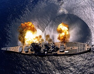
Naval gunfire support (NGFS), also known as naval surface fire support (NSFS), or shore bombardment, is the use of naval artillery to provide fire support for amphibious assault and other troops operating within their range. NGFS is one of several disciplines encompassed by the term naval fires. Modern naval gunfire support is one of the three main components of amphibious warfare assault operations support, along with aircraft and ship-launched land-attack missiles. Shipborne guns have been used against shore defences since medieval naval warfare.

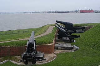
New Tavern Fort is an historic artillery fort in Gravesend, Kent. Dating mostly from the 18th and 19th centuries, it is an unusually well-preserved example of an 18th-century fortification and remained in use for defensive purposes until the Second World War. It was built during the American War of Independence to guard the Thames against French and Spanish raiders operating in support of the newly formed United States of America. It was redesigned and rebuilt in the mid-19th century to defend against a new generation of iron-clad French warships.

Fort Fareham is one of the Palmerston Forts, in Fareham, England. After the Gosport Advanced Line of Fort Brockhurst, Fort Elson, Fort Rowner, Fort Grange and Fort Gomer had been approved by the Royal Commission on the Defence of the United Kingdom a decision was made to build an outer line of three more forts two miles in advance of the Gosport Advanced Line. Of these three projected forts only Fort Fareham was built due to the need to cut costs. It acted as a hinge between the forts on Portsdown Hill and those of the Gosport Advanced Line, filling the gap at Fareham. It has been a Grade II Listed Building since 1976.

A casemate is a fortified gun emplacement or armoured structure from which guns are fired, in a fortification, warship, or armoured fighting vehicle.

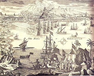
The Great Siege of Gibraltar was an unsuccessful attempt by Spain and France to capture Gibraltar from the British during the American Revolutionary War. It was the largest battle in the war by number of combatants.

Fort Rodd Hill National Historic Site is a 19th-century coastal artillery fort on the Colwood side of Esquimalt Harbour,. The site is adjacent to Fisgard Lighthouse National Historic Site, the first lighthouse on the west coast of Canada. Both the fort and lighthouse are managed and presented to the public by Parks Canada.

Seacoast defense was a major concern for the United States from its independence until World War II. Before airplanes, many of America's enemies could only reach it from the sea, making coastal forts an economical alternative to standing armies or a large navy. Substantial fortifications were built at key locations, especially protecting major harbors. Seacoast defense also included submarine minefields, nets and booms, ships, and, later, airplanes. The U.S. Army Corps of Engineers played the central role in constructing fixed defenses, but all of the armed forces participated.

Siege artillery is heavy artillery primarily used in military attacks on fortified positions. At the time of the American Civil War, the U.S. Army classified its artillery into three types, depending on the gun's weight and intended use. Field artillery were light pieces that often traveled with the armies. Siege and garrison artillery were heavy pieces that could be used either in attacking or defending fortified places. Seacoast artillery were the heaviest pieces and were intended to be used in permanent fortifications along the seaboard. They were primarily designed to fire on attacking warships. The distinctions are somewhat arbitrary, as field, siege and garrison, and seacoast artillery were all used in various attacks and defenses of fortifications. This article will focus on the use of heavy artillery in the attack of fortified places during the American Civil War.

The siege of Gibraltar of 1727 saw Spanish forces besiege the British garrison of Gibraltar as part of the Anglo-Spanish War. Depending on the sources, Spanish troops numbered between 12,000 and 25,000. British defenders were 1,500 at the beginning of the siege, increasing up to about 5,000. After a five-month siege with several unsuccessful and costly assaults, Spanish troops gave up and withdrew. Following the failure the war drew to a close, opening the way for the 1728 Treaty of El Pardo and the Treaty of Seville signed in 1729.

The siege of Fort St. Philip was a ten day long distance bombardment of exploding bomb shells - by two Royal Navy bomb vessels, mounting a total of four mortars - against the American garrison of Fort St. Philip. The fort was unable to retaliate at the start, as the bomb vessels were out of the range of its solid shot cannon, and its mortar did not have ammunition. This was remedied by supply boats, whereby the fort counter-attacked the bomb vessels with its mortar on January 17, and the British duly withdrew. This riverine engagement took place during the concluding hostilities of the War of 1812.

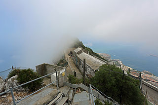
Princess Anne's Battery is an artillery battery in the British Overseas Territory of Gibraltar. It is located on Willis's Plateau at the northern end of the Upper Rock Nature Reserve, below Princess Caroline's Battery. It was named after Anne, Princess Royal and Princess of Orange, the eldest daughter of George II. However, its name is often confused with those of other batteries in the area. In 1732, guns were first mounted on the battery, which also saw action during the Great Siege of Gibraltar. Princess Anne's Battery was updated in the nineteenth and twentieth centuries, with the latter modernisation entailing the installation of four QF 5.25 inch guns with both anti-aircraft and coastal defence capabilities. The battery was manned into the early 1980s, after which it was decommissioned. The guns were refurbished in the early twenty-first century, and represent the world's only intact battery of 5.25 inch anti-aircraft guns. Princess Anne's and Amelia’s Battery are listed with the Gibraltar Heritage Trust.

Princess Amelia's Battery is an artillery battery in the British Overseas Territory of Gibraltar. It is located on Willis's Plateau at the northern end of the Upper Rock Nature Reserve, adjacent to Gun No. 4 of Princess Anne's Battery. It was named after Princess Amelia of Great Britain, the second daughter of George II. It was formerly referred to as the 2nd Willis's Battery. The plateau and its batteries had previously been named after an artillery officer by the name of Willis who was outstanding during the capture of Gibraltar in 1704. Princess Amelia's Battery saw action during the Great Siege of Gibraltar, during which it sustained substantial damage. Little remains of the original site, aside from two derelict buildings. The battery is listed with the Gibraltar Heritage Trust.

Princess Royal's Battery is an artillery battery in the British Overseas Territory of Gibraltar. It is located on Willis's Plateau at the northern end of the Upper Rock Nature Reserve, just southeast of Princess Anne's Battery. Formerly known as Willis' Battery, and later, Queen Anne's Battery or Queen's Battery, it was renamed in the late 18th century after Charlotte, Princess Royal, the eldest daughter of George III. The battery was active from the early 18th century until at least the mid-20th century. However, it has been decommissioned and guns are no longer present. Princess Royal's Battery is listed with the Gibraltar Heritage Trust.

The Soldier Artificer Company was a unit of the British Army raised in Gibraltar in 1772 to work on improving the fortifications there. It was the Army's first unit of military artificers and labourers – the existing Corps of Engineers was entirely made up of commissioned officers – and it replaced the traditional but unreliable practice of employing civilian craftsmen. The company was an immediate success and was responsible for upgrading the British fortress's defences before the Great Siege of Gibraltar.

Farringdon's Battery is an artillery battery in the British Overseas Territory of Gibraltar. Named after Sir Anthony Farrington, 1st Baronet, it is located above the north face of the Rock of Gibraltar within the Upper Rock Nature Reserve.

Spy Glass Battery or Spyglass Battery was originally a high angle artillery battery in the British Overseas Territory of Gibraltar. The battery is mounted high on the rock to give extra range and protection. The battery was still in use during the Second World War as a listening post and site for a Bofors Gun.

The Gibraltar peninsula, located at the far southern end of Iberia, has great strategic importance as a result of its position by the Strait of Gibraltar where the Mediterranean Sea meets the Atlantic Ocean. It has repeatedly been contested between European and North African powers and has endured fourteen sieges since it was first settled in the 11th century. The peninsula's occupants – Moors, Spanish, and British – have built successive layers of fortifications and defences including walls, bastions, casemates, gun batteries, magazines, tunnels and galleries. At their peak in 1865, the fortifications housed around 681 guns mounted in 110 batteries and positions, guarding all land and sea approaches to Gibraltar. The fortifications continued to be in military use until as late as the 1970s and by the time tunnelling ceased in the late 1960s, over 34 miles (55 km) of galleries had been dug in an area of only 2.6 square miles (6.7 km2).

The Lines of Contravallation of Gibraltar, known in English as the "Spanish Lines", were a set of fortifications built by the Spanish across the northern part of the isthmus linking Spain with Gibraltar. They later gave their name to the Spanish town of La Línea de la Concepción. The Lines were constructed after 1730 to establish a defensive barrier across the peninsula, with the aim of preventing any British incursions, and to serve as a base for fresh Spanish attempts to retake Gibraltar. They played an important role in the Great Siege of Gibraltar between 1779 and 1783 when they supported the unsuccessful French and Spanish assault on the British-held fortress. The siege was ended after the lines of contravallation were attacked by British and Dutch forces under the command of the Governor of Gibraltar, General Augustus Eliot. The attack caused the Spanish forces to retreat and abandon the fortifications and the combined British led forces virtually destroyed all the Spanish gun batteries and the enemy cannon and munitions either captured or destroyed. This attack is still commemorated to this day and is known as 'Sortie Day'.

The Queen's Lines are a set of fortified lines, part of the fortifications of Gibraltar, situated on the lower slopes of the north-west face of the Rock of Gibraltar. They occupy a natural ledge which overlooks the landward entrance to Gibraltar and were an extension to the north-east of the King's Lines. They run from a natural fault called the Orillon to a cliff above the modern Laguna Estate, which stands on the site of the Inundation, an artificial lake created to obstruct landward access to Gibraltar. The Prince's Lines run immediately behind and above them on a higher ledge. All three of the Lines were constructed to enfilade attackers approaching Gibraltar's Landport Front from the landward direction.

The Prince's Lines are part of the fortifications of Gibraltar, situated on the lower slopes of the north-west face of the Rock of Gibraltar. They are located at a height of about 70 feet (21 m) on a natural ledge above the Queen's Lines, overlooking the landward entrance to Gibraltar, and run from a natural fault called the Orillon to a cliff at the southern end of the isthmus linking Gibraltar with Spain. The lines face out across the modern Laguna Estate, which stands on the site of the Inundation, an artificial lake created to obstruct landward access to Gibraltar. They were constructed to enfilade attackers approaching Gibraltar's Landport Front from the landward direction.


