Woodstock is a city in Southwestern Ontario, Canada. The city has a population of 40,902 according to the 2016 Canadian census. Woodstock is the seat of Oxford County, at the head of the non-navigable Thames River, approximately 128 km from Toronto, and 43 km from London, Ontario. The city is known as the Dairy Capital of Canada and promotes itself as "The Friendly City".

The A34 is a major road in England. It runs from the A33 and M3 at Winchester in Hampshire, to the A6 and A6042 in Salford, close to Manchester City Centre. It forms a large part of the major trunk route from Southampton, via Oxford, to Birmingham, The Potteries and Manchester. For most of its length, it forms part of the former Winchester–Preston Trunk Road. Improvements to the section of road forming the Newbury Bypass around Newbury were the scene of significant direct action environmental protests in the 1990s. It is 151 miles (243 km) long.

East Zorra-Tavistock is a township in southwestern Ontario, Canada, formed on 1 January 1975 through the amalgamation of the Township of East Zorra and the Village of Tavistock. It is part of Oxford County. The township had a population of 7,129 in the Canada 2016 Census.

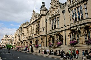
Summertown in North Oxford is a suburb of Oxford, England. Summertown is a one-mile square residential area, north of St Giles, the boulevard leading out of Oxford's city centre. Summertown is home to several independent schools and the city's most expensive houses. On both sides of Banbury Road are Summertown's popular shops. There is also a smaller street of shops and restaurants, South Parade, that links Banbury Road and Woodstock Road. Summertown is home to much of Oxford's broadcast media. BBC Radio Oxford and the BBC Television's Oxford studios are on Banbury Road. Start-ups also have an increasing presence on the parade, such as Brainomix and Passle. The studios for JACK FM, Glide FM, and Six TV Oxford are on Woodstock Road.

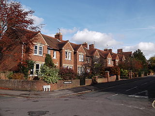
Woodstock Road is a major road in Oxford, England, running from St Giles' in the south, north towards Woodstock through the leafy suburb of North Oxford. To the east is Banbury Road, which it meets at the junction with St Giles'.
St Aldate's is a street in central Oxford, England, named after Saint Aldate, but formerly known as Fish Street.

Walton Street is on the eastern edge of the Jericho district of central Oxford, England.

Bevington Road is a residential road in central North Oxford, England.

Hythe Bridge Street is in the west of central Oxford, England, forming part of the A4144 road.

Worcester Street is a street in west central Oxford, England.

Lathbury Road is a short residential road in north Oxford, England.

Moreton Road is a residential road in the Oxford suburb of North Oxford, Oxfordshire, United Kingdom.

Rawlinson Road is a residential road in North Oxford, England.

Staverton Road is a residential road in North Oxford, England.

Bainton Road is a residential road in north Oxford, England.

Farndon Road is a residential road in North Oxford, England.
Frenchay Road is a residential road in Walton Manor, North Oxford, England.

Observatory Street links at the eastern end Woodstock Road in central North Oxford and at the western end Walton Street and the Jericho area of Oxford, England.

The Waterways is housing estate in North Oxford, England. The Oxford Canal runs through the centre of the estate and it is bounded on the east by the Cherwell Valley railway line. To the west beyond the railway line are Port Meadow and the River Thames. The estate begins in the south as a continuation of Frenchay Road, part of Victorian North Oxford, and as Elizabeth Jennings Way connects with the Woodstock Road (A4144) at the northern end of the estate.

Frideswide Square is a square to the west of central Oxford, England. The square is named after the patron saint of Oxford, St Frideswide.