Bradford (CDP), Vermont

Last updated

Bradford, Vermont
Woods Library and Hotel Low, Bradford, VT.jpg
Woods Library and Hotel Low, c. 1915 postcard view
USA Vermont relief location map.svg
Red pog.svg
Bradford
Location within the state of Vermont
Usa edcp relief location map.png
Red pog.svg
Bradford
Bradford (the United States)
Coordinates: 43°59′34″N72°7′43″W / 43.99278°N 72.12861°W / 43.99278; -72.12861
Country United States
State Vermont
County Orange
Area
  Total
0.5 sq mi (1.3 km2)
  Land0.5 sq mi (1.3 km2)
  Water0.0 sq mi (0.0 km2)
Population
 (2020)
  Total
907
  Density1,800/sq mi (700/km2)
Time zone UTC-5 (Eastern (EST))
  Summer (DST) UTC-4 (EDT)
ZIP code
05033
Area code 802
FIPS code 50-07225 [1]

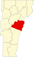
Bradford is a census-designated place in the town of Bradford, Orange County, Vermont, United States. The population was 907 at the 2020 census. [2] The village disincorporated on December 1, 2004. [3] The village became a census-designated place in 2008. [4] The central commercial and residential portion of the village is listed on the National Register of Historic Places as the Bradford Village Historic District.

Contents

History

Bradford was established in the early 19th century, the steep drop of the Waits River recognized as a source of water power for industrial use. Asa Low spearheaded development of that industry, building a brick grist mill in 1847. The village saw continued prosperity through the 19th century. The historic district designated in 1975 comprises 81 commercial, public, and religious buildings showcasing architectural styles from Federal and Greek Revival to Italianate and Romanesque. It includes the commercial business district of the village, the former industrial area near the Waits River, and adjacent residential areas. [5]

Historic buildings

Some of Bradford's more significant historic buildings include: [5]

Geography

According to the United States Census Bureau, the village had a total area of 0.5 square mile (1.3 km2), all land. The Waits River flows through the village. [6]

Demographics

As of the census [1] of 2000, there were 815 people, 322 households, and 191 families residing in the village. The population density was 1,633.1 people per square mile (629.3/km2). There were 372 housing units at an average density of 745.4/sq mi (287.3/km2). The racial makeup of the village was 97.42% White, 0.86% Black or African American, 0.37% Native American, 0.49% Asian, and 0.86% from two or more races. Hispanic or Latino of any race were 0.74% of the population.

There were 322 households, out of which 30.4% had children under the age of 18 living with them, 42.2% were married couples living together, 16.1% had a female householder with no husband present, and 40.4% were non-families. 31.1% of all households were made up of individuals, and 14.6% had someone living alone who was 65 years of age or older. The average household size was 2.32 and the average family size was 2.95.

In the village the population was spread out, with 24.2% under the age of 18, 9.4% from 18 to 24, 23.3% from 25 to 44, 21.2% from 45 to 64, and 21.8% who were 65 years of age or older. The median age was 41 years. For every 100 females, there were 79.1 males. For every 100 females age 18 and over, there were 73.1 males.

The median income for a household in the village was $28,472, and the median income for a family was $32,031. Males had a median income of $30,673 versus $28,375 for females. The per capita income for the village was $14,456. About 10.1% of families and 16.6% of the population were below the poverty line, including 25.2% of those under age 18 and 7.7% of those age 65 or over.

See also

Related Research Articles

<span class="mw-page-title-main">Rohrersville, Maryland</span> CDP in Maryland, United States

Rohrersville is a census-designated place (CDP) in Washington County, Maryland, United States. The population was 175 at the 2010 census.

<span class="mw-page-title-main">Millers Falls, Massachusetts</span> Census-designated place in Massachusetts, United States

Millers Falls is a census-designated place (CDP) in the towns of Montague and Erving in Franklin County, Massachusetts, United States. The population was 1,139 at the 2010 census. It is part of the Springfield, Massachusetts metropolitan statistical area.

<span class="mw-page-title-main">Burlington, Ohio</span> Census-designated place in Ohio, United States

Burlington is an unincorporated community and census-designated place in Lawrence County, Ohio, United States, along the Ohio River. The population was 2,416 at the 2020 census. Connected to neighboring Huntington, West Virginia and connected via the West Huntington Bridge over the Ohio River, it is part of the Huntington–Ashland metropolitan area. Burlington was once the leading community of Lawrence County, being the first county seat and the location of the county's first post office. “The Memory Man” by David Baldacci takes place in Burlington. The main character is Amos Decker. There are 7 books in this series.

<span class="mw-page-title-main">Topsham, Vermont</span> Town in Vermont, United States

Topsham is a town in Orange County, Vermont, United States. The population was 1,199 at the 2020 census. It contains four villages: East Topsham, Topsham Four Corners, Waits River, and West Topsham.

<span class="mw-page-title-main">Chester (CDP), Vermont</span> Census-designated place in Vermont, United States

Chester is a census-designated place (CDP) in Windsor County, Vermont, United States. The population was 1,005 at the 2010 census. The CDP is a statistical area encompassing three distinct places: the urbanized center of the town of Chester; a locale known as Chester Depot, which is separated from the town center by the tracks of the former Rutland Railroad; and the village of North Chester.

<span class="mw-page-title-main">White River Junction, Vermont</span> Census-designated place in Vermont, United States

White River Junction is an unincorporated village and census-designated place (CDP) in the town of Hartford in Windsor County, Vermont, United States. The population was 2,528 at the 2020 census, up from 2,286 in 2010, making it the largest community within the town of Hartford.

<span class="mw-page-title-main">Wilder, Vermont</span> Census-designated place in Vermont, United States

Wilder is an unincorporated village and census-designated place (CDP) within the town of Hartford in Windsor County, Vermont, United States. It is the location of the Wilder Dam on the Connecticut River. The population of the CDP was 1,690 at the 2010 census. The village center is an early example of a planned mill community, and was listed on the National Register of Historic Places as the Wilder Village Historic District in 1999.

Lancaster is a census-designated place (CDP) and the main village in the town of Lancaster in Coos County, New Hampshire, United States. The population of the CDP was 1,941 at the 2020 census, out of 3,218 in the entire town of Lancaster.

<span class="mw-page-title-main">Littleton, New Hampshire</span> Town in New Hampshire, United States

Littleton is a town in Grafton County, New Hampshire, United States. The population was 6,005 at the 2020 census. Situated at the northern edge of the White Mountains, Littleton is bounded on the northwest by the Connecticut River.

<span class="mw-page-title-main">Charlestown (CDP), New Hampshire</span> Census-designated place in New Hampshire, United States

Charlestown is a census-designated place (CDP) and the main village in the town of Charlestown, Sullivan County, New Hampshire, United States. The population of the CDP was 1,078 at the 2020 census, out of 4,806 in the entire town.

<span class="mw-page-title-main">Smithtown (CDP), New York</span> Hamlet and census-designated place in New York, United States

Smithtown is a hamlet and census-designated place (CDP) within the Town of Smithtown in Suffolk County, New York. The population was 25,629 at the 2020 census.

<span class="mw-page-title-main">Middlebury (CDP), Vermont</span> Census-designated place in Vermont, United States

Middlebury is the main settlement in the town of Middlebury in Addison County, Vermont, United States, and a census-designated place (CDP). The population was 7,304 at the 2020 census, out of a total population of 9,152 in the town of Middlebury. Most of the village is listed on the National Register of Historic Places as the Middlebury Village Historic District.

Bennington is a census-designated place (CDP) in Bennington County, Vermont, United States. It is located entirely within the town of Bennington. The population of the CDP was 9,074 at the 2010 census, or 57.6% of the population of the entire town.

<span class="mw-page-title-main">Brandon (CDP), Vermont</span> CDP in Vermont, United States

Brandon is an unincorporated village and census-designated place (CDP) in the town of Brandon, Rutland County, Vermont, United States. As of the 2020 census, the population was 1,727.

<span class="mw-page-title-main">Woodstock (village), Vermont</span> Village in Vermont, United States

Woodstock is an incorporated village located within the town of Woodstock in Windsor County, Vermont, United States. As of the 2020 census, the village population was 900.

<span class="mw-page-title-main">St. Johnsbury, Vermont</span> Town in Vermont, United States

St. Johnsbury is the shire town of Caledonia County, Vermont, United States. As of the 2020 census, the population was 7,364. St. Johnsbury is situated on the Passumpsic River and is located approximately six miles northwest of the Connecticut River and 48 miles (77 km) south of the Canada–U.S. border.

<span class="mw-page-title-main">West Rutland, Vermont</span> Town in Vermont, United States

West Rutland is a town in Rutland County, Vermont, United States. The population was 2,214 at the 2020 census. The town center, located in the south-central portion of the town and where about 87% of the population resides, is defined by the U.S. Census Bureau as a census-designated place (CDP). The town is part of the Rutland micropolitan NECTA.

<span class="mw-page-title-main">Bradford, Vermont</span> Town in Vermont, United States

Bradford is a town in Orange County, Vermont, United States. The population was 2,790 at the 2020 census. Bradford is located on the county's eastern border, bordering both the Connecticut River and New Hampshire, and is a commercial center for some of its surrounding towns.

<span class="mw-page-title-main">Arlington (CDP), Vermont</span> Census-designated place in Vermont, United States

Arlington is a census-designated place (CDP) in the towns of Arlington and Sunderland, Bennington County, Vermont, United States. The population was 1,213 at the 2010 census.

<span class="mw-page-title-main">Colebrook (CDP), New Hampshire</span> Census-designated place in New Hampshire, United States

Colebrook is a census-designated place (CDP) and the main village in the town of Colebrook, Coös County, New Hampshire, United States. The population of the CDP was 1,201 at the 2020 census, out of 2,084 in the entire town. The CDP population had dropped from 1,394 at the 2010 census.

References

  1. 1 2 "U.S. Census website". United States Census Bureau . Retrieved January 31, 2008.
  2. "Census - Geography Profile: Bradford CDP, Vermont" . Retrieved December 26, 2021.
  3. Boundary Changes Archived 2011-12-01 at the Wayback Machine , United States Census Bureau, 2009-03-18. Accessed 2009-07-15.
  4. U.S. Geological Survey Geographic Names Information System: Bradford (CDP), Vermont
  5. 1 2 Hugh Henry (1975). "NRHP nomination for Bradford Village Historic District". National Park Service . Retrieved July 30, 2016. with photos from 1975
  6. DeLorme (1996). Vermont Atlas & Gazetteer. Yarmouth, Maine: DeLorme. ISBN   0-89933-016-9