Related Research Articles

Folcroft is a borough in Delaware County, Pennsylvania, United States. The population was 6,606 at the 2010 census, down from 6,978 at the 2000 census.

Egmont Key National Wildlife Refuge and State Park is a National Wildlife Refuge and State Park located on the island of Egmont Key, at the mouth of Tampa Bay. Egmont Key lies southwest of Fort De Soto Park and can only be reached by boat or ferry. Located within Egmont Key National Wildlife Refuge and State Park are the 1858 Egmont Key Lighthouse, maintained by the U.S. Coast Guard, and the ruins of Fort Dade, a Spanish–American War era fort that housed 300 residents. Egmont Key is located in Hillsborough County Florida on a narrow strip of the county that extends along the Tampa Port Shipping Channel.

The Chautauqua National Wildlife Refuge is located on the Illinois River in Mason County northeast of Havana, Illinois. It is managed by the U.S. Fish and Wildlife Service as one of the four Illinois River National Wildlife and Fish Refuges.
The Mark Twain National Wildlife Refuge Complex was established for the protection of migratory birds including waterfowl, shorebirds, and songbirds. It is located along the Mississippi Flyway, one of the major routes for migrating waterfowl. Refuge units also provide important habitat for big-river fish and a variety of other native wildlife such as deer, fox, beaver, frogs, turtles, and snakes. Key goals are to conserve and enhance the quality and diversity of fish and wildlife and their habitats, to restore floodplain functions in the river corridor, and to provide wildlife-related recreational experiences for the public.
The Stewart B. McKinney National Wildlife Refuge is a 950-acre (384.5 ha) National Wildlife Refuge in ten units across the U.S. state of Connecticut. Located in the Atlantic Flyway, the refuge spans 70 miles (110 km) of Connecticut coastline and provides important resting, feeding, and nesting habitat for many species of wading birds, shorebirds, songbirds and terns, including the endangered roseate tern. Adjacent waters serve as wintering habitat for brant, scoters, American black duck, and other waterfowl. Overall, the refuge encompasses over 900 acres (364.2 ha) of barrier beach, intertidal wetland and fragile island habitats.

The 30,843 acres (124.82 km2) Chassahowitzka National Wildlife Refuge is part of the United States National Wildlife Refuge System, located on the west coast of Florida, about 70 miles (110 km) north of St. Petersburg. It is famous as the southern wintering site for the re-introduced eastern population of whooping cranes.

The J. N. "Ding" Darling National Wildlife Refuge is part of the United States National Wildlife Refuge System, located in southwestern Florida on Sanibel Island in the Gulf of Mexico. "Ding" Darling Wildlife Society (DDWS), a non-profit Friends of the Refuge organization, supports environmental education and services at the J.N. "Ding" Darling National Wildlife Refuge. It is named after the cartoonist Jay Norwood "Ding" Darling.
Barren Island is small, uninhabited landmass in the Chesapeake Bay, just off the coast of Dorchester County, Maryland. It is located at 38°20′4.13″N76°15′11.44″W. It is known to be a mute swan nesting ground.

Coltons Point is an unincorporated community in what is popularly called the "Seventh District" of St. Mary's County, Maryland, United States. A small historical museum and a lighthouse are located there. Seasonal boat service carry visitors the short distance to the shrinking, uninhabited St. Clement's Island, where in 1634 the first European settlers arriving in Maryland landed and celebrated the first Catholic Mass in English-speaking North America. It was listed on the National Register of Historic Places in 1972. The ZIP Code for Coltons Point is 20626. The miraculous medal monument shown below has been moved to the property of a church in Mechanicsville.

James Campbell National Wildlife Refuge is a National Wildlife Refuge on the island of Oʻahu, Hawaii. It was established in 1976 to permanently protect an ecologically-intact unit and to provide habitat for native and migratory fauna and native flora. It established critical habitat for Hawaii's four endangered waterbirds, the ʻalae kea, koloa maoli, ʻalae ʻula, and āeʻo and many migratory seabirds, endangered and native plant species, and the endangered Hawaiian monk seal and green sea turtle. It also provides increased wildlife-dependent public uses and flood control within the refuge and the local community.
Established in 2004, the Theodore Roosevelt National Wildlife Refuge is part of the Theodore Roosevelt National Wildlife Refuge Complex in Mississippi. Although the acquisition boundary for Theodore Roosevelt National Wildlife Refuge has been proposed near Onward, Mississippi, the land exchanges that are prerequisite have not yet been completed. Consequently, the refuge has not been opened for public use.

The Elizabeth A. Morton National Wildlife Refuge is a 187-acre (76 ha) National Wildlife Refuge in Noyack, New York. Much of the refuge is situated on a peninsula surrounded by Noyack and Little Peconic bays. The refuge is managed by the United States Fish and Wildlife Service as part of the Long Island National Wildlife Refuge Complex.

San Diego Bay National Wildlife Refuge is an urban refuge located on San Diego Bay in San Diego County, California. It is part of the San Diego National Wildlife Refuge Complex. It was dedicated in June 1999.
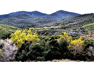
San Diego National Wildlife Refuge is a National Wildlife Refuge in California. It is part of the San Diego National Wildlife Refuge Complex. A variety of habitats from coastal sage scrub and chaparral to oak woodland and freshwater marsh describe this inland refuge in San Diego's backcountry.
Maui National Wildlife Refuge Complex is a National Wildlife Refuge complex in the state of Hawaii.
Southeast Louisiana National Wildlife Refuge Complex is a National Wildlife Refuge complex in the state of Louisiana.
Long Island National Wildlife Refuge Complex is a National Wildlife Refuge complex in the state of New York. All of the component refuges are located on Long Island.
Willamette Valley National Wildlife Refuge Complex is a National Wildlife Refuge complex in the state of Oregon.
The Mattamuskeet, Swanquarter and Cedar Island National Wildlife Refuge Complex is an administrative organization that manages U.S. Fish and Wildlife Service wildlife refuges in eastern North Carolina. The complex includes
Washington Maritime National Wildlife Refuge Complex is an administrative grouping of six National Wildlife Refuges in Washington, managed by the United States Fish and Wildlife Service. It includes:
References
39°1′51″N76°13′28″W / 39.03083°N 76.22444°W
| International | |
|---|---|
| National | |