Domeyko Glacier

Last updated
Domeyko Glacier
King George Island map-en.svg
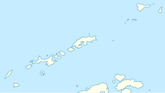
Map of King George Island
South Shetland Islands location map.svg
Blue pog.svg
Location of Domeyko Glacier in Antarctica
Antarctica relief location map.jpg
Blue pog.svg
Domeyko Glacier (Antarctica)
Location King George Island
South Shetland Islands
Coordinates 62°04′00″S58°27′0″W / 62.06667°S 58.45000°W / -62.06667; -58.45000
Thicknessunknown
Terminus Mackellar Inlet
Statusunknown

Domeyko Glacier is a glacier flowing southeast into Mackellar Inlet, Admiralty Bay, King George Island, in the South Shetland Islands. It was named by the Polish Antarctic Expedition, 1980, after Ignacy Domeyko, a Polish-born explorer of the Andes and sometime Professor of Chemistry and Mineralogy, and Rector, of the University of Chile, Santiago. [1]

See also

Related Research Articles

<span class="mw-page-title-main">Leppard Glacier</span> Glacier in Antarctica

Leppard Glacier is a large valley glacier draining east between the Aristotle Mountains and Voden Heights, and flowing into Scar Inlet north of Ishmael Peak, on the east coast of Graham Land, Antarctica. The glacier was first seen from the air and photographed in part by Hubert Wilkins on December 20, 1928, and was surveyed by the Falkland Islands Dependencies Survey (FIDS) in 1955. It is now clear that, on the photographic evidence of his outward flight, Wilkins gave the name "Crane Channel" to this glacier, and that on his return flight he photographed what is now accepted as Crane Glacier, perhaps thinking that it was the same feature. Since Crane Glacier has been retained for the northern of these glaciers photographed by Wilkins, the UK Antarctic Place-Names Committee has named this feature for Norman A.G. Leppard, assistant surveyor with the FIDS, who surveyed this area in 1955.

<span class="mw-page-title-main">Quito Glacier</span> Glacier in Antarctica

Quito Glacier is a glacier draining the northeast slopes of Mount Plymouth and flowing northeastwards into the sea west of Canto Point in north Greenwich Island, South Shetland Islands. It was named after the capital of Ecuador, c. 1990, by the Ecuadorian Antarctic Expedition.

<span class="mw-page-title-main">Ineson Glacier</span> Glacier in Antarctica

Ineson Glacier is a glacier flowing northwest into Gin Cove, James Ross Island, Antarctica. Following geological work by the British Antarctic Survey (BAS), 1981–83, it was named by the UK Antarctic Place-Names Committee after Jonathan R. Ineson, a BAS geologist in the area.

<span class="mw-page-title-main">Anna Glacier</span> Glacier in Antarctica

Anna Glacier is a glacier flowing southeast between Rose Peak and Rea Peak, tributary to Polonia Glacier/Polonia Ice Piedmont at the head of King George Bay, King George Island. It was named by the Polish Antarctic Expedition (PAE), 1981, after Anna Tokarska, field assistant of PAE geological party to King George Island, 1979–80, and wife of Antoni K. Tokarski.

<span class="mw-page-title-main">Baranowski Glacier</span> Glacier in Antarctica

Baranowski Glacier is a glacier flowing east into Admiralty Bay, King George Island, northwest of Demay Point. It was named by the Polish Antarctic Expedition after Stanisław Baranowski (1935–78), Polish glaciologist who died on King George Island as a result of an accident at the Henryk Arctowski Polish Antarctic Station while a member of the 1977–78 expedition.

<span class="mw-page-title-main">Noble Glacier</span>

Noble Glacier is a small glacier lying just north of Flagstaff Glacier on the east side of Keller Peninsula, King George Island, in the South Shetland Islands. Named by the United Kingdom Antarctic Place-Names Committee (UK-APC) in 1960 for Hugh M. Noble of Falkland Islands Dependencies Survey (FIDS), glaciologist at Admiralty Bay in 1957, who made detailed studies of the regime of Flagstaff and Stenhouse Glacier.

Cronus Glacier is a glacier 6 nautical miles (11 km) long and 3 nautical miles (6 km) wide flowing northwest into Bowman Inlet between the Calypso Cliffs and Crabeater Point on the east coast of the Antarctic Peninsula. It was photographed by the Ronne Antarctic Research Expedition on December 22, 1947, and roughly surveyed by the Falkland Islands Dependencies Survey in December 1958. It was named by the UK Antarctic Place-Names Committee after Cronus, the god of agriculture in Greek mythology.

<span class="mw-page-title-main">Jenner Glacier</span> Glacier in Palmer Archipelago, Antarctica

Jenner Glacier is a glacier 3 nautical miles (6 km) long flowing southwest from the Solvay Mountains between Paprat Peak and Kondolov Peak into the eastern arm of Duperré Bay, in the southern part of Brabant Island in the Palmer Archipelago, Antarctica.

<span class="mw-page-title-main">Krak Glacier</span> Glacier in Antarctica

Krak Glacier is an outlet glacier of Kraków Dome at the head of Lussich Cove, Martel Inlet, Admiralty Bay, King George Island, in the South Shetland Islands.It was named by the Polish Antarctic Expedition, 1980, after the legendary prince Krak, founder of Kraków and killer of the Wawel Dragon.

<span class="mw-page-title-main">Koch Glacier</span> Glacier in Antarctica

Koch Glacier is a glacier 3 nautical miles (6 km) long immediately east of Jenner Glacier on the south side of Brabant Island, in the Palmer Archipelago, Antarctica. It drains the south slopes of Solvay Mountains and flows south-southwestwards into Chiriguano Bay southeast of Paprat Peak.

<span class="mw-page-title-main">Polar Club Glacier</span>

Polar Club Glacier is a broad glacier east-northeast of Stranger Point, King George Island, in Antaratica. South of it is Bransfield Strait. Named by the Polish Antarctic Expedition, 1980, after the Polish Polar Club.

<span class="mw-page-title-main">Ecology Glacier</span>

Ecology Glacier is a glacier flowing northeast into Admiralty Bay, King George Island, north of Llano Point. It was named by the Polish Antarctic Expedition, 1980, after the Institute of Ecology of the Polish Academy of Sciences, the sponsor of nearby Arctowski Station.

<span class="mw-page-title-main">Fourcade Glacier</span> Glacier in Antarctica

Fourcade Glacier is a glacier at the head of Potter Cove, Maxwell Bay, on King George Island in the South Shetland Islands. It was named by the Polish Antarctic Expedition, 1980, after Nestor H. Fourcade of the Instituto Antartico Argentino, who made detailed geological investigations of Potter Cove and Fildes Peninsula in several seasons, 1957–58 to 1960–61.

<span class="mw-page-title-main">Goetel Glacier</span>

Goetel Glacier is a glacier flowing south between Ullmann Spur and the Precious Peaks into Martel Inlet, Admiralty Bay, on King George Island in the South Shetland Islands. It was named by the Polish Antarctic Expedition, 1980, after Professor Walery Goetel (1889–1972), a Polish geologist and conservationist.

<span class="mw-page-title-main">Litz Glacier</span> Glacier in Antarctica

Litz Glacier is a glacier flowing northeast from the vicinity of Smith Peak and Litz Bluff in north-central Thurston Island, Antarctica. The glacier enters the west part of Peale Inlet north of the Guy Peaks. It was named by the Advisory Committee on Antarctic Names after A.K. Litz, Chief Photographer's Mate in the Eastern Group of Operation Highjump, which obtained aerial photographs of this glacier and adjacent coastal areas, 1946–47.

<span class="mw-page-title-main">Hoek Glacier</span> Glacier in Antarctica

Hoek Glacier is a glacier flowing into Dimitrov Cove northeast of Veshka Point on the northwest coast of Velingrad Peninsula on Graham Coast in Graham Land, Antarctica, southward of the Llanquihue Islands. It was charted by the British Graham Land Expedition under John Rymill, 1934–37, and was named by the UK Antarctic Place-Names Committee in 1959 for Henry W. Hoek (1878–1951), a pioneer Swiss ski-mountaineer and author of one of the earliest skiing manuals.

McClary Glacier is a glacier 10 nautical miles (19 km) long and 2 nautical miles (4 km) wide on the west coast of Graham Land, Antarctica. It flows southwest along the north side of Butson Ridge into Marguerite Bay between Cape Calmette and the Debenham Islands. The glacier was first roughly surveyed by the British Graham Land Expedition, 1936–37, and resurveyed by the Falkland Islands Dependencies Survey, 1946–50. It was named by the UK Antarctic Place-Names Committee for George B. McClary, father of Nelson McClary, mate on the Port of Beaumont during the Ronne Antarctic Research Expedition, 1947–48.

<span class="mw-page-title-main">Stenhouse Glacier</span>

Stenhouse Glacier is a small glacier flowing into the head of Visca Anchorage immediately west of Stenhouse Bluff, on King George Island in the South Shetland Islands. Charted but not named by the French Antarctic Expedition, 1908–10, under Charcot. The name West Stenhouse Glacier arose locally for this feature in 1958 from association with Stenhouse Bluff, but the shortened form recommended by United Kingdom Antarctic Place-Names Committee (UK-APC) in 1960 has been adopted.

<span class="mw-page-title-main">Rexford Glacier</span> Glacier in Antarctica

Rexford Glacier is a glacier flowing northeast into the head of Wagoner Inlet on the north side of Thurston Island. Named by Advisory Committee on Antarctic Names (US-ACAN) after Aviation Radioman Phillip W. Rexford, PBM Mariner aircrewman in the Eastern Group of U.S. Navy Operation Highjump, which obtained aerial photographs of this glacier and adjoining coastal areas, 1946–47.

<span class="mw-page-title-main">Lange Glacier</span>

Lange Glacier is a glacier flowing into the west side of Admiralty Bay close south of Admiralen Peak, King George Island, in the South Shetland Islands, Antarctica. It was charted by the French Antarctic Expedition, 1908–10, under Jean-Baptiste Charcot, and was named by the UK Antarctic Place-Names Committee in 1960 for Alexander Lange (1860–1922), a Norwegian pioneer of modern steam whaling in the South Shetland Islands in 1905–6, and commander of the Admiralen.

References

  1. "Domeyko Glacier". Geographic Names Information System . United States Geological Survey, United States Department of the Interior . Retrieved 2012-01-24.

62°4′S58°27′W / 62.067°S 58.450°W / -62.067; -58.450