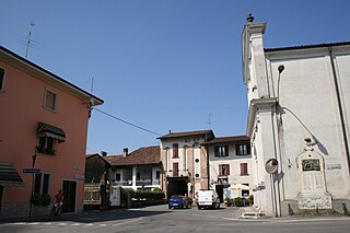
Bagnatica is a comune (municipality) in the Province of Bergamo in the Italian region of Lombardy, located about 50 kilometres (31 mi) northeast of Milan and about 10 kilometres (6 mi) southeast of Bergamo.

Barzana is a comune (municipality) in the Province of Bergamo in the Italian region of Lombardy, located about 45 kilometres (28 mi) northeast of Milan and about 9 kilometres (6 mi) northwest of Bergamo. As of 31 December 2004, it had a population of 1,645 and an area of 2.1 square kilometres (0.81 sq mi).
Bracca is a comune (municipality) in the Province of Bergamo in the Italian region of Lombardy, located about 60 kilometres (37 mi) northeast of Milan and about 14 kilometres (9 mi) northeast of Bergamo. As of 31 December 2004, it had a population of 827 and an area of 5.5 square kilometres (2.1 sq mi).

Colzate is a comune (municipality) in the Province of Bergamo in the Italian region of Lombardy, located about 70 kilometres (43 mi) northeast of Milan and about 20 kilometres (12 mi) northeast of Bergamo. As of 31 December 2004, it had a population of 1,638 and an area of 6.7 square kilometres (2.6 sq mi).

Credaro is a comune (municipality) in the Province of Bergamo in the Italian region of Lombardy, located about 60 kilometres (37 mi) northeast of Milan and about 20 kilometres (12 mi) east of Bergamo. As of 31 December 2004, it had a population of 2,608 and an area of 3.4 square kilometres (1.3 sq mi).

Martinengo is a comune (municipality) in the Province of Bergamo in the Italian region of Lombardy, located about 50 kilometres (31 mi) east of Milan and about 15 kilometres (9 mi) southeast of Bergamo. As of 31 December 2004, it had a population of 9,138 and an area of 21.7 square kilometres (8.4 sq mi).

Misano di Gera d'Adda is a comune (municipality) in the Province of Bergamo in the Italian region of Lombardy, located about 35 kilometres (22 mi) east of Milan and about 25 kilometres (16 mi) south of Bergamo. As of 31 December 2004, it had a population of 2,877 and an area of 6.1 square kilometres (2.4 sq mi).

Mozzo is a comune (municipality) in the Province of Bergamo in the Italian region of Lombardy, located about 45 kilometres (28 mi) northeast of Milan and about 5 kilometres (3 mi) west of Bergamo. As of 31 December 2004, it had a population of 7,202 and an area of 3.6 square kilometres (1.4 sq mi).

Onore is a comune (municipality) in the Province of Bergamo in the Italian region of Lombardy, located about 80 kilometres (50 mi) northeast of Milan and about 35 kilometres (22 mi) northeast of Bergamo. As of 31 December 2004, it had a population of 799 and an area of 11.6 square kilometres (4.5 sq mi).

Predore is a comune (municipality) in the Province of Bergamo in the Italian region of Lombardy, located about 70 kilometres (43 mi) northeast of Milan and about 25 kilometres (16 mi) east of Bergamo. As of 31 December 2004, it had a population of 1,837 and an area of 11.6 square kilometres (4.5 sq mi).

Pumenengo is a comune (municipality) in the Province of Bergamo in the Italian region of Lombardy, located about 50 kilometres (31 mi) east of Milan and about 30 kilometres (19 mi) southeast of Bergamo. As of 31 December 2004, it had a population of 1,512 and an area of 10.1 square kilometres (3.9 sq mi).

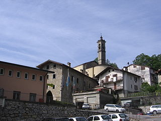
Sedrina is a comune (municipality) in the Province of Bergamo in the Italian region of Lombardy, located about 50 kilometres (31 mi) northeast of Milan and about 10 kilometres (6 mi) northwest of Bergamo. As of 31 December 2010, it had a population of 2,559 and an area of 6.0 square kilometres (2.3 sq mi).

Tavernola Bergamasca is a comune (municipality) in the Province of Bergamo in the Italian region of Lombardy, located about 70 kilometres (43 mi) northeast of Milan and about 30 kilometres (19 mi) east of Bergamo. As of 31 December 2004, it had a population of 2,242 and an area of 12.4 square kilometres (4.8 sq mi).

Torre Boldone is a comune (municipality) in the Province of Bergamo in the Italian region of Lombardy, located about 50 kilometres (31 mi) northeast of Milan and about 3 kilometres (2 mi) northeast of Bergamo, at the entrance of the Valle Seriana. Part of Torre Boldone's territory is part of Parco dei Colli di Bergamo

Torre Pallavicina is a comune (municipality) in the Province of Bergamo in the Italian region of Lombardy, located about 50 kilometres (31 mi) east of Milan and about 30 kilometres (19 mi) southeast of Bergamo. As of 31 December 2004, it had a population of 1,093 and an area of 10.3 square kilometres (4.0 sq mi).

Vigolo is a comune (municipality) in the Province of Bergamo in the Italian region of Lombardy, located about 70 kilometres (43 mi) northeast of Milan and about 25 kilometres (16 mi) east of Bergamo. As of 31 December 2004, it had a population of 641 and an area of 12.2 square kilometres (4.7 sq mi).

Villa di Serio is a comune (municipality) in the Province of Bergamo in the Italian region of Lombardy, located about 50 kilometres (31 mi) northeast of Milan and about 6 kilometres (4 mi) northeast of Bergamo. As of 31 December 2004, it had a population of 6,118 and an area of 4.6 square kilometres (1.8 sq mi).
Casaletto di Sopra is a comune (municipality) in the Province of Cremona in the Italian region Lombardy, located about 50 kilometres (31 mi) east of Milan and about 35 kilometres (22 mi) northwest of Cremona.