Fredericktown-Millsboro, Pennsylvania

Last updated
Fredericktown-Millsboro
Former CDP
FredericktownPA.jpg
Fredericktown from Route 88
Map of Fredericktown-Millsboro, Washington County, Pennsylvania Highlighted.png
Location of Fredericktown-Millsboro in Washington County
Coordinates: 39°59′42″N79°59′58″W / 39.99500°N 79.99944°W / 39.99500; -79.99944 Coordinates: 39°59′42″N79°59′58″W / 39.99500°N 79.99944°W / 39.99500; -79.99944
CountryUnited States
StatePennsylvania
County Washington
Area
  Total1.8 sq mi (5 km2)
Population
 (2000)
  Total1,094
  Density610/sq mi (230/km2)
Time zone UTC-4 (EST)
  Summer (DST) UTC-5 (EDT)
Area code(s) 724

Fredericktown-Millsboro was a census-designated place (CDP) in East Bethlehem Township, Washington County, Pennsylvania, United States. The population was 1,094 at the 2000 census. For the 2010 census the area was split into two CDPs, Fredericktown and Millsboro.

Contents

Geography

The Fredericktown-Millsboro CDP was located at 39°59′42″N79°59′58″W / 39.99500°N 79.99944°W / 39.99500; -79.99944 (39.995095, -79.999370). [1]

According to the United States Census Bureau, the CDP had a total area of 1.8 square miles (4.7 km2), all of it land.

Both Fredericktown and Millsboro are located along the Monongahela River in the river valley. The communities and the surrounding areas are the former homes of bituminous coal mines. The topography has been somewhat altered by the addition of slate dumps: large mounds of coal byproducts have been created on the riverbanks.

Demographics

As of the census [2] of 2000, there were 1,094 people, 446 households, and 290 families residing in the CDP. The population density was 624.3 people per square mile (241.4/km2). There were 510 housing units at an average density of 291.0/sq mi (112.5/km2). The racial makeup of the CDP was 97.90% White, 1.01% African American, 0.27% Native American, and 0.82% from two or more races. Hispanic or Latino of any race were 0.37% of the population.

There were 446 households, out of which 29.4% had children under the age of 18 living with them, 52.2% were married couples living together, 9.6% had a female householder with no husband present, and 34.8% were non-families. 30.7% of all households were made up of individuals, and 18.4% had someone living alone who was 65 years of age or older. The average household size was 2.45 and the average family size was 3.07.

In the CDP, the population was spread out, with 22.1% under the age of 18, 8.4% from 18 to 24, 27.1% from 25 to 44, 23.5% from 45 to 64, and 18.8% who were 65 years of age or older. The median age was 40 years. For every 100 females, there were 90.6 males. For every 100 females age 18 and over, there were 85.6 males.

The median income for a household in the CDP was $25,086, and the median income for a family was $32,292. Males had a median income of $27,188 versus $17,120 for females. The per capita income for the CDP was $13,425. About 10.0% of families and 13.5% of the population were below the poverty line, including 21.9% of those under age 18 and 8.2% of those age 65 or over.

Related Research Articles

Parks, Arizona CDP in Arizona, United States

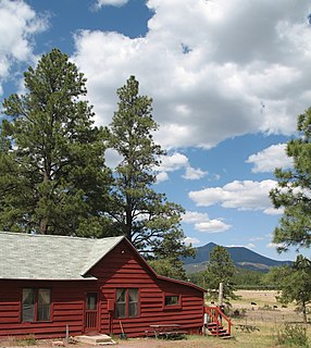
Parks is a census-designated place (CDP) in Coconino County, Arizona, United States. The population was 1,188 at the 2010 census.

Mountain View, Contra Costa County, California Census designated place in California, United States

Mountain View is a census designated place (CDP) in Contra Costa County, California, United States. The population was 2,372 at the 2010 census.

Farmington, California census-designated place in San Joaquin, California

Farmington is a census-designated place (CDP) in San Joaquin County, California. The population was 207 at the 2010 census, down from 262 at the 2000 census.

Edgemoor, Delaware CDP in Delaware, United States

Edgemoor is a census-designated place in New Castle County, Delaware, United States. The population was 5,677 at the 2010 census.

Homestead Base, Florida CDP in Florida, United States

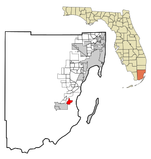
Homestead Base is a census-designated place (CDP) in Miami-Dade County, Florida, United States. The population was 446 at the 2000 census.

Oakbrook, Kentucky Census-designated place in Kentucky, United States

Oakbrook is a census-designated place (CDP) in Boone County, Kentucky, United States. The population was 9,036 at the 2010 census.

Killona, Louisiana Census-designated place in Louisiana, United States

Killona is a census-designated place (CDP) in St. Charles Parish, Louisiana, United States. The population was 797 at the 2000 census.

West Chatham, Massachusetts Census-designated place in Massachusetts, United States

West Chatham is a census-designated place (CDP) in the town of Chatham in Barnstable County, Massachusetts, United States. The population was 1,410 at the 2010 census.

Sun Valley, Nevada Census-designated place in Nevada, United States

Sun Valley is a census-designated place (CDP) in Washoe County, Nevada, United States. The population was 19,299 at the 2010 census. It is north of Reno and is part of the Reno–Sparks Metropolitan Statistical Area.

Turpin Hills, Ohio Census-designated place in Ohio, United States

Turpin Hills is a census-designated place (CDP) outside of Anderson Township, Hamilton County, Ohio, United States. The population was 5,099 at the 2010 census.

Russellton, Pennsylvania Census-designated place in Pennsylvania, United States

Russellton is a census-designated place (CDP) in Allegheny County, Pennsylvania, United States. The population was 1,440 at the 2010 census.

Fairdale, Pennsylvania Census-designated place in Pennsylvania, United States

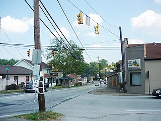
Fairdale is a community and census-designated place (CDP) in Greene County, Pennsylvania, United States. The population was 2,059 at the 2010 census.

Morrisville, Greene County, Pennsylvania Census-designated place in Pennsylvania, United States

Morrisville is a census-designated place (CDP) in Franklin Township, Greene County, Pennsylvania, United States. The population was 1,265 at the 2010 census.

Harrison City, Pennsylvania census designated place

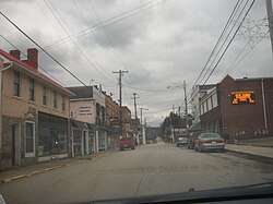
Harrison City is a census-designated place (CDP) in Westmoreland County, Pennsylvania, United States. The population was 155 at the 2000 census.

Lake Bosworth, Washington CDP in Washington, United States

Lake Bosworth is a census-designated place (CDP) in Snohomish County, Washington, United States. The population was 667 at the 2010 census.

Three Lakes, Washington CDP in Washington, United States

Three Lakes is a census-designated place (CDP) in Snohomish County, Washington, United States. The population was 3,184 at the 2010 census.

Cassville, West Virginia CDP in West Virginia, United States

Cassville is a census-designated place (CDP) in Monongalia County, West Virginia, United States. The population was 701 at the 2010 census. It is included in the Morgantown, West Virginia Metropolitan Statistical Area. Cassville was named after Lewis Cass, a prominent American statesman who served as Secretary of War, Secretary of State, and Governor of Michigan.

Mineralwells, West Virginia CDP in West Virginia, United States

Mineralwells, also known as Mineral Wells, is a census-designated place (CDP) in Wood County, West Virginia, United States. It is part of the Parkersburg-Marietta-Vienna, WV-OH Metropolitan Statistical Area. The population was 1,950 at the 2010 census.

Lake Wazeecha, Wisconsin CDP in Wisconsin, United States

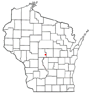
Lake Wazeecha is a census-designated place (CDP) in the town of Grand Rapids, Wood County, Wisconsin, United States. The population was 2,651 at the 2010 census.

Airport Road, Wyoming Unincorporated community in Wyoming, United States

Airport Road is an unincorporated community in Washakie County, Wyoming, United States. The population was 297 at the 2000 census, when it was a census-designated place (CDP).

References

  1. "US Gazetteer files: 2010, 2000, and 1990". United States Census Bureau. 2011-02-12. Retrieved 2011-04-23.
  2. "U.S. Census website". United States Census Bureau . Retrieved 2008-01-31.