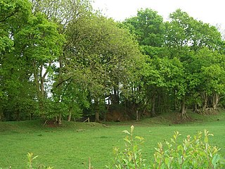
Oldbury Camp is the largest Iron Age hill fort in south-eastern England. It was built in the 1st century BC by Celtic British tribes on a hilltop west of Ightham, Kent, in a strategic location overlooking routes through the Kentish Weald. The fort comprises a bank and ditch enclosing an area of about 50 hectares, with entrances at the north-east and south ends. Wooden gates barred the entrances. Archaeological excavations carried out in the 1930s and 1980s found that the hill fort's interior had probably not been permanently occupied. It had been abandoned around 50 BC and the north-east gate had been burned down, possibly due to a Roman invasion. The wooded southern part of Oldbury Camp is now owned and managed by the National Trust and is open to the public.

Carl Wark is a rocky promontory on Hathersage Moor in the Peak District National Park, just inside the boundary of Sheffield, England. The promontory is faced by vertical cliffs on all but one side, which is protected by a prehistoric embankment. The cliffs and embankment form an enclosure that has been interpreted as an Iron Age hill fort, though the date of construction and purpose of the fortifications remains unknown. The site is a scheduled monument.

Cave Hill or Cavehill is a rocky hill overlooking the city of Belfast, Northern Ireland, with a height of 368 metres (1,207 ft). It is marked by basalt cliffs and caves, and its distinguishing feature is 'Napoleon's Nose', a tall cliff which resembles the profile of the emperor Napoleon. On top of this are the remains of an ancient promontory fort called McArt's Fort. Cavehill was also historically called 'Ben Madigan', after a king of Ulster called Madagán who died in 856AD.
Hillsborough is a local nature reserve in Ilfracombe, North Devon. It is known locally as the sleeping elephant. It was bought by the local council in the late nineteenth century to prevent development on the site. As well as a pleasant coastal area where visitors may roam, it includes the remains of an Iron Age hill fort.

Fast Castle is the ruined remains of a coastal fortress in Berwickshire, south-east Scotland, in the Scottish Borders. It lies 4 miles (6.4 km) north west of the village of Coldingham, and just outside the St Abb's Head National Nature Reserve, run by the National Trust for Scotland. The site is protected as a Scheduled Ancient Monument.
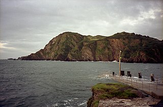
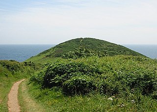
Treryn Dinas is a headland near Treen, on the Penwith peninsula between Penberth Cove and Porthcurno in Cornwall, England.
Cruggleton Castle is a multi-period archaeological site on the coast of the Machars, in the historical county of Wigtownshire in south-west Scotland. It is located at Cruggleton Point, around 4.5 kilometres (2.8 mi) east of Whithorn and 6 kilometres (3.7 mi) south-east of Sorbie. Excavations in the 1970s and 1980s revealed several periods of use, from the 1st century AD to the 17th century. The first stone tower was built in the 13th century, on an earlier motte.

Maiden Castle is an Iron Age hill fort, one of many fortified hill-top settlements constructed across Britain during the Iron Age, but one of only seven in the county of Cheshire in northern England. The hill fort was probably occupied from its construction in 600 BC until the Roman conquest of Britain in the 1st century AD. At this time the Cornovii tribe are recorded to have occupied parts of the surrounding area but, because they left no distinctive pottery or metalworking, their occupation has not been verified. Since then it has been quarried and used for military exercises. It is protected as a Scheduled Ancient Monument, and is owned by the National Trust. The hill fort is open to visitors, but unrestricted access to the site has resulted in it being classified as "at high risk" from erosion.

Kelsborrow Castle is an Iron Age hill fort in Cheshire, northern England. Hill forts were fortified hill-top settlements constructed across Britain during the Iron Age. It is one of only seven hill forts in the county of Cheshire and was probably in use for only a short time. In the 19th century, a bronze palstave was recovered from the site. It is protected as a Scheduled Ancient Monument.

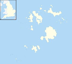
Cornish promontory forts, commonly known in Cornwall as cliff castles, are coastal equivalents of the hill forts and Cornish "rounds" found on Cornish hilltops and slopes. Similar coastal forts are found on the north–west European seaboard, in Normandy, Brittany and around the coastlines of the British Isles, especially in Wales, Scotland and Ireland. Many are known in southwest England, particularly in Cornwall and its neighbouring county, Devon. Two have been identified immediately west of Cornwall, in the Isles of Scilly.

Crosskirk Broch was a fortification near the present day hamlet of Crosskirk near Thurso, Caithness, Scotland. After thorough archaeological exploration it was destroyed in 1972 since the site had become unsafe due to sea erosion. The site was unusual in having a broch, a large circular fortification, built within an older promontory fortification with a ring wall and blockhouse.
Castle Rings is a univallate hill fort in the parish of Donhead St Mary in Wiltshire in England. The fort is a Scheduled Ancient Monument, with a list entry identification number of 1005698. Castle Rings has been dated to the Iron Age and is situated at an altitude of 228 metres (748 ft) upon Upper Greensand sandstone beds. The main bulk of the fort enclosure lies within the boundaries of Donhead St Mary parish but some of the outlying earthworks are situated in the neighbouring Sedgehill and Semley parish. In the mid-1980s a metal detectorist unearthed a hoard of stater coins of the Durotriges tribe within the hill fort.

St Andrew's Castle was an artillery fort constructed by Henry VIII near Hamble-le-Rice, Hampshire, between 1542 and 1543. It formed part of the King's Device programme to protect against invasion from France and the Holy Roman Empire, and defended Southampton Water near the Solent. St Andrew's comprised a keep and a gun platform, protected by a moat. The castle was decommissioned in 1642 during the English Civil War and has been largely destroyed through coastal erosion.

Caesar's Camp is an Iron Age hill fort straddling the border of the counties of Surrey and Hampshire in southern England. The fort straddles the borough of Waverley in Surrey and the borough of Rushmoor and the district of Hart, both in Hampshire. Caesar's Camp is a Scheduled Ancient Monument with a list entry identification number of 1007895. It lies approximately 3 kilometres (1.9 mi) north of the town of Farnham, and a similar distance west of Aldershot. The hillfort lies entirely within the Bourley and Long Valley Site of Special Scientific Interest. Caesar's Camp is a multivallate hillfort, a fort with multiple defensive rings, occupying an irregular promontory, with an entrance on the south side. The site has been much disturbed by military activity, especially at the southeast corner. The remains of the hillfort are considered to be of national importance.

The Bulwarks, Porthkerry is a promontory fort in Rhoose, Vale of Glamorgan, on the southern coast of Wales overlooking the Bristol Channel. It probably dates to the Iron Age and continued to be occupied during the Roman period in Britain. The ramparts and ditches along the west side are well preserved, but the fortifications are heavily overgrown.

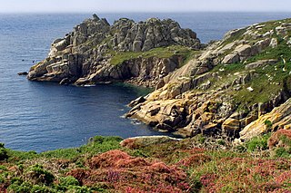
Trevelgue Head, also known as Porth Island, is a headland north-east of Newquay, Cornwall, England, next to Porth at the eastern end of Newquay Bay.
Bury Walls is an Iron Age hillfort about 1 mile (1.6 km) south-east of Weston-under-Redcastle, in Shropshire, England. It is a scheduled monument.

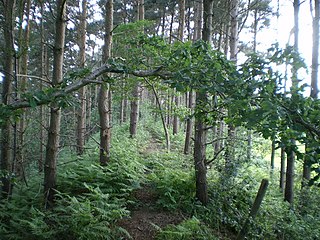
Jenny's Lantern is an area of moorland in north Northumberland, England, taking its name from an 18th-century 'eye-catcher' folly sited towards the top of a small promontory hill above the River Aln. Situated on the southern slope of the Jenny's Lantern area is an Iron Age hillfort, overbuilt by and adjoined to a larger and very well preserved Romano-British stone-built settlement and field system. It partially collapsed during a storm in November 2021.
Black Head is a headland at the western end of St Austell Bay, in Cornwall, England. It is owned by the National Trust.
Sturminster Newton Castle is a site consisting of the remains of a medieval manor house within an Iron Age hillfort, near Sturminster Newton in Dorset, England. The ruins are privately owned.