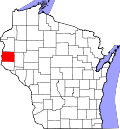
Glenwood City, Wisconsin

Last updated

Glenwood City, Wisconsin
Nickname: 
The City of 57 Hills
St. Croix County Wisconsin Incorporated and Unincorporated areas Glenwood City Highlighted.svg
Location of Glenwood City
in St. Croix County, Wisconsin
USA Wisconsin location map.svg
Red pog.svg
Glenwood City
Location within the state of Wisconsin
Usa edcp location map.svg
Red pog.svg
Glenwood City
Location within the United States
North America laea location map.svg
Red pog.svg
Glenwood City
Glenwood City (North America)
Coordinates: 45°3′26″N92°10′12″W / 45.05722°N 92.17000°W / 45.05722; -92.17000
Country United States
State Flag of Wisconsin.svg  Wisconsin
County St. Croix
Area
[1]
  Total3.47 sq mi (9.00 km2)
  Land3.47 sq mi (9.00 km2)
  Water0.00 sq mi (0.00 km2)
Elevation
[2]
1,030 ft (314 m)
Population
 (2010) [3]
  Total1,242
  Estimate 
(2019) [4]
1,201
  Density345.81/sq mi (133.50/km2)
Time zone UTC-6 (Central (CST))
  Summer (DST) UTC-5 (CDT)
Area code(s) 715 & 534
FIPS code 55-29625 [5]
GNIS feature ID1581635 [2]
Website glenwoodcitywi.com

Glenwood City is a city in St. Croix County, Wisconsin, United States. The population was 1,242 at the 2010 census. It is known as the "City of 57 Hills." [6] Glenwood City is the site of the annual St. Croix County Fair.

Contents

History

The city was founded in 1880. It was once a stop on the Wisconsin Central Railway, but the line to Glenwood City is now abandoned.

Geography

According to the United States Census Bureau, the city has a total area of 2.49 square miles (6.45 km2), all of it land. [7]

Glenwood City is along Tiffany Creek.

Wisconsin Highways 128 and 170 are main routes in the community. Other routes include County Roads G and X, Oak Street, and Maple Street.

Glenwood City is geographically within the town of Glenwood, but is a separate entity.

It is located at 45°3′26″N92°10′12″W / 45.05722°N 92.17000°W / 45.05722; -92.17000 (45.057220, -92.169991). [8]

Demographics

Historical population
CensusPop.Note
1900 1,789
1910 954−46.7%
1920 779−18.3%
1930 771−1.0%
1940 8115.2%
1950 778−4.1%
1960 8357.3%
1970 822−1.6%
1980 95015.6%
1990 1,0268.0%
2000 1,18315.3%
2010 1,2425.0%
2019 (est.)1,201 [4] −3.3%
U.S. Decennial Census [9]

2010 census

As of the census [3] of 2010, there were 1,242 people, 509 households, and 328 families living in the city. The population density was 498.8 inhabitants per square mile (192.6/km2). There were 561 housing units at an average density of 225.3 per square mile (87.0/km2). The racial makeup of the city was 97.7% White, 0.1% African American, 0.1% Native American, 0.5% Asian, 0.6% from other races, and 1.1% from two or more races. Hispanic or Latino of any race were 1.9% of the population.

There were 509 households, of which 33.6% had children under the age of 18 living with them, 42.2% were married couples living together, 15.7% had a female householder with no husband present, 6.5% had a male householder with no wife present, and 35.6% were non-families. 32.6% of all households were made up of individuals, and 17.3% had someone living alone who was 65 years of age or older. The average household size was 2.37 and the average family size was 2.91.

The median age in the city was 37.7 years. 26.7% of residents were under the age of 18; 7.1% were between the ages of 18 and 24; 25.2% were from 25 to 44; 23.5% were from 45 to 64; and 17.5% were 65 years of age or older. The gender makeup of the city was 48.1% male and 51.9% female.

2000 census

As of the census [5] of 2000, there were 1,183 people, 460 households, and 305 families living in the city. The population density was 477.2 inhabitants per square mile (184.2/km2). There were 491 housing units at an average density of 198.1 per square mile (76.5/km2). The racial makeup of the city was 99.07% White, 0.08% African American, 0.17% Native American, 0.34% Asian, and 0.34% from two or more races. Hispanic or Latino of any race were 0.17% of the population.

There were 460 households, out of which 36.3% had children under the age of 18 living with them, 48.9% were married couples living together, 12.0% had a female householder with no husband present, and 33.5% were non-families. 29.3% of all households were made up of individuals, and 17.6% had someone living alone who was 65 years of age or older. The average household size was 2.48 and the average family size was 3.08.

In the city, the population was spread out, with 28.6% under the age of 18, 8.5% from 18 to 24, 26.6% from 25 to 44, 17.8% from 45 to 64, and 18.5% who were 65 years of age or older. The median age was 36 years. For every 100 females, there were 89.3 males. For every 100 females age 18 and over, there were 82.9 males.

The median income for a household in the city was $36,964, and the median income for a family was $45,417. Males had a median income of $32,875 versus $25,833 for females. The per capita income for the city was $17,424. About 6.1% of families and 9.1% of the population were below the poverty line, including 11.8% of those under age 18 and 10.2% of those age 67 or over.

Culture

Glenwood City is home to the St. Croix County Fair in July. It also hosts a PRCA Rodeo in June annually.

Education

The public school district of Glenwood City maintains a K–12 educational complex on the southeast corner of the city. Glenwood City High School is the local high school.

See also

Related Research Articles

<span class="mw-page-title-main">Jupiter Island, Florida</span> Town in the state of Florida, United States

Jupiter Island is a town located on the barrier island also called Jupiter Island, in Martin County, Florida, United States; the town is part of Florida's Treasure Coast. It is part of the Port St. Lucie metropolitan area. The Town of Jupiter Island is located next to the unincorporated community of Hobe Sound. The population of Jupiter Island was 804 at the 2020 census.

<span class="mw-page-title-main">Glenwood, Illinois</span> Village in Illinois, United States

Glenwood is a village in Cook County, Illinois, United States. The population was 8,662 at the 2020 census.

<span class="mw-page-title-main">Glenwood, Indiana</span> Town in Indiana, United States

Glenwood is a town in Union Township, Rush County and in Orange and Fairview townships, Fayette County in the U.S. state of Indiana. The population was 250 at the 2010 census.

<span class="mw-page-title-main">Taylors Falls, Minnesota</span> City in Minnesota, United States

Taylors Falls is a city in Chisago County, Minnesota, United States, located at the junction of U.S. Highway 8 and Minnesota State Highway 95. The population was 1,055 at the 2020 census.

<span class="mw-page-title-main">Glenwood, Minnesota</span> City in Minnesota, United States

Glenwood is a city in, and the county seat of, Pope County, Minnesota, United States. The population was 2,657 at the 2020 census. It is located on the northeastern shore of Lake Minnewaska.

<span class="mw-page-title-main">Long Beach, Minnesota</span> City in Minnesota, United States

Long Beach is a city in Pope County, Minnesota, United States. The population was 338 at the 2020 census.

<span class="mw-page-title-main">Lakeland, Minnesota</span> City in Minnesota, United States

Lakeland is a city in Washington County, Minnesota, United States. The population was 1,796 at the 2010 census.

<span class="mw-page-title-main">Glenwood, Missouri</span> Village in Missouri, United States

Glenwood is a village in Schuyler County, Missouri, United States. As of the 2020 census, its population was 181. It is part of the Kirksville Micropolitan Statistical Area.

<span class="mw-page-title-main">Porter Township, Jefferson County, Pennsylvania</span> Township in Pennsylvania, United States

Porter Township is a township in Jefferson County, Pennsylvania, United States. The population was 294 at the 2020 census.

<span class="mw-page-title-main">Nottingham Township, Pennsylvania</span> Township in Pennsylvania, United States

Nottingham Township is a township in Washington County, Pennsylvania, United States. The population was 2,933 in the 2020 census.

<span class="mw-page-title-main">Finley, Washington</span> CDP in Washington, United States

Finley is a census-designated place (CDP) in Benton County, Washington, United States. The population was 6,152 at the 2020 census. It is located to the southeast of the larger city of Kennewick.

<span class="mw-page-title-main">Springdale, Washington</span> Town in Washington, United States

Springdale is a town in Stevens County, Washington, United States. The population was 234 at the 2020 census.

<span class="mw-page-title-main">Markesan, Wisconsin</span> City in Wisconsin, United States

Markesan is a city in Green Lake County, Wisconsin, United States. The population was 1,476 at the 2010 census. The center of population of Wisconsin is located in Markesan.

<span class="mw-page-title-main">Amery, Wisconsin</span> City in Wisconsin, United States

Amery is a city in Polk County, Wisconsin, United States, along the Apple River. It is a part of Wisconsin's 7th congressional district. The population was 2,902 at the 2010 census. The city was named in honor of William Amery, a carpenter who held several local offices in the 1870s.

<span class="mw-page-title-main">Spring Valley, Wisconsin</span> Village in Wisconsin, United States

Spring Valley is a village in Pierce and St. Croix counties in Wisconsin, United States. The population was 1,401 at the 2020 census. Of those, 1,390 were in Pierce County and 11 in St. Croix County. The village is mostly within the Town of Spring Lake in Pierce County. Small parts also lie in the Town of Gilman, also in Pierce County, and the Town of Cady in St. Croix County.

<span class="mw-page-title-main">Grantsburg, Wisconsin</span> Village in Wisconsin, United States

Grantsburg is a village in Burnett County, Wisconsin, United States. The population was 1,341 at the 2010 census. The village is located within the Town of Grantsburg. It was established by Canute Anderson.

<span class="mw-page-title-main">Brillion, Wisconsin</span> City in Wisconsin, United States

Brillion is a city in Calumet County in the U.S. state of Wisconsin. The population was 3,538 as of 2024. The city is located within the Town of Brillion, though it is politically independent.

<span class="mw-page-title-main">Osceola, Wisconsin</span> Village in Wisconsin, United States

Osceola is a village in Polk County, Wisconsin, United States. The population was 2,765 at the 2020 census. Located mostly within the Town of Osceola, the village sits on the border with Minnesota, separated by the St. Croix River. It is along Wisconsin Highway 35.

<span class="mw-page-title-main">St. Croix Falls (town), Wisconsin</span> Town in Wisconsin, United States

St. Croix Falls is a town in Polk County, Wisconsin, United States. The population was 1,119 at the 2000 census. The City of St. Croix Falls is located within the town. The unincorporated community of Lamar is located in the town.

<span class="mw-page-title-main">St. Croix Falls, Wisconsin</span> City in Wisconsin, United States

St. Croix Falls is a city in Polk County, Wisconsin, United States. The population was 2,208 at the 2020 census. The city is located within the Town of St. Croix Falls.

References

  1. "2019 U.S. Gazetteer Files". United States Census Bureau. Archived from the original on October 9, 2020. Retrieved August 7, 2020.
  2. 1 2 "US Board on Geographic Names". United States Geological Survey. October 25, 2007. Archived from the original on February 2, 2001. Retrieved January 31, 2008.
  3. 1 2 "U.S. Census website". United States Census Bureau. Archived from the original on July 9, 2021. Retrieved November 18, 2012.
  4. 1 2 "Population and Housing Unit Estimates". United States Census Bureau. May 24, 2020. Archived from the original on July 1, 2021. Retrieved May 27, 2020.
  5. 1 2 "U.S. Census website". United States Census Bureau. Archived from the original on July 9, 2021. Retrieved January 31, 2008.
  6. "Glenwood City, Wisconsin Police". www.glenwoodcitywi.com. Archived from the original on July 11, 2011. Retrieved February 26, 2009.
  7. "US Gazetteer files 2010". United States Census Bureau. Archived from the original on January 12, 2012. Retrieved November 18, 2012.
  8. "US Gazetteer files: 2010, 2000, and 1990". United States Census Bureau. February 12, 2011. Archived from the original on August 24, 2019. Retrieved April 23, 2011.
  9. "Census of Population and Housing". Census.gov. Archived from the original on July 1, 2021. Retrieved June 4, 2015.