Bala Cynwyd is a community and census-designated place in Lower Merion Township, Pennsylvania, United States. It is located on the Philadelphia Main Line in Southeastern Pennsylvania and borders the western edge of Philadelphia at U.S. Route 1. The present-day community was originally two separate towns, Bala and Cynwyd, but was united as a singular community largely because the U.S. Post Office, the Bala Cynwyd branch, served both towns using ZIP Code 19004. The combining of the communities gives a total population of 9,285 as of the 2020 census. The community was long known as hyphenated Bala-Cynwyd. Bala and Cynwyd are currently served by separate stations on SEPTA's Cynwyd Line of Regional Rail.

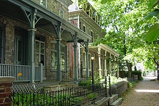
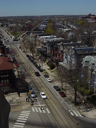
Powelton Village is a neighborhood of mostly Victorian, mostly twin homes in the West Philadelphia section of Philadelphia, Pennsylvania. It is a national historic district that is part of University City. Powelton Village extends north from Market Street to Spring Garden Street, east to 32nd Street, west to 40th and Spring Garden Streets, and to 44th and Market Streets.

University City is the easternmost portion of West Philadelphia, encompassing several Philadelphia universities. It is situated directly across the Schuylkill River from Center City.

Northeast Philadelphia, nicknamed Northeast Philly, the Northeast and the Great Northeast, is a section of Philadelphia, Pennsylvania. According to the 2000 census, Northeast Philadelphia has a population of between 300,000 and 450,000, depending on how the area is defined. The Northeast is known as being home to a large and diverse working class population, including Polish, German, Jewish, Russian, African American, Brazilian, Puerto Rican, Dominican, Guatemalan, Ukrainian, Indian, Chinese, Irish, and Vietnamese neighborhoods.

Overbrook is a historic neighborhood of Philadelphia, Pennsylvania. It is situated in the northwest of West Philadelphia.

West Philadelphia, nicknamed West Philly, is a section of the city of Philadelphia. Although there are no officially defined boundaries, it is generally considered to reach from the western shore of the Schuylkill River, to City Avenue to the northwest, Cobbs Creek to the southwest, and the SEPTA Media/Wawa Line to the south. An alternate definition includes all city land west of the Schuylkill; this would also include Southwest Philadelphia and its neighborhoods. The eastern side of West Philadelphia is also known as University City.
Roosevelt Boulevard, officially named the Theodore Roosevelt Memorial Boulevard and locally known as "the Boulevard", is a major traffic artery through North and Northeast Philadelphia. The road begins at Interstate 76 in Fairmount Park, running as a freeway also known as the Roosevelt Boulevard Extension or the Roosevelt Expressway through North Philadelphia, then transitioning into a twelve-lane boulevard that forms the spine of Northeast Philadelphia to its end at the city line.

Holmesburg began as a Village within Lower Dublin Township, Pennsylvania. It is now a neighborhood in the Northeast section of Philadelphia, Pennsylvania, United States. Holmesburg was named in Honor of Surveyor General of Pennsylvania Thomas Holme, who was a cartographer.

Rhawnhurst is a residential neighborhood in the Northeast section of Philadelphia, Pennsylvania, United States, named for George and William Rhawn by area real estate developers. Roughly bordered by Cottman Avenue to the south, Pennway Street to the west, the Pennypack Creek to the north, and Roosevelt Boulevard to the east, Rhawnhurst encompasses ZIP codes 19152 and part of ZIP code 19111. The geographic center of Rhawnhurst is at the intersection of Castor Avenue and Rhawn Street.
East Oak Lane is a neighborhood at the northern end of the North Philadelphia planning district of Philadelphia, Pennsylvania, United States. Many of the houses in the neighborhood are large single homes or twins built at a later period than much of central North Philadelphia. There is also a significant number of typical Philadelphia rowhouses.
Ashton-Woodenbridge is a neighborhood in Northeast Philadelphia, in the U.S. state of Pennsylvania. It is located on the eastern side of the far northeast, in the vicinity of Northeast Philadelphia Airport, including Wooden Bridge Run west to Academy Gardens, and south to Pennypack Park. Originally farm land, it was part of the holdings of Thomas Holme, surveyor for Philadelphia's founder, William Penn. The area was part of one of the original townships, Lower Dublin Township, until the 1854 Act of Consolidation incorporated it into the City of Philadelphia.

Point Breeze is a multicultural neighborhood in South Philadelphia in Philadelphia, Pennsylvania, United States. It is bounded by 25th Street to the west, Washington Avenue to the north, Broad Street to the east, and Moore Street to the south. Southwest Center City lies to its north. Passyunk Square and East Passyunk Crossing lie to its east. Point Breeze is separated from Grays Ferry to the west by a CSX railway viaduct over 25th Street.

Broad Street is a major arterial street in Philadelphia, Pennsylvania. The street runs for approximately 13 miles (21 km), beginning at the intersection of Cheltenham Avenue on the border of Cheltenham Township and the West/East Oak Lane neighborhoods of North Philadelphia to the Philadelphia Navy Yard in South Philadelphia. It is Pennsylvania Route 611 along its entire length with the exception of its northernmost part between Old York Road and Pennsylvania Route 309 and the southernmost part south of Interstate 95.

Pennsport is a neighborhood in the South Philadelphia section of Philadelphia, Pennsylvania, United States.

U.S. Route 1 (US 1) is a major north–south U.S. Route, extending from Key West, Florida, in the south to Fort Kent, Maine, at the Canada–United States border in the north. In the U.S. state of Pennsylvania, US 1 runs for 81 miles (130 km) from the Maryland state line near Nottingham northeast to the New Jersey state line at the Delaware River in Morrisville, through the southeastern portion of the state. The route runs southwest to northeast and serves as a major arterial road through the city of Philadelphia and for many of the suburbs in the Delaware Valley metropolitan area. South of Philadelphia, the road mostly follows the alignment of the Baltimore Pike. Within Philadelphia, it mostly follows Roosevelt Boulevard. North of Philadelphia, US 1 parallels the route of the Lincoln Highway. Several portions of US 1 in Pennsylvania are freeways, including from near the Maryland state line to Kennett Square, the bypass of Media, the concurrency with Interstate 76 and the Roosevelt Expressway in Philadelphia, and between Bensalem Township and the New Jersey state line.

Castor Gardens is a neighborhood in the lower Northeast section of Philadelphia, Pennsylvania, United States. Castor Gardens' borders are not clearly defined, but it exists in the vicinity of Castor Avenue and Cottman Avenue. It is also near Roosevelt Boulevard. The neighborhood can either be entered from the south, by taking the Oxford Circle exit of Roosevelt Boulevard, or from the north, by taking the Cottman Avenue exit. Adjacent neighborhoods are Mayfair, Lawndale, Burholme, Oxford Circle, and Rhawnhurst.

Wissahickon is a neighborhood in the section of Lower Northwest Philadelphia in the state of Pennsylvania, United States. Wissahickon is located adjacent to the neighborhoods of Roxborough and Manayunk, and it is bounded by the Wissahickon Valley Park, Ridge Avenue, Hermit Street, and Henry Avenue. The name of the neighborhood is derived from the Lenni Lenape word wisameckham, for "catfish creek", a reference to the fish that were once plentiful in the Wissahickon Creek.

Crescentville is a neighborhood in Northeast Philadelphia, United States. It is located in the vicinity of Adams, Rising Sun, and Tabor Avenues. The name Crescentville is thought to be derived from the Crescentville Rope Factory that once stood along the Tookany Creek watershed.
Winchester Park is a neighborhood in Far Northeast Philadelphia, Pennsylvania, United States. It is located in the vicinity of Pennypack Park, north and west of Holmesburg.

Belmont Village is a middle class neighborhood located in the West Philadelphia section of Philadelphia, Pennsylvania, United States. The zip code is 19131.


