Indigenous Australian seasons

Last updated

Indigenous Australian seasons are classified differently from the traditional four-season calendar used by most western European peoples. Aboriginal Australians and Torres Strait Islander people have distinct ways of dividing the year up. Naming and understanding of seasons differs among groups of Aboriginal peoples, and depends on where in Australia the group lives.

Contents

The Australian Bureau of Meteorology and the CSIRO have both worked with various groups to produce information about a number of Aboriginal and Torres Strait Islander seasonal calendars.

Background

Aboriginal and Torres Strait Islander peoples observe the position of the stars in the sky and follow water, plant and animal cycles as ways of identifying seasonal phenomena. The seasonal calendars of different Aboriginal and Torres Strait Islander cultural groups demonstrate an understanding of the interdependence and interrelationships amongst living things. They use their calendars to predict seasonal changes and weather patterns to determine the availability of particular resources or the timing of journeys. [1]

The seasonal calendars vary according to geographic location, ecological context and cultural interpretation. Specific biotic events, often referred to as bio-indicators, can occur locally or over great distances, enabling accurate predictions of seasonal changes. For instance, the appearance of particular insect species may be an indication that the wet season is approaching, indicating that it is time to harvest yams. Observations of cyclical animal behavioural patterns are also important, for example when the D'harawal people of the Sydney basin area hear the mating cries of tiger quolls, the lillipilli fruit has started to ripen. Once the fruit starts falling, it is a sign for the people of this country to begin their annual journey to the coast, to seek out other seasonal resources. [1]

Seasonal calendars continue to be used by many groups today. The publication of First Nations' calendars has revealed the immense scientific knowledge held by the respective communities and has informed Western scientific understandings across a wide range of disciplines, for example, botany, zoology, ecology, meteorology and many more. [1]

BOM and CSIRO resources

The Bureau of Meteorology (BOM) and the CSIRO have both worked with various groups to produce Aboriginal and Torres Strait Islander seasonal calendars. [2] BOM has produced an interactive map, [3] and both BOM and the CSIRO have also documented the seasonal calendars of many Aboriginal groups in detail. [4] Both sites provide downloadable and printable posters showing each group's calendar. [2]

Some Aboriginal seasons

North coast – Yolngu seasons

The Yolngu, the Aboriginal Australians of North-East Arnhem Land, identify six seasons. Non-Indigenous people living in the Top End usually identify two: the Wet and the Dry. (Arguably, the build-up period between dry and wet is coming to be identified as a distinct third season.) The six Yolngu seasons, and their characteristics, are:[ citation needed ]

Season namePeriodWeatherFlora and faunaSeasonal activities
MirdawarrLate March,
April
End of wet season with scattered showers. Wind in south-east quarter but air still hot and humid.Vegetable foods becoming plentiful. Fish numerous.People generally sedentary & living in big camps. Nomadic movement restricted by floodwaters. Long rank grass and mosquitoes. Macassar traders used to depart at this time with south-east winds. Goose-hunting expeditions into swamps. Fishing, especially large-scale communal fishing operations and drives where floodwaters receding; including basket traps in weirs, nets and the gurl in use only in the valley of the Glyde River.
DhaarratharramirriLate April,
May,
June,
July,
August
South-east or dry season. Wind in east and south-east People nomadic; big wet-season camps breaking up. Systematic burning of all extensive grassed areas, communal drives for kangaroo, bandicoots, goanna. Fishing still important, with nets, grass barriers, in shallow waters on plains & salt pans. August to November (inclusive) is the most important period for ceremonial activities.
RarranhdharrSeptember,
October
Hot dry season. Hot periods towards close of dry (south-east) season. Wind chiefly north-east, lightning frequent and first thunder heard. Stringybark in flower.Nomadic activities lessen after burning of grass. Poisoning of fish in waters now concentrated by evaporation. Fish spearing continues in estuarine & coastal waters. Important ceremonial time.
WorlmamirriLate October,
November,
December
The 'nose of the wet season', with or bringing thunder - late October. Period of maximum heat and humidity immediately before the rain season, characterised by violent thunder storms of increasing frequency. Nomadic activities much restricted. People generally in camps near permanent water.
BaarramirriLate December,
January
Short season with wind in north-west; breaking of the wet. Also called munydjutjmirri from the fruit of munydjutj. Two kinds of north-west wind recognised: (i) Baarra yindi, the big, or gurrkamirri (male), baarra; (ii) Baarra nyukukurniny, the small, or dhuykun (female), baarra. The first refers to the more boisterous north-west gales, the second to the gentler breezes from the north-west. Macassar fleets used to arrive with north-west winds (baarra) and disperse to regular sites for trepang fishing. People concentrated in wet season camps leading almost sedentary life. Inland travel restricted by floods and dense growth of rank grass.
Gurnmul or
Waltjarnmirri
January,
February,
March
Wet season proper. Two phases, the first, girritjarra is again subdivided into three. People concentrated in camps. Inland travel restricted by floods.

Central – Anangu Pitjantjajara seasons

The Anangu Pitjantjatjara of northern South Australia and the southern part of the Northern Territory live in central Australia. Examples of some of their seasons include:

Season namePeriodWeatherFlora and faunaSeasonal activities
WanitjunkupaiApril,
May
The beginning of the cold weather. Tjuntalpa (clouds) start around April but usually don't bring rain. They come from the south, brought mainly by westerly winds, and sit low over the hills till late in the day.Reptiles hibernate. (Wanitjunkupai literally means "hibernate"). 
WariLate May,
June,
July
The cold time when there is nyinnga (frost) and kulyakulyarpa (mist or dew) every morning, but little rain.  
Piriyakutu/ Piriya-Piriya~August,
September
This is when the priya comes – a warm steady wind from the north and west.Animals breed. Food plants flower, fruit and seed. Hibernating reptiles come out and the honey grevillea is in bloom.A good time for hunting malu (kangaroo).
Mai Wiyaringkupai / Kuli~DecemberHottest season. Ngangkali (storm clouds) and wangangara (lightning), but little rain. Lightning strikes can start fires.Not much food around at this time. 
Itjanu / InuntjjiJanuary,
February,
March
Utuwari (overcast clouds) usually bring rain.Food plants flower. If rains are good there is plenty of fruit and seed. 

South-west – Noongar seasons

Noongar seasons do not follow a rigid cycle; timing is dependent on subtle changes in the weather with wind, rain and temperature. The cycles are part of katitjin-bidi or "knowledge trails" that lead groups to reliable sources of food and water. [5] [6] The seasons are named as follows by the Whadjuk Noongar people of Perth: [7] [8]

Season name
PeriodWeatherFlora and faunaSeasonal activities
Bunuru (second summer)February,
March
Hot, dry, easterly and north winds.Fish – tailor and mullet – in shallow water. Macrozamia riedlei fruiting. Wattle ( Acacia ) and banksia in blossom.Trapping fish (coasts and estuaries). Collecting kooyal (frogs), marron, gilgies (freshwater crayfish), tortoises from wetlands. Climbing trees for possums. Collecting Macrozamia fruit and removing toxin. Pounding the horizontal rhizomes of the bulrush ( Typha domingensis ) into a cake and roasting it. Collecting the bulb of Haemodorum spicatum and roasting for a spice. Collecting wattle and banksia blossoms and various roots.
Djeran (autumn)April,
May
Cooling, south-west winds. Group fishing at lakes and weirs (inland). Continued fishing at estuaries. Collecting edible bulbs and seeds.
Makuru (winter)June,
July
Cold, rain, westerly gales.Kuljak (black swans) begin moulting, making them unable to fly.Moving inland to hunt, when the watersheds fill. Hunting kuljak (black swans). Collecting Tribonanthus tubers. Keeping warm by holding smouldering bull Banksia branches ( Banksia grandis ) beneath bookas (skin cloaks).
Djilba (first spring)August,
September
Warming. Collecting roots (meen and djakat). Digging out Platysace cirrosa tubers from under wandoo . Hunting of waitch (emus), quenda (southern brown bandicoot), yonga (kangaroos), koormul (possums).
Kambarang (second spring}October,
November
Rain lessening. Astroloma and desert quandong ( Santalum acuminatum ) fruiting.Movement to the coast. Sweet gum gathered by removing the bark from the moodjar or WA Christmas tree ( Nuytsia floribunda ). Collection of yams ( Dioscorea hastifolia and Platysace cirrosa). Collection of eggs from waterfowl and other birds. Catching of yaarkin (tortoises), kooyal (frogs), gilgie (freshwater crayfish). Trapping of possums and kangaroos.
Birak (first summer)December,
January
Hot, dry, daytime easterly breezes, late afternoon south-west sea breezes.Banksia in flower.Gathering banksia flowers for honey. Catching bronzewing pigeons. Controlled burning for hunting, and to assist regrowth.

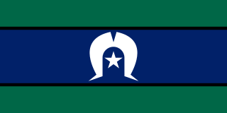
Torres Strait Islands seasons

In the Torres Strait Islands, the seasons are associated with the way the wind blows and changes in the environment. The four seasons based on the wind are known as Kuki, Zey (Zei in Masig) and Nay Gay (Nai Gai in Masig) and Sager (Zoerr): [9] [10]

The people of Masig (otherwise known as Yorke Island), known as the Masigalgal, are part of the Kulkulgal nation of the central Torres Strait. The timing and duration of these four seasons varies from year to year, and Masig islanders observe signs in the winds, weather, sea life, plants and animals that tell them when one season is expected to change to another. Community celebrations, hunting, gardening and cultural activities are based around this annual cycle of resource availability and renewal. [10]

Sources

  1. 1 2 3 "Teacher background information: Year 7 Science content description". The Australian Curriculum. 13 June 2014. Archived from the original on 11 March 2022. Retrieved 16 July 2020. CC-BY icon.svg Text was copied from this source, which is available under an Attribution 4.0 International (CC BY 4.0) licence, as per this note.
  2. 1 2 "Australia's national weather agencies now provide Indigenous weather information". Welcome To Country. 25 May 2018. Retrieved 16 July 2020.
  3. "Indigenous Weather Knowledge: Select a community to view their seasonal calendar". Bureau of Meteorology. Retrieved 16 July 2020.
  4. "Indigenous seasons calendars". CSIRO. Retrieved 16 July 2020.
  5. Collard, F.; Wally, J.; Bennell, B. "Six Seasons - Nyungar Life on the Coastal Plain". Derbal Nara. Retrieved 12 October 2022.
  6. Barrow, Jason (2016). "Indigenous Weather Knowledge – Nyoongar calendar". Bureau of Meteorology. Commonwealth of Australia. Retrieved 12 October 2022. The Nyoongar seasonal calendar includes six different seasons in a yearly cycle. These are Birak, Bunuru, Djeran, Makuru, Djilba and Kambarang.
  7. Swan River System, Landscape Description (Report No 27/28 1997), 6. Resource Inventory, 6.2 Cultural Context pp4142 Lisa Chalmers (Waterways Management Planning, Water and Rivers Commission), for the Swan River Trust. The section references Hunters And Gatherers, Landscope Volume 8, 1, 3135, (P. Bindon & T. Walley, 1993) and Broken Spears: Aboriginals and Europeans in the South West of Australia, Perth: Focus (N. Green, 1984). Portal page for the entire report. Retrieved 9 June 2007.
  8. Logan, Tyne (31 March 2023). "How Indigenous Australians rely on subtle changes in the environment to track the seasons". ABC News. Australian Broadcasting Corporation . Retrieved 30 March 2023.
  9. "Torres Strait". Gab Titui. 29 May 2015. Retrieved 16 July 2020.
  10. 1 2 "Masig calendar - Indigenous Weather Knowledge". Bureau of Meteorology. Retrieved 16 July 2020. CC-BY icon.svg Text was copied from this source, which is available under a Attribution 3.0 Australia (CC BY 3.0 AU) licence, as in this note.

Further reading

Related Research Articles

<span class="mw-page-title-main">Noongar</span> Group of Aboriginal peoples on the southwest coast of Australia

The Noongar are Aboriginal Australian peoples who live in the south-west corner of Western Australia, from Geraldton on the west coast to Esperance on the south coast. There are 14 different groups in the Noongar cultural bloc: Amangu, Ballardong, Yued, Kaneang, Koreng, Mineng, Njakinjaki, Njunga, Pibelmen, Pindjarup, Wadandi, Whadjuk, Wiilman and Wudjari. The Noongar people refer to their land as Noongar boodja.

<span class="mw-page-title-main">Torres Strait Islands</span> Group of islands in the Torres Strait between Australia and New Guinea

The Torres Strait Islands are a group of at least 274 small islands in the Torres Strait, a waterway separating far northern continental Australia's Cape York Peninsula and the island of New Guinea. They span an area of 48,000 km2 (19,000 sq mi), but their total land area is 566 km2 (219 sq mi).

<span class="mw-page-title-main">Torres Strait Islanders</span> Ethnic group of Australia

Torres Strait Islanders are the Indigenous Melanesian people of the Torres Strait Islands, which are part of the state of Queensland, Australia. Ethnically distinct from the Aboriginal peoples of the rest of Australia, they are often grouped with them as Indigenous Australians. Today there are many more Torres Strait Islander people living in mainland Australia than on the Islands.

Murri is a demonym for Aboriginal Australians of modern-day Queensland and north-western New South Wales. For some people and organisations, the use of Indigenous language regional terms is an expression of pride in their heritage. The term includes many ethno-linguistic groups within the area, such as the Kamilaroi (Gamilaraay) and Yuggera (Jagera) peoples.

<span class="mw-page-title-main">Southwest Australia</span> Biogeographic region of Western Australia

Southwest Australia is a biogeographic region in Western Australia. It includes the Mediterranean-climate area of southwestern Australia, which is home to a diverse and distinctive flora and fauna.

The Gove Peninsula is at the northeastern corner of Arnhem Land in the Northern Territory of Australia. The peninsula became strategically important during World War II when a Royal Australian Air Force base was constructed at what is now Gove Airport. The peninsula was involved in a famous court case known as the Gove land rights case, when local Yolngu people tried to claim native title over their traditional lands in 1971, after the Australian Government had granted a mineral lease to a bauxite mining company without consulting the local peoples. Today the land is owned by the Yolngu people.

<span class="mw-page-title-main">Australian Institute of Aboriginal and Torres Strait Islander Studies</span> Australian research institute for Indigenous studies

The Australian Institute of Aboriginal and Torres Strait Islander Studies (AIATSIS), established as the Australian Institute of Aboriginal Studies (AIAS) in 1964, is an independent Australian Government statutory authority. It is a collecting, publishing and research institute and is considered to be Australia's premier resource for information about the cultures and societies of Aboriginal and Torres Strait Islander peoples. The institute is a leader in ethical research and the handling of culturally sensitive material and holds in its collections many unique and irreplaceable items of cultural, historical and spiritual significance. The collection at AIATSIS has been built through over 50 years of research and engagement with Aboriginal and Torres Strait Islander communities and is now a source of language and culture revitalisation, native title research and family and community history. AIATSIS is located on Acton Peninsula in Canberra, Australian Capital Territory.

<span class="mw-page-title-main">Aboriginal Australians</span> First Nations peoples of the Australian continent

Aboriginal Australians are the various First Nations peoples of the Australian mainland and many of its islands, such as the peoples of Tasmania, Fraser Island, Hinchinbrook Island, the Tiwi Islands, and Groote Eylandt, but excluding the ethnically distinct Torres Strait Islands. The term Indigenous Australians refers to Aboriginal Australians and Torres Strait Islanders collectively.

Kenneth Desmond Colbung AM MBE, also known by his indigenous name Nundjan Djiridjarkan, was an Aboriginal Australian leader from the Noongar people who became prominent in the 1960s. He was appointed an MBE and an AM for his service to the Aboriginal community.

Djabugay is an endangered Australian Aboriginal language spoken by the Djabugay people with 46 native speakers at the 2016 census. The Djabugay language region includes Far North Queensland, particularly around the Kuranda Range and Barron River catchment, and the landscape within the local government boundaries of the Cairns Regional Council.

<span class="mw-page-title-main">Mapoon, Queensland</span> Town in Queensland, Australia

Mapoon is a coastal town in the Aboriginal Shire of Mapoon and a locality split between the Aboriginal Shire of Mapoon and the Shire of Cook in Queensland, Australia. In the 2016 census, Mapoon had a population of 317 people.

<span class="mw-page-title-main">Climate of Australia</span> Climate of the country

Australia's climate is governed mostly by its size and by the hot, sinking air of the subtropical high pressure belt. This moves north-west and north-east with the seasons. The climate is variable, with frequent droughts lasting several seasons, thought to be caused in part by the El Niño-Southern Oscillation. Australia has a wide variety of climates due to its large geographical size. The largest part of Australia is desert or semi-arid. Only the south-east and south-west corners have a temperate climate and moderately fertile soil. The northern part of the country has a tropical climate, varying between grasslands and desert. Australia holds many heat-related records: the continent has the hottest extended region year-round, the areas with the hottest summer climate, and the highest sunshine duration.

Noongar is an Australian Aboriginal language or dialect continuum, spoken by some members of the Noongar community and others. It is taught actively in Australia, including at schools, universities and through public broadcasting. The country of the Noongar people is the southwest corner of Western Australia. Within that region, many Noongar words have been adopted into English, particularly names of plants and animals.

Indigenous Australian customary law refers to the legal systems and practices uniquely belonging to Indigenous Australians of Australia, that is, Aboriginal and Torres Strait Islander people.

<span class="mw-page-title-main">Season</span> Subdivision of the year based on orbit and axial tilt

A season is a division of the year based on changes in weather, ecology, and the number of daylight hours in a given region. On Earth, seasons are the result of the axial parallelism of Earth's tilted orbit around the Sun. In temperate and polar regions, the seasons are marked by changes in the intensity of sunlight that reaches the Earth's surface, variations of which may cause animals to undergo hibernation or to migrate, and plants to be dormant. Various cultures define the number and nature of seasons based on regional variations, and as such there are a number of both modern and historical cultures whose number of seasons varies.

The Australian Indigenous HealthInfoNet, formerly National Aboriginal and Torres Strait Islander Health Clearinghouse, is an internet resource that collects, collates, interprets, and presents evidence-derived knowledge on Aboriginal and Torres Strait Islander health in Australia.

Indigenous land rights in Australia, also known as Aboriginal land rights in Australia, relate to the rights and interests in land of Aboriginal and Torres Strait Islander people in Australia, and the term may also include the struggle for those rights. Connection to the land and waters is vital in Australian Aboriginal culture and to that of Torres Strait Islander people, and there has been a long battle to gain legal and moral recognition of ownership of the lands and waters occupied by the many peoples prior to colonisation of Australia starting in 1788, and the annexation of the Torres Strait Islands by the colony of Queensland in the 1870s.

Alyangula is the largest township on Groote Eylandt in the Northern Territory.

The South West Aboriginal Land and Sea Council is the organisation that represents the Noongar people, the Aboriginal Australians of the southwest corner of Western Australia. It was formed in 2001, and is incorporated under the Corporations Act 2006. The Council's primary role is to assist the Noongar people with native title claims and Indigenous land use agreements. It also helps support Noongar culture and heritage, and publishes the Kaartdijin Noongar website.

<span class="mw-page-title-main">Masig Island, Queensland</span> Suburb of Torres Strait Island Region, Queensland, Australia

Masig Island is an island and locality in the Torres Strait Island Region, Queensland, Australia. In the 2016 census Masig Island had a population of 270 people.