The Isle of Wight is an island, county and unitary authority in the English Channel, 2 to 5 miles off the coast of Hampshire, across the Solent. It is the largest and second-most populous island in England. Referred to as "The Island" by residents, the Isle of Wight has resorts that have been popular holiday destinations since Victorian times. It is known for its mild climate, coastal scenery, and verdant landscape of fields, downland, and chines. The island is historically part of Hampshire, however is now a ceremonial county and unitary authority in its own right. The island is designated a UNESCO Biosphere Reserve.

Southampton County is a county located on the southern border of the Commonwealth of Virginia. North Carolina is to the south. As of the 2020 census, the population was 17,996. Its county seat is Courtland.

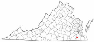
Isle of Wight County is a county located in the Hampton Roads region of the U.S. state of Virginia. It was named after the Isle of Wight, England, south of the Solent, from where many of its early colonists had come. As of the 2020 census, the population was 38,606. Its county seat is Isle of Wight, an unincorporated community.

Smithfield is a town in Isle of Wight County, in the South Hampton Roads subregion of the Hampton Roads region of Virginia in the United States. The population was 8,089 at the 2010 census.

Windsor is an incorporated town in Isle of Wight County in the Hampton Roads region of southeastern Virginia in the United States. It is located near the crossroads of U.S. Route 460 and U.S. Route 258. The population was 2,626 at the 2010 census, up from 916 at the 2000 census.

The James River Bridge (JRB) is a four-lane divided highway lift bridge across the James River in the Commonwealth of Virginia. Owned and operated by the Virginia Department of Transportation, it carries U.S. Route 17 (US 17), US 258, and State Route 32 across the river near its mouth at Hampton Roads. The bridge connects Newport News on the Virginia Peninsula with Isle of Wight County in the South Hampton Roads region, and is the easternmost such crossing without a tunnel component.

State Route 10 is a primary state highway in the U.S. state of Virginia. The state highway runs 93.58 miles (150.60 km) from U.S. Route 360 in Richmond east to SR 337 in Suffolk. SR 10 is a major suburban highway through Chesterfield County between the Southside of Richmond and Hopewell. Between Hopewell and Smithfield, which is served by SR 10 Business, the state highway passes through rural Prince George, Surry, and Isle of Wight counties, following the route of an old stagecoach road through an area that features many of the preserved James River plantations. SR 10 runs concurrently with US 258 and SR 32 between Smithfield and Suffolk.
Warrosquoake Shire was officially formed in 1634 in the Virginia colony, but had already been known as "Warascoyack County" before this. It was named for an Algonquian-speaking tribe that was part of the Powhatan Confederacy. The county was renamed in 1637 as Isle of Wight County, after an island in the English Channel.

State Route 32 is a primary state highway in the U.S. state of Virginia. The state highway runs 38.89 miles (62.59 km) from the North Carolina state line in Suffolk north to U.S. Route 17, US 258, and SR 143 in Newport News. The southernmost part of SR 32 connects Suffolk with the Albemarle Region of North Carolina via North Carolina Highway 32. The remainder of SR 32 runs concurrently with at least one other state or U.S. Highway between Suffolk and Newport News, including US 13, SR 10, US 258, and US 17. The last two highways run together with SR 32 on the James River Bridge.
The Isle of Wight is an island and ceremonial county in England.

Josiah Parker was an American politician, Revolutionary War officer and Virginia planter who served in the United States House of Representatives from Virginia in the First through Sixth United States Congresses as well as represented Isle of Wight County in three of the five Virginia revolutionary convention and in the Virginia House of Delegates for several terms before his federal service.
Carrollton is a census-designated place (CDP) in Isle of Wight County, Virginia, United States. The population as of the 2010 census was 4,574.

The eight Shires of Virginia were formed in 1634 in the Virginia Colony. These shires were based on a form of local government used in England at the time, and were redesignated as counties a few years later. As of 2007, five of the eight original shires were considered still extant in the Commonwealth of Virginia in essentially their same political form, although some boundaries and several names have changed in the almost 400 years since their creation.

Isle of Wight Academy (IWA) is a private non-profit day school located in Isle of Wight County, Virginia. It was founded in 1967 as a segregation academy. The school has students from Pre-kindergarten to 12th grade and is non-sectarian and coeducational.

Joel Holleman was an American politician and lawyer from Virginia. A Democrat, he served in the United States House of Representatives and as Speaker of the Virginia House of Delegates.

This is a list of the National Register of Historic Places listings in Isle of Wight County, Virginia.

The Old Isle of Wight Courthouse was built in 1750-51 and was used as the main courthouse for Isle of Wight County, Virginia until a new courthouse was built at Isle of Wight, Virginia in 1800. It is located in the Historic District in the town of Smithfield.
John George (1603–1679) was an early Virginia colonist, landowner, soldier, county court justice and legislative representative (politician). He served at least two terms as a burgess in the Virginia House of Burgesses in the 1640s and 1650s representing Isle of Wight County, Virginia.

Emily M. Brewer is an American small business owner and member of the Virginia House of Delegates representing the 64th District.


