La Jolla Village, San Diego

Last updated
La Jolla Village, San Diego
La Jolla Village
Location map Northwestern San Diego.png
Red pog.svg
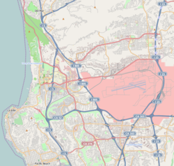
La Jolla Village, San Diego
Location within Northwestern San Diego
Coordinates: 32°51′49″N117°14′03″W / 32.863611°N 117.234167°W / 32.863611; -117.234167 Coordinates: 32°51′49″N117°14′03″W / 32.863611°N 117.234167°W / 32.863611; -117.234167
Country Flag of the United States.svg  United States of America
State Flag of California.svg  California
County Flag of San Diego County, California.png San Diego
City Flag of San Diego, California.svg San Diego
Area
[1]
  Total1.65 km2 (0.638 sq mi)
Population
  Total5,783
  Density3,500/km2 (9,100/sq mi)
ZIP Code
92037
Area code(s) 858

La Jolla Village is a mixed residential/business neighborhood in the coastal San Diego community of La Jolla. La Jolla Village Square and The Shops at La Jolla Village are in the center of the neighborhood and contain a variety of stores, restaurants, apartments, a post office and two movie theaters.

San Diego City in California, United States

San Diego is a city in the U.S. state of California. It is in San Diego County, on the coast of the Pacific Ocean in Southern California, approximately 120 miles (190 km) south of Los Angeles and immediately adjacent to the border with Mexico.

La Jolla Community of San Diego in California, United States

La Jolla is a hilly, seaside community within the city of San Diego, California, occupying 7 miles (11 km) of curving coastline along the Pacific Ocean within the northern city limits. The population reported in the 2010 census was 46,781.

La Jolla Village Square is a retail power center with a collection of mostly big box retailers that, before 1992, was an enclosed upscale regional mall with department store anchors and an adjacent "convenience center" portion. It is located in La Jolla Village, San Diego just south of UC San Diego (UCSD) and about one mile west of Westfield UTC, with which it used to compete as an upscale regional mall. It is across the street from "The Shops at La Jolla Village", whose tenants include Whole Foods Market, Nordstrom Rack, and CVS Pharmacy.

Contents

Geography

La Jolla Village is bordered by I-5 and University City to the east; Gilman Drive and La Jolla Heights to the west and south and La Jolla Village Drive, UCSD and Torrey Pines to the north. [4] [5]

Interstate 5 (I-5) is a major north–south route of the Interstate Highway System in the United States, stretching from the Mexican border at the San Ysidro crossing to the Canadian border near Blaine, Washington. From San Ysidro, the segment of I-5 in California runs north across the length of the state, and crosses into Oregon south of the Medford-Ashland metropolitan area. It is the more important and most-used of the two major north–south routes on the Pacific Coast, the other being U.S. Route 101 (US 101), which is primarily coastal.

University of California, San Diego Public university in La Jolla, California, United States

The University of California, San Diego is a public research university located in the La Jolla neighborhood of San Diego, California, in the United States. The university occupies 2,141 acres (866 ha) near the coast of the Pacific Ocean, with the main campus resting on approximately 1,152 acres (466 ha). Established in 1960 near the pre-existing Scripps Institution of Oceanography, UC San Diego is the seventh-oldest of the 10 University of California campuses and offers over 200 undergraduate and graduate degree programs, enrolling approximately 30,000 undergraduate and 8,500 graduate students.

Torrey Pines, San Diego human settlement in San Diego, California, United States of America

Torrey Pines is a primarily residential community of 2,600 acres (1,100 ha) in the northern coastal area of San Diego, California.

Demographics

As of the Census of 2010, there were 5,783 people living in 3,283 households in La Jolla Village. The population density was 9,064 people per square mile. The racial makeup of La Jolla Village was 69.03% White, 22.10% Asian, 1.68% African American, 0.07% American Indian and Alaska Native, 0.03% Native Hawaiian and Pacific Islander, 2.80% from other races and 4.29% from two or more races. Hispanic or Latino of any race were 9.99%. [2] [3]

2010 United States Census 23rd national census of the United States, taken in 2010

The 2010 United States Census is the twenty-third and most recent United States national census. National Census Day, the reference day used for the census, was April 1, 2010. The census was taken via mail-in citizen self-reporting, with enumerators serving to spot-check randomly selected neighborhoods and communities. As part of a drive to increase the count's accuracy, 635,000 temporary enumerators were hired. The population of the United States was counted as 308,745,538, a 9.7% increase from the 2000 Census. This was the first census in which all states recorded a population of over half a million, as well as the first in which all 100 largest cities recorded populations of over 200,000.

Native Americans in the United States Indigenous peoples of the United States (except Hawaii)

Native Americans, also known as American Indians, Indigenous Americans and other terms, are the indigenous peoples of the United States, except Hawaii. More than 570 federally recognized tribes live within the US, about half of which are associated with Indian reservations. The term "American Indian" excludes Native Hawaiians and some Alaska Natives, while "Native Americans" are American Indians, plus Alaska Natives of all ethnicities. The US Census does not include Native Hawaiians or Chamorro, instead being included in the Census grouping of "Native Hawaiian and other Pacific Islander".

Alaska Natives indigenous peoples of Alaska

Alaska Natives are indigenous peoples of Alaska, United States and include: Iñupiat, Yupik, Aleut, Eyak, Tlingit, Haida, Tsimshian, and a number of Northern Athabaskan cultures. They are often defined by their language groups. Many Alaska Natives are enrolled in federally recognized Alaska Native tribal entities, who in turn belong to 13 Alaska Native Regional Corporations, who administer land and financial claims.

Education

La Jolla Village is served by Torrey Pines Elementary School (K-5) in La Jolla Heights, Muirlands Middle School (6-8) in the Muirlands, La Jolla High School (9-12) in the Beach-Barber Tract and University City High School (9-12) in University City.

La Jolla High School

La Jolla High School (LJHS) is a comprehensive high school for grades 9–12 located in La Jolla, California, a community within the city limits of San Diego. Opened in 1922, La Jolla High School (LJHS) is San Diego Unified School District's second oldest campus. The site encompasses 12 acres with 14 permanent buildings. LJHS, one of the 16 high schools in the district, is located in La Jolla, a community of about 41,000 within the city limits of San Diego. The high school is surrounded by residential housing and private and public entities including the University of California, San Diego, Salk Institute, Scripps Institution of Oceanography, Scripps Health, Scripps Research Institute, and retail, financial and professional services, and located south of downtown La Jolla. Modernization of the school has been funded through Proposition MM, The Foundation of La Jolla High School, the ongoing efforts of the PTA, and other community partnerships.

University City High School (San Diego)

University City High School (UCHS) is a comprehensive four-year public high school located in the University City section of San Diego, California, United States. It is part of the San Diego Unified School District. The school opened in September 1981. The school was ranked 222nd in 2008 and 297th in 2009 on Newsweek's list of Best U.S. Public High Schools. In 2013, The Washington Post ranked the school as the 602nd most challenging high school in America.

The neighborhood is also adjacent to the University of California, San Diego campus.

Transportation

La Jolla Village is served by the I-5 and SR-52 freeways, several MTS bus routes and the Rose Canyon Bike Path. A planned Mid-Coast Trolley station will be located on Nobel Drive on the west side of the I-5 when the Mid-Coast Trolley Extension is complete in 2021.

State Route 52 (SR 52) is a state highway in San Diego County, California, that extends from La Jolla Parkway at Interstate 5 (I-5) in La Jolla, San Diego, to SR 67 in Santee. It is a freeway for its entire length and serves as a major east–west route through the northern part of the city of San Diego. The road connects the major north–south freeways of the county, including I-5, I-805, SR 163, I-15, SR 125, and SR 67. SR 52 passes north of the Rose Canyon Fault before traversing Marine Corps Air Station Miramar. East of Santo Road and west of SR 125, the highway goes through Mission Trails Regional Park, a large open preserve. SR 52 is also known as the Soledad Freeway and the San Clemente Canyon Freeway.

San Diego Metropolitan Transit System Public transit operator in San Diego, California

The San Diego Metropolitan Transit System is the public transit service provider for Central, South, Northeast and Southeast San Diego County, in the United States. MTS operating subsidiaries include the San Diego Trolley, Incorporated (SDTI), and San Diego Transit Corporation (SDTC). Average daily ridership among all public transit services provided by MTS was 271,500 in the Fourth Quarter of 2017.

Recreation

Related Research Articles

Del Mar, California City in California, United States

Del Mar is a beach city in San Diego County, California, incorporated on July 15, 1959. Del Mar is Spanish for "of the sea" or "by the sea," which reflects its location on the coast of the Pacific Ocean. The Del Mar Horse Races are hosted on the Del Mar racetrack every summer. In 1885, Colonel Jacob Taylor purchased 338 acres (1.37 km2) from Enoch Talbert, with visions of building a seaside resort for the rich and famous. The United States Navy operated a Naval Auxiliary Air Facility for blimps at Del Mar during World War II. The population was estimated at 4,311 in 2014, up from 4,161 at the 2010 census.

Torrey Pines State Natural Reserve

Torrey Pines State Natural Reserve is 2,000 acres of coastal state park located in the community of La Jolla, in San Diego, California, off North Torrey Pines Road. Although it is located within San Diego city limits, it remains one of the wildest stretches of land (8 km²) on the Southern California coast. It is bordered immediately on the south by Torrey Pines Municipal Golf Course and on the north by the city of Del Mar. The reserve was designated a National Natural Landmark in 1977.

Blacks Beach beach

Black's Beach is a secluded section of beach beneath the bluffs of Torrey Pines on the Pacific Ocean in La Jolla, San Diego, California, United States. It is officially part of Torrey Pines State Beach. The northern portion of Black's Beach is owned and managed by the California Department of Parks and Recreation, while the southern portion of the beach, officially known as Torrey Pines City Beach, is jointly owned by the city of San Diego and the state park, but is managed by the city of San Diego. This distinction is important as Black’s Beach is most known as a nude beach, a practice that is now prohibited in the southern portion managed by the city of San Diego.

Carmel Valley, San Diego Community of San Diego in California

Carmel Valley is an affluent suburban planned community in the north-western corner of San Diego, California, United States. The community is composed of commercial offices, residential units, hotels, and retail stores and restaurants. This is not to be confused with Carmel Valley Village, an unincorporated community in Monterey County, California.

University Heights, San Diego Community of San Diego in California

University Heights is a neighborhood in Central San Diego, California centered on Park Boulevard and Adams Avenue. According to the City of San Diego Assessor/Recorder/County Clerk parcel maps, University Heights is bounded on the west and north by the edge of the mesa, the southern boundary is Lincoln Avenue, and the eastern boundary is Boundary Street along the western edge of Interstate 805. The area is filled with a number of restaurants, coffee shops, boutiques, and artist studios primarily on Park Boulevard and Adams Avenue. Live entertainment can be found most nights. Adjacent to Hillcrest, Normal Heights and North Park, additional restaurants, bars, coffee shops, and night clubs are within easy reach.

University City, San Diego Community of San Diego in California

University City (UC) is a community in San Diego, California, located in the northwestern portion of the city next to the University of California, San Diego. University City is bordered by La Jolla and Interstate 5 to the west, Miramar and Interstate 805 to the east, and North Clairemont and Highway 52 to the south, giving the community a triangular-shaped boundary. University City is a part of District 1, which is represented by Councilmember Barbara Bry on the San Diego City Council.

Torrey Hills, San Diego Community of San Diego in California

Torrey Hills is a community of 784 acres (317 ha) located in northern San Diego, California, United States. Torrey Hills is a part of District 1 which is represented by Councilmember Barbara Bry on the San Diego City Council.

<i>Dudleya brevifolia</i> subspecies of plant

Dudleya brevifolia, is a rare succulent plant known by the common name short-leaved liveforever or short-leaved dudleya. It was formerly a subspecies of Dudleya blochmaniae.

Torrey Pines Gliderport

The Torrey Pines Gliderport is a city-owned private-use glider airport located in the La Jolla neighborhood of San Diego, California, 11 nautical miles (20 km) northwest of the city's central business district.

Sherri Lightner American politician

Sherri Schuler Lightner is a San Diego, California politician and community activist. She was the councilmember for San Diego City Council District 1, elected to a four-year term in November 2008 and re-elected in November 2012. She is a Democrat, although council positions are officially nonpartisan per California state law. She and her husband live in La Jolla Shores.

Del Mar Heights, San Diego human settlement in San Diego, California, United States of America

Del Mar Heights is an upscale, wealthy neighborhood near the coast in San Diego, California bordered by Solana Beach to the north, North City and Carmel Valley to the east, Del Mar to the west, and Torrey Pines to the south. I-5 forms the eastern boundary. It is noted for its hills.

San Diego County, California County in California, United States

San Diego County, officially the County of San Diego, is a county in the southwestern corner of the state of California, in the United States. As of the 2010 census, the population was 3,095,313. making it California's second-most populous county and the fifth-most populous in the United States. Its county seat is San Diego, the eighth-most populous city in the United States. It is the southwesternmost county in the 48 contiguous United States.

2004 San Diego City Council election

The 2004 San Diego City Council election occurred on November 2, 2004. The primary election was held on March 2, 2004. Four of the eight seats of the San Diego City Council were contested. This election used the boundaries created by the 2000 Redistricting Committee for the odd-numbered districts. All four incumbent council members ran for reelection in their respective districts.

The Scripps Formation is a geologic formation in coastal San Diego County, California.

Guy L. Fleming was an American naturalist whose conservation work led to the founding of Torrey Pines State Natural Reserve, now a 2000-acre protected coastal area of La Jolla, San Diego. The Torrey pine, Pinus torreyana, is the rarest pine species in the United States.

2016 San Diego City Council election

The 2016 San Diego City Council election occurred on Tuesday, November 8, 2016. The primary election was held on Tuesday, June 7, 2016. Five of the nine seats were contested. Two incumbents ran for reelection.

Safdie Rabines Architects is an American architecture, interiors and urban design firm based in San Diego, California. The firm works in public and private sectors on projects of varying contexts and scales, including municipal; academic; bridges and infrastructure; single and multifamily/mixed-use residential; and large urban master plans.

References