Liberty, Grant County, Wisconsin

Last updated

Liberty, Wisconsin
Liberty Town Hall.jpg
Liberty Town Hall in Stitzer
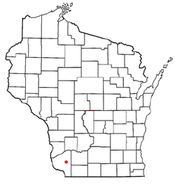
WIMap-doton-Liberty.png
Location of Liberty, Wisconsin
Coordinates: 42°53′38″N90°36′32″W / 42.89389°N 90.60889°W / 42.89389; -90.60889
Country Flag of the United States.svg  United States
State Flag of Wisconsin.svg  Wisconsin
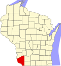
County Grant
Area
  Total36.5 sq mi (94.5 km2)
  Land36.5 sq mi (94.5 km2)
  Water0.0 sq mi (0.0 km2)
Elevation
[1]
945 ft (288 m)
Population
 (2000)
  Total552
  Density15.1/sq mi (5.8/km2)
Time zone UTC-6 (Central (CST))
  Summer (DST) UTC-5 (CDT)
Area code 608
FIPS code 55-43825 [2]
GNIS feature ID1583550 [1]

Liberty is a town in Grant County, Wisconsin, United States. The population was 552 at the 2000 census. The unincorporated community of Stitzer, Wisconsin is in the town. The town was named from the American ideal of liberty. [3]

Contents

Geography

According to the United States Census Bureau, the town has a total area of 36.5 square miles (94.5 km2), all of it land.

Demographics

As of the census [2] of 2000, there were 552 people, 189 households, and 147 families living in the town. The population density was 15.1 people per square mile (5.8/km2). There were 204 housing units at an average density of 5.6 per square mile (2.2/km2). The racial makeup of the town was 99.28% White, 0.54% African American, 0.18% from other races. Hispanic or Latino of any race were 1.09% of the population.

There were 189 households, out of which 41.3% had children under the age of 18 living with them, 69.8% were married couples living together, 4.2% had a female householder with no husband present, and 22.2% were non-families. 19.6% of all households were made up of individuals, and 7.9% had someone living alone who was 65 years of age or older. The average household size was 2.92 and the average family size was 3.37.

In the town, the population was spread out, with 32.8% under the age of 18, 6.5% from 18 to 24, 28.3% from 25 to 44, 22.6% from 45 to 64, and 9.8% who were 65 years of age or older. The median age was 34 years. For every 100 females, there were 111.5 males. For every 100 females age 18 and over, there were 105.0 males.

The median income for a household in the town was $37,000, and the median income for a family was $44,688. Males had a median income of $23,068 versus $23,750 for females. The per capita income for the town was $15,560. About 12.1% of families and 16.3% of the population were below the poverty line, including 20.2% of those under age 18 and 13.7% of those age 65 or over.

Related Research Articles

<span class="mw-page-title-main">Taylor, Alabama</span> Town in Alabama, United States

Taylor is a town in Geneva and Houston counties in the U.S. state of Alabama. Taylor was first settled in the 1870s, named after an early family that helped secure the first post office. It was not incorporated until almost a century later in June 1967. It is part of the Dothan, Alabama Metropolitan Statistical Area. At the 2010 census the population was 2,375, up from 1,898 in 2000.

<span class="mw-page-title-main">New Chicago, Indiana</span> Town in Indiana, United States

New Chicago is a town in Hobart Township, Lake County, Indiana, United States. The population was 2,035 at the 2010 census.

<span class="mw-page-title-main">Whiting, Iowa</span> City in Iowa, United States

Whiting is a city in Monona County, Iowa, United States. The population was 745 at the time of the 2020 census.

<span class="mw-page-title-main">Chapman, Maine</span> Town in the state of Maine, United States

Chapman is a town in Aroostook County, Maine, United States. The population was 491 at the 2020 census.

<span class="mw-page-title-main">Loch Lynn Heights, Maryland</span> Town in Maryland, United States

Loch Lynn Heights is a town in Garrett County, Maryland, United States. The population was 493 at the 2020 census.

<span class="mw-page-title-main">Winside, Nebraska</span> Village in Wayne County, Nebraska, United States

Winside is a village in Wayne County, Nebraska, United States. The population was 381 at the 2020 census.

<span class="mw-page-title-main">Wingate, North Carolina</span> Town in North Carolina, United States

Wingate is a town in Union County, North Carolina, United States. The population was 3,491 at the 2010 census.

<span class="mw-page-title-main">Mingo Junction, Ohio</span> Village in Ohio, United States

Mingo Junction is a village in eastern Jefferson County, Ohio, United States, along the Ohio River. The population was 3,347 at the 2020 census. It is part of the Weirton–Steubenville metropolitan area.

<span class="mw-page-title-main">Clark, South Dakota</span> City in South Dakota, United States

Clark is a city in and county seat of Clark County, South Dakota, United States. The population was 1,148 at the 2020 census.

<span class="mw-page-title-main">Fairburn, South Dakota</span> Town in South Dakota, United States

Fairburn is a town in Custer County, South Dakota, United States. The population was 60 at the 2020 census.

<span class="mw-page-title-main">Sand Fork, West Virginia</span> Town in West Virginia, United States

Sand Fork is a town in Gilmer County, West Virginia, United States. The population was 182 at the 2020 census. It is located along the Little Kanawha River, at the mouth of the Sand Fork.

<span class="mw-page-title-main">West Liberty, West Virginia</span> Town in West Virginia, United States

West Liberty is a town in Ohio County, West Virginia, United States. The population was 1,557 at the 2020 census. It is part of the Wheeling metropolitan area.

<span class="mw-page-title-main">Boyd, Wisconsin</span> Village in Wisconsin, United States

Boyd is an autonomous village in the town of Delmar, Chippewa County, Wisconsin, United States. The population was 552 at the 2010 census.

<span class="mw-page-title-main">Liberty Grove, Wisconsin</span> Town in Wisconsin, United States

Liberty Grove is a town in Door County, Wisconsin, United States. The population was 2,096 at the 2020 census. The unincorporated communities of Ellison Bay, Gills Rock, North Bay, Northport, and Rowleys Bay are in the town.

<span class="mw-page-title-main">Grover, Marinette County, Wisconsin</span> Town in Wisconsin, United States

Grover is a town in Marinette County, Wisconsin, United States. The population was 1,768 at the 2010 census.

<span class="mw-page-title-main">Liberty, Outagamie County, Wisconsin</span> Town in Wisconsin, United States

There are three other towns called 'Liberty' in Wisconsin. See Liberty, Wisconsin

<span class="mw-page-title-main">Whitewater (town), Wisconsin</span>

Whitewater is a town in Walworth County, Wisconsin, United States. The population was 1,433 at the 2020 census.

<span class="mw-page-title-main">James Town, Wyoming</span> CDP in Wyoming, United States

James Town is a census-designated place (CDP) in Sweetwater County, Wyoming, United States. The population was 536 at the 2010 census.

<span class="mw-page-title-main">Reynolds, North Dakota</span> City in North Dakota, United States

Reynolds is a city in Grand Forks and Traill counties in the State of North Dakota. It is part of the Grand Forks, ND-MN Metropolitan Statistical Area or "Greater Grand Forks". The population was 277 at the 2020 census. Reynolds, named for pioneer settler Dr. Henry Reynolds, was founded in 1881.

<span class="mw-page-title-main">Deerfield (town), Dane County, Wisconsin</span> Town in Wisconsin, USA

Deerfield is a town in Dane County, Wisconsin, United States. The population was 1,470 at the 2000 census. The City of Deerfield is located within the town. The unincorporated communities of London and Old Deerfield are located in the town.

References

  1. 1 2 "US Board on Geographic Names". United States Geological Survey. October 25, 2007. Retrieved January 31, 2008.
  2. 1 2 "U.S. Census website". United States Census Bureau . Retrieved January 31, 2008.
  3. Chicago and North Western Railway Company (1908). A History of the Origin of the Place Names Connected with the Chicago & North Western and Chicago, St. Paul, Minneapolis & Omaha Railways. p. 94.