List of United Kingdom locations: Wha-Whitc

Last updated

The United Kingdom Uk-map.svg
The United Kingdom

This is part of the list of United Kingdom locations: a gazetteer of place names in the United Kingdom showing each place's locality and geographical coordinates.

Contents

Wha

LocationLocality Coordinates
(links to map & photo sources)
OS grid
reference
Whaddon Cambridgeshire 52°05′N0°02′W / 52.09°N 00.03°W / 52.09; -00.03 TL3546
Whaddon Cheltenham 51°54′15″N2°03′23″W / 51.9043°N 2.0565°W / 51.9043; -2.0565 SO9622
Whaddon Buckinghamshire 51°59′N0°50′W / 51.99°N 00.83°W / 51.99; -00.83 SP8034
Whaddon Gloucestershire 51°49′18″N2°14′36″W / 51.8218°N 2.2432°W / 51.8218; -2.2432 SO8313
Whaddon (Salisbury)Wiltshire 51°02′N1°44′W / 51.03°N 01.73°W / 51.03; -01.73 SU1926
Whaddon (Trowbridge)Wiltshire 51°20′N2°11′W / 51.34°N 02.18°W / 51.34; -02.18 ST8761
Whaddon Gap Cambridgeshire 52°05′N0°02′W / 52.09°N 00.04°W / 52.09; -00.04 TL3446
Whale Cumbria 54°35′N2°44′W / 54.58°N 02.74°W / 54.58; -02.74 NY5221
Whaley Derbyshire 53°14′N1°14′W / 53.23°N 01.23°W / 53.23; -01.23 SK5171
Whaley Bridge Derbyshire 53°19′N1°59′W / 53.32°N 01.98°W / 53.32; -01.98 SK0181
Whaley Thorns Derbyshire 53°14′N1°12′W / 53.23°N 01.20°W / 53.23; -01.20 SK5371
Whalley Lancashire 53°49′N2°25′W / 53.82°N 02.41°W / 53.82; -02.41 SD7336
Whalley Banks Lancashire 53°49′N2°25′W / 53.81°N 02.41°W / 53.81; -02.41 SD7335
Whalley Range Manchester 53°26′N2°16′W / 53.44°N 02.27°W / 53.44; -02.27 SJ8294
Whalleys Lancashire 53°34′N2°47′W / 53.56°N 02.78°W / 53.56; -02.78 SD4808
Whalsay Shetland Islands 60°21′N0°59′W / 60.35°N 00.98°W / 60.35; -00.98 HU562635
Whalton Northumberland 55°07′N1°47′W / 55.12°N 01.79°W / 55.12; -01.79 NZ1381
Whaplode Lincolnshire 52°47′N0°02′W / 52.79°N 00.04°W / 52.79; -00.04 TF3224
Whaplode Drove Lincolnshire 52°41′N0°04′W / 52.69°N 00.06°W / 52.69; -00.06 TF3113
Wharf Warwickshire 52°10′N1°22′W / 52.17°N 01.37°W / 52.17; -01.37 SP4353
Wharfe North Yorkshire 54°07′N2°20′W / 54.11°N 02.33°W / 54.11; -02.33 SD7869
Wharles Lancashire 53°48′N2°51′W / 53.80°N 02.85°W / 53.80; -02.85 SD4435
Wharley End Milton Keynes 52°04′N0°38′W / 52.06°N 00.64°W / 52.06; -00.64 SP9342
Wharmley Northumberland 54°59′N2°11′W / 54.98°N 02.18°W / 54.98; -02.18 NY8866
Wharncliffe Side Sheffield 53°26′N1°34′W / 53.44°N 01.56°W / 53.44; -01.56 SK2994
Wharram le Street North Yorkshire 54°05′N0°41′W / 54.08°N 00.68°W / 54.08; -00.68 SE8666
Wharram Percy North Yorkshire 54°04′N0°42′W / 54.06°N 00.70°W / 54.06; -00.70 SE8564
Wharton Herefordshire 52°11′N2°44′W / 52.19°N 02.73°W / 52.19; -02.73 SO5055
Wharton Lincolnshire 53°25′N0°44′W / 53.42°N 00.73°W / 53.42; -00.73 SK8493
Wharton Cheshire 53°11′N2°31′W / 53.19°N 02.51°W / 53.19; -02.51 SJ6666
Wharton Green Cheshire 53°11′N2°31′W / 53.19°N 02.51°W / 53.19; -02.51 SJ6667
Whashton North Yorkshire 54°26′N1°46′W / 54.44°N 01.77°W / 54.44; -01.77 NZ1506
Whassett Cumbria 54°13′N2°46′W / 54.22°N 02.76°W / 54.22; -02.76 SD5081
Whatcote Warwickshire 52°05′N1°34′W / 52.09°N 01.57°W / 52.09; -01.57 SP2944
Whateley Warwickshire 52°35′N1°40′W / 52.58°N 01.67°W / 52.58; -01.67 SP2299
Whatfield Suffolk 52°04′N0°56′E / 52.07°N 00.94°E / 52.07; 00.94 TM0246
Whatley Mendip, Somerset 51°13′N2°23′W / 51.22°N 02.38°W / 51.22; -02.38 ST7347
Whatley South Somerset 50°51′N2°55′W / 50.85°N 02.91°W / 50.85; -02.91 ST3606
Whatlington East Sussex 50°56′N0°29′E / 50.93°N 00.48°E / 50.93; 00.48 TQ7518
Whatmore Shropshire 52°20′N2°34′W / 52.33°N 02.57°W / 52.33; -02.57 SO6171
Whatsole Street Kent 51°09′N1°01′E / 51.15°N 01.01°E / 51.15; 01.01 TR1144
Whatstandwell Derbyshire 53°05′N1°30′W / 53.08°N 01.50°W / 53.08; -01.50 SK3354
Whatton (Whatton-in-the-Vale)Nottinghamshire 52°56′N0°54′W / 52.94°N 00.90°W / 52.94; -00.90 SK7439
Whauphill Dumfries and Galloway 54°49′N4°29′W / 54.81°N 04.49°W / 54.81; -04.49 NX4049
Whaw North Yorkshire 54°26′N2°02′W / 54.43°N 02.03°W / 54.43; -02.03 NY9804

Whe

LocationLocality Coordinates
(links to map & photo sources)
OS grid
reference
Wheal Alfred Cornwall 50°10′N5°24′W / 50.17°N 05.40°W / 50.17; -05.40 SW5736
Wheal Baddon Cornwall 50°14′N5°07′W / 50.23°N 05.12°W / 50.23; -05.12 SW7742
Wheal Busy Cornwall 50°15′N5°10′W / 50.25°N 05.17°W / 50.25; -05.17 SW7444
Wheal Frances Cornwall 50°19′N5°07′W / 50.32°N 05.12°W / 50.32; -05.12 SW7852
Wheal Kitty Cornwall 50°19′N5°12′W / 50.31°N 05.20°W / 50.31; -05.20 SW7251
Wheal Rose Cornwall 50°15′N5°13′W / 50.25°N 05.21°W / 50.25; -05.21 SW7144
Wheatacre Norfolk 52°28′N1°37′E / 52.47°N 01.62°E / 52.47; 01.62 TM4693
Wheatcroft Derbyshire 53°06′N1°28′W / 53.10°N 01.47°W / 53.10; -01.47 SK3557
Wheatenhurst Gloucestershire 51°46′N2°20′W / 51.77°N 02.34°W / 51.77; -02.34 SO7608
Wheathall Shropshire 52°37′N2°45′W / 52.62°N 02.75°W / 52.62; -02.75 SJ4903
Wheathampstead Hertfordshire 51°49′N0°18′W / 51.81°N 00.30°W / 51.81; -00.30 TL1714
Wheathill Somerset 51°04′N2°36′W / 51.06°N 02.60°W / 51.06; -02.60 ST5830
Wheathill Shropshire 52°26′N2°34′W / 52.43°N 02.56°W / 52.43; -02.56 SO6282
Wheat Hold Hampshire 51°20′N1°13′W / 51.33°N 01.21°W / 51.33; -01.21 SU5560
Wheatley Hampshire 51°09′N0°53′W / 51.15°N 00.88°W / 51.15; -00.88 SU7840
Wheatley Oxfordshire 51°44′N1°08′W / 51.74°N 01.14°W / 51.74; -01.14 SP5905
Wheatley Calderdale 53°44′N1°53′W / 53.73°N 01.89°W / 53.73; -01.89 SE0726
Wheatley Doncaster 53°31′N1°07′W / 53.52°N 01.12°W / 53.52; -01.12 SE5804
Wheatley Hill Durham 54°44′N1°25′W / 54.73°N 01.42°W / 54.73; -01.42 NZ3738
Wheatley Hills Doncaster 53°31′N1°05′W / 53.52°N 01.09°W / 53.52; -01.09 SE6004
Wheatley Lane Lancashire 53°50′N2°15′W / 53.83°N 02.25°W / 53.83; -02.25 SD8338
Wheatley Park Doncaster 53°32′N1°07′W / 53.53°N 01.11°W / 53.53; -01.11 SE5905
Wheaton Aston Staffordshire 52°42′N2°13′W / 52.70°N 02.22°W / 52.70; -02.22 SJ8512
Wheddon Cross Somerset 51°08′N3°32′W / 51.13°N 03.54°W / 51.13; -03.54 SS9238
Wheelbarrow Town Kent 51°10′N1°04′E / 51.16°N 01.07°E / 51.16; 01.07 TR1545
Wheeler End Buckinghamshire 51°38′N0°50′W / 51.63°N 00.84°W / 51.63; -00.84 SU8093
Wheelerstreet Surrey 51°09′N0°39′W / 51.15°N 00.65°W / 51.15; -00.65 SU9440
Wheelock Cheshire 53°07′N2°23′W / 53.12°N 02.39°W / 53.12; -02.39 SJ7459
Wheelock Heath Cheshire 53°06′N2°22′W / 53.10°N 02.37°W / 53.10; -02.37 SJ7557
Wheelton Lancashire 53°41′N2°36′W / 53.68°N 02.60°W / 53.68; -02.60 SD6021
Wheldale Wakefield 53°43′N1°19′W / 53.72°N 01.31°W / 53.72; -01.31 SE4526
Wheldrake York 53°53′N0°58′W / 53.89°N 00.96°W / 53.89; -00.96 SE6845
Whelford Gloucestershire 51°41′N1°46′W / 51.68°N 01.76°W / 51.68; -01.76 SU1698
Whelley Wigan 53°32′N2°37′W / 53.54°N 02.62°W / 53.54; -02.62 SD5906
Whelpley Hill Buckinghamshire 51°43′N0°34′W / 51.72°N 00.56°W / 51.72; -00.56 SP9904
Whelpo Cumbria 54°44′N3°05′W / 54.74°N 03.08°W / 54.74; -03.08 NY3039
Whelp Street Suffolk 52°06′N0°50′E / 52.10°N 00.83°E / 52.10; 00.83 TL9449
Whelston Flintshire 53°16′N3°11′W / 53.27°N 03.18°W / 53.27; -03.18 SJ2176
Whempstead Hertfordshire 51°52′N0°05′W / 51.86°N 00.09°W / 51.86; -00.09 TL3120
Whenby North Yorkshire 54°07′N1°02′W / 54.11°N 01.03°W / 54.11; -01.03 SE6369
Whepstead Suffolk 52°11′N0°40′E / 52.19°N 00.67°E / 52.19; 00.67 TL8358
Wherry Town Cornwall 50°06′N5°33′W / 50.10°N 05.55°W / 50.10; -05.55 SW4629
Wherstead Suffolk 52°01′N1°08′E / 52.01°N 01.13°E / 52.01; 01.13 TM1540
Wherwell Hampshire 51°09′N1°27′W / 51.15°N 01.45°W / 51.15; -01.45 SU3840
Wheston Derbyshire 53°17′N1°48′W / 53.28°N 01.80°W / 53.28; -01.80 SK1376
Whetley Cross Dorset 50°50′N2°47′W / 50.83°N 02.78°W / 50.83; -02.78 ST4504
Whetsted Kent 51°11′N0°21′E / 51.18°N 00.35°E / 51.18; 00.35 TQ6545
Whetstone Leicestershire 52°34′N1°11′W / 52.56°N 01.18°W / 52.56; -01.18 SP5597
Whetstone Barnet 51°37′N0°11′W / 51.62°N 00.18°W / 51.62; -00.18 TQ2693
Whettleton Shropshire 52°26′N2°49′W / 52.43°N 02.82°W / 52.43; -02.82 SO4482

Whi-Whitc

LocationLocality Coordinates
(links to map & photo sources)
OS grid
reference
Whicham Cumbria 54°13′N3°20′W / 54.22°N 03.33°W / 54.22; -03.33 SD1382
Whichford Warwickshire 52°00′N1°32′W / 52.00°N 01.54°W / 52.00; -01.54 SP3134
Whickham Gateshead 54°56′N1°41′W / 54.93°N 01.68°W / 54.93; -01.68 NZ2060
Whiddon Devon 51°07′N4°04′W / 51.12°N 04.07°W / 51.12; -04.07 SS5538
Whiddon Down Devon 50°43′N3°52′W / 50.71°N 03.87°W / 50.71; -03.87 SX6892
Whifflet North Lanarkshire 55°51′N4°02′W / 55.85°N 04.03°W / 55.85; -04.03 NS7364
Whigstreet Angus 56°35′N2°50′W / 56.58°N 02.84°W / 56.58; -02.84 NO4844
Whilton Northamptonshire 52°16′N1°04′W / 52.27°N 01.07°W / 52.27; -01.07 SP6364
Whilton Locks Northamptonshire 52°16′N1°06′W / 52.27°N 01.10°W / 52.27; -01.10 SP6164
Whimble Devon 50°47′N4°21′W / 50.79°N 04.35°W / 50.79; -04.35 SS3402
Whimple Devon 50°46′N3°22′W / 50.76°N 03.36°W / 50.76; -03.36 SY0497
Whimpwell Green Norfolk 52°48′N1°32′E / 52.80°N 01.53°E / 52.80; 01.53 TG3829
Whinfield Darlington 54°32′N1°31′W / 54.54°N 01.52°W / 54.54; -01.52 NZ3117
Whinhall North Lanarkshire 55°52′N3°59′W / 55.86°N 03.99°W / 55.86; -03.99 NS7565
Whin Lane End Lancashire 53°52′N2°55′W / 53.86°N 02.92°W / 53.86; -02.92 SD3941
Whinmoor Leeds 53°49′N1°27′W / 53.81°N 01.45°W / 53.81; -01.45 SE3636
Whinney Hill Darlington 54°34′N1°25′W / 54.56°N 01.41°W / 54.56; -01.41 NZ3819
Whinney Hill Rotherham 53°26′N1°19′W / 53.44°N 01.32°W / 53.44; -01.32 SK4594
Whinnieliggate Dumfries and Galloway 54°50′N4°01′W / 54.84°N 04.01°W / 54.84; -04.01 NX7152
Whinnyfold Aberdeenshire 57°23′N1°53′W / 57.38°N 01.88°W / 57.38; -01.88 NK0733
Whinny Heights Lancashire 53°43′N2°28′W / 53.72°N 02.47°W / 53.72; -02.47 SD6926
Whins of Milton Stirling 56°05′N3°56′W / 56.08°N 03.94°W / 56.08; -03.94 NS7990
Whins Wood Bradford 53°50′N1°55′W / 53.83°N 01.92°W / 53.83; -01.92 SE0538
Whipcott Devon 50°57′N3°19′W / 50.95°N 03.32°W / 50.95; -03.32 ST0718
Whippendell Botton Hertfordshire 51°42′N0°29′W / 51.70°N 00.48°W / 51.70; -00.48 TL0502
Whippingham Isle of Wight 50°44′N1°16′W / 50.73°N 01.27°W / 50.73; -01.27 SZ5193
Whipsiderry Cornwall 50°25′N5°03′W / 50.42°N 05.05°W / 50.42; -05.05 SW8363
Whipsnade Bedfordshire 51°51′N0°32′W / 51.85°N 00.54°W / 51.85; -00.54 TL0018
Whipton Devon 50°43′N3°30′W / 50.72°N 03.50°W / 50.72; -03.50 SX9493
Whirley Grove Cheshire 53°16′N2°11′W / 53.27°N 02.18°W / 53.27; -02.18 SJ8875
Whirlow Sheffield 53°20′N1°32′W / 53.33°N 01.53°W / 53.33; -01.53 SK3182
Whirlow Brook Sheffield 53°20′N1°32′W / 53.33°N 01.53°W / 53.33; -01.53 SK3182
Whisby Lincolnshire 53°11′N0°39′W / 53.19°N 00.65°W / 53.19; -00.65 SK9067
Whissendine Rutland 52°43′N0°47′W / 52.71°N 00.78°W / 52.71; -00.78 SK8214
Whissonsett Norfolk 52°46′N0°50′E / 52.77°N 00.83°E / 52.77; 00.83 TF9123
Whisterfield Cheshire 53°14′N2°16′W / 53.23°N 02.27°W / 53.23; -02.27 SJ8271
Whistlefield Dunbartonshire 56°05′36″N4°50′13″W / 56.0933°N 4.8369°W / 56.0933; -4.8369 NS236926
Whistlefield Argyll and Bute 56°05′N4°50′W / 56.08°N 04.84°W / 56.08; -04.84 NS2392
Whistley Green Berkshire 51°27′N0°52′W / 51.45°N 00.86°W / 51.45; -00.86 SU7974
Whistlow Oxfordshire 51°55′N1°20′W / 51.92°N 01.34°W / 51.92; -01.34 SP4525
Whiston Knowsley 53°25′N2°47′W / 53.41°N 02.79°W / 53.41; -02.79 SJ4791
Whiston Northamptonshire 52°14′N0°46′W / 52.23°N 00.77°W / 52.23; -00.77 SP8460
Whiston Rotherham 53°24′N1°19′W / 53.40°N 01.32°W / 53.40; -01.32 SK4590
Whiston (Staffordshire Moorlands)Staffordshire 53°01′N1°57′W / 53.02°N 01.95°W / 53.02; -01.95 SK0347
Whiston (South Staffordshire)Staffordshire 52°43′N2°10′W / 52.72°N 02.16°W / 52.72; -02.16 SJ8914
Whiston Cross Knowsley 53°25′N2°49′W / 53.41°N 02.81°W / 53.41; -02.81 SJ4691
Whiston Cross Shropshire 52°37′N2°19′W / 52.62°N 02.31°W / 52.62; -02.31 SJ7903
Whitacre Heath Warwickshire 52°31′N1°41′W / 52.52°N 01.69°W / 52.52; -01.69 SP2192
Whitbeck Cumbria 54°14′N3°22′W / 54.24°N 03.36°W / 54.24; -03.36 SD1184
Whitbourne Herefordshire 52°12′N2°25′W / 52.20°N 02.41°W / 52.20; -02.41 SO7256
Whitbourne Moor Wiltshire 51°12′N2°15′W / 51.20°N 02.25°W / 51.20; -02.25 ST8245
Whitburn South Tyneside 54°57′N1°22′W / 54.95°N 01.37°W / 54.95; -01.37 NZ4062
Whitburn West Lothian 55°51′N3°41′W / 55.85°N 03.69°W / 55.85; -03.69 NS9464
Whitburn Colliery South Tyneside 54°58′N1°22′W / 54.96°N 01.37°W / 54.96; -01.37 NZ4063
Whitby North Yorkshire 54°28′N0°37′W / 54.47°N 00.62°W / 54.47; -00.62 NZ8910
Whitby Cheshire 53°16′N2°55′W / 53.26°N 02.91°W / 53.26; -02.91 SJ3975
Whitbyheath Cheshire 53°15′N2°55′W / 53.25°N 02.91°W / 53.25; -02.91 SJ3974
Whitchurch (Bristol)Bath and North East Somerset 51°24′N2°34′W / 51.40°N 02.56°W / 51.40; -02.56 ST6167
Whitchurch Buckinghamshire 51°52′N0°50′W / 51.87°N 00.83°W / 51.87; -00.83 SP8020
Whitchurch Cardiff 51°30′N3°14′W / 51.50°N 03.24°W / 51.50; -03.24 ST1479
Whitchurch Devon 50°32′N4°08′W / 50.53°N 04.13°W / 50.53; -04.13 SX4973
Whitchurch Hampshire 51°13′N1°20′W / 51.22°N 01.34°W / 51.22; -01.34 SU4648
Whitchurch Herefordshire 51°50′N2°40′W / 51.84°N 02.66°W / 51.84; -02.66 SO5417
Whitchurch Pembrokeshire 51°53′N5°11′W / 51.88°N 05.19°W / 51.88; -05.19 SM8025
Whitchurch Shropshire 52°58′N2°41′W / 52.96°N 02.68°W / 52.96; -02.68 SJ5441
Whitchurch (Henstridge)Somerset 50°58′N2°24′W / 50.97°N 02.40°W / 50.97; -02.40 ST7220
Whitchurch Canonicorum Dorset 50°45′N2°52′W / 50.75°N 02.86°W / 50.75; -02.86 SY3995
Whitchurch Hill Oxfordshire 51°30′N1°04′W / 51.50°N 01.07°W / 51.50; -01.07 SU6479
Whitchurch-on-Thames Oxfordshire 51°29′N1°05′W / 51.48°N 01.09°W / 51.48; -01.09 SU6377
Whitcombe Somerset 51°00′N2°31′W / 51.00°N 02.52°W / 51.00; -02.52 ST6323
Whitcombe Dorset 50°41′N2°25′W / 50.69°N 02.41°W / 50.69; -02.41 SY7188
Whitcot Shropshire 52°31′N2°55′W / 52.51°N 02.92°W / 52.51; -02.92 SO3791
Whitcott Keysett Shropshire 52°26′N3°04′W / 52.43°N 03.07°W / 52.43; -03.07 SO2782

Related Research Articles

Britain most often refers to:

<span class="mw-page-title-main">Parliament of the United Kingdom</span> Supreme legislative body of the United Kingdom

The Parliament of the United Kingdom of Great Britain and Northern Ireland is the supreme legislative body of the United Kingdom, and may also legislate for the Crown Dependencies and the British Overseas Territories. It meets at the Palace of Westminster in London. Parliament possesses legislative supremacy and thereby holds ultimate power over all other political bodies in the United Kingdom and the Overseas Territories. While Parliament is bicameral, it has three parts: the sovereign, the House of Lords, and the House of Commons. The three parts acting together to legislate may be described as the King-in-Parliament. The Crown normally acts on the advice of the prime minister, and the powers of the House of Lords are limited to only delaying legislation.

<span class="mw-page-title-main">Primary school</span> School for children

A primary school, elementary school, or grade school is a school for primary education of children who are 4 to 10 years of age. Primary schooling follows preschool and precedes secondary schooling.
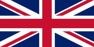
<span class="mw-page-title-main">United Kingdom</span> Island country in Northwestern Europe

The United Kingdom of Great Britain and Northern Ireland, commonly known as the United Kingdom (UK) or Britain, is a country in Northwestern Europe, off the coast of the continental mainland. It comprises England, Scotland, Wales, and Northern Ireland. The UK includes the island of Great Britain, the north-eastern part of the island of Ireland, and most of the smaller islands within the British Isles, making up a total area of 94,354 square miles (244,376 km2). Northern Ireland shares a land border with the Republic of Ireland; otherwise, the United Kingdom is surrounded by the Atlantic Ocean, the North Sea, the English Channel, the Celtic Sea, and the Irish Sea. The United Kingdom had an estimated population of over 68.2 million people in 2023. The capital and largest city of both England and the United Kingdom is London, whose wider metropolitan area is the largest in Western Europe, with a population of 14.9 million. The cities of Edinburgh, Cardiff, and Belfast are the national capitals of Scotland, Wales, and Northern Ireland, respectively.

The Peerage of Ireland consists of those titles of nobility created by the English monarchs in their capacity as Lord or King of Ireland, or later by monarchs of the United Kingdom of Great Britain and Ireland. It is one of the five divisions of Peerages in the United Kingdom. The creation of such titles came to an end in the 19th century. The ranks of the Irish peerage are duke, marquess, earl, viscount and baron. As of 2016, there were 135 titles in the Peerage of Ireland extant: two dukedoms, ten marquessates, 43 earldoms, 28 viscountcies, and 52 baronies. However, these titles have no official recognition in Ireland, with Article 40.2 of the Constitution of Ireland forbidding the state conferring titles of nobility and stating that an Irish citizen may not accept titles of nobility or honour except with the prior approval of the Irish government.
<span class="mw-page-title-main">Kingdom of England</span> Kingdom in northwestern Europe (until 1707)

The Kingdom of England was a sovereign state on the island of Great Britain from the early tenth century, when it was unified from various Anglo-Saxon kingdoms, until 1 May 1707, when it united with Scotland to form the Kingdom of Great Britain, which would later become the United Kingdom. The Kingdom of England was among the most powerful states in Europe during the medieval and early modern periods.

<span class="mw-page-title-main">December 1910 United Kingdom general election</span>

The December 1910 United Kingdom general election was held from 3 to 19 December. It was the last general election to be held over several days and the last to be held before the First World War.
<span class="mw-page-title-main">2004 European Parliament election in the United Kingdom</span> Election

The 2004 European Parliament election was the United Kingdom's part of the wider 2004 European Parliament election which was held between 10 and 13 June 2004 in the 25 member states of the European Union. The United Kingdom's part of this election was held on Thursday 10 June 2004. The election also coincided with the 2004 local elections and the London Assembly and mayoral elections. In total, 78 Members of the European Parliament were elected from the United Kingdom using proportional representation.

<span class="mw-page-title-main">Lists of places in Wales</span>

These are lists of places in Wales.

<span class="mw-page-title-main">Member of Parliament (United Kingdom)</span> Representative in the House of Commons

In the United Kingdom, a member of Parliament (MP) is an individual elected to serve in the House of Commons, the lower house of the Parliament of the United Kingdom.
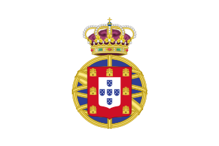
<span class="mw-page-title-main">United Kingdom of Portugal, Brazil and the Algarves</span> Pluricontinental monarchy

The United Kingdom of Portugal, Brazil and the Algarves was a pluricontinental monarchy formed by the elevation of the Portuguese colony named State of Brazil to the status of a kingdom and by the simultaneous union of that Kingdom of Brazil with the Kingdom of Portugal and the Kingdom of the Algarves, constituting a single state consisting of three kingdoms.

<span class="mw-page-title-main">UFC 38</span> UFC mixed martial arts event in 2002

UFC 38: Brawl at the Hall was a mixed martial arts event held by the Ultimate Fighting Championship. It took place at the Royal Albert Hall in London, United Kingdom, on July 13, 2002. The event was seen live on pay-per-view in the United States, and was later released on home video.

<span class="mw-page-title-main">Unitary authorities of England</span> Local government in some parts of England

The unitary authorities of England are a type of local authority responsible for all local government services in an area. They combine the functions of a non-metropolitan county council and a non-metropolitan district council, which elsewhere in England provide two tiers of local government.

<span class="mw-page-title-main">Kingdom of Portugal</span> Kingdom in Southwestern Europe (1139–1910)

The Kingdom of Portugal was a monarchy in the western Iberian Peninsula and the predecessor of the modern Portuguese Republic. Existing to various extents between 1139 and 1910, it was also known as the Kingdom of Portugal and the Algarves after 1415, and as the United Kingdom of Portugal, Brazil and the Algarves between 1815 and 1822. The name is also often applied to the Portuguese Empire, the realm's overseas colonies.

<span class="mw-page-title-main">United Kingdom in the Eurovision Song Contest</span>

The United Kingdom has participated in the Eurovision Song Contest 66 times. Its first participation was at the second contest, in 1957, and it has entered every year since 1959. The British participant broadcaster in the contest is the British Broadcasting Corporation (BBC). The country has won the contest five times: in 1967, with "Puppet on a String" performed by Sandie Shaw; in 1969, with "Boom Bang-a-Bang" by Lulu ; in 1976, with "Save Your Kisses for Me" by Brotherhood of Man; in 1981, with "Making Your Mind Up" by Bucks Fizz; and in 1997, with "Love Shine a Light" by Katrina and the Waves. The UK has also achieved a record sixteen second-place finishes, the first in 1959 and the most recent in 2022.

<span class="mw-page-title-main">Countries of the United Kingdom</span> Component parts of the UK since 1922

Since 1922, the United Kingdom has been made up of four countries: England, Scotland, Wales and Northern Ireland. The UK Prime Minister's website has used the phrase "countries within a country" to describe the United Kingdom.