This article has multiple issues. Please help improve it or discuss these issues on the talk page . (Learn how and when to remove these template messages)
|
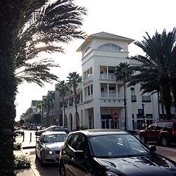
The following towns, neighborhoods, and developments are examples of New Urbanism .
Shawnee County is located in northeast Kansas, in the central United States. Its county seat and most populous city is Topeka, the state capital. As of the 2020 census, the population was 178,909, making it the third-most populous county in Kansas. The county was one of the original 33 counties created by the first territorial legislature in 1855, and it was named for the Shawnee tribe.
Lake in the Hills is a village in McHenry County, Illinois, United States. As of the 2020 census, the population was 28,982.
Hillsboro is a rural town in Loudoun County, Virginia, United States. The population was 114 at the 2020 census.
Pleasant Prairie is a village in the U.S. state of Wisconsin. Located in Kenosha County along the southwestern shoreline of Lake Michigan, Pleasant Prairie was home to 21,250 people at the 2020 census. The village is positioned directly south of the city of Kenosha and directly north of the Illinois border.
Little Italy is the catch-all name for an ethnic enclave populated primarily by Italians or people of Italian ancestry, usually in an urban neighborhood. The concept of "Little Italy" holds many different aspects of the Italian culture. There are shops selling Italian goods as well as Italian restaurants lining the streets. A "Little Italy" strives essentially to have a version of the country of Italy placed in the middle of a large non-Italian city. This sort of enclave is often the result of periods of Italian immigration, during which people of the same culture settled or were ostracized and segregated together in certain areas. As cities modernized and grew, these areas became known for their ethnic associations, and ethnic neighborhoods like "Little Italy" blossomed, becoming the areas they are today.
The Kansas City metropolitan area is a bi-state metropolitan area anchored by Kansas City, Missouri. Its 14 counties straddle the border between the U.S. states of Missouri and Kansas. With 8,472 square miles (21,940 km2) and a population of more than 2.2 million people, it is the second-largest metropolitan area centered in Missouri and is the largest metropolitan area in Kansas, though Wichita is the largest metropolitan area centered in Kansas. Alongside Kansas City, Missouri, these are the suburbs with populations above 100,000: Overland Park, Kansas; Kansas City, Kansas; Olathe, Kansas; Independence, Missouri; and Lee's Summit, Missouri.
The Millionaires' Mile, Millionaires' Row, Billionaires Row, Golden Mile or Alpha Street are the exclusive residential neighborhoods of various cities, often along one scenic strip such as a riverside or hilltop drive, or a wide city boulevard.
Lake Highlands is a neighborhood constituting most of Northeast Dallas. The neighborhood is a collection of dozens of subdivisions served by Richardson ISD and Dallas ISD public schools, as well as an array of private schools.
This is a list of official neighborhoods in Louisville, Kentucky. Like many older American cities, Louisville has well-defined neighborhoods, many with well over a century of history as a neighborhood.
The list of neighborhoods of Kansas City, Missouri has nearly 240 neighborhoods. The list includes only Kansas City, Missouri and not the entire Kansas City metropolitan area, such as Kansas City, Kansas.
Short Hill Mountain is a mountain ridge of the Blue Ridge Mountains in northwest Loudoun County, Virginia.
There are more than 500 neighborhoods within the area of Jacksonville, Florida, the largest city in the contiguous United States by area. These include Downtown Jacksonville and surrounding neighborhoods. Additionally, greater Jacksonville is traditionally divided into several major sections with amorphous boundaries: Northside, Westside, Southside, and Arlington, as well as the Jacksonville Beaches.
Virginia State Route 9 is a primary state highway in the U.S. state of Virginia. Known as Charles Town Pike, the state highway runs 13.08 miles (21.05 km) from the West Virginia state line near Mechanicsville, where the highway continues west as West Virginia Route 9, east to SR 7 and SR 7 Business in Paeonian Springs. SR 9 is the main east–west highway of northwestern Loudoun County, connecting Leesburg with Hillsboro and the West Virginia cities of Charles Town and Martinsburg. As a result, the state highway and its West Virginia continuation are a major, overburdened commuter route between the Eastern Panhandle of West Virginia and Washington, D.C.