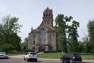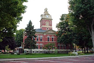
LaGrange County is a county located in the U.S. state of Indiana. As of 2010, the population was 37,128. The county seat is LaGrange, Indiana.

Scouting in Indiana has a long history, from the 1910s to the present day, serving thousands of youth in programs that suit the environment in which they live.

Michiana is a region in northern Indiana and southwestern Michigan centered on the city of South Bend, Indiana. The Chamber of Commerce of St. Joseph County, Indiana defines Michiana as St. Joseph County and "counties that contribute at least 500 inbound commuting workers to St. Joseph County daily." Those counties include Elkhart, La Porte, Marshall, St. Joseph, and Starke in Indiana, and Berrien and Cass in Michigan. As of the 2010 census, the population of those seven counties was 856,377.

The U.S. District Court for the Northern District of Indiana was created in 1928 by an act of Congress that split Indiana into two separate districts, northern and southern. As part of the act, the Northern District was divided into three divisions, South Bend, Fort Wayne, and Hammond. Appeals from this court are taken to the United States Court of Appeals for the Seventh Circuit. The court has eight judges and four magistrate judges.
The first United States Attorney to serve while Indiana was still a territory was Elijah Sparks in 1813. His successor, William Hendricks, witnessed Indiana's admission to the Union as the 19th state in 1816. On April 21, 1928, the federal district for the State of Indiana was divided into the Northern and Southern Judicial Districts, resulting in the creation of the Office of the United States Attorney for the Northern District of Indiana. The Northern District of Indiana consists of the northern 32 counties of the State of Indiana. The district has three staffed offices in Hammond, South Bend and Fort Wayne. By contrast, the State of Indiana has 92 prosecuting attorneys located in each county seat.

Northern Indiana is a region of the U.S. State of Indiana, including 26 counties which border the states of Illinois, Michigan, and Ohio. Northern Indiana is also considered part of the Great Lakes Megalopolis. The area is generally classified into other sub-regions; Northwest Indiana is closely tied with Chicago economically, culturally, and politically and is part of the Chicago metropolitan area. The north central region centers on South Bend metropolitan area, with economic connections to southwest Michigan. Northeast Indiana is centered on the Fort Wayne metropolitan area.

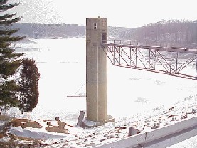
State Road 5 (SR 5) is a north–south state road in the US state of Indiana. Its southern terminus is at SR 22 in Upland, and the northern terminus is at SR 120 just north of Shipshewana. The state road runs for just over 96 miles (154 km), passing through five counties in northern Indiana, mostly through rural farm fields and small towns. The largest city along its path is Huntington. It is entirely a surface highway that is very rural outside of the towns. SR 5 runs along two dams the first being J. Edward Roush Lake Dam and the second being the Wilmot Dam.
Washington Township is the name of forty-six townships in Indiana:

The Kankakee Outwash Plain is a flat plain interspersed with sand dunes in the Kankakee River valley in northwestern Indiana and northeastern Illinois of the United States. It is just south of the Valparaiso Moraine and was formed during the Wisconsin Glaciation. As the glacier, stopped at the Valparaiso Moraine, melted, the meltwater was carried away to the outwash plain. On the south side of the moraine, where the elevation drops, the meltwaters eroded away valleys, carrying sand and mud with them. As the muddy meltwater reached the valley where the slope lessened, the water slowed down, depositing the sand on the outwash plain. This created a smooth, flat, and sandy plain. Before its draining, the Kankakee Marsh, located on the outwash plain, was one of the largest freshwater marshes in the United States.
The South Bend–Mishawaka Metropolitan Statistical Area, sometimes referred to as Michiana, as defined by the United States Census Bureau, is an area consisting of two counties – one in northern Indiana and one in southwest Michigan (Cass), anchored by the cities of South Bend and Mishawaka in Indiana. As of the 2010 census, the MSA had a population of 319,224.

The Northeast Corner Conference is an twelve-member Indiana High School Athletic Association (IHSAA)-sanctioned conference based in Northeast Indiana. Its schools are located within DeKalb, Elkhart, LaGrange, Noble, Steuben, and Whitley counties.
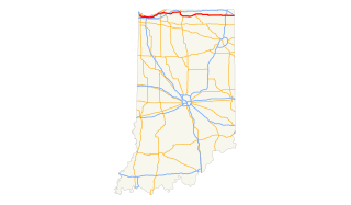
U.S. Route 20 (US 20) in Indiana is a main east–west highway that is parallel to the Indiana Toll Road. The western terminus of US 20 is at the Illinois state line and the eastern terminus is at the Ohio state line. US 20 through Whiting, East Chicago, and Gary is concurrent with US 12 twice. The route varies between one-way, two-lane, and four-lane streets, in northwestern Indiana. From the east side of Gary to west of South Bend, US 20 is a four-lane undivided highway. The route then heads around the west and south sides of South Bend and Elkhart as a four-lane limited access divided highway. East of State Road 15 (IN-15), US 20 is two-lane rural highway.
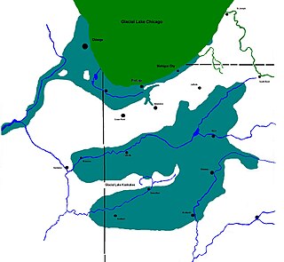
Lake Kankakee formed 14,000 years before present (YBP) in the valley of the Kankakee River. It developed from the outwash of the Michigan Lobe, Saginaw Lobe, and the Huron-Erie Lobe of the Wisconsin glaciation. These three ice sheets formed a basin across Northwestern Indiana. It was a time when the glaciers were receding, but had stopped for a thousand years in these locations. The lake drained about 13,000 YBP, until reaching the level of the Momence Ledge. The outcropping of limestone created an artificial base level, holding water throughout the upper basin, creating the Grand Kankakee Marsh.
The Indiana Department of Natural Resources Law Enforcement Division is the law enforcement division of the Indiana Department of Natural Resources, the fish and game regulatory agency of Indiana. The department has jurisdiction anywhere in the state and in state territorial waters. The division headquarters is located in Indianapolis and operates 10 law enforcement districts in the state. The Law Enforcement Division employs 214 conservation officers. Indiana conservation officers not only enforce state laws, but teach outdoor education courses, conduct river rescue, cave rescue, underwater search and recovery, and have K-9 teams.


