Loch Indaal

Last updated

Lochindaalmap.jpg
Loch Indaal Lighthouse
Rubh'an Duin
Rubh an Duin - geograph.org.uk - 1225.jpg
The lighthouse just outside Port Charlotte on Islay.
Loch Indaal
Location Port Charlotte
Islay
Argyll and Bute
Scotland
United Kingdom
Coordinates 55°44′41″N6°22′20″W / 55.744760°N 6.372223°W / 55.744760; -6.372223
Tower
Constructed1869
Constructionbrick tower
Height13 metres (43 ft)
Shapectlindrical tower with balcony and lantern
Markingswhite tower, black lantern, ochre trim
Power sourcemains electricity  OOjs UI icon edit-ltr-progressive.svg
OperatorNorthern Lighthouse Board
Light
Focal height15 metres (49 ft)
Range11 nmi (20 km; 13 mi) (white), 8 nmi (15 km; 9.2 mi) (red)  OOjs UI icon edit-ltr-progressive.svg
Characteristic Fl(2) WR 7s.

Loch Indaal (or Lochindaal) is a sea loch on Islay, the southernmost island of the Hebrides, off the west coast of Scotland. Together with Loch Gruinart to the north, it was formed by the Loch Gruinart Fault, [1] which branches off the Great Glen Fault.

Contents

Along the northwestern coast are the villages of Bruichladdich and Port Charlotte. Along its northeastern shore is the tiny village of Bridgend and on its southeastern shore is the island capital of Bowmore.

At night the lights of the villages along the three sides of the loch inspired the well-known folk song "The Lights of Lochindaal" by Iain Simpson. [2]

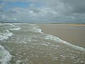
South of Bowmore the entire coastline is a six-mile-long sandy beach stretching to Kintra. This beach, known as the Big Strand, is very popular with holidaymakers and locals alike in the summer.

Waters

Loch Indaal slopes gently from its NE corner down to its opening into the Atlantic. [3] At the mouth of the loch, which lies between Portnahaven to the north and the American Monument on The Oa to the south, the depth is around 40 metres, rising steadily upwards towards the northeast and reaching a depth of barely 10 metres between Laggan Point and Port Charlotte.

The waters of the loch are calm and safe but the approaches are hazardous especially for small vessels. There are tidal streams, eddies, races and heavy overfalls both in the east and west flowing streams of the tide.

The Big Strand and Laggan Bay

The eastern shore of the loch is taken up by the six mile length of the Big Strand, the area as a whole being known as Laggan Bay. The Big Strand itself is sandy along its whole length being broken by a rocky outcrop roughly half way along its length at Glenegedale Airport.

In the north the Big Strand is accessible by car along a stretch of unmade road leading from Island farm, on a road signed off the A846 south of Bowmore. The river Laggan empties into the ocean near the northern point of the beach. In the south the Big Strand is accessible from Kintra Farm on the Oa.

Glenegedale Airport has two runways, although one is not in use. The approach from to the northwest runway takes aircraft over Lochindaal at very low altitude giving excellent views of Laggan Bay.

See also

Related Research Articles

<span class="mw-page-title-main">Argyll and Bute</span> Council area of Scotland

Argyll and Bute is one of 32 unitary council areas in Scotland and a lieutenancy area. The current lord-lieutenant for Argyll and Bute is Jane Margaret MacLeod. The administrative centre for the council area is in Lochgilphead at Kilmory Castle, a 19th-century Gothic Revival building and estate. The current council leader is Robin Currie, a councillor for Kintyre and the Islands.

<span class="mw-page-title-main">Islay single malts</span> Scotch whisky distilled on Islay, Scotland

Islay single malts are the single malt Scotch whiskies made on Islay or Ìle in Gaelic, one of the southernmost of the Inner Hebridean Islands located off the west coast of Scotland. Islay is one of five whisky distilling localities and regions in Scotland whose identity is protected by law.

<span class="mw-page-title-main">Argyll</span> Historic county in Scotland

Argyll, sometimes called Argyllshire, is a historic county and registration county of western Scotland.

<span class="mw-page-title-main">Island Davaar</span> Tidal island off the east coast of Kintyre, Scotland

Island Davaar or Davaar Island is located at the mouth of Campbeltown Loch off the east coast of Kintyre, in Argyll and Bute, Scotland. It is a tidal island, linked to the mainland by a natural shingle causeway called the Doìrlinn near Campbeltown at low tide. The crossing can be made in around 40 minutes.

<span class="mw-page-title-main">Thames Estuary</span> Estuary in which the River Thames meets the waters of the North Sea

The Thames Estuary is where the River Thames meets the waters of the North Sea, in the south-east of Great Britain.

<span class="mw-page-title-main">Bowmore</span> Human settlement in Scotland

Bowmore is a small town on the Scottish island of Islay. It serves as administrative capital of the island, and gives its name to the noted Bowmore distillery producing Bowmore single malt scotch whisky.

<span class="mw-page-title-main">Port Charlotte, Islay</span> Human settlement in Scotland

Port Charlotte is a village on the island of Islay in the Inner Hebrides, Scotland. It was founded in 1828. In 1991 it had a population of 350.

<span class="mw-page-title-main">Tail of the Bank</span>

The Tail of the Bank is the name given to the anchorage in the upper Firth of Clyde immediately North of Greenock, between Inverclyde and Argyll and Bute. This area of the Firth gets its name from the deep water immediately to the west of the sandbank which marks the entrance to the navigable channel up the Estuary of the River Clyde.

<span class="mw-page-title-main">Gasparilla Island Lights</span> Lighthouses on Gasparilla Island, Boca Grande, Florida, U.S.

The Gasparilla Island Lights are on Gasparilla Island in Boca Grande, Florida. The Port Boca Grande Lighthouse is on the southern tip of Gasparilla Island, and marked the Boca Grande Pass entrance to Charlotte Harbor.

<span class="mw-page-title-main">Tralee Bay</span> Bay in County Kerry, Ireland

Tralee Bay is located in on the west coast of County Kerry, Ireland. It is situated between Kerry Head on the north side and the Maharees on the west and extends eastwards as far as the bridge at Blennerville. Several small rivers feed into the bay through the town of Tralee. Villages around the bay include; Ballyheigue, Fenit, Kilfinora, Spa, Blennerville, Camp and Castlegregory.

Kilchoman is a small settlement and large parish on the Scottish island of Islay, within the unitary council of Argyll and Bute.

<span class="mw-page-title-main">Nave Island</span>

Nave Island lies to the north of Islay in the Inner Hebrides near the mouth of Loch Gruinart. It is uninhabited.

Islay is the southernmost island of the Inner Hebrides of Scotland. Known as "The Queen of the Hebrides", it lies in Argyll just south west of Jura and around 40 kilometres north of the Northern Irish coast. The island's capital is Bowmore where the distinctive round Kilarrow Parish Church and a distillery are located. Port Ellen is the main port.

<span class="mw-page-title-main">Caledonian Maritime Assets</span>

Caledonian Maritime Assets Limited owns the ferries, ports, harbours and infrastructure for the ferry services serving the west coast of Scotland, the Firth of Clyde and the Northern Isles.

<span class="mw-page-title-main">Kyle of Durness</span> Bay in Highland, Scotland, UK

Kyle of Durness is a coastal inlet on the north coast of Scotland in the county of Sutherland. It extends 5+12 miles inland from Balnakeil and divides the Cape Wrath peninsula from the mainland. The nearest village is Durness.

<span class="mw-page-title-main">Haulbowline Lighthouse</span> Lighthouse in County Down, Northern Ireland

The Haulbowline Lighthouse is an active 19th century lighthouse. Described as an "elegant, tapering stone tower" it is located at the entrance to Carlingford Lough, near Cranfield Point in County Down, Northern Ireland. The lighthouse was built on the eastern part of the Haulbowline rocks, one of a number of navigation hazards at the seaward end of Carlingford Lough, which include a notable rocky shoal or bar across the mouth of the lough. The multi-purpose light was designed to help mark the rocks and, when first built, the depth of water over the bar, as well as acting as a landfall light for ships entering from the Irish Sea. Associated with the lighthouse are the leading lights at Green Island and Vidal Bank which mark the safe channel along Carlingford Lough, with Haulbowline displaying a reserve light in case of problems with these leading lights.

Loch Buie is a sea loch on the south coast of the Isle of Mull, off the west coast of Scotland. It takes the form of a deep bay opening onto the Firth of Lorn. At the head of the loch is the settlement of Lochbuie at the end of a minor road form the A849 at Ardura. There are a handful of small islands and rocky islets close to shore, the largest of which is Eilean Mor which is connected to the mainland of Mull at low tide. Nearby is Moy Castle. There are extensive shore platforms around the loch, notably on its southeastern side beneath Laggan Deer Forest. Numerous caves are located at the rear of this platform including Uaimh nan Taillearan. Sandy beaches lie at the head of the loch. The cliffs at either side are formed from basalt lava flows of Palaeogene age, intruded by numerous dolerite dykes. At the head of the loch, the rocks include granophyres and gabbro. Though unseen at the surface, the Great Glen Fault is usually considered to run beneath this loch and nearby Loch Spelve.

MV Loch Indaal is a roll-on/roll-off vehicle and passenger ferry being constructed for use by Caledonian MacBrayne on routes on the west coast of Scotland. She is the second of four ferries being built at Cemre Shipyard in Turkey for Caledonian Maritime Assets Limited, and is expected to be delivered in 2024 for service on routes linking Islay with Kennacraig on the mainland. She is named for the sea loch of Loch Indaal, which lies on the west coast of Islay. The loch is well known as the inspiration for the folk song "The Lights of Lochindaal" by Iain Simpson.

References

  1. Roberts, AM & Holdsworth, RE (1999). "Linking onshore and offshore structures" (PDF). Journal of the Geological Society. 156 (6): 1061–64. doi:10.1144/gsjgs.156.6.1061. S2CID   130517950 . Retrieved 22 December 2007.
  2. Iain Simpson. "Lights of Lochindaal" . Retrieved 22 December 2007.
  3. Admiralty Chart 2168 Approaches to the Sound of Jura available from Admiralty on line catalogue

55°45′N6°21′W / 55.750°N 6.350°W / 55.750; -6.350