
Begusarai is the administrative headquarters of Begusarai district, which is one of the thirty-eight districts of the Indian state of Bihar. The district lies on the northern bank of river Ganga. It is located between latitudes 25.15N & 25.45N and longitudes 85.45E & 86.36E. It was established in 1870.

Chhatrapur is a town and a Notified Area Council in Ganjam district in the state of Odisha, India. It is the district headquarters town of Ganjam district. Chhatrapur is a Tehsil / Block (CD) in the Ganjam District of Odisha. According to Census 2011 information the sub-district code of Chhatrapur block is 03085. Total area of Chhatrapur is 124 km2 (48 sq mi) including 119.92 km2 (46.30 sq mi) rural area and 4.40 km2 (1.70 sq mi) urban area. Chhatrapur has a population of 94,683 people. There are 20,415 houses in the sub-district. There are about 46 villages in Chhatrapur block.

Bah is a city in Agra district of Uttar Pradesh in India.

Jaspur is a developing town and a municipal board in Udham Singh Nagar district in the Indian state of Uttarakhand.

Kaladhungi is a town and a nagar panchayat in Nainital district in the Indian state of Uttarakhand.
Kuchinda is a town and a notified area council in Sambalpur district in the Indian state of Odisha. It is located about 80 kilometres from the district headquarters of Sambalpur and about 48 km away from Jharsuguda. Kuchinda is famous for its "dushera." Kuchinda is more famous for the Gudguda waterfall. Most of the people of Kuchinda sub-division depends on farming. Kuchinda is more of a tribal area.

Namagiripettai is a panchayat town in Namakkal district in the Indian state of Tamil Nadu.

Dangoh Khurd or Pirthipur is a small village in Una District of Himachal Pradesh, India. Khurd and Kalan Persian language word which means small and Big respectively when two villages have same name then it is distinguished as Kalan means Big and Khurd means Small with Village Name.

For Sampagaon Taluka, see Bailhongal.

Kailashahar is a city located in the Indian state of Tripura & a Municipal council in Unakoti district. Located near the Bangladesh border it is also the headquarter of Unakoti district.
Karnah is an administrative tehsil of the Kupwara district in Jammu and Kashmir, India. It has 42 village and is 78 kilometres (48 mi) away from the main town of Kupwara.

Nadihal is a village located in the north of the Indian union territory of Jammu and Kashmir. It is just 4 km away from Bandipora town, and 51 km away from Srinagar. It the largest village in Bandipora district. There are many small villages around it. It is a prosperous and modern village with a population of 5167. Nadihal is inhabited by only Muslims. In this village, there are two government middle schools, one higher secondary school, and two high schools. Besides Government-run schools, there are a few private schools and a Public Institute Popularly known as Radiant Public Secondary School as well in this village. The level of education in Nadihal is moderate but has significantly increased in recent times.

Wapauwe Old Mosque is a historic mosque in Kaitetu village, a village in the Wawane Mountains on the north part of cape Keitetu, Maluku, Indonesia. Established in 1414, it is the oldest mosque in the Moluccas and possibly the oldest mosque in Indonesia which has been maintained in its original state.

Loma is a village in the Jandaha block of Vaishali district in the Indian state of Bihar. It is located more than 30 km from the nearest city of Hajipur.
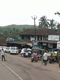
Mulleria is a small town located in Karadka Panchayath, Kasaragod district in Kerala, India.

Umayanaloor is a village near Mayyanad in the Kollam District, Kerala, located near the western coast of the southern tip of India.
Bhagwa or Bhagwah is a Tehsil in Doda district of the Indian union territory of Jammu and Kashmir. The town is located 14 kilometres from the district headquarters Doda.
Pouni is a village and municipality in Reasi district of the Indian union territory of Jammu and Kashmir. The town is located 25 kilometres from the district headquarters Reasi.
Mandi is a village and municipality in Poonch district of the Indian union territory of Jammu and Kashmir. The town is located 20 km (12 mi) from the district headquarters Poonch.
Jamwara is a small village located in Sheikhpura district of Bihar comes under Sheikhpura. The village is surrounded on by three sides by mountains. Jamwara has two madrasas and one government middle school. The polling booth for elections is at Madrasa Jamia Habibiya. Jamwara has a mosque named Jamuara Masjid.


