Milecastle 38

Last updated

Milecastle 38
(The site of) Milecastle 38 - geograph.org.uk - 674778.jpg
The site of Milecastle 38
Northumberland UK location map.svg
Red pog.svg
Location within Northumberland
Type Milecastle
Location
Coordinates 55°00′26″N2°21′25″W / 55.007253°N 2.35684°W / 55.007253; -2.35684
CountyNorthumberland
CountryEngland
Reference
UK-OSNG reference NY77276813

Milecastle 38 (Hotbank) was a milecastle on Hadrian's Wall in the vicinity of Hotbank Farm, (grid reference NY77276813 ). It is notable for the joint inscription bearing the names of the emperor Hadrian and Aulus Platorius Nepos, the governor of Britannia at the time the Wall was built.

Contents

Description

The site of Milecastle 38 is in the vicinity of Hotbank Farm, [1] Little remains of the milecastle except rubble walls outlined by robber trenches. [2]

Excavations

The milecastle was excavated in 1935 and found to be 18 metres (59 ft) east–west by 15 metres (49 ft) north–south. It was found to have a short axis, with a Type I gateway. [2] Pottery finds indicated an occupation of the 4th century. There was a rectangular building in the south-west corner and a causeway, 3.6 metres (12 ft) wide, to the east. [2] A tombstone was found, inscribed "...us.. xit annis... mensibus du...ebus quinque", re-used as a pivot stone in the south gateway. [3]

Inscription

Milecastle 38 is notable for the joint inscription bearing the names of the emperor Hadrian and Aulus Platorius Nepos, the governor of Britannia at the time the Wall was built. [4] The left-hand part was found c. 1715 and the right-hand part was found in 1829. [5]

The stone reads:

IMP CAES TRAIAN
HADRIANI AVG
LEG II AVG
APLATORIONEPOTELEGPRPR

The first two lines identifies the emperor Hadrian, the third the Legion Legio secunda Augusta (Second Augustan Legion) which erected the plaque, and the fourth the governor Aulus Platorius Nepos.

Associated turrets

Hadrian's Wall Path near the site of Turret 38A Walking towards turret 38A - geograph.org.uk - 2888596.jpg
Hadrian's Wall Path near the site of Turret 38A
View over Crag Lough near the site of Turret 38B The Hadrian's Wall Path above Crag Lough - geograph.org.uk - 3501150.jpg
View over Crag Lough near the site of Turret 38B

Each milecastle on Hadrian's Wall had two associated turret structures. These turrets were positioned approximately one-third and two-thirds of a Roman mile to the west of the Milecastle, and would probably have been manned by part of the milecastle's garrison. The turrets associated with Milecastle 38 are known as Turret 38A and Turret 38B.

Turret 38A

Turret 38A (Milking Gap) (grid reference NY76876792 ) was located by exploratory excavation in 1911. [6] There are no visible remains. [6]

Turret 38B

Turret 38B (Highshield Crag) (grid reference NY76396785 ) was also located by exploratory excavation in 1911. [7] The turret is only visible as an earthwork platform. [7]

Public access

The milecastle, and the sites of both turrets, are accessible via the Hadrian's Wall Path.

Related Research Articles

<span class="mw-page-title-main">Milecastle 48</span>

Milecastle 48 (Poltross Burn), is a milecastle on Hadrian's Wall (grid reference NY6340666195). Its remains lie near the village of Gilsland in Cumbria where it was historically known as "The King's Stables", owing to the well-preserved interior walls. Unusually a substantial section of stone stairs has survived within the milecastle. The two turrets associated with this milecastle have also survived as above-ground masonry.

<span class="mw-page-title-main">Milecastle 50</span>

Milecastle 50 (High House) was a milecastle on Hadrian's Wall (grid reference NY60676601).

<span class="mw-page-title-main">Milecastle 51</span>

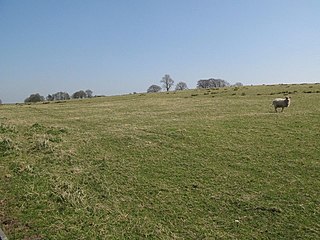
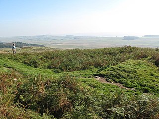
Milecastle 51 (Wall Bowers) was a milecastle on Hadrian's Wall (grid reference NY59306549).

<span class="mw-page-title-main">Milecastle 52</span>

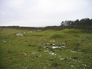
Milecastle 52 (Bankshead) was a milecastle on Hadrian's Wall (grid reference NY57946490).

<span class="mw-page-title-main">Milecastle 53</span>

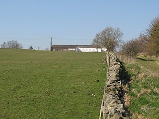
Milecastle 53 (Banks Burn) was a milecastle on Hadrian's Wall (grid reference NY56486460).

<span class="mw-page-title-main">Milecastle 39</span> Small Roman fort, part of Hadrians Wall

Milecastle 39 (Castle Nick) is a milecastle on Hadrian's Wall (grid reference NY76066773).

<span class="mw-page-title-main">Milecastle 13</span>

Milecastle 13 (Rudchester Burn) was a milecastle of the Roman Hadrian's Wall. Its remains exist as a low platform south of the B6318 Military Road.

<span class="mw-page-title-main">Milecastle 22</span>

Milecastle 22 (Portgate) was a milecastle of the Roman Hadrian's Wall. Its remains exist as a low, turf covered platform just east of the Portgate roundabout (junction of the A68 and B6318). The platform is 0.5 metres (1.6 ft) on the east side, reducing to only a parch mark on the west side.

<span class="mw-page-title-main">Milecastle 47</span>

Milecastle 47 (Chapel House) was a milecastle on Hadrian's Wall (grid reference NY64906607).

<span class="mw-page-title-main">Milecastle 24</span>

Milecastle 24 (Wall Fell) was a milecastle of the Roman Hadrian's Wall. Its remains exist as a low platform, and are located to the south of the B6318 Military Road around 3 kilometres (1.9 mi) west of its junction with the A68.

<span class="mw-page-title-main">Milecastle 25</span>

Milecastle 25 (Codlawhill) was a milecastle of the Roman Hadrian's Wall. Its remains exist as a low platform, and are located to the south of the B6318 Military Road (about 1 metre (3.3 ft) high), nearly 5 kilometres (3.1 mi) to the west of its junction with the A68.

<span class="mw-page-title-main">Milecastle 30</span>

Milecastle 30 (Limestone Corner) was a milecastle of the Roman Hadrian's Wall. Its remains exist as an outward-facing scarp with a maximum height of 0.8 metres (2.6 ft). Masonry from the east wall (both faces) remains in situ. The remaining stretch is 3.1 metres (10 ft) in length by 2.25 metres (7.4 ft) thick, and survives to a height of 0.6 metres (2.0 ft). It is located at the western part of Limestone Corner, just off the B6318 Military Road.

<span class="mw-page-title-main">Milecastle 32</span>

Milecastle 32 (Carraw) was a milecastle of the Roman Hadrian's Wall. Its remains exist as earthworks and with no exposed masonry. The layout of the milecastle walls is defined (still quite evident) by robber trenches (to a maximum depth of 0.3 metres (1 ft 0 in). The north wall is beneath a modern wall.

<span class="mw-page-title-main">Milecastle 34</span>

Milecastle 34 (Grindon) was a milecastle of the Roman Hadrian's Wall. There are no visible remains, but the site is within a small, tree-filled, walled enclosure located around 0.5 kilometres (0.31 mi) east of Sewingshields farm.

<span class="mw-page-title-main">Milecastle 44</span>

Milecastle 44 (Allolee) was a milecastle on Hadrian's Wall (grid reference NY68886694).

<span class="mw-page-title-main">Milecastle 37</span>

Milecastle 37 is one of the milecastles on Hadrian's Wall. It is immediately west of the Housesteads Roman Fort.

<span class="mw-page-title-main">Milecastle 35</span>

Milecastle 35 (Sewingshields) is one of the milecastles on Hadrian's Wall (grid reference NY80497018). The remains still exist as exposed masonry.

<span class="mw-page-title-main">Milecastle 41</span>

Milecastle 41 (Melkridge) was a milecastle on Hadrian's Wall (grid reference NY73026705).

<span class="mw-page-title-main">Milecastle 43</span>

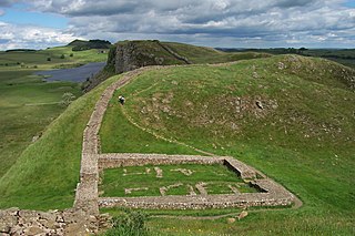
Milecastle 43 (Great Chesters) was a milecastle on Hadrian's Wall (grid reference NY70356684). It was obliterated when the fort at Great Chesters (Aesica) was built.

<span class="mw-page-title-main">Milecastle 50TW</span>

Milecastle 50TW (High House) was a milecastle on the Turf Wall section of Hadrian's Wall (grid reference NY60716583). The milecastle is located close to the Birdoswald Roman Fort and is unique in that it was not replaced by a stone milecastle when the turf wall was upgraded to stone, the replacement wall instead running some 200m to the north. The milecastle was partially demolished by the Romans after it was abandoned. The milecastle was excavated in 1934 and several Roman rubbish pits discovered. The remains of the two turrets associated with this milecastle (which were demolished when the turf wall was abandoned) have also been located. As the turf wall lies some distance from the stone wall, the sites are not accessible from the Hadrian's Wall Path.

References

  1. Nikolaus Pevsner, John Grundy, Grace McCombie, Peter Ryder, Humphrey Welfare, Northumberland, 1992, Yale University Press, 704 pages ISBN   978-0-300-09638-5
  2. 1 2 3 MILECASTLE 38, Pastscape, retrieved 3 December 2013
  3. MONUMENT NO. 1004316, Pastscape, retrieved 3 December 2013
  4. Roger J.A.Wilson "A Guide to the Roman Remains in Britain" 2002 Constable, London ISBN   1-84119-318-6 p467
  5. MONUMENT NO. 15229, Pastscape, retrieved 3 December 2013
  6. 1 2 TURRET 38A, Pastscape, retrieved 3 December 2013
  7. 1 2 TURRET 38B, Pastscape, retrieved 3 December 2013