Milecastle 79

Last updated

Milecastle 79
Bowness Marsh and Bowness Wath - geograph.org.uk - 3492600.jpg
View towards the Solway Firth near the site of Milecastle 79
Cumbria UK location map.svg
Red pog.svg
Location within Cumbria
Type Milecastle
Location
Coordinates 54°56′56″N3°11′40″W / 54.948979°N 3.194427°W / 54.948979; -3.194427 Coordinates: 54°56′56″N3°11′40″W / 54.948979°N 3.194427°W / 54.948979; -3.194427
CountyCumbria
CountryEngland
Reference
UK-OSNG reference NY23596224

Milecastle 79 (Solway House) was one of a series of Milecastles or small fortlets built at intervals of approximately one Roman mile along Hadrian's Wall (grid reference NY23596224 ).

Contents

Description

Milecastle 79 is 350 metres west of Field View Lane, to the west of the village of Port Carlisle. [1] The site is on slightly raised ground, but there is no surface trace of the milecastle. [2]

When the antiquarian William Hutton walked the length of Hadrian's Wall in 1801 this area was the only place west of the city of Carlisle in which he says that he saw Hadrian's Wall. [3] He describes it as "five or six hundred yards long, and three feet high ... in two places it is six feet high, eight broad, and three thick; but has no facing-stones". [3] Hutton encountered a farmer who boasted how he had destroyed parts of the Wall, but Hutton extracted a promise from him not to disturb any remaining parts of the Wall. [3]

Excavations

Excavations of Milecastle 79 were conducted in 1949. [1] It was originally a turf and timber milecastle built for the Turf Wall. [1] It measured 14.9 metres east to west and 12.5 metres north to south internally. [1] The area around the milecastle is subject to flooding, which may explain the 1.5 metre high artificial platform on which the milecastle was built. [2] The milecastle was replaced in the later 2nd century by a stone milecastle which measured 17.7 metres square internally. [1] The gates of the stone milecastle were reduced in size after the initial construction. [1] A timber-framed building stood in the eastern half of the stone milecastle. [1]

This milecastle was excavated again in 1999 as part of the Milecastles Project. [2] The excavations uncovered the remains of both the turf and stone milecastles, and detected the timber building that occupied the east side of the milecastle. [2] The results indicated that the 1949 excavations were largely accurate. [2]

Associated turrets

Each milecastle on Hadrian's Wall had two associated turret structures. These turrets were positioned approximately one-third and two-thirds of a Roman mile to the west of the Milecastle, and would probably have been manned by part of the milecastle's garrison. The turrets associated with Milecastle 79 are known as Turret 79A and Turret 79B.

Turret 79A (grid reference NY23196229 ) has never been located, and its approximate position has been calculated in relation to the known position of neighbouring wall structures. [4] It is thought to be located approximately 400 metres west of Milecastle 79 where the route of Hadrian's Wall changes direction. [1] Hadrian's Wall itself is visible at this location as an irregular bank up to 14 metres wide and up to 1 metre high at the bend. [5]

Turret 79B (Jeffrey Croft) (grid reference NY22836256 ) is situated about 250 metres southeast of the houses at the east end of Bowness-on-Solway in the field known as Jeffrey Croft. [1] Its site is indicated by a very slight platform, visible on the ground. [1] It was partially excavated in 1934. [6] The excavations found the south and west walls of the turret. [6] It was originally built as a free-standing stone tower abutting the Turf Wall. [1] It is the most westerly turret known on Hadrian's Wall. [1]

Related Research Articles

Milecastle 49

Milecastle 49 was a milecastle on Hadrian's Wall.

Milecastle 80

Milecastle 80 was one of a series of Milecastles or small fortlets built at intervals of approximately one Roman mile along Hadrian's Wall.

Milecastle 78

Milecastle 78 (Kirkland) was one of a series of Milecastles or small fortlets built at intervals of approximately one Roman mile along Hadrian's Wall.

Milecastle 76

Milecastle 76 (Drumburgh) was one of a series of Milecastles or small fortlets built at intervals of approximately one Roman mile along Hadrian's Wall.

Milecastle 73

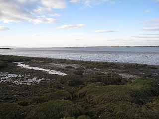
Milecastle 73 (Dykesfield) was one of a series of Milecastles or small fortlets built at intervals of approximately one Roman mile along Hadrian's Wall.

Milecastle 72

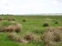
Milecastle 72 was one of a series of Milecastles or small fortlets built at intervals of approximately one Roman mile along Hadrian's Wall.

Milecastle 71

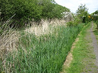
Milecastle 71 (Wormanby) was one of a series of Milecastles or small fortlets built at intervals of approximately one Roman mile along Hadrian's Wall.

Milecastle 42

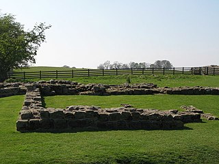
Milecastle 42 (Cawfields) is a milecastle on Hadrian's Wall.

Milecastle 40

Milecastle 40 (Winshields) was a milecastle on Hadrian's Wall.

Milecastle 54

Milecastle 54 (Randylands) was a milecastle on Hadrian's Wall.

Milecastle 55

Milecastle 55 was a milecastle on Hadrian's Wall.

Milecastle 56

Milecastle 56 (Walton) was a milecastle on Hadrian's Wall.

Milecastle 57

Milecastle 57 (Cambeckhill) was a milecastle on Hadrian's Wall.

Milecastle 58

Milecastle 58 (Newtown) was a milecastle on Hadrian's Wall.

Milecastle 59

Milecastle 59 was a milecastle on Hadrian's Wall.

Milecastle 62 was a milecastle on Hadrian's Wall.

Milecastle 64 (Drawdykes) was a milecastle on Hadrian's Wall.

Milecastle 65 (Tarraby) was a milecastle on Hadrian's Wall.

Milecastle 50TW

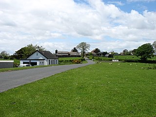
Milecastle 50TW was a milecastle on the Turf Wall section of Hadrian's Wall. The milecastle is located close to the Birdoswald Roman Fort and is unique in that it was not replaced by a stone milecastle when the turf wall was upgraded to stone, the replacement wall instead running some 200m to the north. The milecastle was partially demolished by the Romans after it was abandoned. The milecastle was excavated in 1934 and several Roman rubbish pits discovered. The remains of the two turrets associated with this milecastle have also been located. As the turf wall lies some distance from the stone wall, the sites are not accessible from the Hadrian's Wall Path.

Milecastle 70

Milecastle 70 (Braelees) was one of a series of Milecastles or small fortlets built at intervals of approximately one Roman mile along Hadrian's Wall.

References

  1. 1 2 3 4 5 6 7 8 9 10 11 12 Historic England, "Hadrian's Wall between Port Carlisle and Bowness-on-Solway in wall miles 78 and 79 (1015951)", National Heritage List for England , retrieved 22 December 2013
  2. 1 2 3 4 5 Historic England, "Milecastle 79 (10106)", Research records (formerly PastScape), retrieved 22 December 2013
  3. 1 2 3 William Hutton (1802) The History of the Roman Wall pages 306–7
  4. Historic England, "Turret 79A (10094)", Research records (formerly PastScape), retrieved 22 December 2013
  5. Historic England, "Hadrian's Wall (1011412)", Research records (formerly PastScape), retrieved 22 December 2013
  6. 1 2 Historic England, "Turret 79B (10089)", Research records (formerly PastScape), retrieved 22 December 2013