Milecastle 5

Last updated

Milecastle 5
Tyne and Wear, England, UK
Westgate Road (A186) - geograph.org.uk - 3582844.jpg
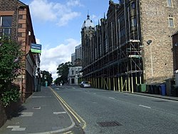
Milecastle 5 probably lies under the A186 road
Tyne and Wear UK location map.svg
Red pog.svg
Milecastle 5
Location in Tyne and Wear
Coordinates 54°58′17″N1°37′44″W / 54.971402°N 1.628967°W / 54.971402; -1.628967 Coordinates: 54°58′17″N1°37′44″W / 54.971402°N 1.628967°W / 54.971402; -1.628967
Grid reference NZ23806410

Milecastle 5 (Quarry House) was the first milecastle west of Pons Aelius fort of the Roman Hadrian's Wall. No remains exist of the milecastle, though its supposed position is at the junction of the A186 Westgate road and the B1311 Corporation Street. [1] No remains currently exist. [2]

Contents

Construction

Nothing is known of the long/axis or gateways type of Milecastle 5.

Excavations and investigations

thought there were visible signs of a castellum just behind the quarry-house

Associated turrets

Each milecastle on Hadrian's Wall had two associated turret structures. These turrets were positioned approximately one-third and two-thirds of a Roman mile to the west of the Milecastle, and would probably have been manned by part of the milecastle's garrison. The turrets associated with Milecastle 5 are known as Turret 5A and Turret 5B.

Turret 5A

The discovery of Milecastle 4 some way from its presumed location has brought into question the presumed sites of all milecastles and turrets in this area. However, the site is included in the English Heritage Archive. [5]
Presumed location: 54°58′24″N1°38′12″W / 54.973223°N 1.636761°W / 54.973223; -1.636761 (Turret 5A)

Turret 5B

The discovery of Milecastle 4 some way from its presumed location has brought into question the presumed sites of all milecastles and turrets in this area. However, the site is included in the English Heritage Archive. [6]
Presumed location: 54°58′27″N1°38′40″W / 54.974144°N 1.644564°W / 54.974144; -1.644564 (Turret 5B)

Monument records

MonumentMonument Number English Heritage Archive Number
Milecastle 525026NZ 26 SW 3
Turret 5A22667NZ 26 SW 4
Turret 5B25032NZ 26 SW 5

Related Research Articles

Milecastle 4

Milecastle 4 was a milecastle of the Roman Hadrian's Wall. Its remains exist beneath the Newcastle Arts Centre at 67-75 Westgate Road. This position is some way away from its predicted position which is at these coordinates: 54.970440°N 1.608669°W The actual location is between the predicted positions of Turrets 4A and 4B, which has led to suggestions that the numbering and positioning of milecastles and turrets on this part of Hadrian's Wall should be reconsidered.

Milecastle 3

Milecastle 3 (Ouseburn) was a milecastle of the Roman Hadrian's Wall. No remains exist, but it was thought to have been located at the junction of the A187 Byker Bridge and Stephen Street.

Milecastle 1

Milecastle 1 was a milecastle of the Roman Hadrian's Wall. It was located near the valley of Stott's Pow. Its remains are covered over, and are located beneath the recreation ground at Miller's Dene. Early excavations and investigations of Turret 0B were mistakenly interpreted as Milecastle 1. The Milecastle sits within the parish of Wallsend.

Milecastle 0

Milecastle 0 is a possible milecastle of the Roman Hadrian's Wall which may have preexisted the fort of Segedunum. Although its existence has been suggested by historian Peter Hill, no evidence of this milecastle has been found. It is not known whether the decision to establish forts on the line of the wall predated the decision to extend the wall to Wallsend, so it is possible that this milecastle was never built.

Milecastle 2

Milecastle 2 (Walker) was a milecastle of the Roman Hadrian's Wall. No remains are currently visible, having been built over, but its probable location is at or near the junction of the A187 Fossway and Tunstall Avenue, in the parish of Wallsend.

Milecastle 6

Milecastle 6 was a milecastle of the Roman Hadrian's Wall.

Milecastle 7 Milecastle of the Roman Hadrians Wall in United Kingdom

Milecastle 7 was a milecastle of the Roman Hadrian's Wall. The milecastle itself has not been discovered by archaeologists and its presumed location lies beneath a modern housing development. Roman finds have been made in the area and the associated structure of Turret 7B is a significant surviving structure of the wall.

Milecastle 9

Milecastle 9 was a milecastle of the Roman Hadrian's Wall. Its remains exist partially as a low platform, and are located in West Denton, 300 yards (270 m) from Chapel House Farm. However, the northern part of the remains are now mostly covered by the modern roads (A69/B6528). The milecastle marks a watershed between those with relatively well-defined positions and those whose position are less certain.

Milecastle 10

Milecastle 10 was a milecastle of the Roman Hadrian's Wall. It is located near to the modern village of Throckley in Tyne and Wear, northern England. Much of the milecastle lies beneath a road but partial remains of the north wall can be seen in the garden of Dene House. It has been excavated several times and its walls located, though the remains have been "considerably damaged by ploughing". Only one of the two associated turrets has been located and excavated.

Milecastle 11 Milecastle of Hadrians Wall

Milecastle 11 was a milecastle of the Roman Hadrian's Wall. No remains exist, but the measured position is the middle of the old village of Throckley Bank Top, under the Working Men's Club.

Milecastle 12

Milecastle 12 (Heddon) was a milecastle of the Roman Hadrian's Wall. Its remains lay under Town Farm, Heddon-on-the-Wall, with nothing visible on the surface.

Milecastle 14

Milecastle 14 was a milecastle of the Roman Hadrian's Wall. Its remains exist as a low platform, south of the B6318 Military Road and about 1 kilometre (0.62 mi) to the west of the road junction at Rudchester Farm.

Milecastle 16

Milecastle 16 was a milecastle of the Roman Hadrian's Wall. The milecastle is located at Harlow Hill, Northumberland. There are no visible surface remains of the milecastle or either of its associated turrets.

Milecastle 17

Milecastle 17 (Welton/Whittledean) was a milecastle of the Roman Hadrian's Wall. The milecastle is located near to the Whittle Dene reservoirs and is visible as a platform in the ground. Just 174m west of the milecastle is a distinct change in wall construction, indicating that it may have formed a boundary between different legions. The existence of the milecastle has been known since at least 1732 and excavations have produced numerous finds and evidence of post-Roman occupation. The associated turrets both lie beneath the B3618 Military Road. A stone found near the milecastle is the only known written record of the name of Gaius Julius Marcus, a Roman Governor of Britain whose name has been erased from other inscriptions possibly because he fell out of favour with Emperor Caracalla.

Milecastle 21

Milecastle 21 was a milecastle of the Roman Hadrian's Wall. The site was identified by measurement only, as the milecastle's remains have been totally removed. This is probably due to extensive quarrying at the site, which now lies under pasture.

Milecastle 23

Milecastle 23 (Stanley) was a milecastle of the Roman Hadrian's Wall. Its remains exist as a low, grass covered platform with traces of an external ditch. It is located to the south of the B6318 Military Road around 1.5 kilometres (0.93 mi) west of its junction with the A68.

Milecastle 26

Milecastle 26 (Planetrees) was a milecastle of the Roman Hadrian's Wall. Its position is slightly to the south of, but mostly covered by the B6318 Military Road., and it is located around 700 metres (0.43 mi) east of the B6318 Military Road's junction with the A6079. No visible traces exist currently. The dimensions are the same as Milecastles 23, 24, and 25.

Milecastle 28

Milecastle 28 (Walwick) was a milecastle of the Roman Hadrian's Wall in England. No remains are currently visible. Its location is immediately to the south of the B6318 Military Road in Walwick.

Milecastle 31

Milecastle 31 (Carrawburgh) was a milecastle of the Roman Hadrian's Wall. Its remains exist as a turf covered platform beside the B6318 Military Road, just to the east of Carrawburgh fort.

Milecastle 32

Milecastle 32 (Carraw) was a milecastle of the Roman Hadrian's Wall. Its remains exist as earthworks and with no exposed masonry. The layout of the milecastle walls is defined by robber trenches (to a maximum depth of 0.3 metres. The north wall is beneath a modern wall.

References

  1. Hope Dodds, Madeleine (1930), A History of Northumberland, vol. 13 (first ed.), Andrew Reid, Sons & Co, p. 498
  2. Birley, Eric B (1961), Research on Hadrian's Wall, Titus Wilson & Son
  3. Horsley, John (1732), Britannia Romana or the Roman Antiquities of Britain, Frank Graham (published 1974), pp. 137–8, ISBN   0-85983-090-X
  4. "Milecastle 5". Pastscape. English Heritage. Archived from the original on 25 February 2012. Retrieved 26 May 2010.
  5. "Turret 5A". Pastscape. English Heritage. Archived from the original on 25 February 2012. Retrieved 26 May 2010.
  6. "Turret 5B". Pastscape. English Heritage. Archived from the original on 25 February 2012. Retrieved 26 May 2010.

Bibliography