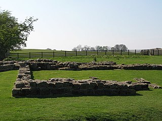
Milecastle 72

Last updated

Milecastle 72
Burgh by Sands by The Greyhound Inn - geograph.org.uk - 4406956.jpg
Milecastle 72 lies next to the road passing through Burgh by Sands
Location map United Kingdom City of Carlisle.svg
Red pog.svg
Location in the City of Carlisle district, Cumbria
Cumbria UK location map.svg
Red pog.svg
Location in Cumbria, England
Type Milecastle
Location
Coordinates 54°55′20″N3°03′22″W / 54.922312°N 3.056017°W / 54.922312; -3.056017 Coordinates: 54°55′20″N3°03′22″W / 54.922312°N 3.056017°W / 54.922312; -3.056017
CountyCumbria
CountryEngland
Reference
UK-OSNG reference NY32415913

Milecastle 72 (Fauld Farm) was one of a series of Milecastles or small fortlets built at intervals of approximately one Roman mile along Hadrian's Wall (grid reference NY32415913 ).

Contents

Description

Milecastle 72 is in the village of Burgh by Sands. The east wall of the milecastle is below a farm access track. [1] It was located about 400 metres west of the Roman fort of Aballava. [2] There are no visible remains above ground. [3]

Excavations

Milecastle 72 was located and partially excavated in 1960. [3] It was excavated again in 1977 and 1989. [3] The excavations uncovered the north, west and east walls. [3] The milecastle was originally built with turf walls and then replaced in stone, probably in the second half of the 2nd-century at the same time as the replacement of the Turf Wall by a stone wall. [1] The walls were 2.2 metres wide. [1] The stone milecastle measured 24.3 metres across its overall width, with an internal width between the walls of 19 metres. [1] The south side of the milecastle has not been identified. [1] Most of the pottery found was of the 2nd century. [3]

Associated turrets

Each milecastle on Hadrian's Wall had two associated turret structures. These turrets were positioned approximately one-third and two-thirds of a Roman mile to the west of the Milecastle, and would probably have been manned by part of the milecastle's garrison. The turrets associated with Milecastle 72 are known as Turret 72A and Turret 72B.

Turret 72A (grid reference NY31925908 ) has never been located, and its position has been calculated from the neighbouring milecastles. [4] Pottery fragments have been found near the measured position, but no trace of the turret has been found. [4]

Turret 72B (Rindle Hill) (grid reference NY31445922 ) was located and partially excavated in 1948. [5] It lies in the north east corner of a field. [1] The excavations showed that it was from the original Turf Wall series and it projected 1.2 metres north of the line of the later Stone Wall. [1] There are no visible remains above ground. [5]

Related Research Articles

Milecastle 49

Milecastle 49 was a milecastle on Hadrian's Wall.

Milecastle 79

Milecastle 79 was one of a series of Milecastles or small fortlets built at intervals of approximately one Roman mile along Hadrian's Wall.
Milecastle 78

Milecastle 78 (Kirkland) was one of a series of Milecastles or small fortlets built at intervals of approximately one Roman mile along Hadrian's Wall.
Milecastle 76

Milecastle 76 (Drumburgh) was one of a series of Milecastles or small fortlets built at intervals of approximately one Roman mile along Hadrian's Wall.

Milecastle 75

Milecastle 75 (Easton) was one of a series of Milecastles or small fortlets built at intervals of approximately one Roman mile along Hadrian's Wall in England.

Milecastle 74

Milecastle 74 was one of a series of milecastles or small fortlets built at intervals of approximately one Roman mile along Hadrian's Wall.

Milecastle 73

Milecastle 73 (Dykesfield) was one of a series of Milecastles or small fortlets built at intervals of approximately one Roman mile along Hadrian's Wall.
Milecastle 71

Milecastle 71 (Wormanby) was one of a series of Milecastles or small fortlets built at intervals of approximately one Roman mile along Hadrian's Wall.

Milecastle 42

Milecastle 42 (Cawfields) is a milecastle on Hadrian's Wall.

Milefortlet 13

Milefortlet 13 was a Milefortlet of the Roman Cumbrian Coast defences. These milefortlets and intervening stone watchtowers extended from the western end of Hadrian's Wall, along the Cumbrian coast and were linked by a wooden palisade. They were contemporary with defensive structures on Hadrian's Wall. The exact location of Milefortlet 13 is unknown, although two of the nearby turrets have been located and excavated.

Milecastle 40

Milecastle 40 (Winshields) was a milecastle on Hadrian's Wall.

Milecastle 54

Milecastle 54 (Randylands) was a milecastle on Hadrian's Wall.
Milecastle 55

Milecastle 55 was a milecastle on Hadrian's Wall.

Milecastle 57

Milecastle 57 (Cambeckhill) was a milecastle on Hadrian's Wall.

Milecastle 58

Milecastle 58 (Newtown) was a milecastle on Hadrian's Wall.

Milecastle 59

Milecastle 59 was a milecastle on Hadrian's Wall.

Milecastle 64 (Drawdykes) was a milecastle on Hadrian's Wall.

Milecastle 65 (Tarraby) was a milecastle on Hadrian's Wall.

Milecastle 50TW

Milecastle 50TW was a milecastle on the Turf Wall section of Hadrian's Wall. The milecastle is located close to the Birdoswald Roman Fort and is unique in that it was not replaced by a stone milecastle when the turf wall was upgraded to stone, the replacement wall instead running some 200m to the north. The milecastle was partially demolished by the Romans after it was abandoned. The milecastle was excavated in 1934 and several Roman rubbish pits discovered. The remains of the two turrets associated with this milecastle have also been located. As the turf wall lies some distance from the stone wall, the sites are not accessible from the Hadrian's Wall Path.

Milecastle 70

Milecastle 70 (Braelees) was one of a series of Milecastles or small fortlets built at intervals of approximately one Roman mile along Hadrian's Wall.

References

  1. 1 2 3 4 5 6 7 Historic England, "Hadrian's Wall between Fulwood House at Burgh by Sands and Burgh Marsh in wall miles 72 and 73 (1014698)", National Heritage List for England , retrieved 18 December 2013
  2. Historic England, "Aballava Roman Fort (10705)", Research records (formerly PastScape), retrieved 18 December 2013
  3. 1 2 3 4 5 Historic England, "Milecastle 72 (10708)", Research records (formerly PastScape), retrieved 18 December 2013
  4. 1 2 Historic England, "Turret 72A (10720)", Research records (formerly PastScape), retrieved 18 December 2013
  5. 1 2 Historic England, "Turret 72B (10723)", Research records (formerly PastScape), retrieved 18 December 2013