Milefortlet 4

Last updated

Milefortlet 4
Fields by the Solway Firth - geograph.org.uk - 3590916.jpg
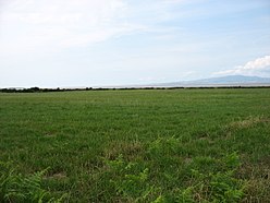
Fields by the Solway Firth, and the approximate site of Milefortlet 4
Cumbria UK location map.svg
Red pog.svg
Location within Cumbria
Type Milecastle
Place in the Roman world
Province Britannia
Location
Coordinates 54°55′35″N3°17′21″W / 54.926352°N 3.289258°W / 54.926352; -3.289258 Coordinates: 54°55′35″N3°17′21″W / 54.926352°N 3.289258°W / 54.926352; -3.289258
CountyCumbria
CountryEngland
Reference
UK-OSNG reference NY17475983

Milefortlet 4 (Herd Hill) was a Milefortlet of the Roman Cumbrian Coast defences. These milefortlets and intervening stone watchtowers extended from the western end of Hadrian's Wall, along the Cumbrian coast and were linked by a wooden palisade. They were contemporary with defensive structures on Hadrian's Wall. There is little to see on the ground but Milefortlet 4 has been located by archaeologists.

Contents

Description

Milefortlet 4 is situated at the seaward edge of a low ridge, just north of the hamlet of Cardurnock in the civil parish of Bowness. It was located in 1945 by the finding of turfwork on Herd Hill. [1] There is nothing to see from the ground but a geophysical survey of the site was undertaken in 1994 and the precise position of the milefortlet was located. [1]

Associated Towers

Each milefortlet had two associated towers, similar in construction to the turrets built along Hadrian's Wall. These towers were positioned approximately one-third and two-thirds of a Roman mile to the west of the Milefortlet, and would probably have been manned by part of the nearest Milefortlet's garrison. The towers associated with Milefortlet 4 are known as Tower 4A (grid reference NY172594 ) and Tower 4B (grid reference NY17115888 ). [2] [3]

The position of Tower 4A is uncertain, although it thought to lie on the crest of a ridge with good views seaward. [2] Tower 4B is located in a field west of Cardurnock. It was excavated by in 1977, which located three sides of the tower surviving as robber trenches: the western side having been completely eroded. [3] The tower was interpreted as having had three phases: in the first two phases palisade structures were built, but in the third phase these were abandoned and a stone tower was built. [3]

Related Research Articles

Milecastle 80

Milecastle 80 was one of a series of Milecastles or small fortlets built at intervals of approximately one Roman mile along Hadrian's Wall.

Milecastle 79

Milecastle 79 was one of a series of Milecastles or small fortlets built at intervals of approximately one Roman mile along Hadrian's Wall.

Milefortlet 21

Milefortlet 21 was a Milefortlet of the Roman Cumbrian Coast defences. These defences were contemporary with defensive structures on Hadrian's Wall. Its remains exist as reconstructed turf ramparts and ditch, reinstated to its original profile. They are located on a low cliff on the coast, north of the village of Crosscanonby, and just inland from the coastal road. It is the only milefortlet to have been fully excavated and is open to the public.

Turret (Hadrians Wall)

A turret was a small watch tower, incorporated into the curtain wall of Hadrian's Wall. The turrets were normally spaced at intervals of one third of a Roman mile between Milecastles, giving two Turrets between each Milecastle.

Milefortlet 1

Milefortlet 1 was a milefortlet of the Roman Cumbrian Coast defences. These milefortlets and intervening stone watchtowers extended from the western end of Hadrian's Wall, along the Cumbrian coast and were linked by a wooden palisade. They were contemporary with defensive structures on Hadrian's Wall. The remains of Milefortlet 1 survive as a slight earthwork.

Milefortlet 3

Milefortlet 3 was a Milefortlet of the Roman Cumbrian Coast defences. These milefortlets and intervening stone watchtowers extended from the western end of Hadrian's Wall, along the Cumbrian coast and were linked by a wooden palisade. They were contemporary with defensive structures on Hadrian's Wall. There is little to see on the ground but Milefortlet 3 has been located on aerial photographs.

Milefortlet 5

Milefortlet 5 (Cardurnock) was a Milefortlet of the Roman Cumbrian Coast defences. These milefortlets and intervening stone watchtowers extended from the western end of Hadrian's Wall, along the Cumbrian coast and were linked by a wooden palisade. They were contemporary with defensive structures on Hadrian's Wall. The remains of Milefortlet 5 was excavated in 1943-4 prior to its destruction in 1944.

Milefortlet 9

Milefortlet 9 (Skinburness) was a Milefortlet of the Roman Cumbrian Coast defences. These milefortlets and intervening stone watchtowers extended from the western end of Hadrian's Wall, along the Cumbrian coast and were linked by a wooden palisade. They were contemporary with defensive structures on Hadrian's Wall. There is little to see on the ground but Milefortlet 9 has been located on aerial photographs.

Milefortlet 12 (Blitterlees) was a Milefortlet of the Roman Cumbrian Coast defences. These milefortlets and intervening stone watchtowers extended from the western end of Hadrian's Wall, along the Cumbrian coast and were linked by a wooden palisade. They were contemporary with defensive structures on Hadrian's Wall. There is little to see on the ground but Milefortlet 12 has been located and excavated. The milefortlet is located close to the hamlet of Blitterlees, in the civil parish of Holme Low.

Milefortlet 16 was a Milefortlet of the Roman Cumbrian Coast defences. These milefortlets and intervening stone watchtowers extended from the western end of Hadrian's Wall, along the Cumbrian coast and were linked by a wooden palisade. They were contemporary with defensive structures on Hadrian's Wall. There is little to see on the ground but Milefortlet 16 has been located.

Milefortlet 17

Milefortlet 17 was a Milefortlet of the Roman Cumbrian Coast defences. These milefortlets and intervening stone watchtowers extended from the western end of Hadrian's Wall, along the Cumbrian coast and were linked by a wooden palisade. They were contemporary with defensive structures on Hadrian's Wall. There is little to see except a slight depression in the ground, but Milefortlet 17 has been located and surveyed.

Milefortlet 20 was a Milefortlet of the Roman Cumbrian Coast defences. These milefortlets and intervening stone watchtowers extended from the western end of Hadrian's Wall, along the Cumbrian coast and were linked by a wooden palisade. They were contemporary with defensive structures on Hadrian's Wall. There is little to see on the ground, but Milefortlet 20 has been located and excavated.

Milefortlet 22

Milefortlet 22 (Brownrigg) was a Milefortlet of the Roman Cumbrian Coast defences. These milefortlets and intervening stone watchtowers extended from the western end of Hadrian's Wall, along the Cumbrian coast and were linked by a wooden palisade. They were contemporary with defensive structures on Hadrian's Wall. There is little to see on the ground, but Milefortlet 22 has been located and excavated.

Milefortlet 23

Milefortlet 23 was a Milefortlet of the Roman Cumbrian Coast defences. These milefortlets and intervening stone watchtowers extended from the western end of Hadrian's Wall, along the Cumbrian coast and were linked by a wooden palisade. They were contemporary with defensive structures on Hadrian's Wall. There is nothing to see on the ground, but Milefortlet 23 has been located and surveyed.

Milefortlet 2

Milefortlet 2 was a Milefortlet of the Roman Cumbrian Coast defences. These milefortlets and intervening stone watchtowers extended from the western end of Hadrian's Wall, along the Cumbrian coast and were linked by a wooden palisade. They were contemporary with defensive structures on Hadrian's Wall. The exact location of Milefortlet 2 is unknown, although one of the nearby turrets has been located and excavated.

Milefortlet 13

Milefortlet 13 was a Milefortlet of the Roman Cumbrian Coast defences. These milefortlets and intervening stone watchtowers extended from the western end of Hadrian's Wall, along the Cumbrian coast and were linked by a wooden palisade. They were contemporary with defensive structures on Hadrian's Wall. The exact location of Milefortlet 13 is unknown, although two of the nearby turrets have been located and excavated.

Milefortlet 15

Milefortlet 15 was a Milefortlet of the Roman Cumbrian Coast defences. These milefortlets and intervening stone watchtowers extended from the western end of Hadrian's Wall, along the Cumbrian coast and were linked by a wooden palisade. They were contemporary with defensive structures on Hadrian's Wall. The site of Milefortlet 15 has been probably been destroyed by coastal erosion. A 3rd-century Roman cemetery, associated with a nearby fort at Beckfoot, was located in the area of the milefortlet.

Milefortlet 14

Milefortlet 14 was a Milefortlet of the Roman Cumbrian Coast defences. These milefortlets and intervening stone watchtowers extended from the western end of Hadrian's Wall, along the Cumbrian coast and were linked by a wooden palisade. They were contemporary with defensive structures on Hadrian's Wall. The site of Milefortlet 14 has never been identified and it may lie beneath the village of Beckfoot. A larger fort known as Bibra Roman Fort was located 500 metres south-west of Milefortlet 14.

Milefortlet 25

Milefortlet 25 was a Milefortlet of the Roman Cumbrian Coast defences. These milefortlets and intervening stone watchtowers extended from the western end of Hadrian's Wall, along the Cumbrian coast and were linked by a wooden palisade. They were contemporary with defensive structures on Hadrian's Wall. Milefortlet 25 is the southernmost known of the fortlets of the Cumberland coast, but there is nothing to see on the ground, as Milefortlet 25 lies in an industrial area of Maryport.

Milefortlet 11

Milefortlet 11 was a Milefortlet of the Roman Cumbrian Coast defences. These milefortlets and intervening stone watchtowers extended from the western end of Hadrian's Wall, along the Cumbrian coast and were linked by a wooden palisade. They were contemporary with defensive structures on Hadrian's Wall. Milefortlet 11 has never been accurately located on the ground although other Roman remains have been found in the area.

References

  1. 1 2 Historic England, "Milefortlet 4 (9613)", Research records (formerly PastScape), retrieved 26 November 2013
  2. 1 2 Historic England, "Tower 4A (9617)", Research records (formerly PastScape), retrieved 26 November 2013
  3. 1 2 3 Historic England, "Cardurnock Tower 4B (9610)", Research records (formerly PastScape), retrieved 26 November 2013