Milecastle 18

Last updated

Milecastle 18
Northumberland, England, UK
(The line of) Hadrian's Wall by the site of Milecastle 18 - geograph.org.uk - 2599664.jpg
The line of Hadrian's Wall (beneath the modern road) at Milecastle 18
Northumberland UK location map.svg
Red pog.svg
Milecastle 18
Location in Northumberland
Coordinates 55°00′35″N1°55′35″W / 55.009777°N 1.926324°W / 55.009777; -1.926324 Coordinates: 55°00′35″N1°55′35″W / 55.009777°N 1.926324°W / 55.009777; -1.926324
Grid reference NZ04816836

Milecastle 18 (East Wallhouses) was a milecastle of the Roman Hadrian's Wall. It is located to the west of the settlement of East Wallhouses in Northumberland and is visible as a platform in the ground. The milecastle is of a unique construction, having a gateway associated with builders of the Legio II Augusta and a layout typical of the Legio VI Victrix or Legio XX Valeria Victrix. Historians have suggested that it may have been begun by men of one legion and finished by those of another. One of Milecastle 18's associated turrets shows evidence of being used as a workshop, possibly for the repair of shoes.

Contents

Construction

Milecastle 18 was a long-axis milecastle with Type I gateways. [1] Long axis milecastles were usually built by the Legio VI Victrix or Legio XX Valeria Victrix, whilst those with type I gateways are thought to have been built by Legio II Augusta. [2] Milecastle 18 is the only one of the series of 80 to have the combination of type I gateways and a long axis. [3] The gateway of this milecastle is of a rougher construction than others with type I gateways. [1] The milecastle has a broad north wall but narrow side walls suggesting that this example was begun by troops of one legion but completed by those of another. [1]

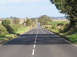
The milecastle is situated on the Military Road just to the west of East Wallhouses. It measures 53 feet 8 inches (16.36 m) east to west and 59 feet 6 inches (18.14 m) north to south with side walls 7 feet 9 inches (2.36 m) thick. [4] It was scheduled as an ancient monument on 14 July 1997. [4] There are no structural remains though part of the milecastle is visible as a 0.5-metre-high (1.6 ft) platform next to the road, which covers much of the former milecastle. [4]

Excavations and investigations

Associated turrets

Each milecastle on Hadrian's Wall had two associated turret structures. These turrets were positioned approximately one-third and two-thirds of a Roman mile to the west of the Milecastle, and would probably have been manned by part of the milecastle's garrison. The turrets associated with Milecastle 18 are known as Turret 18A and Turret 18B.

Turret 18A

Turret 18A (Wallhouses East) is located at the junction of Moorhouse Road and the Military Road. Its position can be seen by a rise in the hedgeline. When excavated in 1931 it was found to be well preserved with the ladder platform still standing at full height and with six stone steps. [7] A ballista ball was also discovered during the excavation. [1] To the west of Turret 18A an excavation of the Vallum was undertaken in 1980–81 in advance of construction works for a pipeline. [8] The Vallum was discovered to be 8m wide and 2.29m deep at this point. [8] The mounds beside the Vallum had been breached during the Antonine period to allow a metalled causeway to be laid across. [8] Plough marks were discovered beneath the mounds, indicating the presence of farming in this area prior to the Vallum's construction. [8] Turret 18A became a scheduled monument at the same time as milecastle 18. [7]

Location on Ordnance Survey 1:25 000 map: 55°00′37″N1°56′02″W / 55.010320°N 1.933828°W / 55.010320; -1.933828 (Turret 18A)

Turret 18B

Turret 18B (Wallhouses West) lies beneath the grass verge of the Military Road. A toll house, now demolished, used to stand on much of the turret's remains. [9] The turret was partially excavated in 1931 with a full excavation being undertaken by Durham University in 1959. [8] [9] The excavations revealed evidence of a platform on the turret's floor (made of clay) and a hearth in the doorway. [8] This turret may have functioned as a workshop, as the hearth shows evidence of being used at high temperatures; a 1 m (3 ft 3 in) deep layer of iron oxide impregnated ash was present and many iron finds were made. [8] A nearby small enclosure was apparently used as a coal store. [8] Finds included an iron shield boss and 60 hobnails (suggesting the repair of shoes was carried out here) as well as a brooch, three copper items, a bone plaque, a struck flake, cooking pots, cut bones of cattle and pigs and shellfish remains. [8] These finds demonstrate two distinct periods of occupation, separated by a layer of rubble. [8] Durham University's excavation concluded that the turret had fallen out of use by the end of the 2nd century AD. [9] There are no visible remains, and the turret was scheduled at the same time as the Milecastle and Turret 18A. [9]

Location on Ordnance Survey 1:25 000 map: 55°00′39″N1°56′30″W / 55.010863°N 1.941646°W / 55.010863; -1.941646 (Turret 18B)

Monument records

MonumentMonument Number English Heritage Archive Number
Milecastle 1820446NZ 06 NW 1
Turret 18A20449NZ 06 NW 2
Turret 18B20452NZ 06 NW 3

Related Research Articles

Milecastle 4

Milecastle 4 was a milecastle of the Roman Hadrian's Wall. Its remains exist beneath the Newcastle Arts Centre at 67-75 Westgate Road. This position is some way away from its predicted position which is at these coordinates: 54.970440°N 1.608669°W The actual location is between the predicted positions of Turrets 4A and 4B, which has led to suggestions that the numbering and positioning of milecastles and turrets on this part of Hadrian's Wall should be reconsidered.

Milecastle 9

Milecastle 9 was a milecastle of the Roman Hadrian's Wall. Its remains exist partially as a low platform, and are located in West Denton, 300 yards (270 m) from Chapel House Farm. However, the northern part of the remains are now mostly covered by the modern roads (A69/B6528). The milecastle marks a watershed between those with relatively well-defined positions and those whose position are less certain.

Milecastle 10

Milecastle 10 was a milecastle of the Roman Hadrian's Wall. It is located near to the modern village of Throckley in Tyne and Wear, northern England. Much of the milecastle lies beneath a road but partial remains of the north wall can be seen in the garden of Dene House. It has been excavated several times and its walls located, though the remains have been "considerably damaged by ploughing". Only one of the two associated turrets has been located and excavated.

Milecastle 13

Milecastle 13 was a milecastle of the Roman Hadrian's Wall. Its remains exist as a low platform south of the B6318 Military Road.

Milecastle 14

Milecastle 14 was a milecastle of the Roman Hadrian's Wall. Its remains exist as a low platform, south of the B6318 Military Road and about 1 kilometre (0.62 mi) to the west of the road junction at Rudchester Farm.

Milecastle 15

Milecastle 15 (Whitchester) was a milecastle of the Roman Hadrian's Wall. Its remains exist as a bold platform with robbed walls located on the southern side of the B6318 Military Road approximately 3 kilometres (1.9 mi) west of its crossing of the A69 road. It has not been excavated.

Milecastle 17

Milecastle 17 (Welton/Whittledean) was a milecastle of the Roman Hadrian's Wall. The milecastle is located near to the Whittle Dene reservoirs and is visible as a platform in the ground. Just 174m west of the milecastle is a distinct change in wall construction, indicating that it may have formed a boundary between different legions. The existence of the milecastle has been known since at least 1732 and excavations have produced numerous finds and evidence of post-Roman occupation. The associated turrets both lie beneath the B3618 Military Road. A stone found near the milecastle is the only known written record of the name of Gaius Julius Marcus, a Roman Governor of Britain whose name has been erased from other inscriptions possibly because he fell out of favour with Emperor Caracalla.

Milecastle 19

Milecastle 19 was a milecastle of the Roman Hadrian's Wall. Sited just to the east of the hamlet of Matfen Piers, the milecastle is today covered by the B6318 Military Road. The milecastle is notable for the discovery of an altar by Eric Birley in the 1930s. An inscription on the altar is one of the few dedications to a mother goddess found in Roman Britain, and was made by members of the First Cohort of Varduli from northern Spain. The presence of the Vardulians at this milecastle has led to debate amongst archaeologists over the origins of troops used to garrison the wall. A smaller altar was found at one of the two associated turrets.

Milecastle 22

Milecastle 22 (Portgate) was a milecastle of the Roman Hadrian's Wall. Its remains exist as a low, turf covered platform just east of the Portgate roundabout. The platform is 0.5 metres (1.6 ft) on the east side, reducing to only a parch mark on the west side.

Milecastle 23

Milecastle 23 (Stanley) was a milecastle of the Roman Hadrian's Wall. Its remains exist as a low, grass covered platform with traces of an external ditch. It is located to the south of the B6318 Military Road around 1.5 kilometres (0.93 mi) west of its junction with the A68.

Milecastle 27

Milecastle 27 was a milecastle of the Roman Hadrian's Wall. It was located on the line of Hadrian's Wall, approximately midway between the A6079 and the River North Tyne. Its remains survive as a slight squarish platform with a maximum height of 0.4 metres (1.3 ft), but it is poorly defined to the north and east.

Milecastle 24

Milecastle 24 was a milecastle of the Roman Hadrian's Wall. Its remains exist as a low platform, and are located to the south of the B6318 Military Road around 3 kilometres (1.9 mi) west of its junction with the A68.

Milecastle 25

Milecastle 25 (Codlawhill) was a milecastle of the Roman Hadrian's Wall. Its remains exist as a low platform, and are located to the south of the B6318 Military Road, nearly 5 kilometres (3.1 mi) to the west of its junction with the A68.

Milecastle 26

Milecastle 26 (Planetrees) was a milecastle of the Roman Hadrian's Wall. Its position is slightly to the south of, but mostly covered by the B6318 Military Road., and it is located around 700 metres (0.43 mi) east of the B6318 Military Road's junction with the A6079. No visible traces exist currently. The dimensions are the same as Milecastles 23, 24, and 25.

Milecastle 28

Milecastle 28 (Walwick) was a milecastle of the Roman Hadrian's Wall in England. No remains are currently visible. Its location is immediately to the south of the B6318 Military Road in Walwick.

Milecastle 29

Milecastle 29 was a milecastle of the Roman Hadrian's Wall. Its remains exist as a mutilated earth platform accentuated by deep robber-trenches around all sides, and are located beside the B6318 Military Road. Like Milecastles 9, 23, 25, and 51, a ditch has been identified around the Milecastle, and is still visible to a small extent. It has been postulated that this was as a result of the need for drainage on the site.

Milecastle 30

Milecastle 30 was a milecastle of the Roman Hadrian's Wall. Its remains exist as an outward-facing scarp with a maximum height of 0.8 metres (2.6 ft). Masonry from the east wall remains in situ. The remaining stretch is 3.1 metres (10 ft) in length by 2.25 metres (7.4 ft) thick, and survives to a height of 0.6 metres (2.0 ft). It is located at the western part of Limestone Corner, just off the B6318 Military Road.

Milecastle 31

Milecastle 31 (Carrawburgh) was a milecastle of the Roman Hadrian's Wall. Its remains exist as a turf covered platform beside the B6318 Military Road, just to the east of Carrawburgh fort.

Milecastle 32

Milecastle 32 (Carraw) was a milecastle of the Roman Hadrian's Wall. Its remains exist as earthworks and with no exposed masonry. The layout of the milecastle walls is defined by robber trenches (to a maximum depth of 0.3 metres. The north wall is beneath a modern wall.

Milecastle 33

Milecastle 33 was a milecastle of the Roman Hadrian's Wall, one of a series of small fortlets built at intervals of approximately one Roman mile along the length of the UNESCO World Heritage Site in northern England.

References

  1. 1 2 3 4 5 David J Breeze and Brian Dobson (1976). Hadrian's Wall. Allen Lane. p. 174. ISBN   0-14-027182-1.
  2. David J Breeze and Brian Dobson (1976). Hadrian's Wall. Allen Lane. pp. 14–15. ISBN   0-14-027182-1.
  3. "The Milecastles" (PDF). Durham University. Archived from the original (PDF) on 11 December 2009. Retrieved 29 April 2010.
  4. 1 2 3 4 "Milecastle 18". Pastscape. English Heritage. Archived from the original on 25 March 2012. Retrieved 17 February 2012.
  5. Investigative history of Milecastle 18, 1978
  6. Hedley, W. P. A Record of Milecastle 18 (East Wallhouses) in 1687. Proceedings of the Society of Antiquaries of Newcastle upon Tyne, 4th ser., 11:2 (1947), 50–3.
  7. 1 2 "Turret 18A". Pastscape. English Heritage. Archived from the original on 25 March 2012. Retrieved 17 February 2012.
  8. 1 2 3 4 5 6 7 8 9 10 David J Breeze and Brian Dobson (1976). Hadrian's Wall. Allen Lane. p. 175. ISBN   0-14-027182-1.
  9. 1 2 3 4 "Turret 18B". Pastscape. English Heritage. Archived from the original on 25 March 2012. Retrieved 17 February 2012.